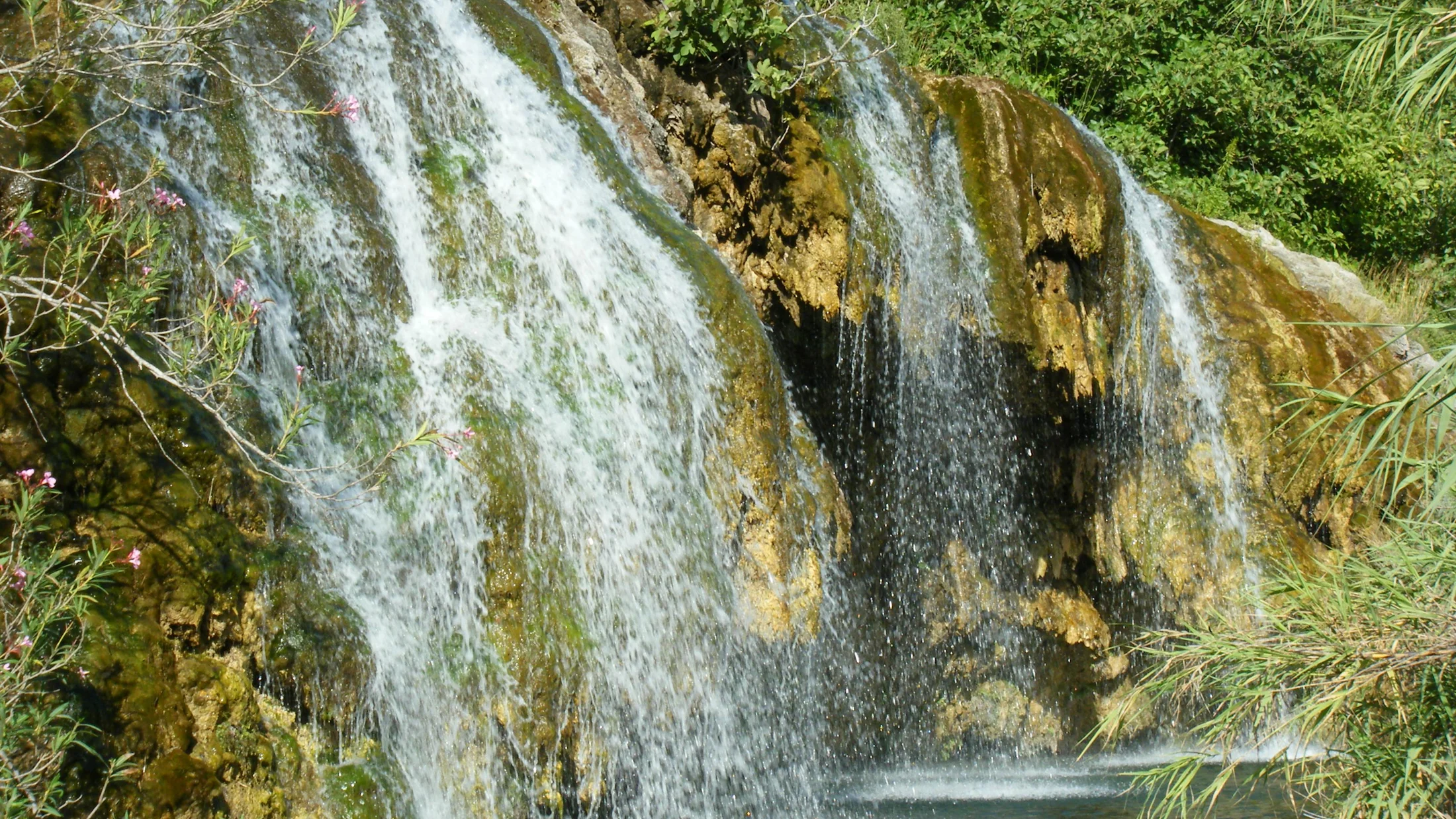
The Chera-Sot de Chera Natural Park covers 6,451 hectares in the mountainous interior of Valencia province, between the Requena-Utiel and Hoya de Buñol districts. Its terrain is shaped by two reservoirs—Buseo and Chera—whose turquoise water contrasts with the limestone walls of the surrounding canyons. Over millions of years the Río Reatillo has carved gorges up to 80 metres deep into Cretaceous limestone and dolomite, creating a karst landscape rich in caves, sinkholes and springs. The Cueva del Turche, with its 12-metre interior waterfall, is one of the park's most visited formations.
Vegetation is arranged in clear altitudinal bands between 400 and 1,100 metres. Ravine floors host riparian woodland of poplars, ash, elm and willow forming shaded galleries where the temperature drops noticeably compared to sun-facing slopes. North-facing hillsides support holm-oak forest (Quercus ilex rotundifolia) and Portuguese-oak groves that turn gold in autumn. The coolest, shadiest areas above 800 metres contain stands of maritime pine (Pinus pinaster) and black pine (Pinus nigra) whose resin scents the air on summer afternoons. Cliff faces harbour rupicoline plants endemic to eastern Iberia, adapted to calcareous crevices with minimal moisture.
The park's fauna reflects the transition between dry Mediterranean lowlands and Valencia's interior ranges. Bonelli's eagle, one of Europe's most threatened raptors, holds several breeding territories on the cliffs overlooking the reservoirs. The Eurasian eagle-owl occupies crevices in the rock faces and can be heard at dusk, its deep hooting echoing off canyon walls. Barbel and carp inhabit the Buseo reservoir, while the upper Reatillo still supports the madrilla, an Iberian-endemic cyprinid. Mammals such as Iberian ibex, wild boar, badger and common genet round out a diverse fauna. In spring, temporary pools host common frogs and midwife toads, whose nocturnal calls set the rhythm of warm evenings.
The villages of Chera and Sot de Chera, with a combined population of fewer than 700, preserve a layout of narrow streets and limestone houses with wrought-iron balconies. Chera sits on a hill at 800 metres, commanding the valley, while Sot de Chera occupies a more sheltered position beside the river. Agriculture endures on terraced hillsides planted with centuries-old almond and olive trees that trace geometric patterns against the pale rock. The August patron-saint festivals bring residents and emigrants together around traditional bull-running events, open-air dances and communal meals that strengthen ties in a community shaped by geographic isolation.
The park's hiking network totals over 60 waymarked kilometres. The Rambla de Alborache path follows the main canyon for 8 kilometres between vertical walls colonised by ivy and wild fig trees. The Buseo Reservoir circular route (12 km) offers natural viewpoints over the water and access to swimming spots in summer. For those seeking vertical terrain, the equipped climbing routes on the Charco Azul cliffs reach 40 metres of compact limestone, with grades ranging from 5a to 7c.