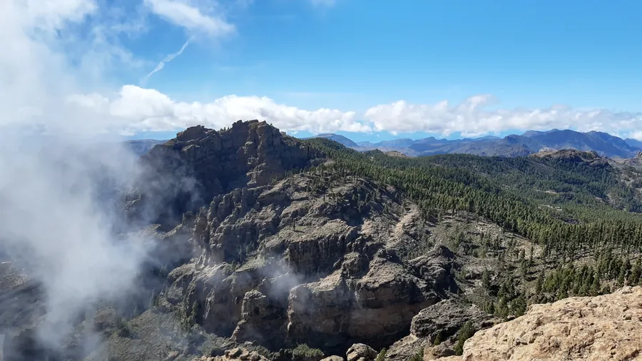
The interior of Gran Canaria is a vertical world. From the coast, the island rises in barely 35 kilometres to the 1,949 metres of Pico de las Nieves, unfurling a mosaic of landscapes that UNESCO recognised as a Biosphere Reserve in 2005: colossal volcanic calderas, centuries-old pine forests, ravines that cut the earth like scars and stone hamlets where time seems to have stood still.
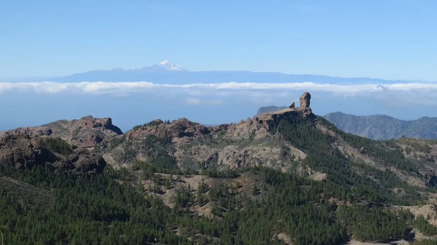
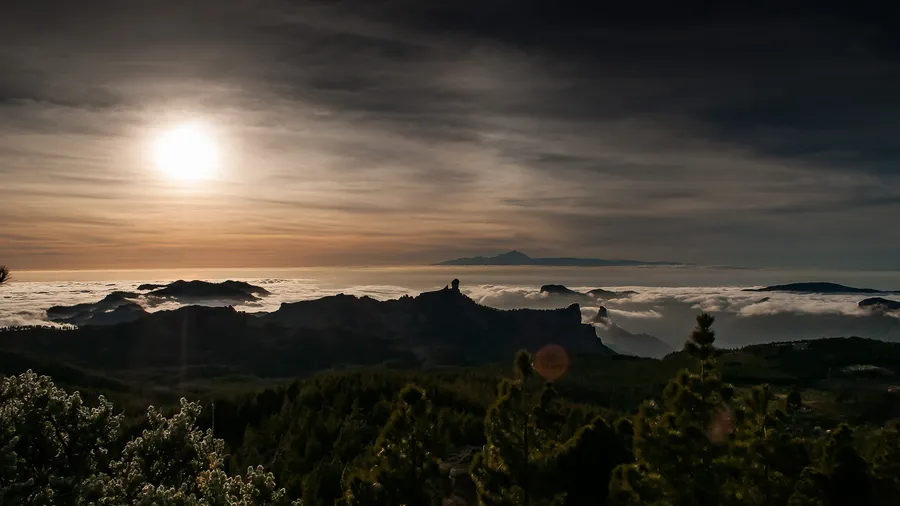
The emblem of this landscape is Roque Nublo, an 80-metre basalt monolith standing at 1,813 metres like a stone sentinel over the Caldera de Tejeda. Walking to its base along the trail from La Goleta is one of the essential experiences in the Canaries: the 3-kilometre route passes through a Canary pine forest (Pinus canariensis), a species that has evolved the ability to resprout after fire, and culminates in a natural viewpoint from which you can see Mount Teide in Tenerife floating above a sea of clouds. At dawn, the raking light bathes the rock in golden and coppery tones that explain why the ancient Canarians considered it a sacred place.
The Caldera de Tejeda, sometimes called the heart of Gran Canaria, is an erosion depression more than 20 kilometres across, surrounded by vertical walls exceeding 1,000 metres of vertical drop. Inside it, the village of Tejeda (barely 2,000 inhabitants) produces almonds of island-wide fame and celebrates each February the Fiesta del Almendro en Flor, when the valleys are blanketed in white and pink announcing spring.
The island's troglodyte heritage adds a layer of wonder. Risco Caído and the Sacred Mountains, declared a UNESCO World Heritage Site in 2019, are a complex of aboriginal caves carved into volcanic tuff that functioned as astronomical sanctuaries. At the equinox, sunlight enters through an opening and casts figures onto the engraved walls, a phenomenon revealing the astronomical knowledge of the ancient Canarians.
Water has sculpted the interior into spectacular ravines. Barranco de Guayadeque, 15 kilometres long, harbours caves inhabited since pre-Hispanic times -- some still used as homes and restaurants -- and a biodiversity that includes over 80 endemic flora species. Further north, Barranco de Azuaje hides a relict laurel forest, a vestige of the subtropical forests that covered the Canaries millions of years ago.
The inland villages preserve an authenticity the coast has lost. Artenara, the highest municipality in Gran Canaria (1,270 m), offers aerial views of the Caldera de Tejeda from its viewpoints and cave-dwellings carved into the mountain. Teror, with its Basilica of Nuestra Señora del Pino (patron saint of Gran Canaria) and its wooden balconies, holds a Sunday market where Teror chorizo, convent sweets and fresh cheeses are sold.
For hikers, the network of caminos reales -- ancient cobbled paths that connected villages before roads existed -- traverses the interior with routes of all levels. The Camino de la Plata links Maspalomas to Las Palmas through the summit, and the Cruz de Tejeda-Artenara trail offers a complete panorama of the caldera. Along each stretch, the vegetation changes: from coastal succulent scrub to mid-mountain pine forests, and from these to summit shrublands where Canary broom blooms in yellow.
The interior of Gran Canaria proves that the Canaries are far more than sun and beach. Here, among volcanoes tamed by greenery and hamlets that smell of firewood and almond, you find an island best discovered on foot.