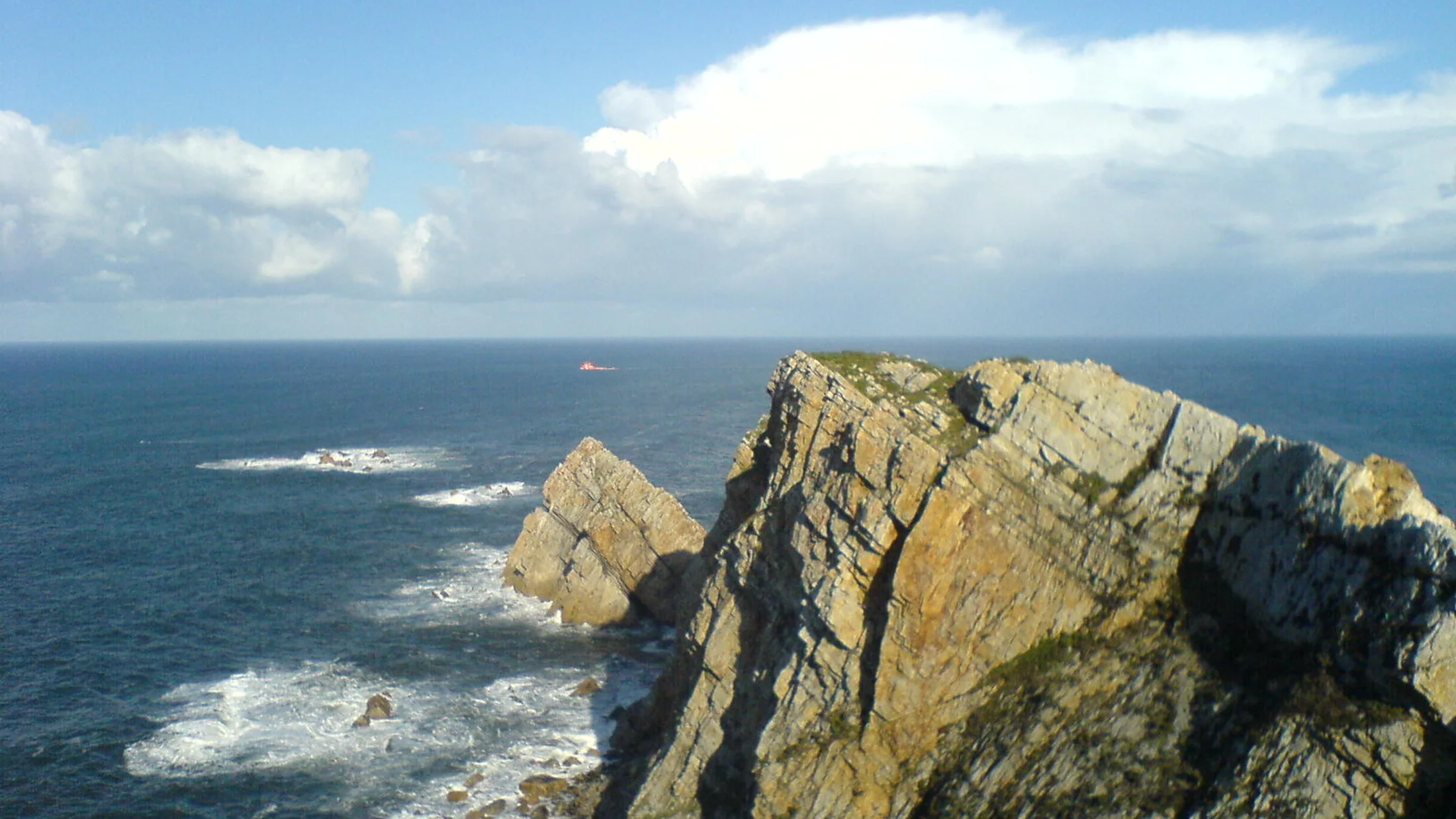
Cabo Peñas is the northernmost point of Asturias, a tongue of quartzite rock jutting into the Cantabrian Sea at 100 metres above the water. Its lighthouse, operational since 1852, serves as the navigation reference for the central Asturian coast and now houses a marine interpretation centre. From the lighthouse esplanade, the horizon opens in a nearly 300-degree arc over the sea, and on clear days the coastline stretches from Cabo Vidio to the west to Cabo Lastres to the east, a panorama spanning over 100 km of shoreline.
The cape's geology is written in Ordovician quartzites and slates, rocks over 450 million years old that rank among the oldest surface materials in Asturias. Marine erosion has carved a stepped cliff relief, wave-cut platforms, blowholes and small rocky coves from these layers. The Podes blowholes, a few kilometres to the east, function as marine geysers when northwesterly swells force water through karst fissures: columns of water and spray can reach several metres in height with a deep sound audible from a distance. At low tide, the rock platforms reveal intertidal pools where limpets, anemones and sea urchins form dense communities visible to the naked eye.
The cape's forward position makes it one of the finest seabird observation points on the Cantabrian coast. During the post-breeding migration, between September and November, thousands of northern gannets, Balearic shearwaters, skuas and lesser black-backed gulls pass the cape heading south. Ornithological counts have recorded days with over 10,000 birds in movement when northwesterly winds push migratory currents close to the coast. In spring and summer, the cliffs host European shag colonies, a species with small Cantabrian populations that uses inaccessible rocky ledges for nesting. Peregrine falcons breed on the steepest faces, and their stooping silhouettes above starling flocks are a regular sight at dusk.
The cape's immediate surroundings blend rocky coast with littoral meadows where Asturiana de los Valles cattle graze. Green pastures reaching the very edge of the cliff create a landscape of contrasts between vivid grass, dark quartzite and the shifting blue of the Cantabrian Sea. The perimeter trail, an 8 km circular route signposted as PR-AS, links the lighthouse with Xagó beach to the south and the Ferrero coves to the east, passing the remains of Civil War coastal defence batteries. Xagó beach, a 1 km strand facing northwest, is a reference point for surfing and bodyboarding in central Asturias.
The coastal towns of Luanco and Candás, 5 and 8 km away respectively, are the natural base for visiting the cape. Luanco retains its working fishing harbour and a historic quarter of Indiano mansions. Candás, adopted home of the sculptor Antón, houses a museum devoted to his work and a canning tradition that lives on in local shops. The cuisine revolves around fresh fish and shellfish: monkfish, spider crab and goose barnacles in the cider houses and harbour restaurants. Gijón is 15 km away via the N-632, making it easy to combine a day at the cape with a city visit.