The Serranía de Cuenca unfolds as a geological labyrinth in the eastern sector of the Iberian System, a territory of limestones sculpted by water and time where nature has carved forms that defy logic. This mountain massif, stretching between the provinces of Cuenca and Guadalajara with altitudes ranging from 900 to 1,866 metres at Pico San Felipe, harbours some of Europe's most spectacular karst landscapes and a hydrological heritage that gives rise to rivers such as the Júcar, Cabriel and Cuervo.
The Ciudad Encantada (Enchanted City), declared a Site of National Natural Interest in 1929, is the serranía's most recognised symbol. This open-air geological museum, set at 1,500 metres altitude, displays limestone formations shaped over millions of years by the differential erosion of water, ice and wind. Blocks resembling petrified ships, giant mushrooms, natural bridges and figures popularly named El Tormo Alto, Los Osos or El Convento appear along a 3-kilometre circular trail that takes about 90 minutes to complete.
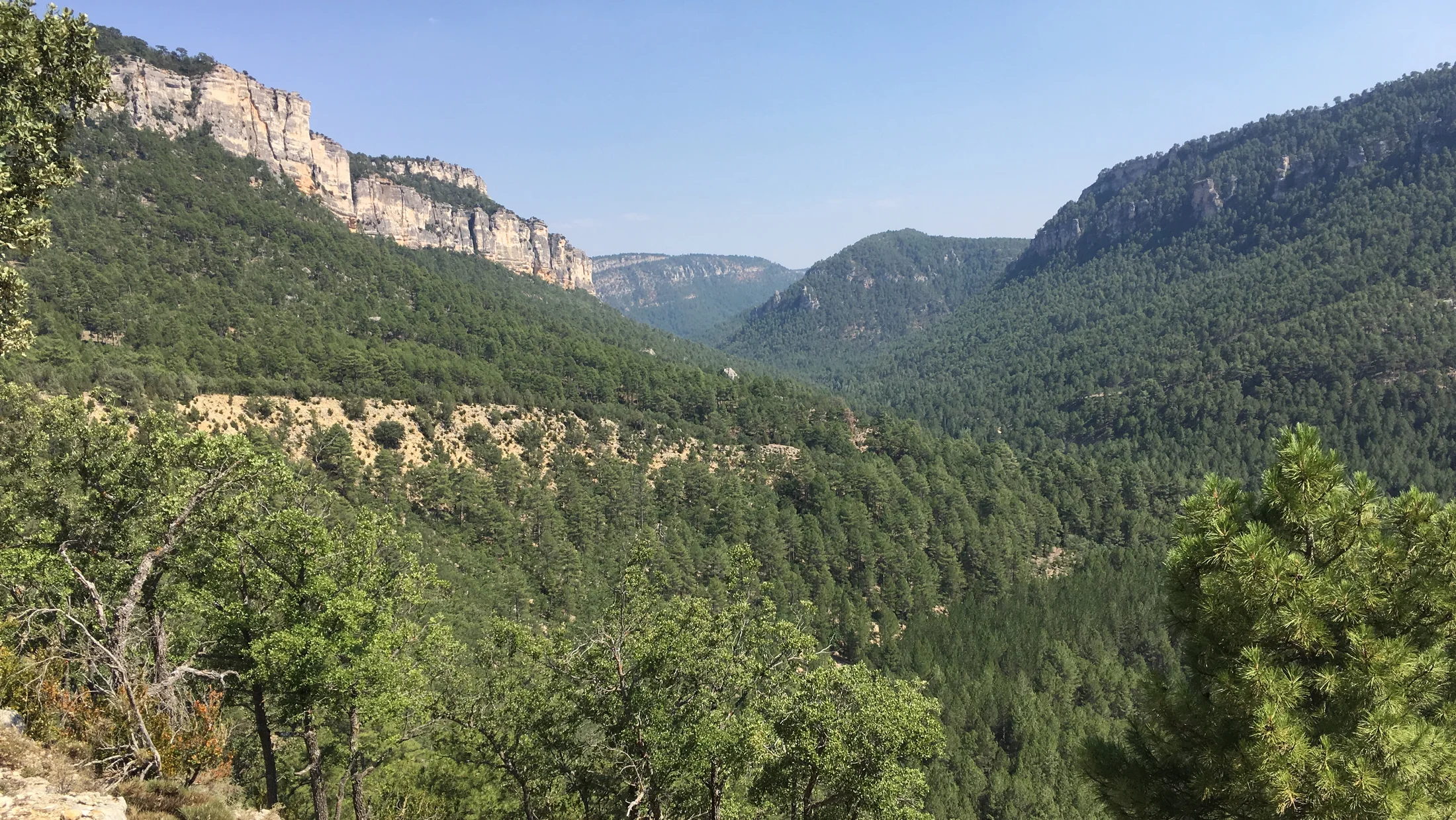
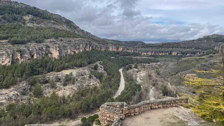
The river canyons of the serranía rival the Ciudad Encantada in spectacle. The Júcar Gorges, between Villalba de la Sierra and Uña, form a ravine with vertical walls up to 150 metres high where the river winds through forests of black pine (Pinus nigra), a species that finds one of its optimal habitats on the peninsula in these mountains. The Cabriel River Gorges, meanwhile, offer a wilder, less-visited landscape ideal for those seeking solitude and crystal-clear water.
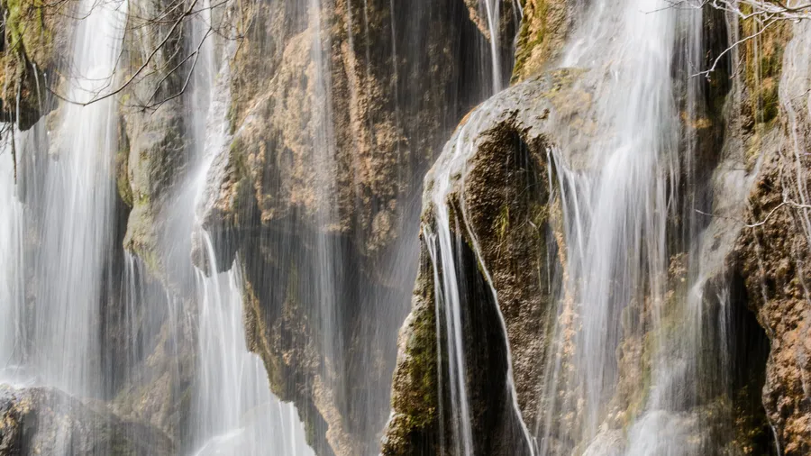
The Source of the River Cuervo, 15 kilometres from Tragacete, is a stepped waterfall where water gushes from moss-covered tufa limestone, creating a vegetal curtain that in winter transforms into an organ of ice stalactites. This natural monument, declared in 1999, is most spectacular in spring, when snowmelt multiplies the flow and water cascades in multiple white threads over the green rock.
The vegetation of the serranía traces a clear altitudinal gradient. At lower elevations, holm oak woodland and rosemary-thyme scrub dominate; at mid-elevations, black pine and maritime pine forests; at the highest levels, Spanish juniper stands (Juniperus thurifera) and mountain pastures. Botanists have identified relict populations of yew (Taxus baccata) and holly (Ilex aquifolium) in shaded ravines where moisture is preserved like a secret.
The fauna includes emblematic species of the Iberian mid-mountain zone. Griffon vultures patrol the limestone cliffs, Iberian ibex scale the crags of the gorges, and brown trout inhabit the upper river reaches. In the riparian forests, otters have recolonised stretches of the Júcar where their presence confirms the good ecological health of the waters.
The Serranía de Cuenca offers a trail network connecting its main attractions. The GR-66 traverses the serranía from north to south over several stages, while local routes allow exploration of sites such as the Laguna del Marquesado, the Callejones de Las Majadas (rock formations similar to the Ciudad Encantada but less crowded) and the Ventano del Diablo, a natural viewpoint over the Júcar Gorges that frames the river like a living painting.
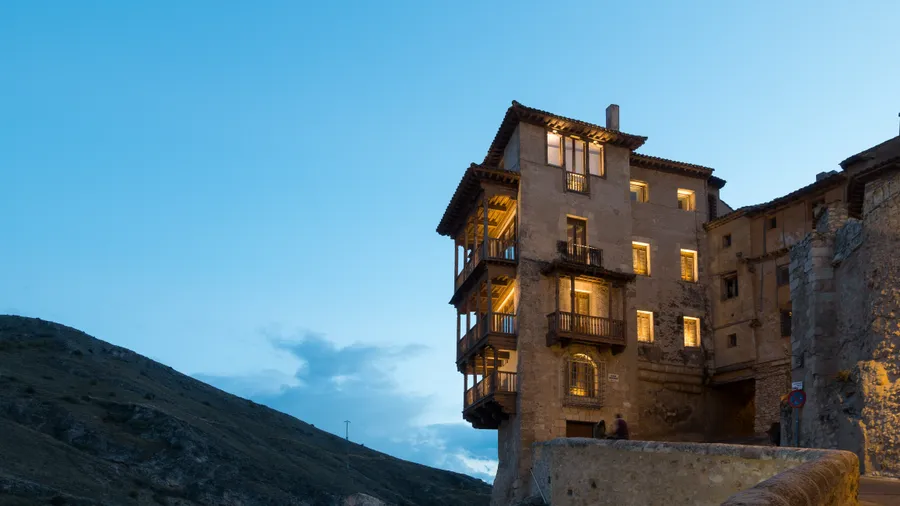
The city of Cuenca, a UNESCO World Heritage Site for its Hanging Houses, serves as the gateway to the serranía. From there, the CU-921 winds into the heart of the mountains, entering a landscape that changes with every bend: from river gorge to dense pine forest, from mountain meadow to limestone cliff face.