Maspalomas occupies the southern tip of Gran Canaria, a territory where the desert meets the ocean and the Atlantic breeze carries grains of sand to form one of Europe's most remarkable dune landscapes. The Maspalomas Dunes, declared a Special Nature Reserve in 1987, cover 403.9 hectares of sandy terrain, palm groves and the celebrated Charca de Maspalomas, a coastal wetland that serves as a vital refuge for migratory birds crossing between Africa and mainland Europe.
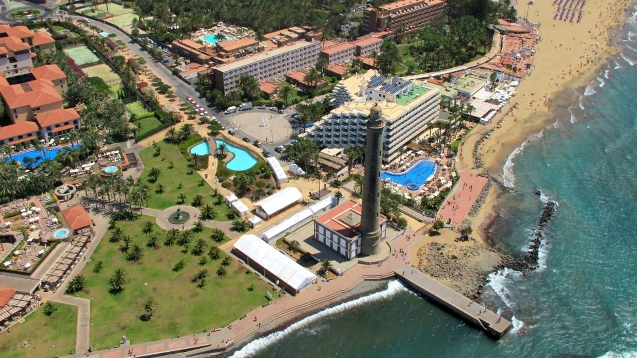
The dune system stretches for nearly six kilometres, from Punta de Maspalomas to the Faro, a stone lighthouse inaugurated in 1890 that still blinks each night across the horizon. Walking among the dunes at dawn, when the low-angled sunlight draws curved shadows on the golden sand, reveals a landscape that could be mistaken for the Sahara were it not for the constant murmur of the Atlantic just metres away.
The Charca de Maspalomas is the ecological heart of the reserve. This wetland, fed by the Maspalomas ravine, shelters species such as the common moorhen, grey heron, Eurasian coot and, during migration season, dunlins, ringed plovers and spoonbills. Botanists have catalogued specimens of Canary Island tamarisk (Tamarix canariensis) and rushes here, species adapted to coastal salinity that form a vegetal barrier between the dunes and the lagoon.
Beyond the dune system, Maspalomas offers a diverse coastal strip. Maspalomas Beach, with its more than two kilometres of fine sand, connects with Playa del Inglés to the east, forming one of the longest coastal stretches in the Canary Islands. The waters, warm year-round thanks to the Canary Current, range from 18 °C in winter to 23 °C in summer, allowing swimming virtually all twelve months.
The Maspalomas palm grove, formed by Canary Island date palms (Phoenix canariensis), adds a green counterpoint to the sandy landscape. This natural oasis extends across the transition zone between the lagoon and the dunes, constituting one of the last strongholds of this coastal ecosystem on the islands.
For birdwatching enthusiasts, the Charca has signposted observation points. The Cabildo de Gran Canaria, responsible for managing the reserve, recommends the early morning hours for observation, when birds are most active and the light is optimal for photography.
Maspalomas combines protected nature with first-rate tourist infrastructure. Just metres from the dunes, visitors find restaurants, hotels and shopping centres, yet the nature reserve imposes a clear boundary: within the dunes, only the wind, the sand and the sea. This coexistence of conservation and tourism makes Maspalomas a singular case in the Canary archipelago, where enjoyment of the landscape depends directly on its protection.