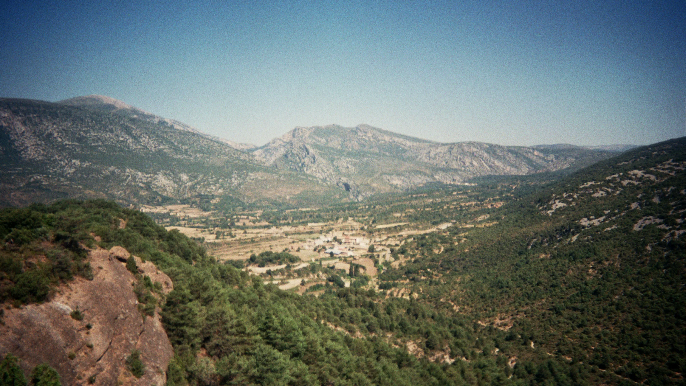
Parque Natural de la Sierra de Guara covers 47,453 hectares in the Huesca pre-Pyrenees, north of the Somontano region. It occupies a transition zone between the arid Ebro lowlands and the snow-capped Pyrenean summits, and this in-between position gives it a landscape diversity hard to match in a space of comparable size: vertical limestone gorges dropping 400 metres to a river on still days, open plateaux with views to France, dense pine forests where sound disappears, and abandoned villages whose stone houses are slowly being absorbed back into the scrub. Sierra de Guara is the birthplace of Iberian canyoning as it is practised today, and the gorges of the Vero, Alcanadre and Flumen rivers are global reference points for the discipline.
The Vero gorge near Alquézar and the Mascún canyon near Rodellar are the park's two most visited sites. Alquézar is a medieval village perched on a limestone spur at 660 m altitude, with an 11th-century Romanesque collegiate church and narrow stone streets that end abruptly at the canyon rim. From the village viewpoints, the Vero river appears at the gorge bottom as a turquoise-green line about 100 m below the level of the houses. The Vero gorge has several sections at different technical levels: from the popular Salto de la Bola section, suitable for beginners in guided groups, to the upper section with rappels exceeding 30 m and extended water passages. The Mascún canyon is more technically demanding and longer—completing the full traverse can take 8 to 12 hours—with narrow passages where water fills the channel wall to wall and progress requires swimming.
Beyond canyoning, Sierra de Guara holds one of Europe's outstanding rock art collections. The Vero paintings, near Colungo and Asque, form part of the Parque Cultural del Río Vero, designated UNESCO World Heritage in 1998 as part of the Rock Art of the Mediterranean Arc. The complex includes more than fifty shelters with paintings ranging from the Upper Palaeolithic to the Bronze Age, showing horses, bovids, human figures and hunting scenes. Access is through authorised guided visits departing from the local museums in Colungo and Alquézar.
Birdwatching is an equally important draw. Sierra de Guara holds one of Spain's densest griffon vulture (Gyps fulvus) colonies, with 400 to 600 breeding pairs recorded in recent counts. The bearded vulture (Gypaetus barbatus)—Europe's largest vulture, with a wingspan of up to 2.8 m—nests on the park's most inaccessible cliff faces, and its numbers have grown steadily following coordinated reintroduction with France and Italy. Egyptian vulture and cinereous vulture are also regular. The cliffs of Mascún and the Alcanadre river provide viewing conditions where these birds appear at eye level from the canyon-rim trails.
Hiking routes follow the network of paths connecting now-abandoned villages in the sierra interior. The Sendero de los Pueblos Abandonados, approximately 25 km and suitable for two days with an overnight at the Otín hostel, passes through the ruins of Santa Cilia, Otín and Balcé, where sunken roofs and empty threshing floors preserve traces of a life that left during the 1950s and 1960s. Landscape photography finds extraordinary material in these ghost villages, in the canyon walls at sunset and in the clouds of vultures riding the thermals.