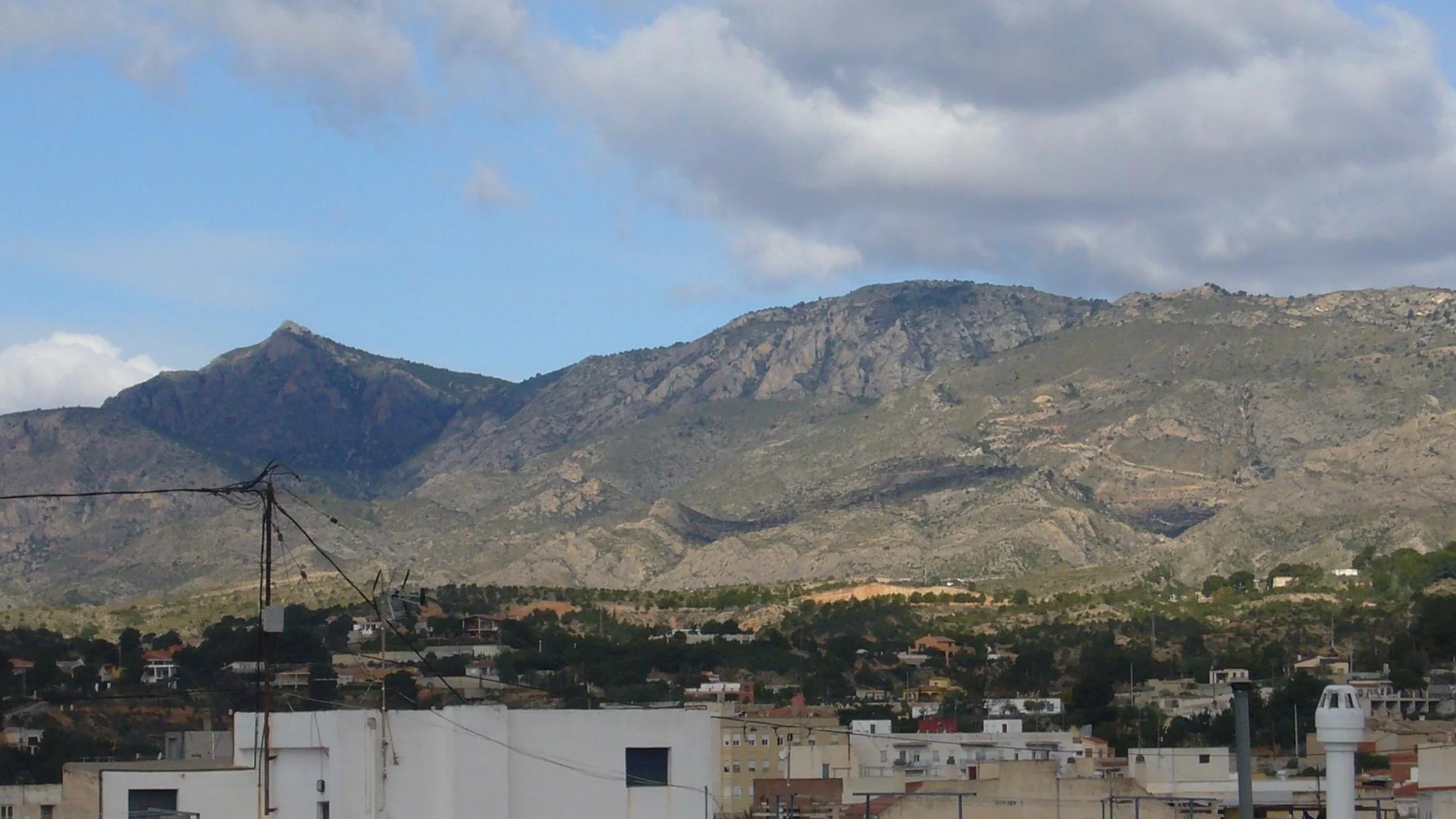
Sierra de Crevillente is a limestone mountain ridge running southwest to northeast across Alicante province, crossing the municipal districts of Crevillente, Hondón de las Nieves, Hondón de los Frailes, Albatera and Aspe. Its highest point is La Vella at 835 metres, followed by El Picatxo (817 m), Sant Juri (794 m) and Puntal de Matamoros (792 m). The natural park protects a Mediterranean mountain landscape where steep slopes, deep ravines and limestone outcrops create rugged terrain that contrasts sharply with the flat agricultural plain of the Vinalopó below.
The range holds Special Conservation Zone (ZEC) status within the Natura 2000 network since 1997, recognising the distinctiveness of its habitats and the presence of plant and animal species of community interest. Flora is dominated by thermophilic Mediterranean scrub: rosemary, thyme, lavender, gorse and esparto grass cover the south-facing slopes, while shaded ravine floors support pockets of holm oak and lentisk that retain soil moisture. The herbal scent saturating the air is a constant on any walk, most intense on spring mornings when the aromatic plants reach peak fragrance.
Wildlife includes high-value raptors such as Bonelli's eagle, one of Europe's most threatened birds, which holds breeding territory on the sierra's cliff faces. Eagle owl, peregrine falcon and kestrel are also present, alongside mammals including fox, genet, badger and Iberian ibex, reintroduced across several ranges in south-eastern Spain. Reptiles thrive on the limestone slopes: ladder snake, ocellated lizard and lataste's viper are regularly recorded species.
Waymarked hiking routes include trails PR-V 108, PR-V 109 and PR-V 110, which form part of the 456.6-kilometre Gran Ruta 330 (Costa Blanca Interior Trail) divided into 20 stages. Sierra routes alternate medium-difficulty ridge sections with views of the Mediterranean Sea and the El Hondo Natural Park with technical descents through ravines where 19th-century dry-stone shelters survive — built by quarry workers to store gunpowder and take cover during limestone extraction. The Los Molinos Environmental Education Centre, housed in restored 19th-century flour mills at the foot of the range, offers workshops on geology, botany and astronomy.
The range's proximity to El Hondo Natural Park, under 20 minutes by car, allows a single day to combine limestone mountains and wetland. This landscape duality — rock and water, aromatic scrubland and reedbed — is one of the distinctive draws of southern Alicante. The sierra's quarrying history has left abandoned workings where cut rock exposes the limestone strata, an open-air teaching resource for those interested in geology. At sunset, golden Mediterranean light catches the eastern ridges and silhouettes El Picatxo against a sky shifting from orange to violet.