Introduction: why hike in Asturias
About hiking in Asturias
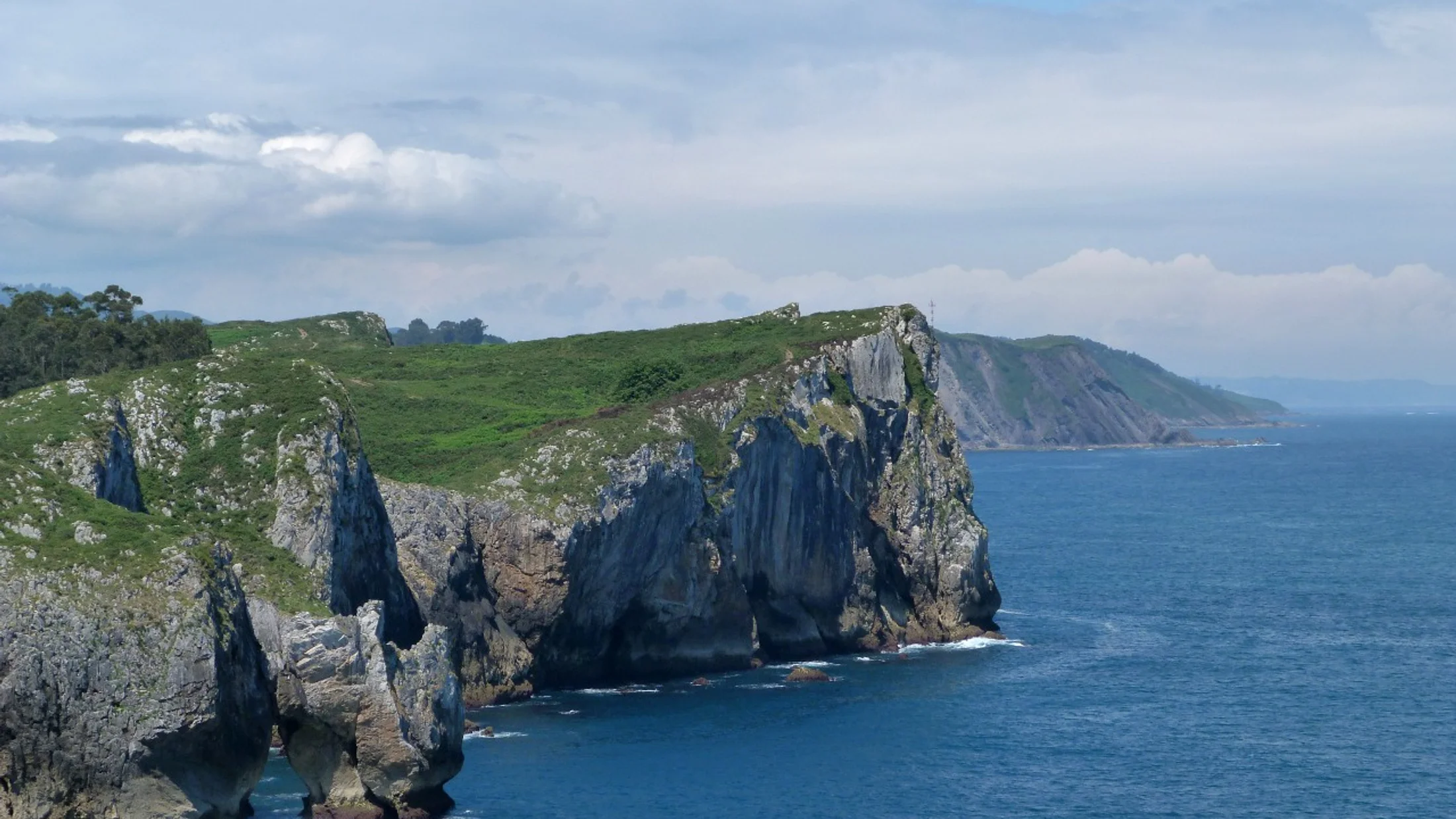
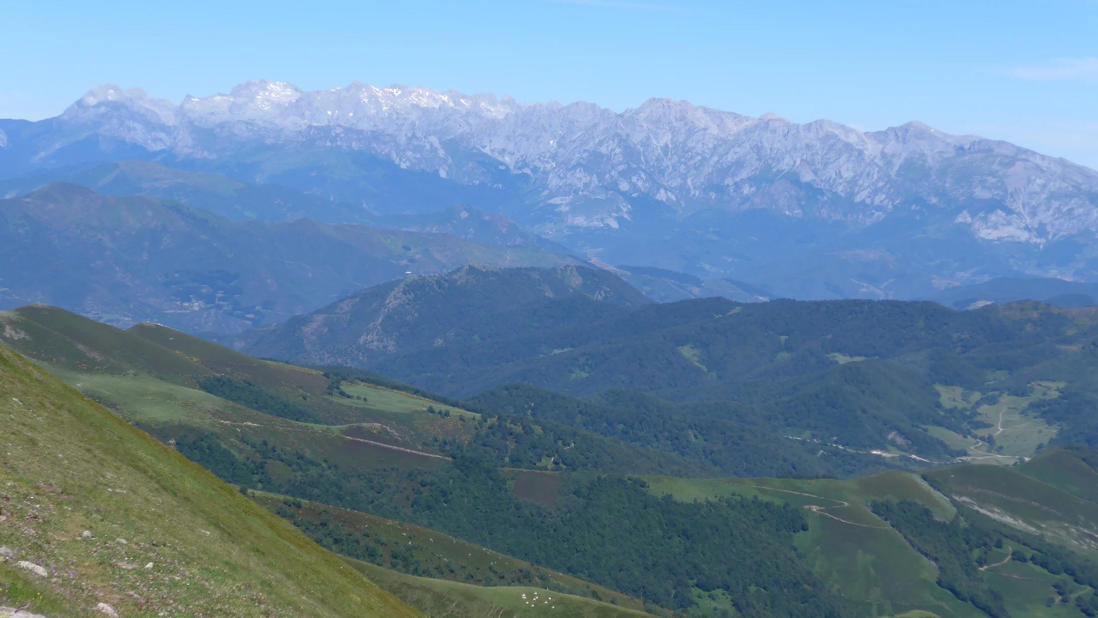
Asturias packs sea, valley, and high mountain into just a few kilometers. This is a perfect mix for hiking in Asturias. In less than 80 km, you go from the Cantabrian Sea to the Picos de Europa. There are summits over 2,500 m and forests that stay moist all year (source: Picos de Europa National Park, AEMET). You smell salt near the cliffs and damp leaves in ancient beech forests. This guide helps you choose routes and organize your getaway with concrete data and local advice.
Reasons to choose Asturias
The region has routes for everyone: families, beginners, and those looking for demanding traverses. There is varied signage and services in valleys and coasts. In one trip, you can walk the Senda del Oso, climb to the Mirador de Ordiales, and look out over the cliffs of Cabo Peñas. The sound of a cowbell in the pastures reminds you that people living from the mountain care for this landscape. Here you will find variety, reliable access, and a food culture that rewards every step.
What you will find in this guide
Picuco te puede ayudar
Does something here catch your eye?
Tell us.
Write to us on WhatsApp or email: we answer questions, find the best options and help you sort out the booking.
You will discover the best hiking routes in Asturias by type: mountain, coast, lakes, and greenways. Times and elevation changes are explained. You will also see planning, safety, accommodation, rules, and FAQs with official sources for more detail. Imagine the fresh wind on a mountain pass. Use this guide as a checklist before you leave and to book rural experiences with Picuco.
Essential information
Location and best time to visit
Asturias is in northern Spain, between the Cantabrian Sea and the Cantabrian Mountains; the climate is Atlantic, with year-round rainfall and mild summers (AEMET). On the coast, spring and autumn offer clear light and temperatures of 12-22 °C, while in the mountains summer is the most stable window; winter with snow and ice demands technical gear and experience. Think of the glow of mist rising over meadows at dawn. Choose months by goal: coastal routes in Asturias and greenways, from March to June and September to November; high mountains, June to October, avoiding afternoon storms. Bring layers: a breathable base layer, a fleece, and a rain jacket, and start early in summer to avoid sun and crowds; in winter, short days, cold, and ice require crampons and an ice axe if there is snow. Always check AEMET mountain weather and the park bulletin before heading out.
How to get there and local transport
You arrive via the A-8 (Autovía del Cantábrico) and the A-66 (Meseta), with direct access to Oviedo, Gijón, and Avilés by car. By train, AVE/ALVIA services connect Madrid to Oviedo in about 3 h 20-3 h 45 depending on the service, and FEVE runs along the coast with useful stops for coastal sections (RENFE). Picture the slow rhythm of the train skirting meadows and inlets. By plane, Asturias Airport (OVD) is 35-40 minutes from Oviedo and Gijón; alternatively, Santander (SDR) is about 2 hours away via the A-8, and A Coruña (LCG) is about 3 hours away. To get around, the Asturias Transport Consortium coordinates buses and commuter trains; ALSA connects towns and valleys. For linear routes, leave your car at the end and reach the start by bus or local taxi, or use a shuttle if available (for example, at Lagos de Covadonga in summer).
Accommodation and bases for routes
You will find guarded mountain huts in the Picos, rural houses, family hotels, and campsites near routes. Cangas de Onís is a versatile base for the lakes and the east; Llanes for coastal routes and beaches; Oviedo for combining culture and interior greenways. It smells of wood and broth in village kitchens after a day of fine rain. Book ahead in summer and on long weekends, and choose lodgings with early starts, luggage storage, or picnic options. If you will do a traverse, check huts like Vegarredonda, Collado Jermoso, or Urriellu and confirm availability and dinner times. For families, look for proximity to the route start and services like cots and microwaves.
Permits, rules, and services in the mountains
Hiking generally does not require permits, except in specific areas like the Muniellos Integral Reserve, which has daily quotas (check the official website of the Principality). At the Lagos de Covadonga, road access is regulated in season, with shuttle buses from Cangas de Onís (check official website). Feel the brief echo of your steps on the wooden walkways. Find out about the rules of the Picos de Europa National Park and the Natural Parks (Somiedo, Redes, Ubiñas-La Mesa): dogs on leads, no camping outside designated areas, no fires. Identify marked springs and always carry a backup water plan. Emergencies: 112 Asturias; check snow and weather reports on AEMET and tide warnings from Puertos del Estado for coastal routes.
Best routes by type: mountain, coast, lakes, and greenways
Mountain routes (Picos de Europa and main massifs)
Cares Route (Poncebos-Caín): 24 km round trip, 600 m cumulative elevation gain, 6-8 hours, spring-autumn; requires controlled tolerance for heights and a helmet is recommended due to falling stones on exposed sections. The trail is carved into the rock like a scar, and the sound of water from the channel echoes under the tunnels. It starts in Poncebos (Asturias) and follows the channel to Caín (León), with taxi alternatives between ends in season; avoid midday hours in summer and bring a headlamp for the tunnels. Pandébano - Urriellu Refuge (Naranjo de Bulnes): 12-14 km round trip, +700-800 m, 5-6 hours, best from June to October. Picu Urriellu appears suddenly like a golden tower at sunset. Depart from Collado Pandébano (limited parking), pass through Terenosa, and tackle the final scree slope with poles; demanding in effort, no technical climbs unless you summit. Bring sun protection, water from the start, and check refuge availability if you plan to stay overnight. Pandecarmen - Ordiales Viewpoint (Vegarredonda): 16-18 km round trip, +900 m, 6-7 hours; classic itinerary from the Lakes of Covadonga with views of the Cornión. The wind cuts across the ledge, and the valley opens like a relief map. Marked path to Vegarredonda and a final section on a steep trail to the viewpoint; frequent fog, GPS and map recommended. In summer, use the bus to the lakes and arrive early to park if access is open. Advanced ascent: Torre de la Palanca (2,614 m, Central Massif): alpine activity with easy scrambles (grade I/II), 8-10 hours from Collado Jermoso or a bivouac, only for experienced mountaineers or with a certified guide. The limestone warms your hand and gives off a mineral smell. Helmet, harness, and rope may be necessary depending on conditions; check with refuges (Diego Mella/Collado Jermoso) for logistics. Less technical alternative: Horcados Rojos from the Fuente Dé cable car, checking cable car schedules.
Coastal and cliff routes
Llanes Coastal Path (section Celorio-Niembro or Barro-Buelna): 8-12 km, mostly flat, 3-4 hours, all year avoiding storms. The sea hits blowholes and rocks, leaving a smell of salt and seaweed. Multiple access points and return by local bus in season; watch for tides at beach crossings and don't get close to cliff edges. Long variant: link Llanes-Andrín with viewpoints and beaches. Cabo Peñas (PR-AS 25 and surroundings): 9-12 km depending on variants, 3-4 hours, windy and exposed terrain. The lighthouse blinks and seagulls glide over meadows cut by sea spray. Start in Verdicio or the Peñas Lighthouse parking and walk along cliffs with boardwalks and rest stops; avoid windy days and respect livestock enclosures. Good sunsets outside August. Dinosaur Coast (Colunga-Ribadesella): 6-10 km in sections, 2-3 hours, clearer at low tide. The footprints at La Griega look like bowls in the wet rock. Combine a coastal walk with a visit to MUJA (Museum of the Jurassic of Asturias), check the tide table (Puertos del Estado) for tracks at Tereñes or La Vega. Vary with easy urban routes in Ribadesella.
Routes around lakes and lagoons
Lakes of Covadonga (Enol and Ercina): easy 5-7 km circuit with variants, 2-3 hours, gentle elevation, accessible in summer with bus and regulation. Enol's surface reflects clouds like a mirror stirred by a breeze. Avoid peak hours 11:00-16:00 in August, walk early or at sunset; add a visit to the Pedro Pidal Center and La Reina Viewpoint by car or bus. Terrain suitable for families used to walking. Somiedo Natural Park: Valle Lake from Valle de Lago, 12 km round trip, +300 m, 4 hours, wide pasture trail. Broom bushes brush your legs with a resinous scent. Best in spring-autumn; in summer, start early due to heat and crowds. Variant: Saliencia Lakes (6-10 km circuits) with old mines and intense turquoise waters; for photographers, side light in early hours.
Greenways and easy routes to enjoy the landscape
Bear's Path: greenway of 22 km main (Tuñón-Entrago) with branches to Quirós, paved/compacted surface, ideal for bikes, strollers, and trailers. Tunnels exhale cool air and the smell of damp stone. Rent bikes in Tuñón, Proaza, or Entrago; plan an outbound with a slight climb (south) and a favorable return. Stops: Buyera Area, Bear Classroom, and bridges over the Trubia. Cervigón Path (Gijón): 9 km between La Arena neighborhood and La Ñora, coastal walk with benches and stairs, 2-3 hours. Foam breaks on rocks below the green railing. Ideal for sunsets and families wanting to combine beach and walk; access to city bus for return. Other options: Greenway of La Camocha (Gijón) with shaded sections and mining panels, perfect on hot days.
:::danger{ "title": "Important" } This itinerary is for guidance only. Times and distances may vary depending on weather conditions, your fitness level, and experience. Assess your abilities before starting the route. The mountains can be dangerous - always go prepared and with the proper equipment. We are not responsible for accidents or incidents. :::
Recommended routes for families and beginner hikers
Short, accessible routes (under 5 km)
Mirador del Fitu (Sierra del Sueve): a 2-3 km circular walk from the parking area, taking 1 hour, with sea and mountain views. The wind carries the smell of heather onto the metal platform. Ideal for children for its immediate visual reward; toilets available seasonally at the viewpoint and picnic areas nearby. Playa de Gulpiyuri: access of 0.3-1 km depending on the parking spot, flat terrain, taking 30 minutes, best at mid/high tide. The sound of water appears without seeing the sea, like a secret in the limestone. Avoid peak August hours and respect private meadows; combine it with the Senda Costera de Llanes. Senda del Río Ñora (short section): 4-5 km round trip to the viewpoint, 1.5-2 hours, with ample shade and boardwalks. The forest smells of damp and leaves along the riverbank. Suitable for short walking poles; there are stairs in some sections, not all strollers can pass; tables available at the riverside beach area. Área de Recreo de La Pesanca (Piloña): 3-4 km along a track next to the Río Infierno, 1-1.5 hours, very shady. The murmur of the water accompanies you like a constant thread. A good spot for a picnic and birdwatching; avoid after storms due to falling branches. Cascada de Oneta (Villayón): 3.5 km round trip, 1.5 hours, be careful of mud. The fresh spray from the waterfall wets your face as you approach. Best with footwear with good grip; some rocks are slippery; do not get close to the edge with children.
Routes with activities for children
Senda del Oso with playful stops: the Tuñón-Proaza section (8-10 km round trip), rental bikes with child seats and trailers. Light filters in strips through the cool tunnels. Add a visit to the Aula del Oso and "track searching" games (PR signs, panels, bridges) to keep their attention. Costa de los Dinosaurios + MUJA: a short walk at La Griega followed by a museum visit with models, 2-3 hours total. The smell of the sea and the museum's waxed wood mixes time and territory. Bring a sheet with silhouette outlines of footprints so they can identify shapes in the rock; check the tides so you don't miss the visit. Minas de Arnao (Castrillón) + coastal walk: a guided tour of the galleries and nearby viewpoints, taking 2 hours. Your helmet echoes when you touch the coal wall. Explain simple terms: galería (mine tunnel), "castillete" (extraction tower); end at the beach if the weather is good. Aula de la Naturaleza de Somiedo + partial Lago del Valle: walk 1-2 km there and back, focusing on observation. The hum of meadow insects sounds like a background track. Bring light binoculars and a "treasure list" (three flowers, one bird, one track).
Tips for beginners and how to progress
Start with trails of 3-5 km and less than +200 m of elevation gain (elevation gain: height difference between the start and highest point). A well-adjusted backpack shouldn't bother you in the first kilometer. Golden rule: walk at a conversational pace, rest every 60-90 minutes, hydrate, and eat lightly. 3-day plan: Day 1, greenway (Senda del Oso 10 km round trip); Day 2, easy coast (Cabo Peñas 8-10 km); Day 3, accessible lake (Lagos circuit 6 km). To progress, increase either distance or elevation by 20-30% on each outing, never both at once. Learn basic orientation: read PR signs (yellow/white), follow a GPX track (file with the route), and use a paper map as backup. Minimum gear: hiking footwear with deep tread, 15-20 L backpack, waterproof jacket, fleece layer, 1-1.5 L water per person, hat, sunscreen, basic first-aid kit, and a phone with offline maps. If you get hooked, add trekking poles, a water filter, and a headlamp. Check local clubs for guided outings to build confidence.
How to plan your route: maps, difficulty levels, and logistics
Assess your level and choose the right route
Be honest about your fitness and technical experience before deciding. The cold air hitting your lungs at a mountain pass shouldn't catch your body off guard. Key criteria: total distance, cumulative elevation gain, technical difficulty (terrain type, scrambles), estimated time, and forecasted weather. Ask yourself questions: How much city walking can I do without tiring? Can I handle slopes without pain? Do I know how to turn back if I get lost? For families, look for a short loop with a visual reward; for advanced hikers, a mountain route with a refuge. Examples: beginner, Río Ñora 5 km; intermediate, Urriellu 12-14 km; advanced, Ordiales 16-18 km with possible fog.
Essential maps, apps, and digital resources
Download offline maps and the GPX track from reliable, verified sources. Your fingers will feel the texture of paper when you fold the map as a backup. Recommended apps: IGN Mapas de España (official cartography), Wikiloc and OruxMaps for tracks and navigation, and Maps.me for basic city cuts and access points. Tips: Check the track's date and comments, compare it with the IGN 1:25,000 sheet, and study the contour lines (lines connecting equal height; close together means steep). Add AEMET for weather forecasts, MeteoBlue for models, and Puertos del Estado for tides. Save battery: use airplane mode, low brightness, and a powerbank.
Logistics: transport, water points, and refuges
Plan if your route is circular or linear and how you'll return: local bus, rural taxi, or a shuttle car with friends. The clink of water in your canteen marks your breaks. Mark reliable springs on your map and carry at least 1 L per 2 hours on the coast and 1.5 L in the mountains; filter stream water if no potability signs are present. For multi-day trips, book refuges in advance (Vegarredonda, Urriellu, Jou de los Cabrones) and know the dinner/breakfast times. Bring a sleeping bag liner, earplugs, and cash. On greenways, locate bike rentals and rest areas; on the coast, coordinate with tides and buses to avoid exposed sections.
Plan B, time management, and permits
Design alternatives: shortened loops, escape points, and turn-around times (if I don't reach X by 12:30, I turn back). The shadow creeping across the valley reminds you daylight is fading. Add stops to your total time: every 300 m of elevation gain adds about 1 hour at a moderate pace, and each long break counts too. Permits: Check reserves with quotas (Muniellos), access regulations (Lagos de Covadonga), and closures for wildlife or quarrying on official websites. Inform someone of your plan and return time, and share your location if there's coverage. In case of doubt, don't go: it's better to turn back on time than to have a problem.
Activities and attractions along the way (viewpoints, wildlife, heritage, gastronomy)
Must-see viewpoints and landscapes
Mirador del Fitu (Sueve) combines sea and peaks in a single glance. The air smells of salt and pine resin at the same time. Use it at dawn or the last light for the best photos; accessible by car and short walks. Mirador de Ordiales in Picos offers pure verticality after a full day's hike. Mist in the abyss draws layers of mountains. Best with high fog and a reliable track; don't approach the edge in windy conditions. Cabo Vidio and Cabo Peñas feature cliffs and scenic lighthouses. The roar of the sea accompanies every photo. Follow marked walkways and avoid eroded areas; spectacular sunsets on clear days.
Flora and fauna: what to expect and how to observe with respect
In the mountains you'll see beech forests, high-altitude pastures, and heathland with heather and broom; on the coast, gorse, sea fennel, and wind-swept meadows. The buzz of insects and the croaking of choughs paint the sound of summer. Iconic mammals: Cantabrian brown bear (Somiedo, Proaza; responsible and distant observation), chamois and roe deer; birds like griffon vultures, Egyptian vultures, and shags on the coast. Observe at dawn/dusk with binoculars and keep your distance; never feed wildlife. Walk quietly, yield to livestock, and close gates. Use identification apps (Merlin, PlantNet) and note species without picking them.
Cultural heritage and historical points of interest
Along the route you can visit Covadonga (Basilica and Holy Cave), pre-Romanesque churches in Oviedo (Naranco and Lillo), medieval bridges (Cangas de Onís), and restored mills in valleys. The damp stone gives off an ancient scent. Include short stops in circular itineraries or plan a half-day for culture when the weather is uncertain.
Local gastronomy and recommended stops
Treat yourself to fabada, Asturian pot stew, tortos, shared cachopo, and cheeses like Cabrales, Gamonéu, and Afuega’l pitu. The sizzle of a grill in a village house awakens the appetite. On eastern routes, stop in Arenas de Cabrales or Cangas de Onís; on the Bear Path (Senda del Oso), Proaza and Entrago offer cider houses and snacks. Pack a sandwich and fruit in your backpack; for special diets, request a picnic from local accommodations.
Practical tips and safety (equipment, weather, signage)
Essential equipment and clothing for each type of route
For mountain trails: boots or shoes with deep tread, trekking poles, layers (three-layer system: base, insulation, waterproof), headlamp, first-aid kit, thermal blanket, map/GPS, and 1.5-2 L of water. Rain jackets often crackle when unfolded before a short summer shower. For coastal paths: shoes with grip, windbreaker, cap, and sunscreen; on greenways: checked bike or comfortable shoes, lights, and a vest if there are tunnels. Choose footwear by fit: firm heel, roomy toe, sole with lugs. Adjust your backpack to your torso, fasten the hip belt to carry weight, and stabilize the straps. For children, use 8-12 L packs with water, a snack, and a windbreaker; assign tasks (holding the map, counting signs) to involve them.
Weather and how to react to sudden changes
Asturias weather changes fast: fog in the Picos, sea breezes on the coast, and brief showers even in summer (AEMET). The smell of wet earth often arrives before the first drops. If a storm threatens, avoid ridges and isolated trees, move to safe ground, and wait; in fog, slow your pace, follow the track, and mark points on your map; if the temperature drops, put on layers and keep hands and head covered. Check the mountain forecast the evening before and on the day, and observe the sky: vertically developing clouds signal a storm. On the coast, check wind and tides to avoid getting cut off.
Signage, orientation, and what to do if lost
Know the markings: GR (red/white, long-distance), PR (yellow/white, short-distance), and SL (green/white, local trails). Paint on rock stands out like markers on pale limestone. Follow posts and panels, but cross-reference with a map or GPX on your phone. If you get lost: stop, stay calm, eat and drink, check your last known point, and return there if possible. Avoid shortcuts through gorges or unstable scree. Call 112 if there is danger; provide coordinates from your phone's GPS (Google Maps or IGN app) and describe your surroundings.
Good practices and environmental responsibility
Practice "Leave No Trace": take all your waste back with you, including organic waste, and use bags. Trampled grass takes a long time to recover after an unnecessary footprint. Keep dogs on leashes where required, respect livestock enclosures, and do not feed wildlife. Do not make fires except in designated areas, and support local guides and providers who care for the land.
Frequently Asked Questions
FAQs on logistics and planning
Can I do routes without a car? Yes, combine ALSA buses, local trains, and taxis; base yourself in Oviedo or Cangas de Onís for better coverage. The bus engine hum sounds like an early mountain departure. Is one base better or several? For the eastern coast, Llanes; for the Picos, Cangas de Onís; for the west, Luarca/Navia. How do I fit several routes into 3 days? Day 1 Senda del Oso, Day 2 coast (Cabo Peñas or Llanes), Day 3 Lagos de Covadonga or a short Ordiales trail. Check access hours for the Lakes and tide times on the coast.
FAQs on safety and equipment
Do I need a GPS? It's not mandatory, but very advisable to carry a GPX track and a paper map as backup. The screen lights up your palm like a small flashlight. What if the weather changes? Reduce exposure, put on layers, descend if there's a storm, and decide with a time margin; check AEMET before you go. Minimum essential gear: shoes with grip, a rain jacket, water, food, a headlamp, a first-aid kit, and a phone with battery. For mid/high mountain, add poles, a thermal layer, and an emergency blanket.
FAQs on regulations, dogs, and reservations
Can I go with a dog? Yes, on a leash in parks and where indicated; avoid pastures with livestock if your dog isn't used to it. Your dog's steady panting sets your pace. Do I need permits in the Picos? Not for general hiking, but respect access regulations (Lakes) and possible closures; check the Park's website. Do the mountain huts require a reservation? Yes, essential during peak season; contact each hut directly and confirm cancellation conditions. For Muniellos, book months in advance on the Principado's website due to daily quotas.
Conclusion and call to action (bookings, Picuco experiences)
Summary and final recommendations
Asturias lets you choose between cliffs, beech forests, and alpine limestone in a single trip. The last ray of sun warms the rock as you review the map for the next day. Pick a route based on your level, check elevation gain and times, and check the weather forecast; on the coast, look at tides and wind; in the mountains, watch for fog and schedules. Recommendations: families, combine the Senda del Oso with the Lagos de Covadonga at dawn; beginners, the coast of Llanes and Fitu at sunset; experienced hikers, Ordiales or Urriellu with an early start. Respect the land and use local services: they maintain the trails and living culture.
How to book and what Picuco offers
With Picuco, you can book rural experiences and guided outings with verified local providers. The click that confirms your spot sounds like a quiet hum before the trip. Steps: choose your destination and level, select a date and group size, and confirm; you'll receive a meeting point, recommended gear, and clear cancellation policies. Benefits: local guides, handled logistics (transfers, refuges), and family options with adapted paces. If you prefer to go on your own, check our curated selection of routes and downloadable checklists. And if the weather changes, we help you replan with safe, realistic alternatives.
Invitation to share experiences and additional resources
We want to hear about your route: share photos, times, and lessons learned, and leave a review to help others. The murmur of shared stories sounds like a common river. Subscribe to receive new guides and last-minute updates (regulations, closures, tides) and consult resources: IGN cartography, AEMET mountain weather, Puertos del Estado, Consorcio de Transportes de Asturias. If you're missing information or want to suggest a route, send us your feedback. With your contributions, we improve this guide and support the community that cares for these paths.