Hiking Routes in Seville: Top 10 (Easy and Hard)
Introduction
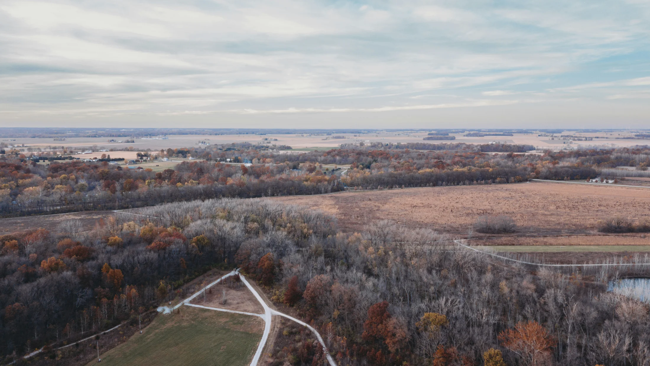
Seville is not just the Giralda and Semana Santa. Just 30 kilometres from the city centre, the Sierra Norte unfolds 177,000 hectares of holm oaks, cork oaks and streams where hiking is enjoyed without the crowds. Here you will find 10 hiking routes in Seville selected for all levels: from family-friendly 5 km walks to demanding 18 km ascents with serious elevation gain. Each route includes technical difficulty, exact distance, what to see along the way and where to start. If you are looking for Seville hiking routes with clear maps and practical tips, this guide takes you from the map to the trail in one read.
Picuco te puede ayudar
Does something here catch your eye?
Tell us.
Write to us on WhatsApp or email: we answer questions, find the best options and help you sort out the booking.
Easy Hiking Routes in Seville
1. Ribera del Huéznar Trail (San Nicolás del Puerto)
Distance: 5 km (out and back) | Elevation: 50 m | Time: 1h 30min | Difficulty: Easy
The water of the Huéznar river accompanies your steps the entire way. This trail starts at the recreational area of San Nicolás del Puerto and follows wooden boardwalks through alders and oleanders. In summer, natural pools invite a quick dip; in autumn, the riverside forest turns shades of ochre. There are no technical sections: you walk along a wide, well-marked path suitable for children aged 6 and up. The only requirement is footwear with grippy soles to avoid slipping on wet rocks. Park in the village (free) and follow the white and yellow trail markers.
2. Vía Verde de la Sierra Norte (Cazalla-San Nicolás section)
Distance: 8 km (one way) | Elevation: 120 m | Time: 2h | Difficulty: Easy
A former railway line converted into a pedestrian and cycling trail. You leave Cazalla de la Sierra along a compacted path, cross three tunnels carved into limestone and walk through pastures of centuries-old holm oaks. The gradient is gentle and steady; you can do it with an all-terrain buggy. In spring, rockrose and lavender scent the air. Bring a torch for the tunnels (the longest is 400 metres) and enough water: there are no fountains along the route. If you prefer a round trip, shuttle services will take you back to the start for 5 euros.
3. Cerro del Hierro Trail (San Nicolás del Puerto)
Distance: 6 km (loop) | Elevation: 180 m | Time: 2h | Difficulty: Easy-Moderate
Karst formations sculpted by erosion and ancient mining. The trail circles old iron workings now turned into natural viewpoints. You climb along a stony path with no technical difficulty; the reward is 360-degree views over the Sierra Norte. In winter, the crags host colonies of griffon vultures soaring on thermals. Bring binoculars if you are interested in birdwatching. The Cerro del Hierro car park (free) marks the start; follow the white and green PR-A 24 trail markers.
Moderate Hiking Routes in Seville
4. Cascadas del Huéznar (Alanís to San Nicolás)
Distance: 12 km (one way) | Elevation: 220 m | Time: 3h 30min | Difficulty: Moderate
A riverside route linking Alanís with San Nicolás del Puerto along the Huéznar valley. You pass through gallery forests, walk beside three waterfalls with drops of 4 to 8 metres and cross two fords (impassable after heavy rain). The terrain alternates between narrow trail and sections of loose rock; basic mountain experience is required. The best time is April-May, when the water flow is high and the waterfalls are at their most impressive. Arrange return transport or leave a car at each end. There is a free camping area at km 7 (fires prohibited).
5. Ruta de los Castillos (Constantina)
Distance: 10 km (loop) | Elevation: 280 m | Time: 3h | Difficulty: Moderate
From Constantina you climb Cerro Mascaraque to visit the ruins of the 12th-century Almohad castle. The trail ascends through abandoned olive groves and cork oak forests; the climb is steady but with no exposed sections. From the keep (at 510 m altitude) you overlook the Viar valley and, on clear days, can make out the outline of Sierra Morena to the north. You descend via the eastern slope, through Portuguese oaks and strawberry trees. The village has bars where you can refuel; try the pumpkin gazpacho typical of the area. Park at Plaza de España.
6. Garganta de la Olla Trail (El Pedroso)
Distance: 11 km (loop) | Elevation: 310 m | Time: 3h 30min | Difficulty: Moderate
A gorge carved between quartzite walls where the Arroyo de la Olla has carved crystal-clear pools. You start in El Pedroso and descend along a rocky trail to the bottom of the gorge. There are two sections with fixed chains to secure the descent (avoidable via a longer alternative). The streambed section involves walking over loose stones; in summer you can wade through. Climb up the opposite slope through rockrose and mastic trees back to the village. An ideal route for hot days: the gorge keeps a cool microclimate. Not suitable for those with moderate vertigo on the chain sections.
More routes and activities near Seville
Discover hiking and outdoor activities near Seville on Picuco. You can also explore the Sierra Norte de Sevilla. See all activities →
Hard Hiking Routes in Seville
7. Pico del Hamapega Summit (966 m)
Distance: 16 km (loop) | Elevation: 520 m | Time: 5h | Difficulty: Hard
The highest point in the province of Seville. From Almadén de la Plata you take the forest track that climbs up the south face; from km 4 the trail narrows and the gradient steepens to 25%. The summit offers views over the Embalse de El Pintado reservoir and, in the distance, the foothills of Extremadura. The final section crosses granite blocks with some easy scrambling (grade I-II). You need good fitness and mountain experience. Carry 2 litres of water per person (no fountains) and sun protection (little shade). In winter, snow is possible on the summit. Check the weather forecast before setting out.
8. Sierra del Viento Traverse (Cazalla-Constantina)
Distance: 18 km (one way) | Elevation: 680 m cumulative | Time: 6h | Difficulty: Hard
A full traverse of the Sierra del Viento linking Cazalla de la Sierra with Constantina. Leave Cazalla early (7am recommended in summer) and climb via the Cordel de la Cañada Real. You cross three mountain passes above 600 m, walk through holm oak pastures where Iberian pigs graze and descend through the Barranco del Loro to Constantina. A demanding route due to length and cumulative elevation; transport planning is required. In spring, the carpet of wildflowers (poppies, foxgloves) makes the effort worthwhile. Carry a GPS or a downloaded track: waymarking is patchy in some sections.
9. Roman Mines Route (Munigua-Itálica)
Distance: 14 km (one way) | Elevation: 420 m | Time: 4h 30min | Difficulty: Moderate-Hard
A historical-natural route connecting the Roman archaeological site of Munigua with the ruins of Itálica. From Villanueva del Río y Minas you climb to the terraced sanctuary of Munigua (1st century AD) and continue along restored ancient Roman roads. The trail winds through cork oak forests and crosses spoil heaps from the copper and silver mines that supplied Rome. The descent to the Río Guadiamar is a technical section: stony and muddy after rain. You finish at the amphitheatre of Itálica (entry 1.50 euros). Booking a guided visit to Munigua in advance is essential. Specialist mining archaeology guides are available.
Birdwatching Routes
10. Reserva del Cíjara Trail (Dehesas de Hornachuelos)
Distance: 9 km (loop) | Elevation: 150 m | Time: 3h (including observation stops) | Difficulty: Easy
Centuries-old pastureland that is home to one of the densest populations of the Spanish imperial eagle in Andalusia. A gentle route through 300-year-old holm oaks where black stork, black vulture and red kite also nest. Four wooden observation hides allow you to watch birds without disturbing them. The best time is March-April (courtship) and September-October (migration). Bring at least 10x42 binoculars and a field guide. The reserve is a private ornithological site; entry is 5 euros, which includes a detailed map of active nests. Hours: 8am-2pm (closed in the afternoon to avoid stressing wildlife). Maximum 8 people per group. Silence is mandatory in the hides.
Practical Tips for Hiking in Seville
Best Time of Year
Spring (March-May) and autumn (October-November) are ideal: temperatures of 15-25°C, trails lined with flowers or autumn colours, high water flow in streams. Avoid July-August due to extreme heat (38-42°C at midday); if you go in summer, set off before 7am and choose riverside routes. Winter is feasible but rainy; check the condition of fords and gorges.
Essential Gear
Easy routes: Trail shoes with Vibram soles, 10L backpack, 1L of water, cap, SPF 50+ sun cream.
Hard routes: Mountain boots with ankle support, telescopic poles, 2L of water + purification tablets, emergency blanket, whistle, GPS or downloaded track, head torch.
Safety
Tell someone your route before you leave. Carry a fully charged phone with the emergency number 112 saved. Mobile coverage in the Sierra Norte is patchy; download offline maps. Do not take shortcuts off marked trails: you risk getting lost in areas with no signal. If you encounter free-range cattle, walk around slowly without shouting.
Transport and Access
From Seville city, the Sierra Norte is 40-70 km away (45min-1h by car). Access via the A-432 or A-8200. Damas buses connect Seville with Constantina, Cazalla and San Nicolás (1-2 services daily; check updated timetables). Parking is free at all trailheads except Cerro del Hierro on public holidays (2 euros).
Accommodation in Sierra Norte
Rural houses in Constantina, Cazalla and San Nicolás from 60 euros/night (4 people). Rural hotels with spa in El Pedroso (90-120 euros). Camping El Martinete in Constantina: 18 euros per pitch (tents and motorhomes welcome). Book in advance during bank holidays and Semana Santa. Search for accommodation in Almadén on Picuco.
Conclusion
The hiking routes in Seville prove that the province offers accessible mountain terrain without sacrificing authentic scenery. From the family stroll along the Huéznar to the demanding Sierra del Viento traverse, each trail gives you a real reason to lace up your boots: waterfalls thundering in spring, castles commanding valleys, birds gliding in silence. The Sierra Norte is waiting just 40 kilometres from the city centre, with 177,000 hectares where hiking is enjoyed far from the crowds. Choose your route by level, download the track, share your plan and set off early. The trail is already marked. Find routes, guides and accommodation for your Seville hiking trip on Picuco.