The essentials of Parque Nacional de los Picos de Europa

  • • Ruta del Cares: 11.4 km between Caín and Poncebos with 1,500 m gorge walls
  • • Naranjo de Bulnes (Picu Urriellu, 2,519 m): landmark of Spanish alpinism
  • • Fuente Dé cable car: 800 m altitude gain in 4 minutes up to 1,823 m
  • • Cantabrian brown bear and chamois in the Western massif and Valdeón area
  • • Cabrales cheese cured in karst caves, sold directly in Arenas de Cabrales

Description

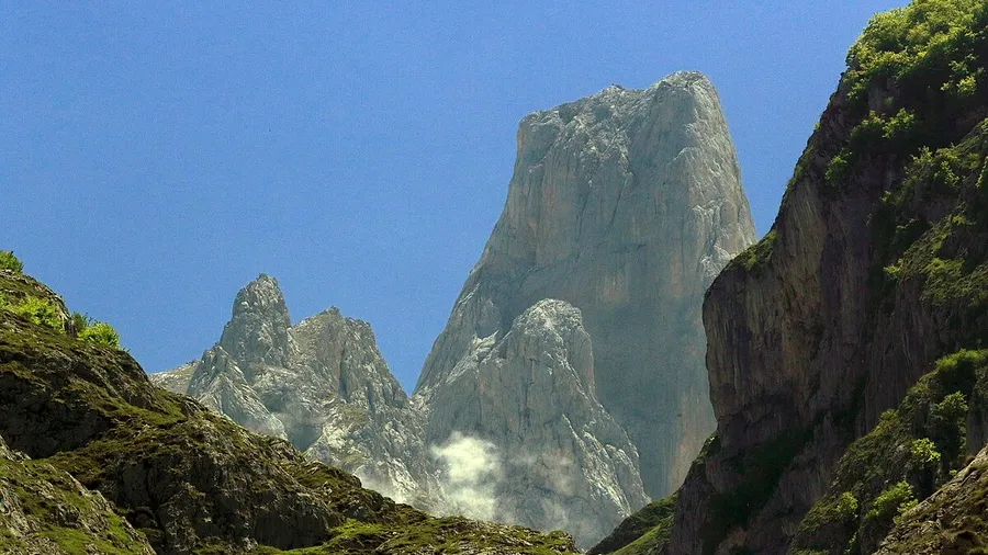
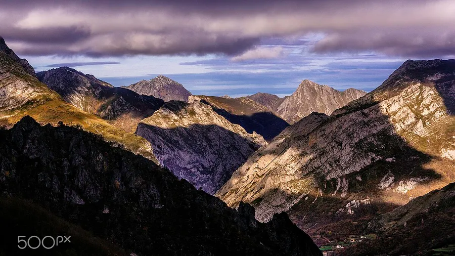
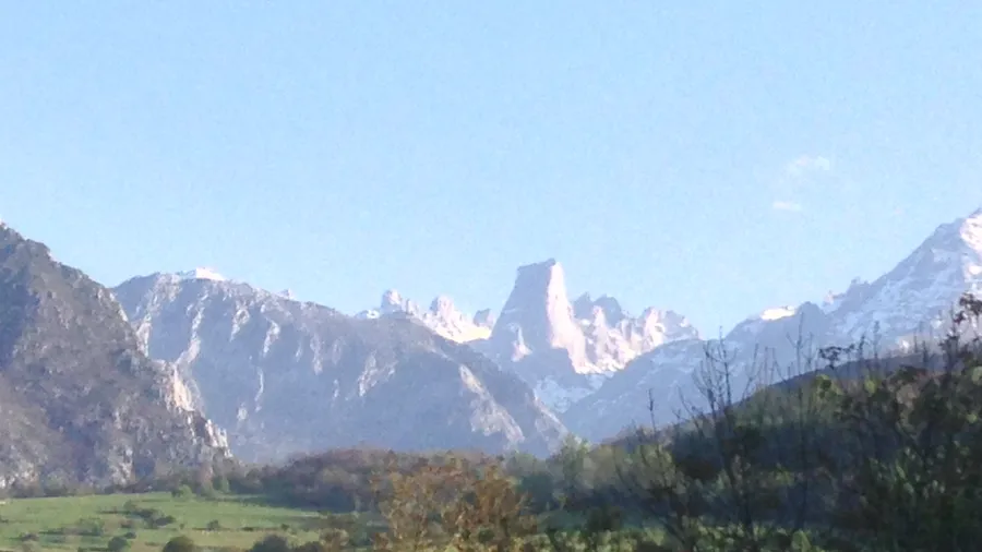
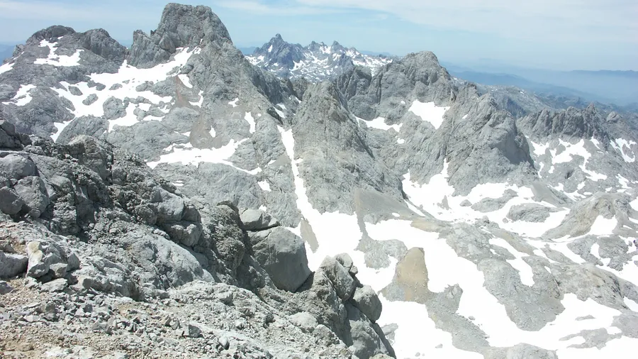
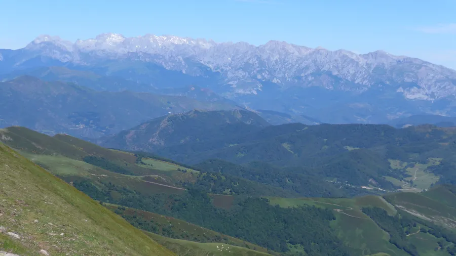
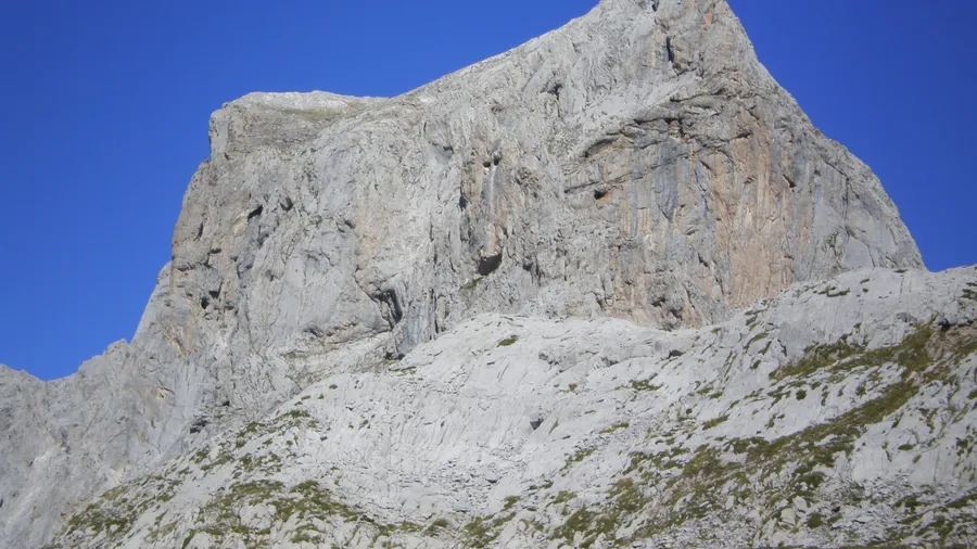
The Parque Nacional de los Picos de Europa was declared in 1918 as the Parque Nacional de la Montaña de Covadonga, making it the first national park in Spain and one of the earliest in Europe. Today it covers 64,660 hectares across Asturias, Cantabria and Castilla y León, organised around three limestone massifs — the Western or Cornión, the Central or Urrieles, and the Eastern or Ándara — separated by the river gorges of the Cares, Duje and Dobra. The highest point is Torrecerredo at 2,648 metres in the Western massif; in the Central massif rises the Naranjo de Bulnes or Picu Urriellu (2,519 m), the park's most iconic summit and a landmark in the history of Spanish alpinism.

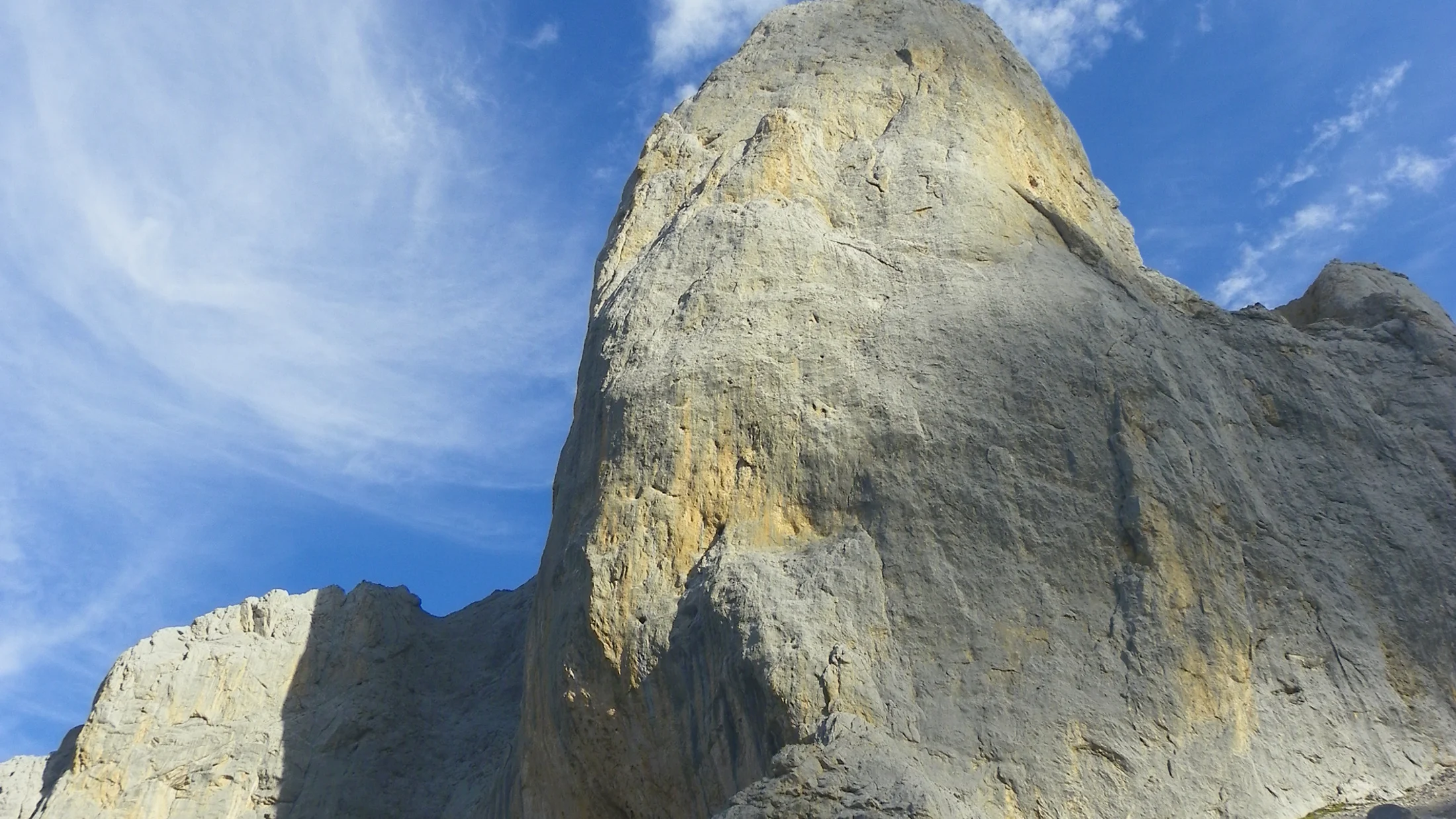
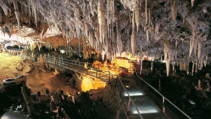
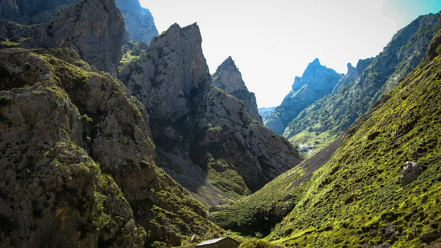
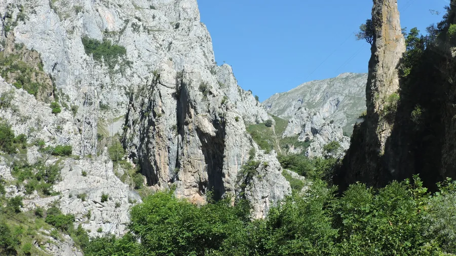
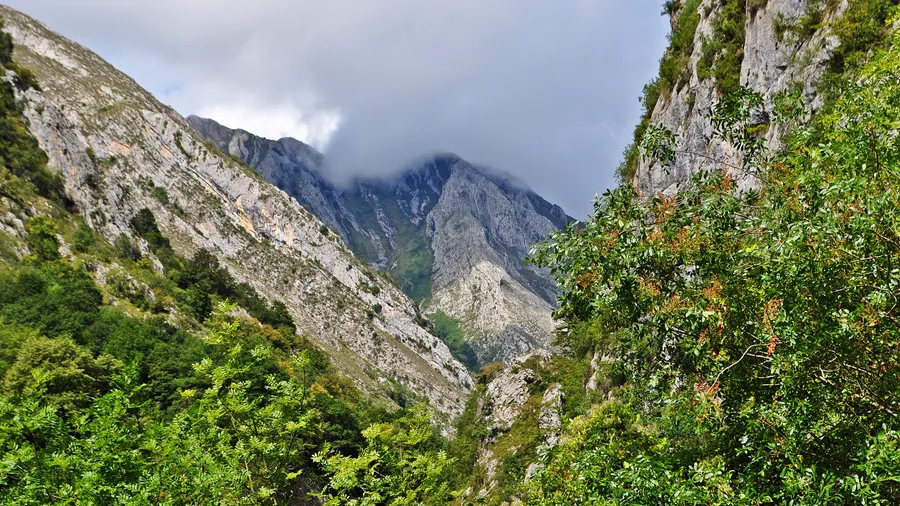
The relief is the result of combined tectonics, river erosion and Quaternary glaciation acting on Carboniferous limestone that in places exceeds 2,000 metres in thickness. Glaciers carved the cirques of Vega Huerta and Trasllambrión and the hanging valleys that now feed the Cares and Sella rivers. Karstic features are abundant: sinkholes, dolines, horizontally developed caves — such as the Cueva del Agua at Posada de Valdeón — and underground systems of several dozen kilometres connecting the upper plateaus with springs at the foot of the range. On north-facing slopes below 1,400 metres, beech and oak forests form continuous cover that turns ochre and deep yellow in October; above that level, limestone grassland with rhododendron and heather dominates.

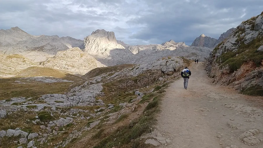
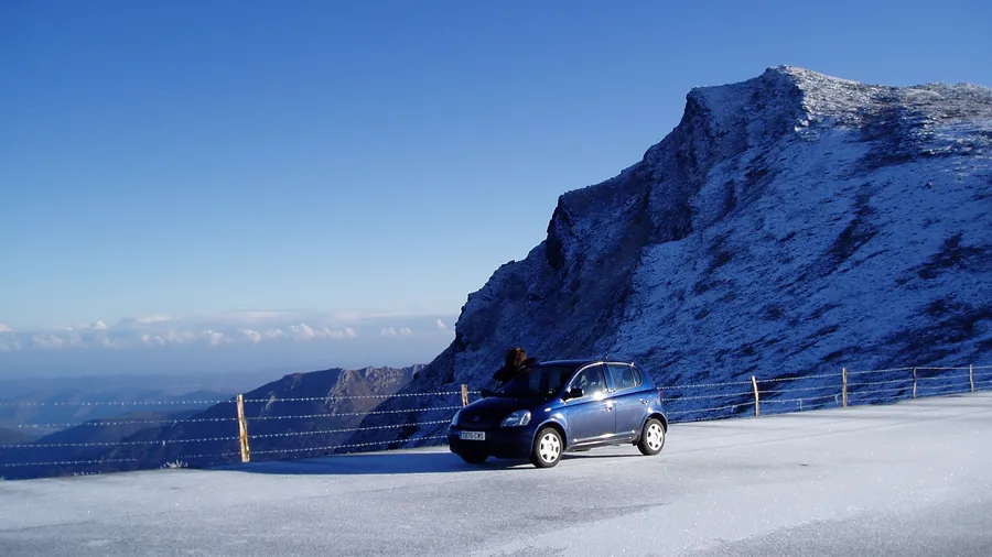
The Ruta del Cares is the park's best-known trail. It runs 11.4 kilometres along a path cut into the rock between Caín (León) and Poncebos (Asturias), with only 200 metres of accumulated elevation change along the entire route. The canal that follows the path was built between 1916 and 1921 to carry water from the Lago reservoir to the Camarmeña power station. The gorge walls reach up to 1,500 metres of vertical relief at certain points, and the Cares river runs up to 400 metres below the path — audible throughout but barely visible. Other significant routes include the ascent to the Cabaña Verónica refuge (2,325 m) from Fuente Dé, partly accessible via the cable car that gains 800 metres of altitude in four minutes, and the Cares-Dobra traverse connecting the Valdeón and Liébana valleys over two days.

The park's wildlife includes the Cantabrian brown bear (Ursus arctos pyrenaicus), with a population of around 350 individuals across the full Cantabrian range, occupying primarily the Western massif and the Valdeón area within the park. Cantabrian chamois are common throughout the high zones. The Cantabrian capercaillie inhabits the northern beech and birch forests, and the bearded vulture was reintroduced in 2009 and now has at least four stable breeding pairs. River otter and white-throated dipper live along the rivers and are easy to spot on the fast sections of the Cares and Sella. Cabrales cheese, cured in the karst caves of the Eastern massif, is the most closely linked gastronomic product to the park and can be bought directly from the creameries in Arenas de Cabrales.

Practical information

Everything you need to know for your visit to Parque Nacional de los Picos de Europa

How to get there
From Oviedo: N-634 to Arriondas, then AS-114 to Cangas de Onís (northern access, 90 km). From Santander: N-621 to Panes and CA-1 to Potes (southern access, 110 km). Fuente Dé from Potes via CA-185 (25 km). Caín from Posada de Valdeón (León) via local road LE-244.
Area Information
Main gateway towns: Cangas de Onís (north, Asturias), Potes (south, Cantabria) and Posada de Valdeón (west, León). Potes is the main hub for the southern side, with concentrated accommodation and certified mountain guides.
Geography
Three Carboniferous limestone massifs: Cornión (max. Torrecerredo 2,648 m), Urrieles (max. Naranjo 2,519 m) and Ándara. River gorges of Cares, Duje and Dobra. Developed karst on upper plateaus.
Flora & Fauna
Cantabrian brown bear, chamois, Cantabrian capercaillie, bearded vulture (reintroduced 2009). Beech and oak forest up to 1,400 m. Limestone grassland with rhododendron. River otter in the Cares and Sella.

Things to do

Find the best plans and things to do in Parque Nacional de los Picos de Europa

20

Accommodations

Best accommodation options in Parque Nacional de los Picos de Europa

Loading accommodation options...

Frequently Asked Questions

Get answers about Parque Nacional de los Picos de Europa

The Ruta del Cares is 11.4 kilometres one way (22.8 km for the full out-and-back) between Caín (León) and Poncebos (Asturias). The accumulated elevation change is only around 200 metres throughout the route, making it accessible to hikers without technical experience. Average one-way duration is 3 hours. No mountain equipment is required, but non-slip footwear is recommended.
The Fuente Dé cable car departs from the lower station (1,070 m) and reaches the upper station (1,823 m) in around 4 minutes, gaining 800 metres of altitude. It operates almost year-round except during maintenance and adverse weather. In July and August queues can be long; arriving before 9:00 or after 16:00 is advisable. From the upper station, several trails lead to Vega de Liordes and the Cabaña Verónica refuge.
It is possible but not a common sighting for general visitors. The Cantabrian brown bear inhabits mainly the Western massif (Valdeón area and Las Rozas) and prefers areas away from busy trails. The chances increase at dawn and dusk in scrubland areas far from tourist access points. Specialist wildlife companies offer guided outings with guides familiar with the animals' regular territories.
Naranjo de Bulnes (Picu Urriellu, 2,519 m) is a high mountain summit requiring climbing or alpinism experience. The normal route on the west face has grade II-III climbing difficulty and requires at least two days with an overnight stay at the Urriellu refuge (2,090 m), advance reservation, climbing equipment and experience on exposed terrain. It is not suitable for walkers without technical mountain training.
Cabrales cheese with Protected Designation of Origin (PDO) can be bought directly from artisan dairies in Arenas de Cabrales and the surrounding villages: Tielve, Sotres and Carreña. Many producing families sell directly from their creameries, where they also explain the cave-curing process. The Tuesday market in Arenas de Cabrales is the most accessible traditional point of sale.