The essentials of Islas Cíes

  • • Playa de Rodas: 1.2 km of quartz sand with a lagoon reaching 18-20 °C in summer
  • • Access limited to ~1,800 visitors per day: book authorisation well in advance
  • • Monte Faro viewpoint (177 m) with views over the Ría de Vigo to the Portuguese coast
  • • Yellow-legged gull and shag colonies on the exposed Atlantic cliffs
  • • Snorkelling and diving in seagrass meadows and rocky reefs within the National Park

Description

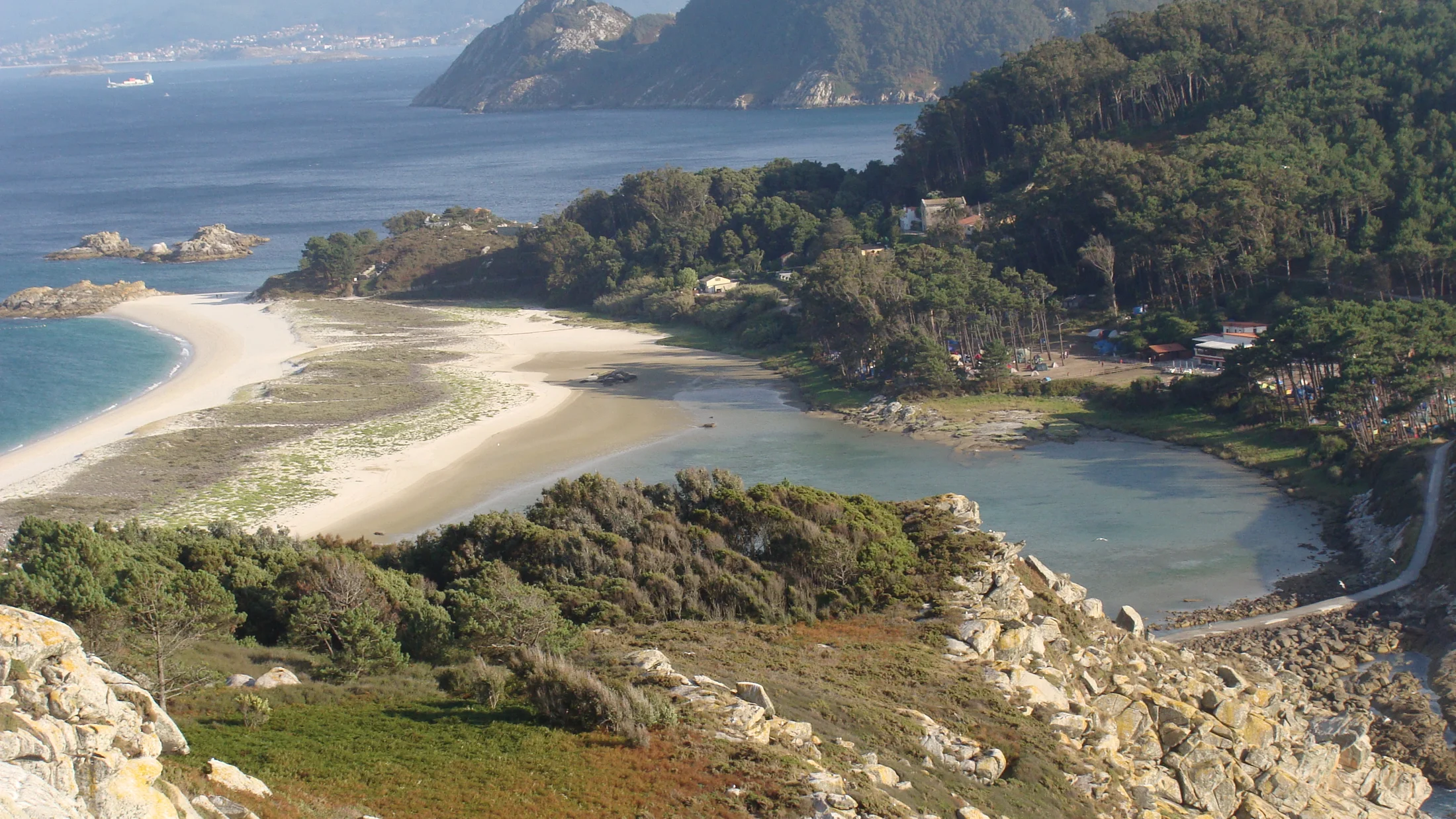
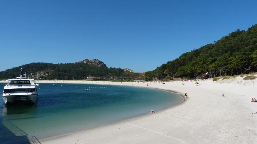
The Islas Cíes form the outer arc of the Ría de Vigo on the Pontevedra coast, and are part of the Atlantic Islands of Galicia National Park alongside the Ons archipelago, the Sálvora islands and Cortegada. The Cíes group consists of three main islands: Monteagudo (the northernmost), San Martiño (the southernmost) and Faro, which is the most visited as it holds the campsite, Playa de Rodas and the main trails. The three islands together cover around 435 hectares of land and are visually connected by the sand tombolo that forms Playa de Rodas on the sheltered inner side of the ría. The beach is 1.2 kilometres long, with fine quartz sand and waters that reach 18-20 °C in summer inside the lagoon formed between Faro and Monteagudo.

Access is regulated: the islands receive a maximum of approximately 1,800 visitors per day between April and October, managed through a pre-authorisation system at the National Park. The ferry departs from Vigo harbour (45 minutes) and from Baiona and Cangas in high season. There is only one accommodation option on the islands: the Rodas campsite, with around 800 pitches that sell out months in advance in July and August. Those who stay overnight can walk the trails at sunrise, when the colonies of yellow-legged gulls (Larus michahellis) and shags (Phalacrocorax aristotelis) are still active on the cliff sections and before the day visitors arrive.

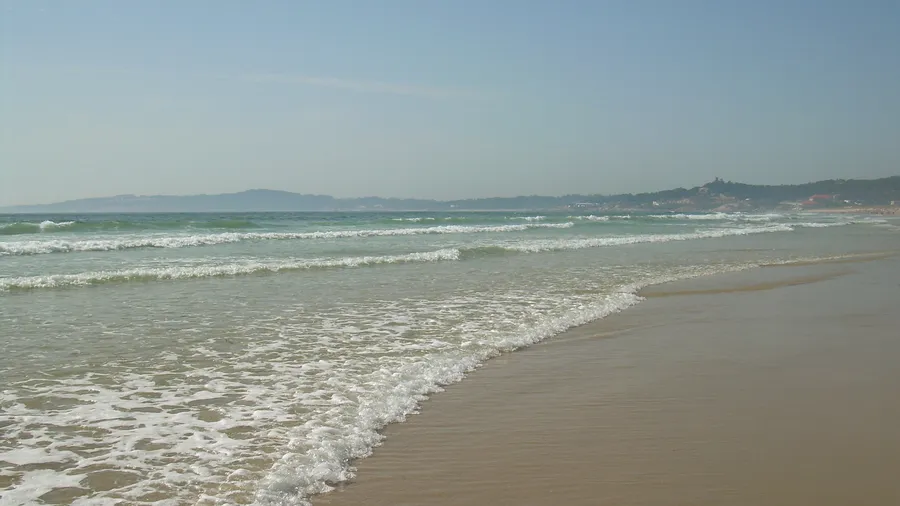
The trail network on Faro island covers around 20 kilometres in total. The Faro trail (3 km, 200 m ascent) climbs to the Cíes lighthouse (177 m) and the Monte Faro viewpoint, which overlooks the Ría de Vigo, the coast as far as Cabo Home and, on clear days, the Portuguese coast to the south. The Playa de Nosa Señora trail (2.5 km) leads to the exposed Atlantic coast of the island, with 50-80 metre cliffs and the open-ocean swell. The dunes, inner lagoon and salt meadows between Rodas and the campsite host characteristic flora such as the sea daffodil (Pancratium maritimum) and sea thrift (Armeria maritima).

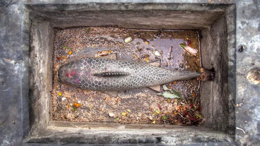
The seabed around the Cíes is one of the reasons the archipelago was declared a National Park. The seagrass meadow (Zostera marina) covering the Rodas lagoon floor is a nursery habitat for several fish species, and the rocky reefs on the Atlantic side harbour lobster, octopus, spider crab and a variety of reef fish. Snorkelling is common in the sheltered coves on the inner side; scuba diving requires National Park authorisation. Outside the islands, sea kayak and paddleboard operators on the Ría de Vigo allow visitors to approach the islands without entering the terrestrial visitor quota.

Practical information

Everything you need to know for your visit to Islas Cíes

How to get there
By ferry from Vigo harbour (45 min). Also from Baiona and Cangas in high season. No land access to the islands. Ferry booking includes the National Park access authorisation.
Area Information
Vigo harbour is the main departure point. Vigo has high-speed rail, its own airport and bus connections with the rest of Galicia. The only accommodation on the islands is the Rodas campsite.
Geography
Three granite islands (Faro, Monteagudo, San Martiño), 435 ha total. Sandy tombolo forming Playa de Rodas. Cliffs of 50-80 m on the Atlantic side. Sheltered inner lagoon.
Flora & Fauna
Yellow-legged gull and shag (breeding colonies). Bottlenose dolphin and harbour porpoise in the ría. Flora: sea daffodil, sea thrift, sea iris. Seagrass (Zostera marina) meadows underwater.

Things to do

Find the best plans and things to do in Islas Cíes

20

Accommodations

Best accommodation options in Islas Cíes

Loading accommodation options...

Frequently Asked Questions

Get answers about Islas Cíes

Booking is done through the National Park website (islaatlanticas.es) or directly when purchasing a ferry ticket with authorised operators (mainly Mar de Ons from Vigo). The maximum daily visitor number is approximately 1,800. In July and August slots fill up weeks in advance, so booking at least 3-4 weeks ahead is recommended.
Yes, the Rodas campsite is the only accommodation option on the islands. It has around 800 pitches. In high season (July-August) spots are reserved months in advance. Basic facilities are available: cold showers, a small shop with essentials and a restaurant. Camping outside the official campsite is not permitted.
In June the water inside the Rodas lagoon reaches 16-18 °C — cool but manageable. In July and August it rises to 18-22 °C inside the sheltered lagoon, which is warmer than the exposed Atlantic side. Playa de Rodas is the warmest beach on the Cíes islands due to its orientation and the shallow depth of the inner lagoon.
Ferries from Vigo take around 45 minutes to reach the Cíes. Frequency varies by season: in summer there are several daily departures from early morning. Ferries from Baiona and Cangas also run in high season. The last return ferry usually departs around 20:00 or 21:00. Exact timetables vary each season and are published on the ferry operators' websites.
Snorkelling is a free activity in the sheltered coves on the inner side of the islands. Scuba diving requires a specific National Park authorisation. The Atlantic-facing side has currents and swell that make diving more technical. The seagrass meadows in the Rodas lagoon are the most accessible snorkelling area, with a sandy bottom and varied marine life.