The essentials of Montañas de Prades

  • • Climbing at Siurana with over 2,000 limestone routes graded from 5 to 9a+
  • • Ruta dels Refugis, a 90 km circular traverse linking four Montsant shelters
  • • Cova de la Font Major with 3,590 m of galleries and an underground adventure route
  • • Medieval village of Prades with pink sandstone houses and a Renaissance fountain
  • • Wine tourism at DO Priorat and DO Montsant wineries during the autumn grape harvest

Description

The Montañas de Prades form an isolated massif in inland Tarragona province, spanning the comarcas of Conca de Barberà, Priorat and Baix Camp. Two parallel ridges running NE-SW reach their highest point at Tossal de la Baltasana (1,203 m), separated by an interior plateau where the village of Prades sits. The massif rises sharply above the Camp de Tarragona plains, and on clear days the Mediterranean is visible from its crests. Low population density, the absence of major infrastructure and wide-open horizons create an authentic mountain experience just over an hour from Tarragona and Reus.

Deep ravines and streams drain the interior towards the Francolí and Siurana rivers. Limestone formations dominate the ridgelines, with karren fields, vertical walls and rock shelters that hold evidence of human occupation since the Palaeolithic. The Cova de la Font Major in L'Espluga de Francolí, with over 3,590 metres of galleries, is one of the largest cavities in Catalonia and offers an adventure route along its underground river. On the highest summits, the boira de la Mussara — a dense fog that forms when easterly winds meet the massif — wraps the landscape for days at a time in autumn and winter, creating an atmosphere that has fed local legends for centuries.

Rock climbing gives the area its strongest international profile. Siurana, 15 km from the massif in the Priorat, holds over 2,000 sport-climbing routes on high-quality limestone, graded from 5 to 9a+, drawing climbers worldwide between October and May. Within the massif, the L'Argenteria, La Falconera and Cogullò sectors offer limestone and conglomerate walls with fewer crowds. Hiking links the surrounding villages — Prades, Cornudella de Montsant, Mont-ral, Arbolí — via the GR-7 and GR-172 trails, and the Ruta dels Refugis connects four Montsant shelters on a 90 km circular traverse. Mountain biking finds forest tracks and singletracks with substantial elevation changes.

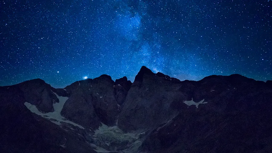
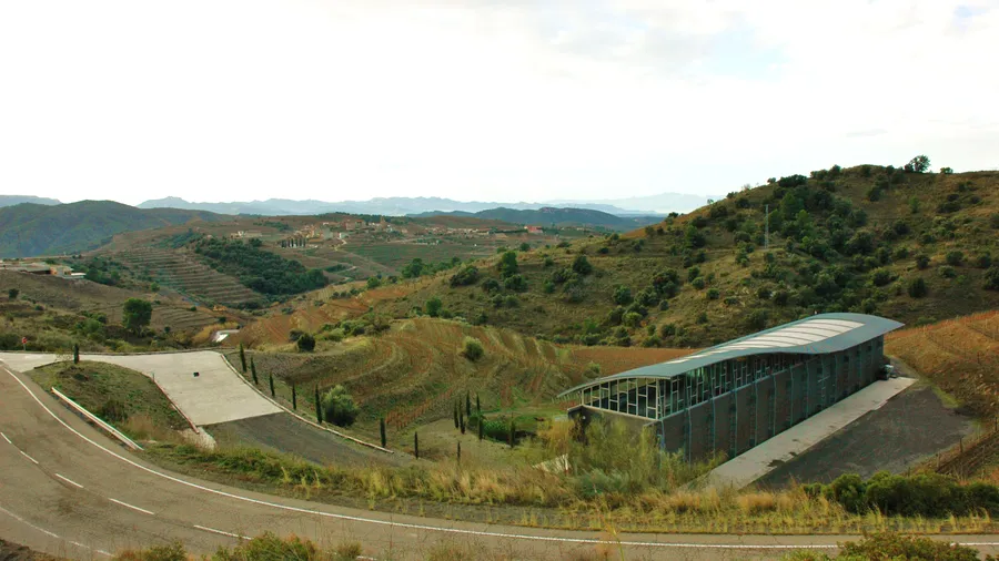
The village of Prades, with its pink sandstone houses and Renaissance fountain in the main square, is the most-visited hub and offers accommodation and Catalan cuisine. Autumn adds wine tourism at the bordering DO Priorat and DO Montsant wineries, two of Catalonia's most acclaimed appellations. The grape harvest coincides with the best climbing and hiking days: mild temperatures, raking evening light and the smell of fresh must rising from the terraced vineyards. Dark skies free of light pollution across much of the interior are turning the massif into an emerging astrotourism destination.

Practical information for Montañas de Prades

Everything you need to know for your visit to Montañas de Prades

How to get there
From Tarragona or Reus via the T-11 and TV-7001 to Prades (55-70 km, 1 h). From Barcelona via the AP-2, exit at Vimbodí or Montblanc (150 km, 1 h 45 min). For Siurana, take the TV-7021 from Cornudella de Montsant (15 km). No direct public transport serves the interior villages; a private vehicle is needed.
Area Information
The massif is surrounded by the DO Priorat and DO Montsant, two of Catalonia's most acclaimed wine appellations. Poblet Monastery, a World Heritage Site, lies 20 km to the north. L'Espluga de Francolí offers visits to the Cova de la Font Major and the Museum of Rural Life.
Geography
Isolated limestone massif between the Camp de Tarragona and Conca de Barberà. Two parallel ridges running NE-SW. Highest point: Tossal de la Baltasana (1,203 m). Deep ravines, limestone walls and drainage towards the Francolí and Siurana rivers.
Flora & Fauna
Holm oak and Aleppo pine on south-facing slopes; Portuguese oak and beech in shaded gullies. Cliff flora on limestone walls with local endemisms. Fauna: Spanish ibex, wild boar, stone marten, eagle owl, peregrine falcon and griffon vulture colonies on the Siurana cliffs.

Things to do in Montañas de Prades

Find the best plans and things to do in Montañas de Prades

20

What to see in Montañas de Prades

Discover the must-see sights in Montañas de Prades

Accommodations in Montañas de Prades

Best accommodation options in Montañas de Prades

Frequently asked questions about Montañas de Prades

Get answers about Montañas de Prades

Siurana has over 2,000 routes, but most are intermediate to advanced (6a-8c). A few grade 5 routes exist at sectors like Racó de la Finestra, though limestone climbing demands specific friction technique. Beginners should go with a certified mountain guide, as some approaches are exposed and the terrain can be demanding.
The GR-7 crosses the massif north to south, linking Prades with Mont-ral and La Mussara. The Arbolí to La Mussara route (10 km, 500 m elevation gain) gives sea views on clear days. For a multi-day experience, the Ruta dels Refugis covers 90 km in a loop connecting four Montsant shelters. Short trails from Prades or Cornudella suit day hikers.
There are no hotels within the massif interior. Lodging is concentrated in the perimeter villages: Prades, Cornudella de Montsant, Mont-ral and Arbolí have rural houses, apartments and small guesthouses. Availability is limited, so booking weeks ahead is advisable in peak season (September-November and Easter). Ruta dels Refugis shelters require advance reservation.
Yes. The cave in L'Espluga de Francolí has over 3,590 metres of galleries. Visitors can choose an accessible tourist route or an adventure route that follows the underground river with helmet and headlamp. It is one of the largest cavities in Catalonia and pairs well with a day of hiking or a visit to nearby Poblet Monastery.
The boira — fog in Catalan — of La Mussara is a frequent weather phenomenon. Moist Mediterranean air pushed by easterly winds becomes trapped at the massif summit, forming a dense, persistent fog layer visible from the Camp de Tarragona below. It occurs most often in autumn and winter and can last several consecutive days, adding a distinctive atmosphere to the landscape.