The essentials of Parque Natural de la Sierra de Mariola

  • • Over 1,000 plant species in Valencia's botanically richest sierra
  • • Montcabrer: 1,390 m summit with views of the Mediterranean and Balearic Islands
  • • GR-7 and over 100 km of trails through gorges and almond-tree valleys
  • • Sport climbing on limestone at Les Penyes Altes and paragliding from Morro de la Penyeta
  • • Living herbal culture: marjoram, lavender and thyme in Bocairent and Agres

Description

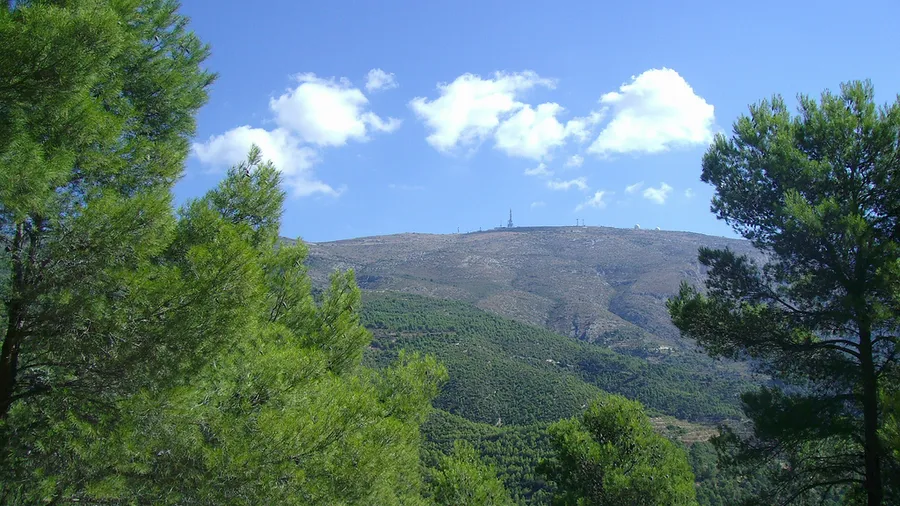
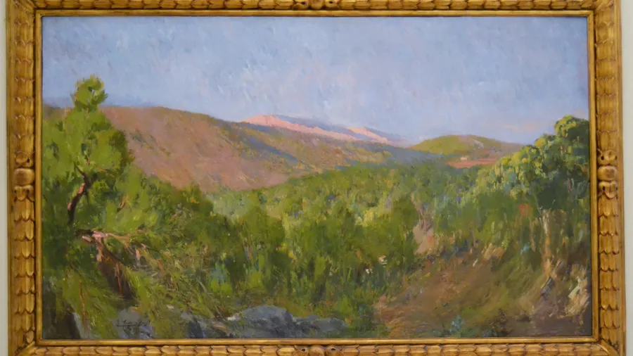
Sierra de Mariola rises as a natural barrier between the Valencian regions of El Comtat, L'Alcoià and La Vall d'Albaida, in the province of Alicante. The natural park that bears its name protects around 17,254 hectares of one of the botanically richest sierras in the Valencian Community, with more than 1,000 plant species catalogued within its boundaries. The highest point is Montcabrer, at 1,390 metres above sea level, from whose summit on clear days the profile of the Balearic Islands is visible on the horizon.

The name Mariola is linked to wild marjoram (Origanum majorana), an aromatic plant that colonises the open scrubland of the sierra and which, together with lavender, Thymus vulgaris and sage, has given rise to a living herbal tradition. The towns of Bocairent, Agres and Alfafara preserve this culture of medicinal plants: local businesses produce liqueurs, soaps and cosmetics from the sierra's aromatic herbs, reflecting the bond between the community and the surrounding landscape.

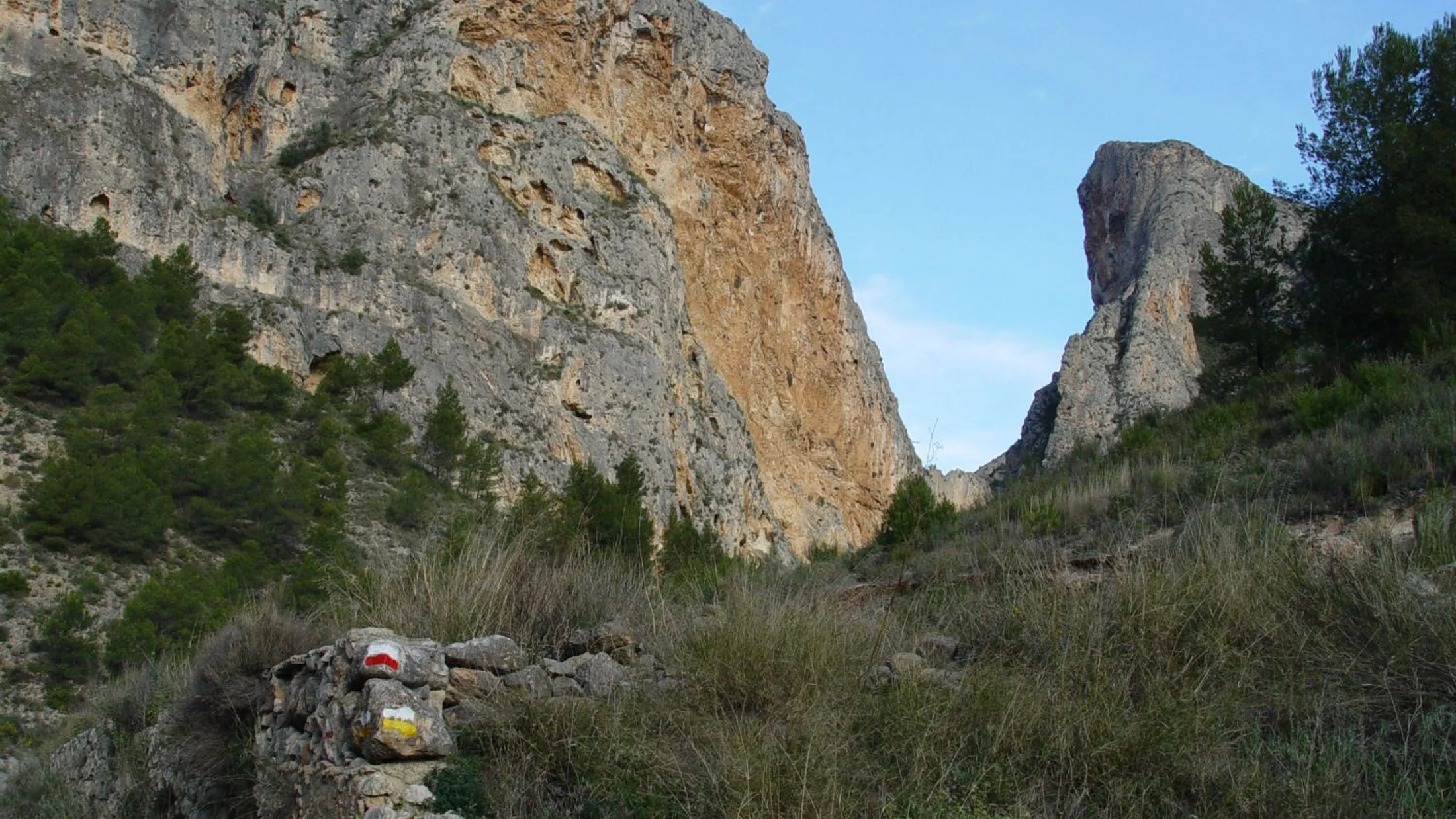
The park's trail network extends over 100 kilometres, traversing the deeply incised gorges of the north face and the valley floors with almond and cherry trees on the south-facing slopes. The long-distance path GR-7 crosses the sierra from east to west, linking the towns of Bocairent and Alfafara in a moderate-difficulty day walk. Climbers frequent the Les Penyes Altes sector, with sport routes on fine-grained limestone reaching up to 20 metres. Paragliding enthusiasts consider the Morro de la Penyeta launch one of the most valued hillside flying spots in the province of Alicante.

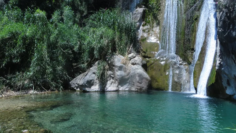
The park supports a well-preserved Mediterranean mountain fauna. Bonelli's eagle (Aquila fasciata) and golden eagle (Aquila chrysaetos) nest on the rocky faces; common genet (Genetta genetta) and European badger (Meles meles) inhabit the mixed forests of Lusitanian oak (Quercus faginea) and maritime pine (Pinus pinaster) at mid-altitude. Gorges with permanent watercourses, such as the Barranc del Cint, maintain populations of white-clawed crayfish (Austropotamobius pallipes), a species in decline throughout most of the Mediterranean arc.

Practical information

Everything you need to know for your visit to Parque Natural de la Sierra de Mariola

How to get there
From Alcoi, take the CV-81 to Agres or the CV-795 to Bocairent. From Valencia, the A-7 and AP-7 give access to Ontinyent, then the CV-81 to the sierra. No regular public transport to park access points; private vehicle is recommended.
Area Information
The main gateway towns are Bocairent, Agres and Alfafara. Bocairent, 10 km from Alcoi, has a notable historic centre and rural tourism offer. Alcoi (10 km) is the nearest city with full services. The park is managed by the Conselleria de Medi Ambient of the Valencian Government.
Geography
The park protects 17,254 ha across the provinces of Alicante and Valencia. Montcabrer (1,390 m) is the highest point. Relief is steep on the north face with deep gorges and gentler on the south slope. The Barranc del Cint and other permanent watercourses drain towards the Vinalopó river.
Flora & Fauna
Over 1,000 plant species, including marjoram, lavender, Thymus vulgaris, Lusitanian oak (Quercus faginea) and maritime pine (Pinus pinaster). Wildlife: Bonelli's eagle, golden eagle, common genet, badger and white-clawed crayfish (Austropotamobius pallipes) in gorges.

Things to do

Find the best plans and things to do in Parque Natural de la Sierra de Mariola

20

Accommodations

Best accommodation options in Parque Natural de la Sierra de Mariola

Loading accommodation options...

Frequently Asked Questions

Get answers about Parque Natural de la Sierra de Mariola

The most frequented route to Montcabrer (1,390 m) starts from the town of Agres, following the trail up through the Barranc del Molinar. The round trip covers around 12 km with approximately 700 metres of positive elevation gain, rated moderate to hard. The ascent takes between 3 and 4 hours depending on pace. On clear days the profile of the Balearic Islands is visible from the summit.
The towns of Agres, Alfafara and Bocairent have establishments that produce and sell products made from the sierra's aromatic plants: marjoram and thyme liqueurs, handmade soaps, essential oils and herbal teas. The Bocairent weekly market is a good place to find these products alongside honey, cured meats and local wine.
Yes. The Les Penyes Altes sector on the north face near Bocairent concentrates the main sport climbing routes on fine-grained limestone. Routes reach up to 20 metres with grades ranging from 5a to 7b. No booking is required. For first-time visitors, climbing companies in Alcoi offer guides and equipment rental.
Yes. The Morro de la Penyeta area is one of the most valued hillside flying launch sites in the province of Alicante, with frequent thermal conditions in spring and autumn. Paragliding clubs in Alcoi organise guided flights for licensed pilots. Beginner courses with certified instructors are available through adventure sports companies in the area.
The park is home to Bonelli's eagle (Aquila fasciata) and golden eagle (Aquila chrysaetos), which nest on the rocky faces of the sierra. Common genet and European badger inhabit the Lusitanian oak and maritime pine forests. Gorges with permanent water, such as the Barranc del Cint, support populations of white-clawed crayfish (Austropotamobius pallipes), a protected species in decline across most of the Mediterranean arc.