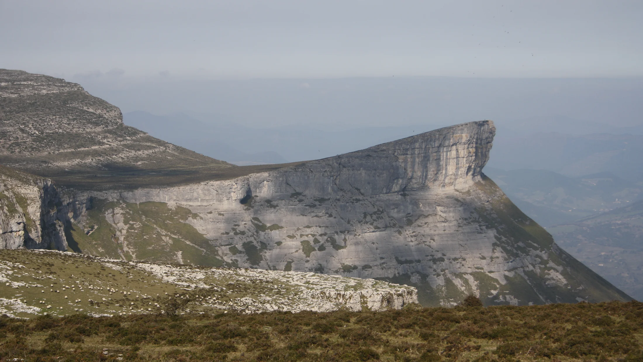
Sierra Salvada marks the natural border between Álava and Burgos, a limestone massif rising from 600 to 1,240 metres at the Tologorri peak. Its vertical cliffs, some exceeding 300 metres in drop, form one of the most extensive rock walls in northern Spain. Karst springs at the base of these crags feed clear streams flowing north toward the Ayala valley and south to the Alavese plain. From the upper plateau, the view reaches the summits of Gorbea to the east and the Ordunte range to the west, a horizon that shifts in tone with every season.
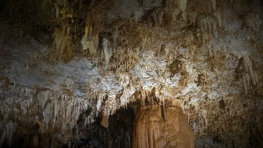
Karst geology defines the sierra's character. Sinkholes, limestone pavements and shafts punctuate the upper plateau, where water has sculpted a subterranean landscape of considerable complexity over millions of years. Pozalagua Cave, opened to the public in 1997 after its accidental discovery during quarrying, shelters one of Europe's densest concentrations of eccentric stalactites: mineral filaments that defy gravity and grow in every direction, the result of aragonite crystallisation under constant humidity. On the southern face, the Gujuli waterfall drops 100 metres in free fall, fed by a stream that collects water filtered through the limestone. In spring, when snowmelt and rainfall saturate the ground, the cascade reaches its full force and the sound of falling water carries all the way to the car park.
The limestone cliffs host stable griffon vulture colonies with over 100 breeding pairs. At dawn, before thermals form, the vultures line the rocky ledges, their silhouettes outlined against pale limestone. Egyptian vultures, peregrine falcons and golden eagles share the crags for nesting and hunting. Beech and Portuguese oak forests on the wetter, shadier northern slopes provide habitat for middle spotted and black woodpeckers among old, moss-covered trunks. The plateau meadows support specialised flora adapted to calcareous substrate and the persistent wind that sweeps the summit: endemics such as Loscos's saxifrage grow alongside stunted box, creeping juniper and calcicole grasslands that flower briefly between May and June.
Transhumance has shaped Sierra Salvada's landscape for centuries, and its traces remain legible. Summit pastures still in use retain cobbled drove roads and dry-stone shepherd shelters linking Ayala valley villages with the high grasslands. Latxa sheep and Pyrenean cattle climb each spring along routes already in use during the Middle Ages. Towns like Maroño and Quejana preserve a quiet but well-maintained rural heritage: medieval towers, Romanesque chapels and stone farmsteads set in a green, sheltered valley. Quejana also houses the Ayala Palace complex, with its 14th-century tower and a small museum tracing the lineage's history.
Proximity to Bilbao (50 km via the AP-68) and Vitoria-Gasteiz (30 km via the A-2625) makes the sierra an accessible mountain destination without long travel times. A visitor setting out early can traverse the plateau, peer over the cliff edges, tour Pozalagua Cave and stop at a cider house in the Ayala valley before returning to the city. Those preferring a longer stay will find rural accommodation in Amurrio and Orduña, a comfortable base for combining the sierra with nearby routes such as the Nervión waterfall or Monte Santiago.