Discover what a hiking route is
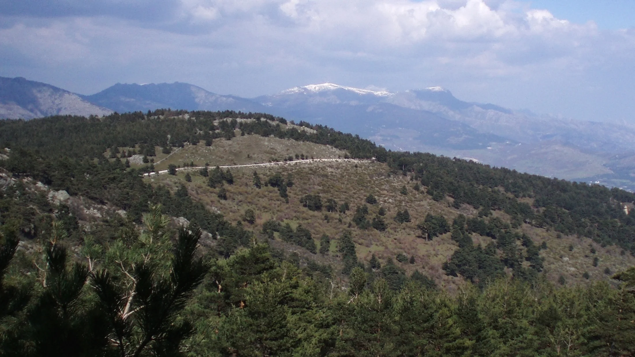
A hiking route is enjoyed by walking, without competing or conquering summits at all costs. In alpinism or high-mountain trekking, the goal is the summit; here, it is the path.
It is traversed via approved paths, which guarantee a minimum of safety and allow you to walk with confidence. Families, groups of friends, or people going out alone find an option suited to their level.
Hiking is also about learning to read the maps that nature has drawn on the landscape, interpreting its colours, its sounds, and its silences.
Interest is growing in Spain: the Provincial Path Programme of the Diputación de Sevilla brought together almost 1,000 people in just six of its ten annual days. If you are starting out, choose an approved path of low difficulty and calculate the time before setting off.
Understanding the types of layout
Before setting off, look at the shape of the itinerary on the map: decide where you leave the car and how you distribute your time and effort. The design of the path conditions all the logistics of the outing.
Types of layout in a hiking route
The linear out-and-back route leaves from point A, reaches point B, and returns via the same path. It is the simplest option and suitable for beginners, because you already know the terrain on the return journey. It works well for reaching a specific point of interest, such as a viewpoint or a waterfall.
The circular route starts and ends in the same place forming a loop, so the landscape is always new and the experience more dynamic. It is the most convenient in terms of logistics: you return directly to the car without repeating the landscape.
The traverse is one-way only: it starts at point A and ends at a different point B, ideal for crossing a mountain range or joining two valleys or villages. Here you have to plan the return to the starting point, either with two cars or with public transport.
Choosing the right type of layout is the first step towards a safe and rewarding experience. If you want more ideas to prepare your outing, take a look at our hiking articles.
Picuco can help you
Does something here catch your eye?
Tell us.
Write to us on WhatsApp or email: we answer questions, find the best options and help you sort out the booking.
Write to us
We guide you based on the type of plan you have in mind and reply by WhatsApp or email.
How to understand the difficulty levels of a route
A route beyond your capabilities turns the outing into a bad time. The goal is to enjoy the path, not to accumulate kilometres.
Knowing how to read the real difficulty of a hiking route is key to ensuring every outing is safe and pleasant. Distance alone is deceiving: a short route can prove very demanding if the terrain is technical or the slope is steep.
The three key factors of difficulty
Ten flat kilometres through a pine forest are a stroll; ten in high mountains, a long day. Distance alone does not tell the whole story.

Total distance is the first thing looked at, but it cannot be the only thing. The terrain changes things significantly: a wide, smooth forest track is nothing like a narrow path full of stones, roots, or mud. Technical terrain forces you to go much slower and increases muscle fatigue and the risk of sprains or falls.
Accumulated elevation gain is the factor that many beginners overlook. It is measured in metres and sums all the climbs you make (positive elevation gain) and descents (negative elevation gain) during the route.
Before setting off, look at the three pieces of data on the route sheet and compare them with your experience and with the hours of daylight on the day you are going to walk.
Elevation gain, the metric that changes everything
Elevation gain measures how much climbing effort a route requires: 300 metres of elevation gain is roughly equivalent to climbing the stairs of a 100-storey building.
A route profile with many short, consecutive climbs and descents (what we call a "leg-breaker") can be much more exhausting than a single long, steady climb, even if the accumulated elevation is the same. The key lies in how that effort is distributed.
Before heading out, don't just focus on the kilometres: check the route profile to see where the hardest ramps are and if the trek suits your fitness level.
Planning your route step by step
A good hiking route starts at home, with a map and a notebook. Prior planning is what separates a good route from a bad day in the mountains.
Check the weather forecast
Before leaving, check the weather: in the mountains, a sunny morning can end in a storm in the afternoon, especially in high-altitude areas. It is the first step and it is non-negotiable.
Mobile apps fall short. Consult specialised sources with forecasts for specific areas and at different altitudes.
- Temperature: look at the maximum, but also the wind chill, which can plummet due to the wind.
- Probability of precipitation: 20% is manageable; with 60%, you need to rethink the outing or have a plan B.
- Wind: speed and direction are crucial, because strong wind is much more exhausting and multiplies the sensation of cold.
- Daylight hours: knowing what time the sun rises and sets helps you calculate timings and avoid being left in the dark.
With these four pieces of data, you decide whether to go, when, and with what clothing. Spend five minutes the day before and check it again the same morning.
Study the map and the route profile
Downloading the track is the first step, not the last: before heading out, sit down and study it thoroughly. A route platform gives you key information visually: where the route is, its path on the map, the distance, and the elevation at a glance.
Open the map in detail and look for water sources to refill your water bottle, escape routes in case something goes wrong, key crossroads, and shelter areas. Note these points down in your notebook or on your phone.
The elevation profile tells you where the hardest slopes are and where you will be able to catch your breath. Use it to distribute your effort and decide what time is best to start.
Planning the route is like reading a film script before watching it: knowing the plot and the moments of tension allows you to enjoy the walk more, without any scares.
Calculate your times and plan stops
The times provided by apps are a guide, not your real time. Everyone walks at their own pace, so it is advisable to calculate your own before setting off.
The MIDE formula (Hiking Information Method) uses distance and elevation gain to estimate duration. As a reference, a hiker with a normal pace takes one hour for every 4 km on flat terrain, and to that, you add an extra hour for every 400 metres of positive elevation gain.
An example: an 8 km route with 400 metres of ascent is 2 hours for the distance plus 1 hour for the elevation, about 3 hours of effective walking.
You must always add stop time to that calculation: a brief one every hour to drink water and stretch your legs, and a longer one to eat. Detailed planning is crucial, especially on multi-day treks; you have a practical case in this complete guide to a 3-day circular route in the Pyrenees.
Inform someone of your plans
Tell a relative or a trusted friend your route before you set off: it is a free and simple life insurance policy. That person will know where to look for you if something goes wrong.
Indicate the exact route you are going to take and, if you can, send them the track. Also tell them the time you plan to start and the estimated time you should have finished. Add a contact number in case an emergency arises.
If you do not show signs of life at the scheduled time, that person will be able to notify the emergency services (112) with key information that will facilitate a possible search and rescue operation.
The essential equipment to enjoy hiking
Preparing equipment to head into the mountains is similar to packing a suitcase: what you take and what you leave behind changes the experience.

You don't need to spend a lot of money or carry expedition gear. The key lies in choosing wisely.
Select what makes the difference in comfort and, above all, in safety. That way, you enjoy any trail with confidence.
The art of dressing like an onion: the layering system
In the mountains, you can start with cold, sweat on the ascent, and encounter freezing wind at the summit. The three-layer system solves these changes without you having to stop to rummage through your backpack.
The first layer touches the skin and its mission is to expel sweat to keep you dry. Use a technical t-shirt made of synthetic material or merino wool. Cotton gets soaked, takes a long time to dry, and leaves you cold as soon as you take a break.
The second layer provides warmth and retains body heat. A fleece or a lightweight fibre jacket is suitable, and you put them on or take them off depending on the effort and the cold.
The third layer is the shield against wind and rain. It must be waterproof and breathable, such as Gore-Tex types, and a good windbreaker is your best ally against the elements.
Mastering the layering system allows you to adapt on the go to whatever the mountain holds in store. Before setting off, check the forecast and put the layer you are not wearing into your backpack.
Your feet are the engine: the importance of footwear
Shoes that cause pain lead to blisters and can end in a sprain or a serious fall. Footwear is the most critical piece of equipment, and choosing it well depends on the terrain: a well-marked forest path is not the same as a rocky ridge.
Footwear is not an expense, it is an investment in safety. A good pair of hiking boots or shoes will give you the confidence to step firmly on any terrain, protecting your ankles and absorbing impacts.
Trekking shoes are lightweight, flexible and comfortable, and they let you feel the terrain. They offer little ankle protection and last less in abrasive terrain. They are good for one-day routes on simple paths, forest tracks and non-technical terrain, especially in good weather.
Mid-cut boots provide a good balance between ankle support and flexibility, and are more robust. They weigh more and breathe less than shoes. They are the most versatile footwear: irregular terrain, multi-day routes with a light backpack and mid-mountain.
High-cut boots provide maximum protection and ankle support, and are very durable and stable. They are heavy, rigid and require a break-in period. Reserve them for high mountains, very rocky or snowy terrain and long routes with a heavy backpack.
Before choosing, try on the footwear with the socks you will use and check that it does not rub or pinch anywhere.
The backpack and that "just in case" that saves your day
For a one-day outing, a backpack between 20 and 30 litres is sufficient: it holds what is necessary without having too much or too little space. Choose one that fits well against your back and has chest and waist straps to distribute the weight and prevent it from moving while walking. If you want to fine-tune your choice, you have this guide to your essential autumn hiking backpack.
The basic safety kit fits in a pocket: a first aid kit with something to clean a wound, plasters, gauze and dressings for blisters. Add a multi-purpose knife, which weighs nothing and can get you out of more than one tight spot.
Carry your mobile phone with a full battery and, if you have one, a power bank: coverage may fail, but for an emergency, it is vital. Also pack a headlamp or torch even if you set off during the day, because an accident or a miscalculation can cause night to fall upon you.
A map and compass, or a GPS, always go in the backpack. Do not rely on your mobile coverage alone for your safety: knowing how to orient yourself traditionally is a fundamental skill. With this equipment on your back, the peace of mind you carry with you is priceless.
Safety and respect for the natural environment
Every hiking route asks you for two things at once: to look after yourself and to look after the environment you walk on. The two go together, and both depend on what you do before leaving and during the journey.
Being prepared and knowing how to react to an unforeseen event turns a problem into a travel anecdote. There is no need to be afraid: it is necessary to be prepared.
Your safety comes first
Even on the simplest route, setbacks can occur: a sprained ankle, a sudden change in weather, or getting lost for a moment. The key is not to lose your calm and to have a plan.
If you think you are lost, apply the P.A.R.A. rule. Stop: stop dead in your tracks and do not keep walking wildly, because you will most likely move even further away from the path. Analyse: look around you and search for landmarks you recognise, such as a peak, a unique tree, or something you have seen before on the map. Reflect: remember what the last known point you were at was and assess whether you can safely retrace your steps. Act: if you cannot orient yourself, find a safe place that is easy to see from a distance and call the emergency number 112.
Even if you do not have data for browsing, the call to 112 almost always works.
The art of leaving no trace
The idea is simple: whoever comes behind you should not know you have been there. The "Leave No Trace" philosophy is an ethical guide to minimising the impact of every outing into nature.
It is summarised in seven principles and goes beyond not littering. It involves respecting animals, always walking on marked paths so as not to damage the ground, and leaving every stone and every plant in its place.
Take all your rubbish with you: everything that goes into your backpack comes back with you, including fruit peels and other organic remains, which in some ecosystems take an eternity to decompose. Regarding wildlife, observe from a distance and never feed them: changing their diet or getting them used to people seriously harms them.
With fire, the safest thing is not to make one. If it is essential, use authorised areas and ensure it is completely extinguished before you leave.
Being a respectful hiker protects the environment and makes the experience richer and deeper, with a conscious immersion in the landscape similar to that of forest bathing in Spain.
Hiking routes that will leave you speechless in Spain
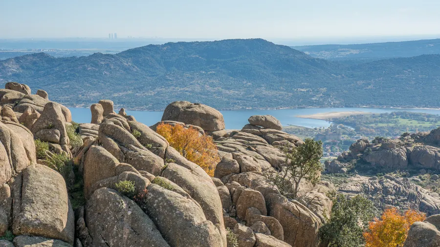
In Spain, you can walk between the snowy peaks of the Pyrenees and the volcanic coves of the Canary Islands. The country has a great variety of hiking routes for all levels and times of the year.
The network of paths is well-signposted and constantly improving, so on every route you find a new path to discover. Furthermore, Spain has exceeded 1,000 kilometres of certified Blue Paths for the first time, with 154 award-winning itineraries throughout the territory.

Before heading out, choose the area according to the season and check the signage of the section you want to do. With that foundation, planning the route and accommodation takes you little time.
The spectacularity of the high mountains
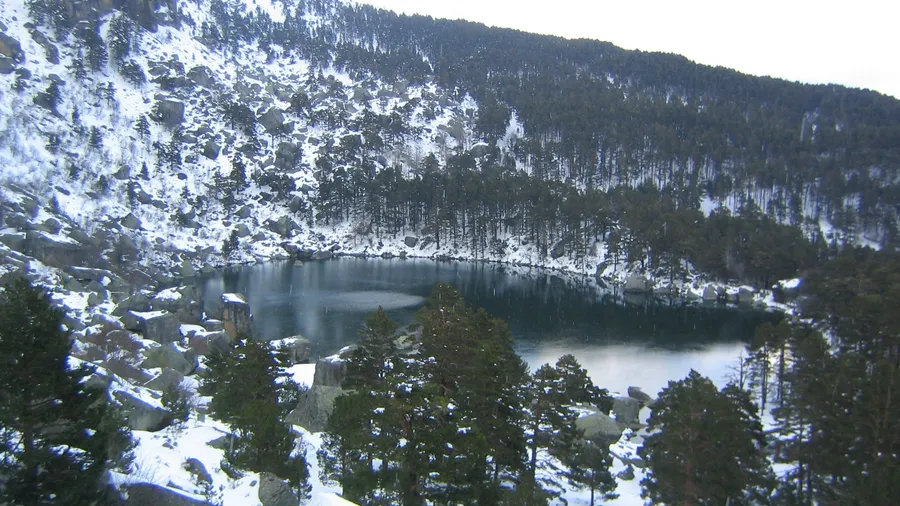
Spanish mountain ranges hold settings of pure and wild nature for those seeking high mountain landscapes. Two very different routes bring you closer to them.
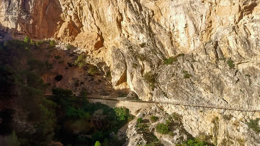
The Cares Route, between Asturias and León, is known as the "Divine Gorge" and is one of the most famous routes in Spain. Its difficulty is medium, not so much due to the elevation gain as the distance and some exposed sections where you must proceed with care.
In the Pyrenees, the Ordesa y Monte Perdido National Park (Huesca) is a protected natural space that receives an average of more than 600,000 visitors a year. The classic route of the Ordesa valley combines waterfalls, European beech forests and alpine meadows with the Monte Perdido massif as a backdrop.
Plan a full day for the Cares and book your accommodation in the villages at both ends in advance. In Ordesa, choose the route according to your fitness level and set off early to walk in daylight.
Paths that embrace the sea
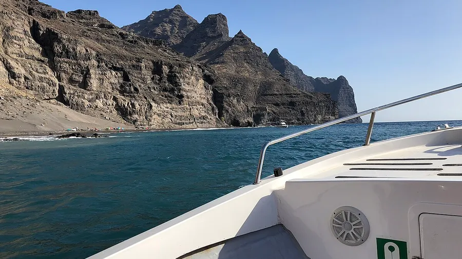
Walking by the sea adds physical effort to the salty breeze and a horizon that stretches out of sight. The coasts gather paths that wind through cliffs and lead to pristine beaches.
A coastal route is therapy for the senses: the sound of the waves, the smell of salt and the immensity of the horizon.
You can traverse the coast in short sections and discover turquoise coves that are impossible to reach by car, lonely lighthouses and Mediterranean landscapes. Choose the stage according to how much you want to walk that day and book your accommodation in the villages along the section.
Natural jewels in the south
Andalusia changes landscape with every step: rugged mountains and valleys full of life for walking. The south gathers routes for all levels, from demanding ascents to short family strolls.
It is refreshing and suitable to do with family.
If you are looking for more ideas near home, consult these hiking routes in Seville, with easy and difficult options. Book your accommodation in the villages along the section in advance and bring footwear that can get wet.
Frequently asked questions before heading to the mountain
Starting out in hiking brings doubts, and almost all of them are resolved before leaving home. Here we have gathered the most typical questions so that you can prepare your route safely.
Can I go in my usual running trainers?
Running trainers are designed for asphalt or smooth surfaces, so they are not suitable for a hiking route, even on an easy route.
In the mountains, they lack three key things: grip on the sole so as not to slip on dirt or rock, support to protect the ankle from sprains and minimal protection against stones and roots.
Specific hiking footwear is the best investment in safety and comfort for the route.
How much water do I put in my backpack?
For a half-day route, plan for a minimum of 1.5 litres of water per person. If the plan is to spend the full day, if it is hot or the route is demanding, increase that figure to 2 litres or even more.
It is better to have too much water than too little: dehydration can appear sooner than you imagine and affects your energy and your ability to make good decisions.
What do I do if I think I am lost?