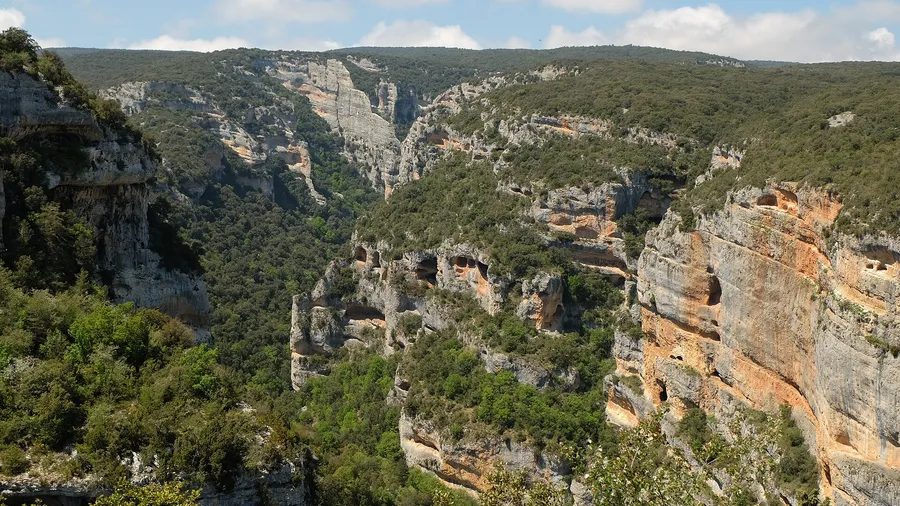
Spain, with its diverse geography, is a paradise for motor and nature lovers. From the snowy peaks of the Pyrenees to the arid deserts of Almería, the country offers many roads that invite you to be explored on four wheels, far from the urban bustle. The true essence of off-road exploration lies in discovering virgin landscapes, accessing secret viewpoints and feeling the freedom of traversing terrain that defies the conventional limits of travel.
Here you have 10 selected 4x4 routes, each with its technical sheet. In each sheet you will find the difficulty level and estimated duration, the key points of interest and their coordinates, the best time to do the route and safety and sustainable driving tips.
The guide is designed so that you can plan your getaway with confidence. Before leaving the asphalt, check the sheet for each route.
1. Pyrenees (Aragon and Catalonia): The Great Trans-Pyrenean Traverse
The Great Trans-Pyrenean Traverse crosses the Pyrenees from sea to sea via high mountain tracks. It is one of the most emblematic and challenging 4x4 routes in Europe.
The route follows the backbone of the mountain range and connects the Cantabrian Sea with the Mediterranean between Aragon and Catalonia. It passes through alpine landscapes and glacial valleys, with stretches of great silence.
The traverse is reserved for experienced drivers. Prepare the vehicle and the itinerary before setting off: high mountain tracks leave no room for improvisation.
Route Sheet
The Trans-Pyrenean traverse demands real experience at the wheel: mountain passes, river crossings and rocky terrain. Calculate between 7 and 14 days, depending on your pace and the stops you make.
You need a 4x4 with low range and good ground clearance. All-Terrain (A/T) or Mud-Terrain (M/T) tyres are what you need.
-
The best time is from June to September, when the mountain passes are free of snow.
-
The route mixes technical challenge with Pyrenean life: stone villages and local gastronomy.
Plan calmly. Check the weather and the condition of the tracks before setting off, because they can change drastically. Respect the traffic regulations in protected natural areas.
Always carry a physical map and an offline GPS: mobile coverage is non-existent in many stretches.
Picuco can help you
Does something here catch your eye?
Tell us.
Write to us on WhatsApp or email: we answer questions, find the best options and help you sort out the booking.
Write to us
We guide you based on the type of plan you have in mind and reply by WhatsApp or email.
2. Atacama Desert (Chile): Adventure on the Red Planet

The route combines salt flats, geysers, colourful lagoons and high altitudes. Therefore, it requires preparation of both the vehicle and the driver before setting off.
Route Sheet
The Atacama Desert is travelled in a 4x4, with an all-wheel drive vehicle and high clearance. The difficulty is very high: experience in driving on sand, salt flats and high mountains is required, and navigation and self-sufficiency are critical.
The vehicle must be a highly reliable 4x4, with high ground clearance, low range and reinforced tyres for hostile terrain. Carry recovery equipment: it is essential.
The best time is from September to November or from March to May, to avoid the extreme heat of summer and the intense cold of winter. Before exceeding 4,000 metres, acclimatising is fundamental; it is advisable to travel in a convoy and with a clear emergency plan.
Calculate a minimum of 5-6 litres of water per person per day and carry additional fuel. Never underestimate the aridity and the distances.
3. Ballestas-Paracas Route (Peru): Desert and Pacific Ocean
Coastal desert and the Pacific coastline, behind the wheel of a 4x4: that is the Ballestas-Paracas route, in Peru.

The journey requires technical driving between cliffs and dunes, and includes stops at wildlife sanctuaries. It thus combines cultural and natural exploration in a single trip.
Route Fact Sheet
The Ballestas-Paracas route crosses the Peruvian desert and requires experience driving over soft sand. It is a medium-high level trek, designed for those who have already driven off-road and want to combine the coast, archaeology, and dunes in one trip.
Book 1-2 days in advance during high season, allowing margin to stop at points of interest. You need a reliable 4x4, with good suspension and wide A/T or sand tyres, and recovery equipment on board. The best time is from April to October, when the heat of the southern summer gives you a break.
Plan your fuel and water carefully: these are the two points that dictate the trip. Lower your tyre pressure to 15-20 PSI to drive over sand and avoid getting stuck. Hiring a local guide helps you understand the archaeological context of the area.
4. Morocco: Adventure from the Sahara to the Atlas
Morocco is crossed in a 4x4 from the Atlas summits to the Sahara dunes near Merzouga. It is an international trek that combines technical demands with the Berber life of the towns along the route.
The itinerary includes mountain passes such as Tizi n'Tichka, with sections that require experience behind the wheel and a prepared vehicle. Allow several days to connect the high mountains and the desert, and book the logistics for the border crossing and accommodation in advance.
Route Fact Sheet
The difficulty is high: experience is needed in driving over sand, on rocky mountain tracks, and in navigating through remote areas.
The recommended vehicle is a robust 4x4 with low range, recovery boards, and a snorkel. Reinforced A/T tyres are crucial.
The landscape shifts from snow on the Atlas summits to a sea of golden sand, amidst souks and starry nights.
Prepare for more complex logistics and expect to be self-sufficient on many sections.
As a practical tip, hire an experienced local guide: they facilitate navigation and permits and provide knowledge of the terrain and the culture, making the route safer and more authentic.
5. Namibia Route: Skeleton Coast (Namibia)
The Skeleton Coast, in Namibia, is one of the most mythical 4x4 routes on the planet. It attracts travellers seeking distant horizons who are willing to prepare thoroughly.
The route is approximately 450-500 km and traverses a landscape where the desert dunes meet the Atlantic, amidst shipwrecked boats and wild nature. It is an expedition that demands preparation and respect: it is one of the most isolated environments on Earth.
Plan your trip with margin, check the vehicle and the water before setting off, and allow for buffer days in case the weather changes. The route is done in organised expeditions, so it is advisable to book in advance.
Route Fact Sheet
The Skeleton Coast is traversed on a total self-sufficiency expedition through remote coast and desert.
The difficulty level is extreme: you must know how to drive on deep sand and move through isolated areas. Always travel in a convoy and with authorised local guides.
The recommended vehicle is a robust 4x4 with low range, great fuel autonomy, reinforced suspension, complete survival equipment and M/T tyres. The best time is from May to October, during the dry season, to avoid sporadic rains and extreme temperatures.
There are no services for hundreds of kilometres: plan your water, food and fuel reserves for the entire route and carry satellite communication systems.
If it is your first visit, hire an experienced tour operator: their knowledge of the terrain, the necessary permits and emergency logistics is vital in this environment.
You can explore more adventures in similar landscapes in our coastal routes section.
6. Icelandic Route: Interior Highlands (Iceland)
The Highlands of Iceland are the destination for those who want to take the 4x4 experience to another level. Driving along the "F-roads" (mountain roads) provides access to the Highlands of Iceland.
It is one of the most memorable 4x4 routes in the world due to its demanding character and the primitive state of the terrain.
Route Fact Sheet
The Icelandic Route: Interior Highlands requires a high-clearance 4x4, all-terrain tyres and two spare wheels. It is a very high difficulty route, designed for those who have already driven on demanding tracks.
The recommended vehicle is a 4x4 with low range, high ground clearance and a snorkel, and it is advisable to carry additional fuel jerrycans.
The key is self-sufficiency and planning: the distances between service points are enormous and the weather can change in a matter of minutes, even in summer. Check the road status daily on road.is before setting off.
Do not ford a river without first assessing the depth and the current; observe the marks and follow the tracks of other vehicles. Travelling in a convoy of at least two cars is the safest option.
7. Argentine Route: Route 9 (Way of History)
The Way of History traverses the province of Córdoba in a 4x4, between Villa de María del Río Seco and the capital. It is an international route, so it is advisable to plan it in advance and with the appropriate vehicle.
Keep the tank full and carry enough water for the long stretches between towns.
Route Fact Sheet
The route runs at altitudes well below 4,000 metres, so planning is paramount. The level is medium-high: the altitude and the stretches of gravel tracks require caution behind the wheel.
Calculate between 7 and 14 days, with margin to explore without rushing. You need a robust 4x4 with good ground clearance; four-wheel drive is essential for safety in mountain passes.
Always keep the fuel tank full, because petrol stations are scarce in the most remote areas.
On the way, the Quebrada de Humahuaca (World Heritage Site) and the Hill of Seven Colours in Purmamarca await you. If you want to prepare the logistics calmly, you have this guide on how to plan a rural getaway.
8. South Africa Route: Garden Route 4x4 Extension (South Africa)
South Africa's Garden Route has an extended 4x4 version that leaves the scenic asphalt and enters off-road tracks.
Driving these tracks requires technique in several sections and brings you closer to the biodiversity and geography of the Western Cape province. It is a route for those who already have off-road driving experience and want to see the region from the inside.
Route Fact Sheet
The route requires driving experience: the level is medium-high and the toughest 4x4 sections appear in mountain passes and forested terrain that can be slippery.
The recommended vehicle is a robust 4x4, with good ground clearance and low range. All-Terrain (A/T) tyres are sufficient for most of the journey.
Avoid the winter rainy season (June-August) if you want better conditions on the tracks.
- The route combines lonely beaches and mountainous trails, and many areas require local guides or specific permits, so planning is fundamental.
- Book accommodation and guides well in advance, especially during high season.
- Always carry your international driving permit with you and check the local wildlife migration calendars to maximise sighting opportunities.
9. Bolivian Route: Salar de Uyuni (Bolivia)

More than 10,000 km² of salt extends across the Bolivian Altiplano: the Salar de Uyuni. In a 4x4, you traverse it like a white canvas under an intense blue sky.
The journey passes 3,600 metres of altitude and adds colourful lagoons, steaming geysers, and rock formations. It is advisable to book the excursion in advance and allow several days to acclimatise to the altitude.
Route Fact Sheet
The Bolivian Route through the Salar de Uyuni requires acclimatisation, a local guide, and a prepared 4x4. It is one of the most demanding routes in South America, and most travellers do it with an organised tour.
The difficulty level is high: it requires acclimatisation to the altitude and expert navigation or a local guide, with extreme and changing weather conditions.
The recommended vehicle is a robust and well-maintained 4x4, preferably hired through a reliable local agency with vehicles prepared for the saltpeter and the altitude. The dry season, from May to October, allows you to travel the salt flat without problems.
The points of interest are Incahuasi Island, Laguna Colorada, the Sol de Mañana geysers, and the Siloli Desert. Driving over an endless salt plain and sleeping in basic shelters under a blanket of stars summarises the trip.
Acclimatisation is crucial: spend at least two days in a high-altitude city such as La Paz or Sucre before starting the route. Carry medication for altitude sickness, very high factor sunscreen, and layered warm clothing, as the temperature can drop below -15°C at night. The altitude, the lack of signage, and the extreme temperatures demand exhaustive planning.
10. Australian Route: Gibb River Road (Australia)
The Gibb River Road covers about 660 km through the remote Kimberley region in Western Australia. It is one of the most legendary 4x4 routes on the planet and connects Derby with Kununurra.
The itinerary crosses one of the last virgin frontiers on Earth. River crossings and red dirt tracks mark the way: it is a demanding expedition, not a simple trip.
Plan it with plenty of time to spare and with the vehicle prepared for fording and dirt tracks. The distance and isolation of Kimberley require calculating short stages and carrying plenty of water and spares.
Route Fact Sheet
The Gibb River Road requires advanced experience, self-sufficiency, and impeccable mechanical preparation: its difficulty level is very high.
You need a robust 4x4, with good ground clearance, a snorkel, and equipped for the Outback, with extra fuel and water tanks and two spare wheels.
The route crosses a vast and unpopulated territory, so self-sufficiency and exhaustive planning are key. Along the way, you can connect with indigenous guides for a deeper cultural experience and reach crystal-clear natural pools and canyons.
Among the points of interest are the Bell Gorge and Manning Gorge gorges, stays at cattle stations such as Ellenbrae Station, and Aboriginal rock art. Always travel in a convoy of at least two vehicles and carry a satellite communication device: mobile coverage is non-existent.
Comparison of 10 4x4 routes
Ten 4x4 routes, from the Pyrenees to the Salar de Uyuni, ordered by complexity so you can choose the one that fits your experience and your vehicle.
| Route | Complexity | You need | When to go |
|---|---|---|---|
| Ballestas-Paracas (Peru) | Intermediate: coast and sand with strong winds | 4x4 with tyre pressure control, local guide and solar water | Lowering pressure in sand and avoiding midday |
| Namibia: Skeleton Coast | Very high: extreme isolation and deep dunes | Very reliable vehicle, survival equipment and satellite communication | With a specialised tour, extreme supplies and in a convoy |
| South Africa: Garden Route 4x4 Extension | Intermediate-high: coast and technical sections | 4x4, optional professional guides, permits and bookings | With accommodation and permits booked |
| Bolivia: Salar de Uyuni | High: extreme altitude and basic conditions | Reliable guide, acclimatisation, thermal clothing and sun protection | Dry season (May-October), with medication for altitude |
| Australia: Gibb River Road | High: stream crossings, isolation and corrugations | Well-maintained 4x4, extra fuel, satellite and convoy | From May to October, with satellite, convoy and spares, and booked stations |
The Pyrenees route is the closest option: panoramic alpine landscape, good local infrastructure and a route that requires leaving early and having the vehicle prepared.
Outside of Europe, the demands increase. In Iceland, book your 4x4 and accommodation months in advance and check the status of the F-roads before setting off.
Before booking, review the fact sheet for each route in the comparison and confirm permits, guides and fuel. In high-altitude destinations, allow one or two days for acclimatisation upon arrival.
Your 4x4 Adventure Starts Here: Final Tips and Next Steps
Summary of Key Points for your 4x4 routes
Preparation is 90% of the success: check your vehicle, plan in detail and respect local regulations. Before setting off, adjust the route to the level of control you have over your 4x4 and the experience of the group.
Check the fact sheet for each route to avoid heavy rain or extreme temperatures. Find out from local town halls about permits and ensure that your insurance covers off-road travel.
Next Steps to plan your trip
Before choosing a route, define your profile. An easy route has smooth tracks, short sections and stops in towns with services. The medium profile adds fords, demanding slopes and basic campsites. The advanced profile includes river crossings, soft sand or volcanic areas.
With the profile clear, create a detailed itinerary: download offline maps and study each section. Mark the refuelling points and points of interest, such as viewpoints or shelters, on that itinerary.
Always carry basic tools, a spare wheel and an emergency radio. Inform an external contact of your plan and your approximate schedule.
Impact and benefits of responsible driving
Driving carefully protects the flora and fauna of each natural environment. It also helps rural communities grow sustainably.
Planning the route well and respecting the environment gives you a safer trip without setbacks. Furthermore, it keeps those paths alive for future generations.
The essence of off-road is to experience it with passion, responsibility and curiosity, not just in overcoming technical obstacles. With Picuco and its intelligent assistant Picu, you can filter routes by region, difficulty level and points of interest to plan the route.