The essentials of Valderejo Natural Park

  • • Largest griffon vulture colony in the Basque Country nesting on limestone cliffs up to 200 m
  • • Purón River gorge: 6 km trail between limestone walls with echoing water
  • • Abandoned villages of Ribera and Villamardones with intact stone walls and threshing floors
  • • Atlantic beech and oak forest alongside Mediterranean holm oak in the same valley
  • • No mobile reception or night lighting: real disconnection just 1 hour from Bilbao

Description

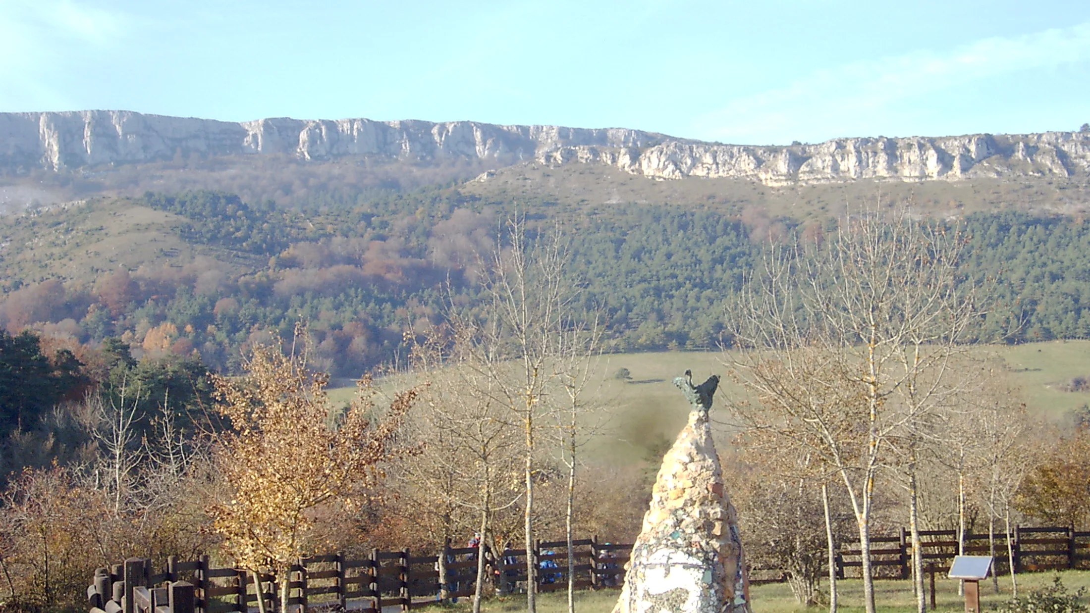
Valderejo Natural Park covers 3,496 hectares at the western edge of the municipality of Valdegovía, in the province of Álava. Declared in 1992, it was the Basque Country's first natural park. The Valderejo valley is an almost uninhabited territory — only Lalastra retains a stable population, while Ribera, Villamardones and Lahoz were abandoned decades ago — and this absence of human pressure has allowed the forest to reclaim the slopes with a density and maturity rarely found along the Cantabrian strip. From the valley floor, the silence is broken only by the murmur of the Purón River and the soaring of vultures above the limestone cliffs.

The landscape blends Atlantic and Mediterranean forest depending on aspect. Shaded slopes are covered in beech and Portuguese oak woodland of good stature, with hazel, holly and box understorey. Sunnier and lower areas support holm oak, accompanied by Scots pine in transitional sections. Valley floors retain riparian vegetation of willows, ashes and alders along the Purón. The mix of climatic influences — Cantabrian from the north, Mediterranean from the south — produces a plant diversity noticeable in the contrast between hillsides just a few hundred metres apart.

The most prominent fauna is the griffon vulture colony, the largest in Euskadi, breeding on the limestone cliffs of the Purón gorge. Access to the upper sections of the park is restricted during the breeding season to avoid disturbing the birds. Alongside the griffon vulture, the Egyptian vulture, golden eagle and goshawk complete the raptor community. Among mammals, the wildcat, roe deer and red squirrel are regular residents. The Purón River holds native brown trout and white-clawed crayfish in its best-preserved stretches.

The park's trail network has nine signposted routes. The Purón River gorge trail is the flagship: it descends for about 6 kilometres between limestone walls up to 200 metres high, with passages between rock blocks where the river changes direction and the echo amplifies the sound of water. The full route (out and back) takes around 4 hours at moderate difficulty. Other paths connect the abandoned settlements of Ribera and Villamardones, where stone walls and threshing-floor remains testify to the farming life that sustained this valley until the second half of the 20th century. The trail climbing to the Portillo de Lerón offers views over the Ebro valley from the park's southern rim.

The Lalastra Interpretation Centre is the starting point for all routes and houses a permanent exhibition on the geology, wildlife and history of the valley. The building occupies a restored village house and has parking. Valderejo works as a disconnection destination: with no mobile phone reception across much of the park, no night lighting and a low visitor density even in peak season. The experience is that of a valley that time passed by and that nature is reclaiming step by step.

Practical information

Everything you need to know for your visit to Valderejo Natural Park

How to get there
From Bilbao, take the N-625 via the Orduña pass and the A-2622 to Villanueva de Valdegovía, then the A-4338 to Lalastra (1 hour 15 min). From Vitoria-Gasteiz, via the A-2622 and A-4338 to Lalastra (about 50 min). No direct public transport to the park; access is by private vehicle only.
Area Information
The Lalastra Interpretation Centre is the only service point inside the park, with an exhibition, toilets and parking. No shops or restaurants inside the park. Rural accommodation available in Lalastra and Villanueva de Valdegovía. The town of Salinas de Añana, 25 km away, offers dining and the historic salt pans.
Geography
Enclosed valley on the southern slope of the Sierra de Árcena, between 600 and 1,200 m altitude. Limestone substrate with developed karst. The Purón River drains the valley southward through a gorge with vertical walls up to 200 m. Bordering Burgos province to the south.
Flora & Fauna
Beech and Portuguese oak on shaded slopes, holm oak on sunny faces, Scots pine in transitions. Riparian: willow, ash, alder. Fauna: griffon vulture (largest Basque colony), Egyptian vulture, golden eagle, goshawk, wildcat, roe deer, squirrel. River: native brown trout and white-clawed crayfish.

Things to do

Find the best plans and things to do in Valderejo Natural Park

20

Accommodations

Best accommodation options in Valderejo Natural Park

Loading accommodation options...

Frequently Asked Questions

Get answers about Valderejo Natural Park

Yes. Valderejo holds the largest griffon vulture colony in the Basque Country, with dozens of breeding pairs nesting on the Purón gorge cliffs. The vultures are visible most of the year soaring over the valley, especially during midday hours when they use thermals. The upper breeding areas are closed to the public from January to August to avoid disturbance.
The full route (out and back) covers about 12 kilometres and takes approximately 4 hours. Difficulty is moderate, with some stretches between rock blocks alongside the river. The gorge has limestone walls up to 200 metres high. Hiking boots with good grip are recommended as the terrain can be damp.
Yes, the park is open year-round. Winter temperatures are cold (lows around 0 °C) and snow may cover the higher ground. The advantage is minimal visitor numbers and the bare beech woodland has its own appeal. Bring warm clothing, waterproof footwear and supplies, as there are no services inside the park.
Not in most of the park. Reception is very limited or non-existent once you enter the valley. It is important to carry a printed map or download routes offline before arriving. The Lalastra Interpretation Centre can provide paper maps. If travelling alone, let someone know your planned itinerary.
The Salinas de Añana salt pans, about 25 kilometres away, are a Roman-era salt complex with guided tours and a salt product shop. The Valdegovía valley has scattered Romanesque churches. To the north, the Delika gorge and the Nervión waterfall (the Iberian Peninsula's highest at 222 metres) are about 30 minutes by car.