The essentials of Parque Natural de las Batuecas-Sierra de Francia

  • • Over thirty rock shelters with Neolithic schematic paintings along the Batuecas river
  • • Las Batuecas gorge with ferns, laurels and alders in a permanently subtropical microclimate
  • • Peña de Francia at 1,732 m with 100-kilometre views stretching to the Portuguese massifs
  • • Stable black stork colony nesting in the rocky outcrops of the natural park
  • • GR-10 hiking network linking Béjar and La Alberca through centuries-old chestnut groves

Description

Parque Natural de las Batuecas-Sierra de Francia covers 32,300 hectares in the southwest of Salamanca province, nestled between the southern foothills of the Sistema Central and the upper Alagón river valley. Elevation ranges from 380 metres at the bottom of the Las Batuecas valley to 1,732 metres at the Peña de Francia summit, creating a marked climatic gradient that allows ecosystems from different latitudes to coexist within a compact territory.

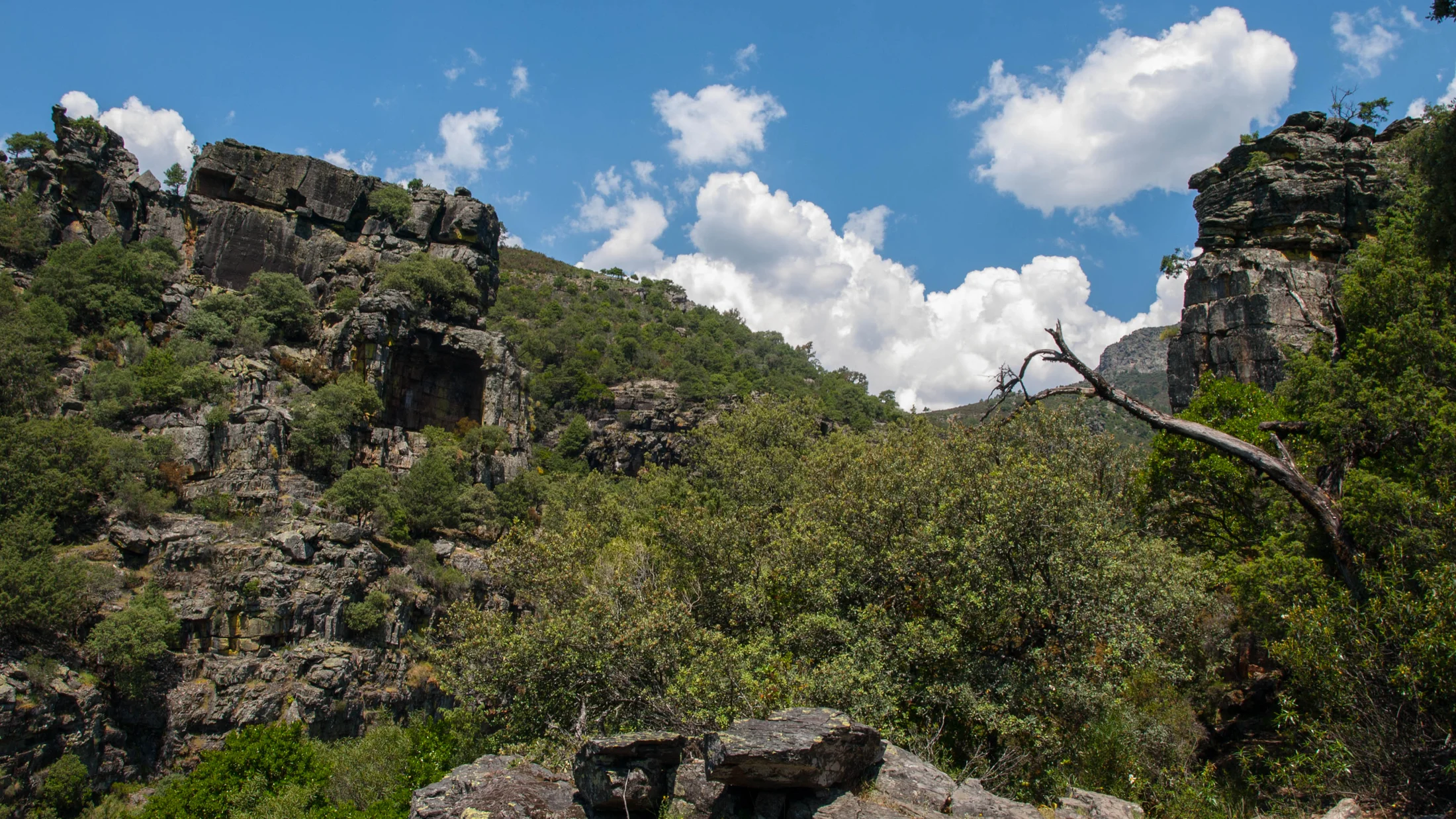
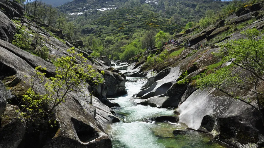
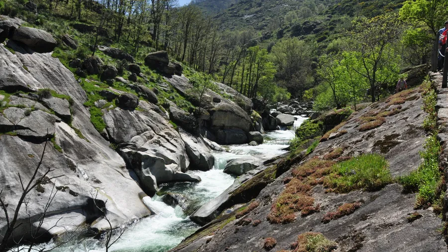
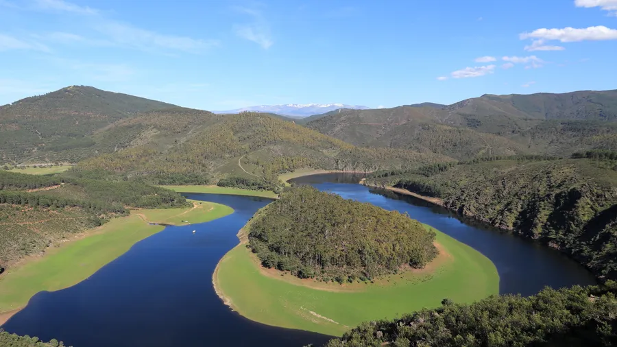
The landscape is carved by fluvial erosion into granite and slate. The Batuecas river, a tributary of the Francia, flows for several kilometres through a gorge with vertical walls and relict subtropical vegetation: ferns, alders and strawberry trees share space with laurels and hazel in an atmosphere of permanent humidity. Above 900 metres, Portuguese and Pyrenean oak woodland appears, mixed with chestnut groves whose presence in the area goes back centuries, linked to the traditional mountain economy. Holm oak and ash dehesas mark the transition towards the Alagón lowlands.

The park's fauna includes a stable population of black stork (Ciconia nigra), which nests in the rocky outcrops of Las Batuecas and is one of the area's emblematic species. Black vulture (Aegypius monachus) and Egyptian vulture (Neophron percnopterus) patrol the hunting grounds. The Francia river and its tributaries support otters (Lutra lutra) and remnant populations of native crayfish (Austropotamobius pallipes), a species in decline across the Iberian Peninsula. Wildcat, roe deer and wild boar complete the mammal list.

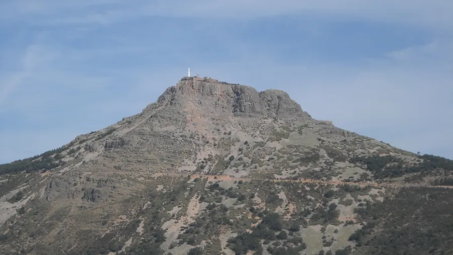
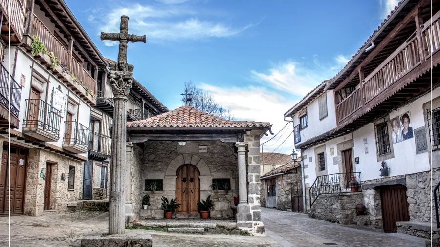
Historically and culturally, the sierra contains one of the most significant schematic rock art assemblages on the Peninsula: the Las Batuecas paintings, dated between the Neolithic and Bronze Age, are spread across more than thirty rock shelters along the river. The Peña de Francia, crowned by the Dominican sanctuary of the same name, was a pilgrimage site for centuries and today offers views of up to 100 kilometres on clear days, stretching from the Sierra de Gredos to the Portuguese massifs. The heritage villages of La Alberca, Béjar and Miranda del Castañar, all listed as Bien de Interés Cultural, add further cultural depth to a destination already rich in natural layers.

For outdoor activities, the park has well-marked hiking routes: the GR-10 crosses the sierra from north to south connecting Béjar with La Alberca in roughly four stages. The descent into the Las Batuecas gorge from the El Portillo pass (1,240 m) is one of the most popular circuits, with 600 metres of descent over five kilometres. Rock climbing is permitted in several granite and slate sectors. The Francia river and its tributaries offer regulated trout fishing, and mountain biking is allowed on forest tracks.

Practical information

Everything you need to know for your visit to Parque Natural de las Batuecas-Sierra de Francia

How to get there
From Salamanca, take the SA-300 towards Ciudad Rodrigo and branch off at Tamames to La Alberca (78 km, 1h 15min). From Madrid, the A-66 to Béjar then the SA-220 into the heart of the sierra (230 km, 2h 30min). Access to the Las Batuecas valley starts at the El Portillo pass, 7 km from La Alberca by paved road.
Area Information
Visitor centre in La Alberca with a permanent exhibition about the park. Recreational area at the Las Batuecas trailhead with parking and picnic facilities. Several mountain shelters in the upper sierra. Wide rural accommodation offer in La Alberca, Miranda del Castañar and San Martín del Castañar.
Geography
Southwest Sistema Central granite and slate massif. Elevations from 380 m at the Batuecas valley floor to 1,732 m at Peña de Francia. Deep gorges carved by the Francia, Batuecas and Quilamas rivers on a Palaeozoic bedrock.
Flora & Fauna
Zonal vegetation of oak and holm oak with chestnut groves. Las Batuecas gorge supports laurel, fern and alder. Fauna: black stork, black vulture, Egyptian vulture, otter, native crayfish (Austropotamobius pallipes), wildcat and roe deer.

Things to do

Find the best plans and things to do in Parque Natural de las Batuecas-Sierra de Francia

20

Accommodations

Best accommodation options in Parque Natural de las Batuecas-Sierra de Francia

Loading accommodation options...

Frequently Asked Questions

Get answers about Parque Natural de las Batuecas-Sierra de Francia

In high season (July and August) booking is recommended through the park office in La Alberca or by phone, as daily visitor numbers on the paintings trail are capped to protect the rock shelters. Outside high season access is free. The full paintings circuit takes between three and four hours and covers several shelters along the river.
Black stork is present in the park from March to September. The most active months are April and May, when adults feed chicks at nests located in the gorge rockfaces. Several designated viewpoints allow observation without disturbing the nesting birds. By October most individuals begin their migration to sub-Saharan Africa.
A paved road reaches the sanctuary and is accessible by car year-round except when snow falls. For those who prefer to walk, the route from La Alberca covers 12 km with around 900 metres of ascent, requiring a moderate-to-high fitness level and about five hours of walking. Views from the summit extend up to 100 kilometres in good weather conditions.
Yes. Climbing sectors are concentrated on the granite and slate cliffs around Las Batuecas and on certain faces of the Peña de Francia massif. Difficulty ranges from grade IV to VII+ depending on the sector. It is mandatory to check temporary restrictions linked to raptor nesting, which typically apply between February and July on specific routes.
Wild camping is prohibited throughout the park to protect the fragile gorge ecosystems and nesting zones. Regulated camping areas with limited capacity exist, managed by the Junta de Castilla y León. Booking in advance is essential, especially in summer. Campsites in La Alberca and Mogarraz offer alternatives just a few kilometres from the park boundary.