The essentials of Embalse de Lareo

  • • 7 km return trail with gorge, chain handrails, rock tunnel and a 2 km circuit around the reservoir
  • • Gipuzkoa's largest beech forest, with autumn colours lasting weeks through October and November
  • • Labeo dolmen beside the reservoir: a megalithic burial structure marking millennia of human presence
  • • 40-metre dam completed in 1988, now naturalised within the Aralar Natural Park
  • • No tourist infrastructure: silence, water, beeches and mountain without intermediaries

Description

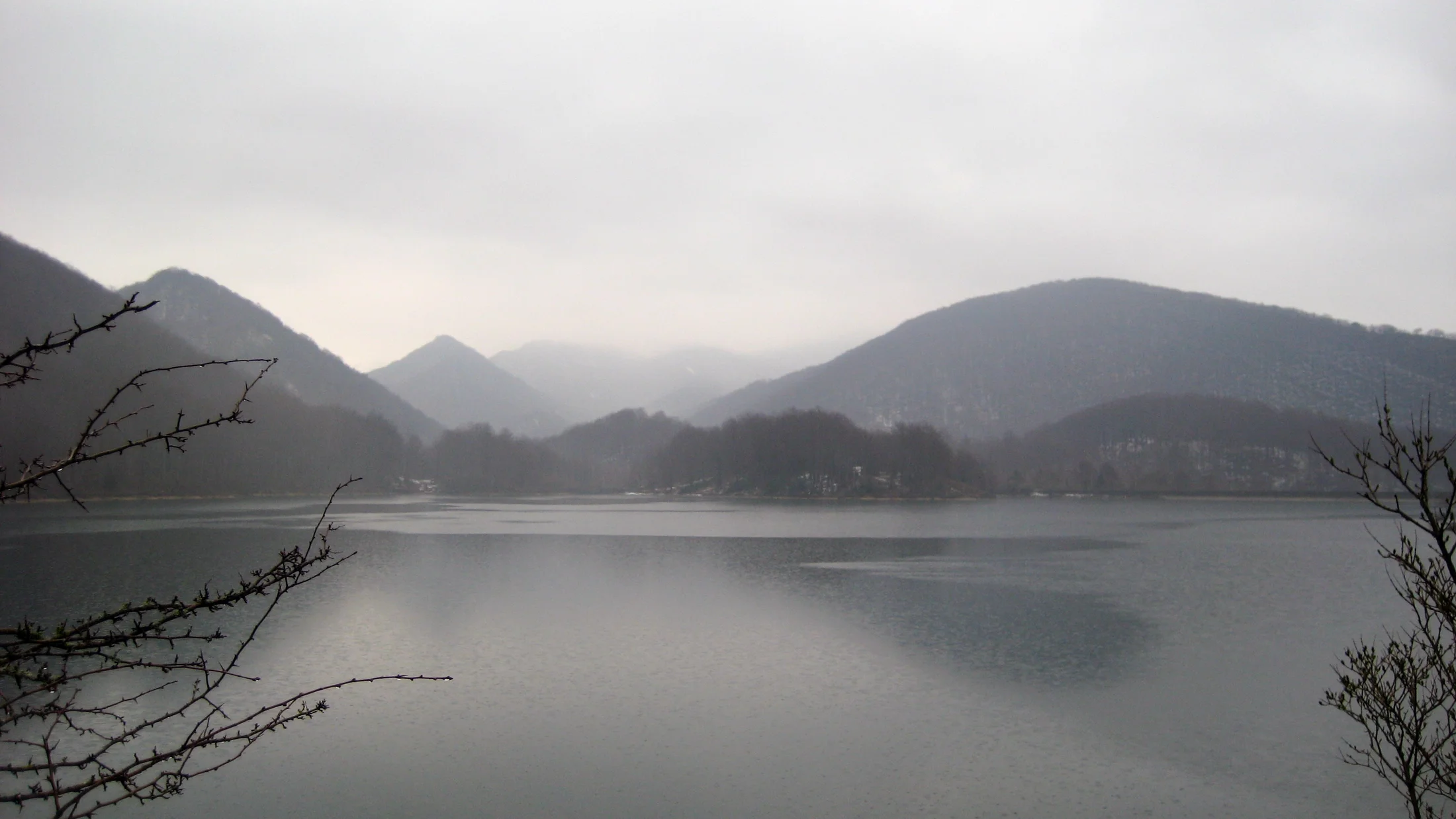
The Embalse de Lareo lies in the municipality of Ataun, within the Aralar Natural Park, in the Goierri district of Gipuzkoa. The rockfill dam with a concrete face stands 40 metres high with a crest length of 364 metres. Its storage capacity is 2.4 cubic hectometres, modest compared to large Iberian reservoirs but sufficient to supply the municipality of Ataun and support the nearby Arriarán reservoir. Completed in 1988, the surroundings have since naturalised and now blend fully into the Aralar mountain landscape.

The main access starts at the Lizarrusti Pass, on the border between Gipuzkoa and Navarra, where the Aralar Natural Park Interpretation Centre is located. From there, the 7-kilometre return trail (roughly 2 hours 10 minutes) descends through the most extensive beech forest in Gipuzkoa to reach the reservoir shore. The route is rated medium difficulty, with 178 metres of accumulated elevation change and an initial stretch through a narrow gorge with vertical walls where metal chains serve as handrails. A tunnel carved through rock bypasses one of the canyon's obstacles before the path opens into the valley holding the reservoir. At the bottom, a 2-kilometre circuit loops around the water's perimeter.

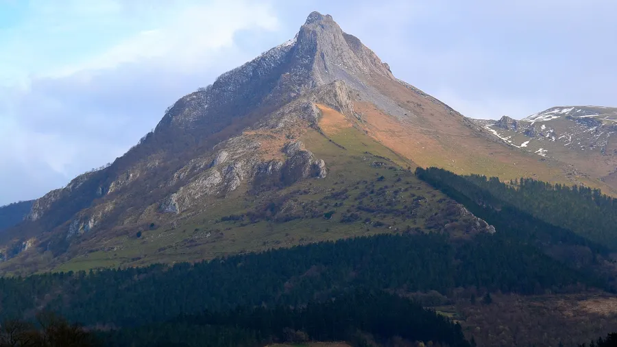
The beech forests between Lizarrusti and Balankaleku cover roughly a quarter of the Aralar Natural Park's surface and form the most extensive beech woodland in the province. In autumn, the beech leaves shift from green through yellow and orange to a deep red over several weeks, drawing walkers and photographers. Beside the reservoir, the Labeo dolmen — a megalithic burial structure — records human presence in these valleys for millennia. Local legend links the reservoir to Basajaun, the mythical guardian of the Basque forests, and the Gipuzkoa Provincial Council has named it "Basajaun's bathtub" in its promotional materials.

The reservoir's surroundings are almost devoid of tourist infrastructure: no visitor centre, no cafes, no drinking water near the shore. This absence of facilities is part of the appeal — silence is broken only by water dripping over rocks, birdsong and beech branches creaking in the wind. Mount Sarastarri to the north offers a natural viewpoint over the reservoir for those extending the walk. Trail markers combine the red-and-white GR blazes with green park waypoints, and the path is well defined except in one or two descending sections where erosion demands careful footing. Dogs are permitted on a lead. The fresh mountain air and light filtering through the beech canopy create a landscape that shifts character with each season, from the green burst of May to the deep ochres of November.

Practical information

Everything you need to know for your visit to Embalse de Lareo

How to get there
From San Sebastián, take the AP-1 to the Beasain exit (50 km, 40 min) and follow the GI-2637 to the Lizarrusti Pass. Parking is available next to the Aralar Natural Park Interpretation Centre. No public transport to Lizarrusti; a private vehicle is needed.
Area Information
Aralar Natural Park Interpretation Centre at the Lizarrusti Pass (trail starting point). No facilities at the reservoir: no café, no drinking water, no toilets. Carry everything needed from the start of the route.
Geography
Reservoir at 620–760 m altitude in the Araxes river valley, within the Aralar Natural Park (Gipuzkoa–Navarra). 40 m rockfill dam with a concrete face. Surrounded by beech-forested slopes, with Mount Sarastarri to the north.
Flora & Fauna
Dominant beech forest, the most extensive in Gipuzkoa, with oaks, pines and riparian vegetation beside the reservoir. Fauna: booted eagle, red kite and woodland birds. Forest mammals: fox, roe deer, wild boar and red squirrel. Historic charcoal-making sites in the woodland.

Things to do

Find the best plans and things to do in Embalse de Lareo

20

Accommodations

Best accommodation options in Embalse de Lareo

Loading accommodation options...

Frequently Asked Questions

Get answers about Embalse de Lareo

It is rated medium difficulty. The 7 km return route includes 178 metres of elevation change. The toughest section is the initial gorge, where metal chains serve as handrails beside vertical walls, plus a rock tunnel. Beyond this stretch, the path eases off to the reservoir. With proper footwear and fair weather, it suits hikers with basic experience.
There is no explicit prohibition posted, but the reservoir supplies drinking water and the water is cold year-round, even in summer. There is no lifeguard or rescue service. The Gipuzkoa Provincial Council informally calls it "Basajaun's bathtub", but it is not set up for recreational swimming.
It depends on age and experience. The chain sections and tunnel require sure-footedness and are not suitable for small children without constant supervision. From age 8–10, children used to mountain walking can complete the route without difficulty. The circuit around the reservoir, once at the bottom, is flat and straightforward.
There is no marked alternative access to the reservoir that bypasses the chain gorge. It is the only signed route. If the technical section is a barrier, the Lizarrusti Interpretation Centre can suggest alternative trails within the Aralar Natural Park that skip the reservoir but pass through the same beech forests.
The ideal window is usually the second half of October and the first half of November. The beech forests change colour gradually depending on altitude: higher zones first, then the valley floor. The process extends over 3–4 weeks. Sunny days after rain provide the best light for photographing the colours reflected in the reservoir water.