The essentials of Bardenas Reales

  • • Castildetierra: 44-metre clay-and-gypsum totem, the visual icon of Las Bardenas Reales
  • • Signed 55 km loop trail suitable for car and mountain bike, no guide required
  • • Great bustard, Montagu's harrier and horseshoe whip snake as most representative wildlife
  • • UNESCO Biosphere Reserve since 2000, with active transhumant shepherding along its drove roads
  • • White, ochre and brown tones that shift with dawn and dusk light

Description

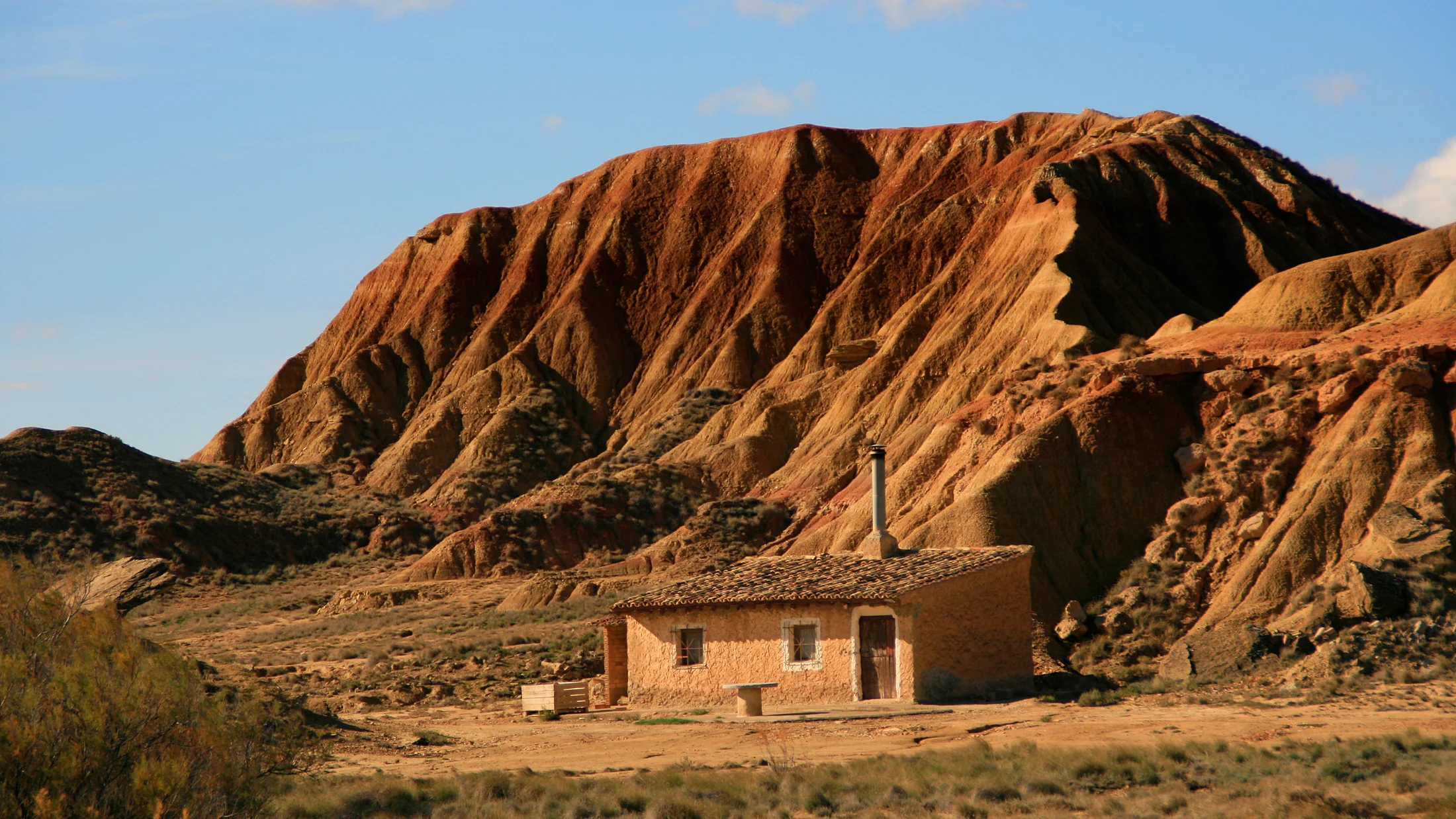
Las Bardenas Reales cover nearly 42,000 hectares in southeastern Navarre, between the merindades of Tudela, Tafalla and Sangüesa. This semi-arid desert is surprising at this latitude: the rain shadow cast by the Sierra de Cantabria and the persistent cierzo wind — the north-westerly that blows more than 150 days a year — have shaped over millions of years a landscape of clay ravines, white plateaus and mushroom-shaped formations called bardales, which evoke the American Southwest more than the Spanish interior. UNESCO recognised this fragile balance between pastoral communities, wildlife and bare terrain by designating it a Biosphere Reserve in 2000.

The territory divides into three main subzones. La Bardena Blanca concentrates the most photogenic scenery and the most recognisable formations: Pisquerra, Aguilucho and Castildetierra, that 44-metre clay-and-gypsum totem that dominates the horizon, sculpted over tens of thousands of years by differential water erosion. Colours shift from white to beige, ochre and reddish brown depending on the time of day and season, and on misty mornings the silence takes on an almost solid quality. La Bardena Negra to the north has a sector under military use — the firing range that provides space for NATO manoeuvres — and combines low scrub of black juniper, common juniper and Aleppo pine with ridges above 600 metres. El Caídas in the centre gathers historic transit corridors where transhumant flocks have walked for centuries between the Roncal Valley and the Navarrese lowlands, leaving a network of drove roads and drinking troughs that can still be walked today.

Wildlife in the Bardenas adapts to aridity with precise evolutionary strategies. The Montagu's harrier nests in cereal plots along the edges and hunts over the wastelands with a low, silent flight. The great bustard, the heaviest flying bird on the Iberian Peninsula, becomes a landmark of the winter landscape: in January and February, groups of more than twenty birds can be spotted on the plains of Bardena Negra. The horseshoe whip snake — Europe's largest snake, reaching two metres — the electrically coloured ocellated lizard and the natterjack toad are regular presences in warm months. After autumn rains, the clay soil retains water in temporary pools that attract migrating waders: snipe, little ringed plover and common sandpiper fill these small seasonal oases for days at a time. The Visitor Centre in Arguedas provides updated sighting data and interpretive panels on the geology and ethnography of the area.

The most direct access is from Arguedas via road NA-5720, which enters the heart of Bardena Blanca in about seven kilometres. The signed 55 km loop trail covers the main formations by car or mountain bike without needing a guide; the estimated driving time with stops is around three hours. For walkers, trail PR-NA 38 crosses less frequented sectors and the GR-13 links several points of the natural space with adequate waymarking. Extreme temperatures — summer highs of 40 °C and winters with freezing cierzo that push wind-chill values below zero — make spring and autumn the best times to visit. Entry to the public-use zone requires no advance booking, though a vehicle fee is charged at main access points during peak season.

Practical information

Everything you need to know for your visit to Bardenas Reales

How to get there
From Pamplona, AP-15 towards Tudela, exit at Arguedas (60 km). Road NA-5720 from Arguedas reaches the main Bardena Blanca access in 7 km. From Zaragoza, A-68 and AP-15 to Tudela (90 km), then NA-5720.
Area Information
Visitor centre in Arguedas with permanent exhibition and updated sighting data. Rest area with parking at Pisquerra. No accommodation inside the protected area; services are concentrated in Arguedas, Tudela and Ejea de los Caballeros.
Geography
Sedimentary depression between 250 and 650 metres, shaped by fluvial and aeolian erosion on Miocene clays, gypsum and limestone. Bardena Blanca dominates the south with mesas and buttes; Bardena Negra to the north is higher and more wooded.
Flora & Fauna
Steppe vegetation of ontina, sisallo and ephedra in the most arid zones. On margins, rosemary, thyme and black juniper. Great bustard, Montagu's harrier, lesser kestrel, ocellated lizard, horseshoe whip snake and natterjack toad. Temporary pools with migrating waders.

Things to do

Find the best plans and things to do in Bardenas Reales

20

Accommodations

Best accommodation options in Bardenas Reales

Loading accommodation options...

Frequently Asked Questions

Get answers about Bardenas Reales

No advance booking is needed for the public-use zone. During peak season (summer and Easter) a vehicle fee of around 8 euros is charged at the main access points in Arguedas. Groups wishing a guided visit can arrange one in advance with the Visitor Centre at Bardena Blanca.
Yes, the signed 55 km loop trail is perfectly suitable for mountain bike or gravel bike. Additional shorter routes exist. It is essential to carry enough water for the entire route, as there are no springs or shops inside the natural space. In summer, set out before 9 am to avoid extreme heat.
The golden hour at dawn (between 7 and 9 am in summer) and at dusk (7 to 9 pm) offer the warmest, most contrasty light on the bardales. At midday, overhead light flattens the relief. Castildetierra and Aguilucho are especially photogenic with raking east light in the first minutes of the day.
Bardena Blanca and most of El Caídas are open with signed tracks. A sector of Bardena Negra belongs to the military firing range and remains closed to the public. Signs along the tracks clearly mark the boundaries of the restricted zone.
The risk is very real: temperatures can exceed 40 °C in July and August, and the near-total lack of shade along much of the route makes it considerably worse. If visiting in summer, set out before 9 am, carry at least 2 litres of water per person, wear lightweight long-sleeved clothing and apply high-factor sun protection. The late afternoon slot is the safest alternative.