Summer Trails That Stay Cool
Why cool trails matter in summer
You can enjoy summer hiking without the heat in Spain if you choose your routes wisely. Heat alters effort, hydration, and decision-making, and it raises risk for children and older hikers; chasing cool microclimates improves both safety and joy. In Spain, fresh summer routes split into mountain hikes that thread forests, rivers, and canyons, and true high-mountain trails where altitude keeps temperatures down.
A beech canopy flickers like green stained glass while a cold stream tugs at your wrists. The environmental lapse rate—roughly 6.5°C per 1,000 m of elevation according to AEMET—means a 2,000 m trail is often 10–13°C cooler than sea level. Shade, water, north-facing slopes, and narrow gorges add extra relief when the plains bake. Read on for the criteria we used to curate routes where the air still feels crisp in July.
Plan around the forecast, start early, and keep stage lengths honest for your group. If the mercury spikes, shorten the route or turn back sooner.
How we selected the routes
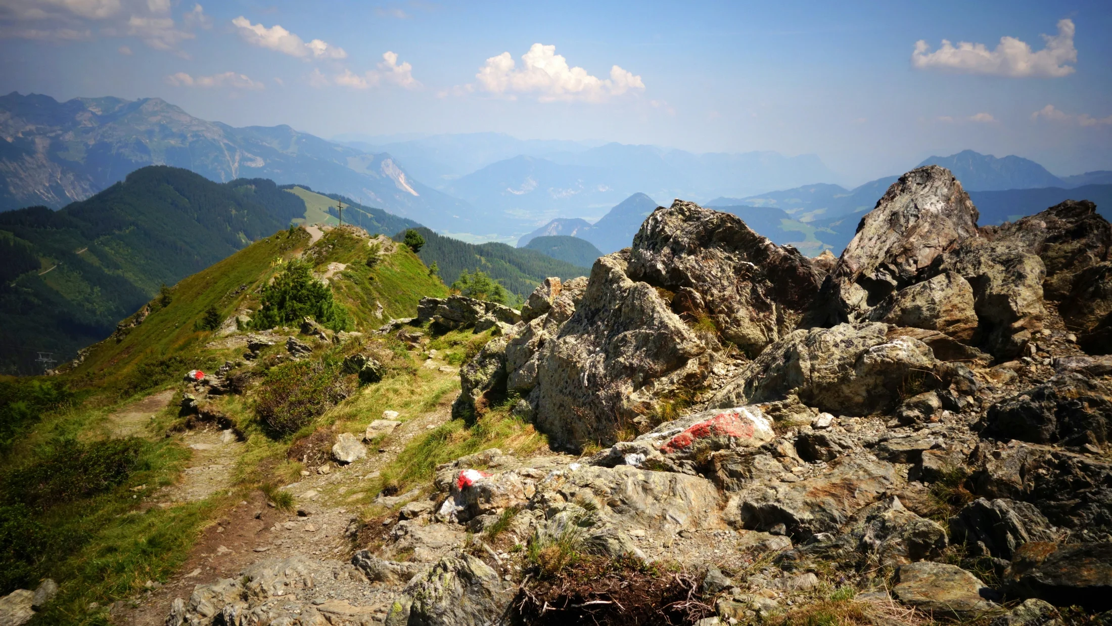
We picked routes where natural elements actively cool you down. We prioritized the presence of water (rivers, lakes, waterfalls) and continuous shade from mixed or conifer forests and canyon walls. We favored altitude above 1,500 m and north-facing orientations that reduce direct sun exposure, plus itineraries inside gorges and narrow valleys where air circulates and heat dissipates.
Cold spray beads on skin where rivers tumble over limestone ledges. We cross-checked seasonality and microclimates with park advisories and AEMET norms, highlighting early-morning and late-afternoon slots when sun angles are kindest. We also balanced accessibility: several options begin near public transport or regulated shuttles used by the national parks system, and difficulties range from family-friendly greenways to demanding high-mountain approaches.
To make the cut, each trail had to meet at least two of the following: altitude >1,500 m, shaded >50% of the time, sustained proximity to water, or enclosed terrain. We then filtered by summer practicality, safety, and appeal for photographs, picnics, and—where allowed—water stops.
Picuco te puede ayudar
Does something here catch your eye?
Tell us.
Write to us on WhatsApp or email: we answer questions, find the best options and help you sort out the booking.
How to Read the Route Cards
You’ll see each trail presented as a concise, scannable card so you can decide fast and well. We always list the exact location (valley, municipality, and park if applicable) and explain how to get there, including parking notes and whether summer shuttles or local buses run. When transport or parking is regulated, we say so and direct you to confirm details on official sources before you go. If fees exist, we mention them as “regulated/paid” without guessing amounts; prices vary by season.
Cool mist drifts across the path where a waterfall breathes into the forest. Distance and time are shown as round-trip unless noted, based on average hikers with brief photo stops; if your group is young kids or you carry heavy gear, add margin. Elevation gain (“ascent”) and difficulty are given in plain language: easy (well-marked, little exposure), moderate (some uneven terrain or drop-offs), or demanding (steep, altitude, or hands-on sections). Where a trail touches high-mountain terrain—above treeline, with snow patches or loose rock—we flag it explicitly and outline extra equipment or skills.
We also specify best season and ideal hours to dodge sun, plus the reasons each route stays cool in summer (shade, water, altitude, canyon). “Ideal for” helps you match the day to your group—families, photographers, fit hikers, or experienced mountaineers—while “Activities” lists what’s reasonable on site: photo stops, scenic picnics, wildlife viewing, and, only if allowed and safe, cooling off by the water. Finally, “Safety and ethics” condenses essentials: weather checks, hydration, footing, local rules (including no bathing in protected waters where prohibited), and a nod to the people who keep these places open—refuge guardians, rangers, and pastoral communities.
Staying Cool on Summer Hikes: Gear and Smart Tactics
Beat the heat with a few deliberate choices before you even lace up. Planning—time of day, route shape, shade percentages—often matters more than fitness when temperatures climb. Start at dawn, move during the cool arc of the morning, and plan longer rests where water and shade coincide.
Pine resin warms in the air while cold creek water numbs your fingertips. Build your kit around cooling, protection, and steady pacing:
- Hydration and salts:
- Carry 0.5–0.7 L per hour in warm conditions; double for high-mountain ascents.
- Add electrolytes (tablets or a pinch of salt) to prevent cramps and headaches.
- Refill only from treated sources or refuges; in-lake or stream drinking is unsafe without purification.
- Clothing and sun:
- Wear light, UV-rated long sleeves and a brimmed hat; dark hats radiate heat—choose light colors.
- Apply broad-spectrum SPF 30+ every two hours; don’t forget ears and backs of hands.
- Sunglasses with category 3–4 lenses protect eyes on bright granite and at altitude.
- Cooling hacks:
- Carry a small microfiber towel; soak and drape on neck or wrists for passive cooling.
- A buff dunked in a stream can drop perceived heat instantly.
- Poles and pacing:
- Trekking poles improve stability on rocky, shaded paths where humidity slicks roots and slabs.
- Slow your uphill pace; a talk-test (you can speak sentences) keeps heart rate manageable.
- Logistics:
- Note regulated access (buses, parking windows) and bring payment methods if needed.
- Download offline maps/GPX and carry a paper map as backup; phones overheat and lose GPS under cliffs.
- High-mountain specifics:
- Weather flips fast; pack a light insulating layer and a waterproof shell, even in August.
- Crossing snow or glacier remnants requires crampons, ice axe, helmet, and skills; avoid if you lack training.
- Thunderstorms build after midday; start early and be below ridges by early afternoon.
Support local cafés and refuges at trailheads; they share current conditions and keep communities vibrant.
10 Cool Summer Routes Across Spain
1.Ruta del Cares — Picos de Europa: a river-carved gorge with Natural airflow
Limestone walls cast long shade while the Cares whispers below turquoise ledges. This celebrated traverse threads a narrow balcony path between Poncebos (Asturias) and Caín (León) inside Parque Nacional de los Picos de Europa.
- Location: Poncebos–Caín, Picos de Europa (Asturias/León).
- Getting there: Limited parking at Poncebos and Caín; arrive early. Occasional summer shuttles run in nearby valleys—confirm locally. No park entry fee.
- Distance/time: 12 km one way; 22–24 km return; 5–7 h total at a steady, photo-friendly pace.
- Elevation/difficulty: ±400–600 m cumulative; moderate. Narrow ledges and drop-offs demand sure footing; not ideal for severe vertigo.
- Cost/regulation: Free trail; parking may be regulated on peak days—confirm on municipal or park boards.
- Best time: Early morning start; late-afternoon return in shaded sections.
- Why it stays cool: Gorge orientation, frequent shade from high walls, and river-cooled air.
- Ideal for: Fit walkers comfortable with exposure, photographers, geology fans.
- Activities: Iconic cliff galleries, karst windows, picnic at shaded lay-bys; avoid entering the river in strong current.
- Safety and ethics: Helm small children; keep distance from edges; rockfall is possible after storms. Respect closures and signage; this is working pastoral land as well as a park corridor.
Consider a partial out-and-back from Poncebos if temperatures rise; turning earlier keeps the magic while trimming effort.
2.Ordesa — Cola de Caballo: waterfalls, beech woods, and cool river spray
Beech leaves shimmer, and the Río Arazas mists your face as cascades drum softly. The classic path from La Pradera de Ordesa to Cola de Caballo climbs a gentle valley beneath Monte Perdido.
- Location: Torla-Ordesa, Parque Nacional de Ordesa y Monte Perdido (Huesca).
- Getting there: Summer access via shuttle bus from Torla to La Pradera; parking in Torla is regulated. Buy bus tickets on-site or via official channels.
- Distance/time: ~17 km round trip; 500–700 m ascent; 5–7 h depending on photo stops at cascades.
- Difficulty: Moderate; excellent waymarking; continuous but gentle incline.
- Cost/regulation: Shuttle required in peak season; confirm schedules and fares with the park or Torla tourism office.
- Best time: Dawn departures beat both sun and crowds.
- Why it stays cool: Dense beech and fir shade, canyon-like valley, constant proximity to cold, fast water.
- Ideal for: Families with good baseline fitness, photographers, first-time Pyrenees visitors.
- Activities: Cascada de Arripas, La Cueva, and El Estrecho viewpoints; picnic in signed areas.
- Safety and ethics: Bathing is not allowed in the national park’s rivers; stay on paths to protect fragile riparian flora. For a tougher alternative, the
GR-11via Faja Pelay is sunnier—avoid it on hot days.
AEMET’s afternoon storm patterns suggest early starts; be back in the woods if cumulonimbus build over the rim.
3.Aigüestortes — Estanys de Sant Maurici: high-mountain lakes and cooling breezes
Granite domes glow pale while a cool valley wind ripples the lake’s skin. This corner of the Pyrenees offers some of the finest high mountain trails in Spain, with altitude and water combining to temper summer heat.
- Location: Parc Nacional d’Aigüestortes i Estany de Sant Maurici (Lleida), access from Espot (east) or Boí (west).
- Getting there: Regulated 4x4 taxis operate from Espot to Estany de Sant Maurici and from Boí to Aigüestortes; private cars are restricted—confirm timetables locally.
- Distance/time: From Espot taxi drop to Sant Maurici–Ratera circuit 7–10 km; 300–450 m ascent; 3–4.5 h. Walking from Espot adds several kilometers and time.
- Difficulty: Moderate; well-maintained trails, some rocky steps.
- Cost/regulation: Park access is free; transport is paid; refuge stays at standard federation rates—check official boards.
- Best time: Early summer to mid-September, with mornings coolest and clearest.
- Why it stays cool: Altitude often >1,900 m, numerous lakes (estanys), and valley breezes.
- Ideal for: Lovers of mirror-lake photography, families used to mountain paths, those seeking routes alta montaña frescas España without technical ground.
- Activities: Viewpoints over Els Encantats, wildflower meadows, visits to nearby refuges for hot drinks.
- Safety and ethics: Bathing in lakes is not allowed inside the national park. Weather shifts quickly; carry layers and be mindful of thunderstorms after midday.
Pair this day with a night in Espot or Boí—small mountain communities whose taxis and refuges keep the park reachable.
4.Ibones de Anayet — Valle de Tena: an alpine circuit with big views
Tufts of alpine grass bend in a chill breeze while Anayet’s pyramidal bulk cuts the sky. The path climbs from the Formigal-Anayet area to a necklace of lakes beneath the Midi d’Ossau skyline.
- Location: Near Formigal (Huesca), Valle de Tena.
- Getting there: Trailhead commonly at Anayet parking along the A-136 toward Portalet; summer parking can fill—arrive early.
- Distance/time: 7–9 km round trip; 550–650 m ascent; 3.5–5 h.
- Difficulty: Moderate; steady climb on mountain paths with occasional boggy patches near the lakes.
- Cost/regulation: Free access; ski-resort areas may manage parking on peak days—confirm locally.
- Best time: Start at sunrise to walk the climb in shade; afternoons bring breezes but also cumulus.
- Why it stays cool: Altitude ~2,200–2,300 m at the ibones, open breezes, and cool lake basins.
- Ideal for: Intermediate hikers seeking a high reward-to-effort ratio, landscape photographers.
- Activities: Circuit the ibones, picnic on rock slabs, photograph Ossau and Anayet reflected in still water.
- Safety and ethics: Sudden cloud can hide landmarks—carry map/GPX. Thunderstorms are common after noon; retreat early. Protect fragile shores—no bathing in high, small lakes.
This is mountain country; greet shepherds and give space to livestock dogs guarding flocks on nearby pastures.
5.Laguna Grande de Gredos — Circo de Gredos: a glacial amphitheatre for crisp mornings
Sunrise paints granite orange as cold air slides down the cirque. From La Plataforma de Gredos, a historic mule path climbs to the Laguna Grande in one of central Spain’s classic high-mountain bowls.
- Location: Sierra de Gredos (Ávila), within the Parque Regional de la Sierra de Gredos.
- Getting there: Drive to La Plataforma de Gredos above Hoyos del Espino; parking can be regulated or limited in summer—arrive early and confirm onsite rules.
- Distance/time: ~12–14 km round trip; 600–700 m ascent; 5–7 h.
- Difficulty: Moderate; well-marked but rocky underfoot, with some sun exposure on the return.
- Cost/regulation: Access is free; parking may carry a fee on peak dates—check municipal information.
- Best time: Dawn departures; the cirque holds shade through mid-morning even in July.
- Why it stays cool: Altitude (~1,900–2,000+ m), north-facing slopes, and katabatic (downslope) air in the morning.
- Ideal for: Fit walkers, photographers, and geology fans tracing moraines and polished granite.
- Activities: Picnic at signed spots away from the lake edge; sunrise or alpenglow photography.
- Safety and ethics: Weather turns quickly—pack a light puffy and rain shell. Bathing is not permitted in the laguna. Watch your ankles on blocky sections and carry ample water; refills are limited.
Respect refuges and signage; local wardens and communities sustain access by maintaining paths and advising visitors.
6.Lagos de Covadonga — Picos de Europa: accessible highland meadows and cool air
Cowbells ring across green pastures as a breeze ripples Enol’s surface. Above Cangas de Onís, this high plateau offers short, cool walks with Atlantic air and lake reflections.
- Location: Lagos de Covadonga (Enol, Ercina), Picos de Europa (Asturias).
- Getting there: CO-4 road from Cangas de Onís; in high season, private access is restricted and buses/shuttles run—confirm schedules and parking rules before travel.
- Distance/time: 3–10 km options; 150–300 m ascent; 1–3.5 h depending on chosen loop.
- Difficulty: Easy to easy-moderate; ideal for mixed groups.
- Cost/regulation: Shuttle bus paid in regulated periods; park entry is free.
- Best time: Mornings for fewer crowds and cool air; late afternoons can be pleasantly breezy.
- Why it stays cool: Altitude ~1,100–1,200 m, frequent cloud cover, lake-cooled microclimate.
- Ideal for: Families and new hikers, picnic lovers, wildlife watchers (griffons, asturian cattle).
- Activities: Loop around the lakes, viewpoints like Mirador de Entrelagos, picnic in signed meadows.
- Safety and ethics: Weather can fog in quickly; stick to waymarked paths. Bathing is not allowed in the lakes. Share space with grazing herds and close gates behind you.
Support local dairies and cafés in Cangas and Covadonga; the cheese tastes better after a breezy walk.
7.Senda del Oso — Ubiñas-la Mesa: shaded greenway beside rivers and tunnels
Cool air breathes from old railway tunnels while the Trubia murmurs just below. This converted rail line weaves through Asturias’ valleys with abundant shade and gentle grades.
- Location: Valles de Trubia (Asturias), near municipalities like Proaza, Quirós, and Teverga.
- Getting there: Multiple trailheads (Tuñón, Proaza, Entrago); buses serve some towns—confirm local timetables if arriving without a car.
- Distance/time: Up to ~36–49 km network; pick 5–20 km out-and-back sections; 2–5 h on foot, less by bike.
- Difficulty: Easy; nearly flat, paved/gravel surface; perfect for families and e-bikes.
- Cost/regulation: Free access; bike rental and shuttles available via local operators—confirm current options.
- Best time: Late morning still feels cool thanks to shade; any time outside midday sun windows.
- Why it stays cool: Continuous tree cover, riverside alignment, tunnels with stable temperatures.
- Ideal for: Families, casual cyclists, stroller-friendly walks, mixed-ability groups.
- Activities: Riverbank pauses, cave viewpoints, picnic areas, small interpretation centers about local fauna.
- Safety and ethics: Lights recommended for longer tunnels; share the path courteously. River bathing varies by spot—use signed areas only and watch currents after rain.
Pause in village bars for cider and to hear about bear recovery projects that give the trail its name.
8.Nacedero del Urederra — Urbasa-andía: turquoise pools under deep forest
The forest smells of damp leaf-litter as limestone pools glow an otherworldly blue. The source of the Urederra offers one of Spain’s coolest-feeling summer walks thanks to shade and perpetual flowing water.
- Location: Near Baquedano (Navarra), Parque Natural Urbasa-Andía.
- Getting there: Access is regulated with mandatory reservation for the Baquedano parking on many dates—book in advance via official channels.
- Distance/time: 6–7 km round trip; 150–200 m ascent; 2–3 h with photo stops.
- Difficulty: Easy-moderate; good paths, some steps and rails.
- Cost/regulation: Parking/reservation usually paid; numbers limited to protect the site—confirm current rules.
- Best time: Morning for soft light and the coolest air under the canopy.
- Why it stays cool: Dense deciduous shade, canyon setting, constant cold water.
- Ideal for: Photographers, families who can manage gentle climbs, lovers of clear streams and shade.
- Activities: Photography from signed viewpoints, quiet picnics away from the pools.
- Safety and ethics: Bathing is strictly prohibited; the color and clarity depend on protecting the water. Stay on marked paths and pack out all waste.
Local guides and rangers help keep visitor pressure low—thank them and follow their instructions.
9.Los Cahorros de Monachil — Sierra Nevada: a shaded gorge with hanging bridges
Cold spray dots your arms as you squeeze past limestone bulges on catwalks above the river. Just outside Granada, this dramatic gorge delivers refreshing shade and playful bridges.
- Location: Monachil (Granada), Sierra Nevada foothills.
- Getting there: Trailheads at Los Cahorros near Monachil village; limited parking—arrive early or use local buses/taxis from Granada.
- Distance/time: 6–8 km loop variants; 250–350 m ascent; 2.5–4 h.
- Difficulty: Moderate; narrow ledges, low overhangs, and hanging bridges require care and balance.
- Cost/regulation: Public access; parking may be regulated on peak days—confirm locally.
- Best time: Early mornings and late afternoons keep the gorge in shade and winds cooler.
- Why it stays cool: Deep canyon shade, constant river proximity, airflow funneled through narrows.
- Ideal for: Adventurous families with older kids, confident walkers, photographers.
- Activities: Bridges, catwalks, rock overhangs, riverside rests at calm pools.
- Safety and ethics: Mind footing and handrails, especially when damp. In calm areas, paddling is often possible—avoid deeper pools and respect private land boundaries beyond the path.
Treat yourself in Monachil’s small eateries; your spend supports communities maintaining this beloved path.
10.La Renclusa and the Aneto approach — Benasque: glacier-cool air and big-mountain horizons
Morning air bites at your cheeks as snow patches glitter above granite slabs. From La Besurta, the path to Refugio de La Renclusa opens a gateway toward Aneto, Spain’s highest Pyrenean summit.
- Location: Valle de Benasque (Huesca), Posets-Maladeta Natural Park.
- Getting there: Summer access commonly by shuttle bus from Benasque/Llanos del Hospital to La Besurta; private cars restricted—confirm official timetables.
- Distance/time: La Besurta to La Renclusa ~3.5–4 km; 300–400 m ascent; 1.5–2 h. Extending to Portillón Superior or glacier viewpoints pushes totals to 12–16 km and 1,100–1,400 m ascent; 6–9 h.
- Difficulty: Moderate to demanding depending on extension; terrain becomes high-mountain above the hut.
- Cost/regulation: Shuttle is paid; refuge stays at standard rates—book early in season.
- Best time: Start at dawn; be off exposed ground by early afternoon when storms can build.
- Why it stays cool: Altitude >2,000–3,000 m, persistent snowfields and glacier remnants cooling the air.
- Ideal for: Experienced hikers seeking rutas alta montaña frescas España; aspiring alpinists acclimating.
- Activities: Hut visit, high-mountain views, moraine and glacier-formed terrain study.
- Safety and ethics: Do not step onto snow or ice without crampons, axe, helmet, and training. Weather and navigation can turn serious—carry map/compass/GPX and know how to use them; consider certified guides for glacier approaches.
Spend a night in Benasque to adjust to altitude and support this valley’s thriving mountain culture.
Map, Practical Choices, and Summer Mountain Safety
A cool breeze lifts meadow scents as you tap between layers on your phone. Use our interactive map to choose the day that fits your group and the forecast:
- Toggle layers to display trailheads, parking areas, shuttle stops, and notable viewpoints.
- Open the GPX track from each pin to save offline; ensure your app works in airplane mode.
- Tap points of interest for quick facts—distance, ascent, best hours, and family-friendliness.
- Check public-transport icons; some valleys (Torla-Ordesa, Benasque, Covadonga) regulate summer access.
When selecting your route:
- Match effort to conditions:
- If the 0–12 h forecast shows high temps or storms, choose shaded canyons (Cares, Cahorros) or shorter lake loops (Covadonga).
- If skies are stable and cool, consider higher routes (Anayet, Gredos) with early starts.
- Plan timing:
- Start at dawn; aim to finish main ascents by 11:00–12:00.
- Slot long rests by water and shade between 11:00–16:00 if you’re still out.
- Logistics and bases:
- Book regulated shuttles where required and confirm return times; the last bus is a hard deadline.
- Consider staying the night nearby (Torla, Benasque, Espot/Boí, Cangas de Onís) to beat crowds and heat.
- Public transport:
- Some valleys are bus-friendly in season; check municipal and park notices a day ahead to avoid car restrictions.
Summer high-mountain safety essentials:
- Weather and warnings:
- Check AEMET mountain forecasts the evening before and the morning of; storms often erupt after midday in the Pyrenees.
- If thunder is audible, descend from ridges and isolated trees; avoid metal bridges while lightning risk persists.
- Hydration and sun:
- Carry 2–3 L per person for medium routes; use electrolytes and sip frequently.
- Reapply sunscreen every two hours; cover neck and ears; use lip balm with SPF.
- Navigation and communication:
- Download offline maps and carry a paper backup; canyons and forests can block GPS.
- Tell someone your plan and turnaround time; signal is patchy in gorges.
- Footing and ethics:
- Poles help on granite steps and wet roots; slow down in shaded slick zones.
- Stay on signed paths, respect no-bathing rules in protected waters, and pack out all waste.
- High-mountain extras:
- Above 2,500–3,000 m, bring a warm layer, waterproof shell, hat, and gloves even in August.
- Snowfields/glacier remnants are mountaineering terrain; if in doubt, turn back or hire a certified guide.
Local rangers, refuge staff, and pastoral families keep these landscapes open—greet them, follow advice, and support village services.
Frequently Asked Questions
A ribbon of cold air flows along rivers and through beech woods even at midday in July.
How can I avoid heat on short summer hikes?
Start at dawn, pick shaded valleys or gorges, and plan your longest break by water. Choose routes under 10 km with <300 m ascent, and turn around if temperatures or effort spike.
Which of these routes are best for families?
Lagos de Covadonga loops, Senda del Oso sections, and the lower Ordesa path suit families with basic fitness. Keep distances modest, pack snacks, and schedule frequent shade stops.
Can I swim in rivers and lakes on these routes?
In national parks like Ordesa, Aigüestortes, and the Covadonga lakes, bathing is not allowed; respect signage. Elsewhere, only enter calm, signed areas, avoid currents, and never disturb wildlife or vegetation.
What should I bring if I plan to cool off by water?
Carry water shoes or sandals with grip, a small towel, and a dry bag for electronics. Always test footing before stepping; limestone can be slick even when it looks rough.
Do I need permits or reservations?
Several valleys regulate access with shuttles or parking reservations (Torla-Ordesa, Covadonga, Urederra). Check official park or municipal sites the day before; refuge overnights should be booked in advance.
How do mountain temperatures on maps translate to trail comfort?
Expect roughly 6.5°C less per 1,000 m of elevation, but wind, shade, humidity, and exertion modify how it feels. A breezy, shaded 1,800 m valley can feel 10–12°C cooler than a sunny lowland.
Should I hire a guide for high-mountain sections?
If your plan touches snow, glacier, or complex terrain (Renclusa–Aneto approaches), hire a certified guide or stay on non-technical segments. Guides add safety, pacing, and local knowledge.
Are e-bikes allowed on the Senda del Oso?
Yes, it’s a greenway; e-bikes are common. Ride courteously, use lights in tunnels, and slow near families and narrow sections.
Book your experience — discover active tourism activities in Spain with providers verified by Picuco.
Conclusion
You don’t have to surrender summer to the sun; pick altitude, shade, water, and smart timing, and you’ll find crisp air and clear light on Spain’s trails. These mountain and high-mountain options balance access, safety, and the cool microclimates that make July feel like May. Dawn starts, steady hydration, and respect for local rules and communities turn a hot forecast into a perfect escape.
A bee hums in the thyme as a breeze slips across a lake at 2,000 meters. Explore the routes above, download GPX tracks, and check shuttle notices the day before you go. Whether you choose a shaded gorge or a breezy cirque, plan your fresh summer day now and treat yourself to a slow lunch in the valley on the way home.