Navarra outdoors: forests, rivers and deserts on a single map
In two hours by car, you go from a humid beech forest to a windy desert. Navarra brings together very different landscapes over short distances, and that changes the way you organise a trip.
The community has trails, navigable rivers and panoramic mountain ranges. With that mix, you can combine several active tourism plans in a single getaway, without changing your base every night.
This section helps you choose plans, seasons and accommodation bases. Start with what appeals to you most and adjust the rest to the days you have.
Diverse nature that invites you to move
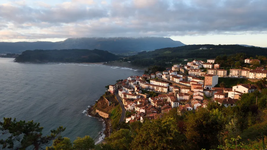
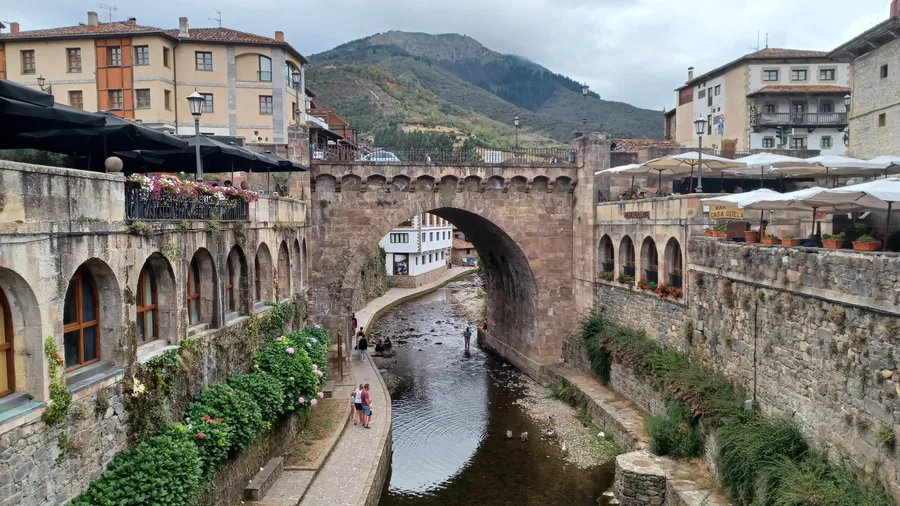
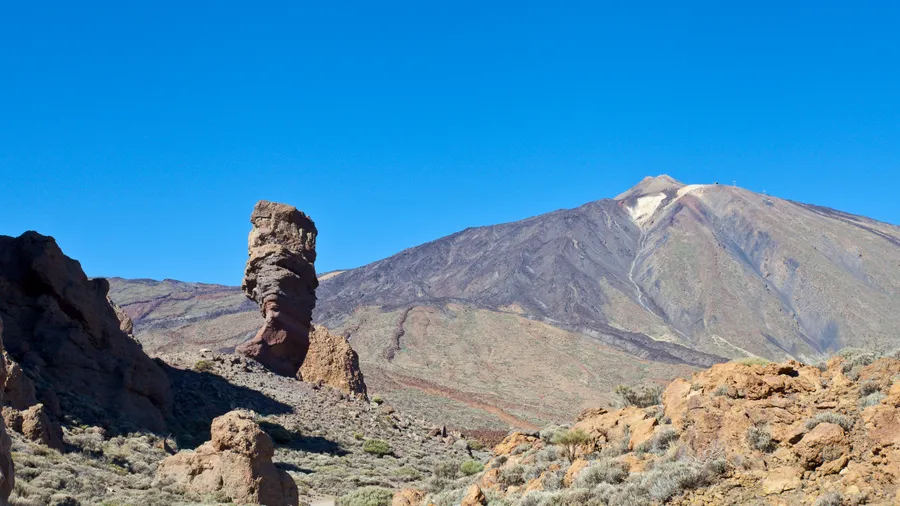
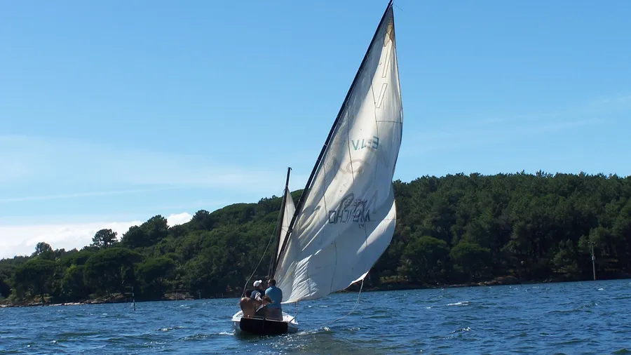
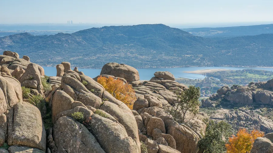
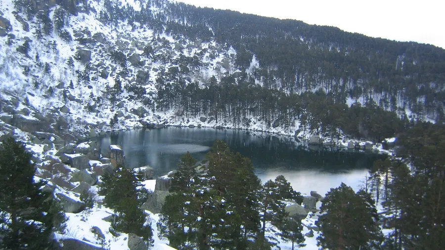
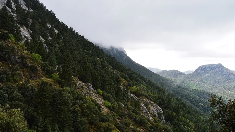
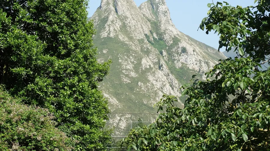
Navarra fits on a map with snow, shaded beech forests and a semi-desert of clays. Four very different landscapes, just a few hours from each other, which change the plan depending on the season.
The cold Pyrenees, the ochres of the Selva de Irati, the limestone of Urbasa and the light of Bardenas coexist in the same community.
The variety allows you to combine hiking, bike routes and water activities in a single trip. There are family proposals and others that are more technical, with nearby alternatives if the weather changes.
Four areas to start choosing:
- The Navarrese Pyrenees has peaks above 2,000 m in Belagua and glacial valleys.
- The Selva de Irati holds one of the best-preserved beech-fir forests in Europe.
- The Sierra de Urbasa-Andía is a karst plateau with viewpoints and springs.
- The Bardenas Reales form a semi-desert of clays and gypsum, photogenic and demanding due to the heat.
Book in advance during bank holidays and summer, and have a backup plan for days of rain or strong wind.
What you are going to find here
Ten concrete plans to move around Navarra with times, access, seasons and key tips. The guide is designed for those who want to decide quickly and arrive with the logistics resolved.
The plans are grouped by areas: Pyrenees, Irati, Urbasa-Andía and Bardenas. Within each one, activities are ordered by type: hiking, cycling, water and adventure. This way you can choose where to go and also what to do, whether by the river or in the heart of the mountains.
You will find routes by area with signage and maps, as well as practical accommodation such as rural houses, hostels and campsites. There are also services for athletes and the keys to booking at points with capacity limits.
The guide is completed with tips, regulations and equipment, and with a frequently asked questions section to resolve logistics and permits. Between 4 and 6 frequently asked questions answer what is most consulted before setting off.
Picuco can help you
Does something here catch your eye?
Tell us.
Write to us on WhatsApp or email: we answer questions, find the best options and help you sort out the booking.
Write to us
We guide you based on the type of plan you have in mind and reply by WhatsApp or email.
Where it is, when to go and how to get there without wasting time
Moving around Navarra is easy if you choose your gateway wisely. You will hear the cierzo wind in the Ribera and the murmur of beech forests in the north in the same weekend. This section summarises distances, transport and the best times by activity so that you can optimise your time.
-
Location and approximate distances by road:
-
Pamplona–Zaragoza: 180 km via the
AP-15+AP-68(≈2 h 13 min). -
Main access points:
- Train: medium and long-distance services to Pamplona/Iruña and Tudela. Check schedules on the Renfe website before leaving.
- Plane: Pamplona-Noáin Airport (
PNA), 6 km from the city; consider Zaragoza (ZAZ) as an alternative. - Bus: daily connections between Pamplona and the main valleys; combine with a rural taxi for the final kilometres.
-
Internal mobility:
- Own car or rental: the most flexible option for linking valleys and access tracks at the start of a route.
- Public transport: useful for sections of the Camino de Santiago and the
Vía Verde del Plazaola; confirm frequencies on weekends. - Bicycle: growing cycling network in urban areas and greenways; there are bike storage facilities in accommodation geared towards activity.
-
Best time by activity:
- Hiking: spring and autumn (mild temperatures and fewer storms); winter for snowshoeing in high mountains with a guide.
- Bike routes Navarra: spring and autumn; early or late summer in Bardenas due to heat.
- Water (kayak, gentle descent, rafting Navarra): spring and early summer with stable flows; adjust according to reservoir releases.
- Landscape photography: autumn in Irati and Urbasa; winter for clear skies in the Ribera.
-
Climatology and safety:
-
Changing weather in the Pyrenees: consult AEMET and the snow report if you climb to the summits, which exceed 2,000 m.
- Heat and wind in Bardenas: start at sunrise, carry 2–3 litres of water per person.
- Occasional fog in Urbasa: offline track and headtorch for tunnels in greenways.
Quick table of recommended seasons:
| Activity | Humid North (Pyrenees/Irati) | Karst plateau (Urbasa) | Dry South (Bardenas/Ribera) |
|---|---|---|---|
| Bike (road/MTB) | May–Oct | Apr–Nov | Mar–May, Oct–Nov |
Where to sleep to move light: rural houses, hostels and campsites
Sleeping near the activity saves you hours of driving and gives you leeway if the weather changes. Navarra has well-maintained rural houses, functional hostels and campsites next to forests or rivers.
Choose accommodation near the start of the trails, the Vías Verdes or the navigable rivers. Before booking, check if there is secure bike storage, an area to wash equipment, a laundry service and early breakfast. Also ask if you can leave before 08:00 and if the group respects the rest of others.
With variable weather, look for flexible cancellation: in autumn in Irati the plan can change from one day to the next. If you are coming from far away, ask for late check-in. Book in advance during bank holidays, in autumn in Irati and in spring in Urederra.
- Rural house or apartment: 100–220 €/night (unit), with kitchen, fireplace, bike storage and patio; works well for families and groups.
- Hostel or refuge: 15–30 € p.p./night, with bunk beds, lockers and a simple breakfast; designed for backpackers and cyclists.
- Camping or bungalow: 25–45 € plot + p.p., with showers, laundry, electricity and bike wash; comfortable for vans, caravans and families.
Rural houses and rural accommodation
Sleeping in the right valley saves you the car every morning. A well-located rural house lets you leave walking or by bike from the door, and that changes the rhythm of the day.
In the valleys of the Pirineo, Irati or Urbasa, look for spaces to dry boots, bike storage and a large kitchen. Ask for bike storage with anchors and a hose area, and ask about early breakfast and picnic packs.
The base towns depend on your plan. Ochagavía and Orbaizeta serve for the Selva de Irati; Baquedano, for the Nacedero del Urederra; Etxarri-Aranatz, a municipality in the Sakana region, works as a base for the area. Ochagavía is in the Valle de Salazar, 18 km from the Selva de Irati, and has an Interpretation Centre about nature and life in the Valle de Salazar and the conservation of the Selva del Irati. The Nacedero del Urederra is located in the Baquedano area, on a limestone wall, and features a trek designed for the tourist route.
Book in advance during peak demand: autumn in Selva de Irati and spring in Nacedero del Urederra fill up quickly. On long weekends, confirm cancellation policies and late arrival times.
Check updated prices and availability directly or on Picuco to compare options by area.
Hostels and refuges
Sleeping in a hostel is the cheapest way to have the trail or bike route right on your doorstep. In Navarra, there are places near the classic stages of the Camino de Santiago and the Pyrenean valleys, so you can link days together without taking the car every day.
Many hostels have a shared kitchen, lockers and a basic breakfast. Before setting off, ask if you need to bring sheets or a sleeping bag and if they charge an extra fee for towels.
In season, call in the morning to confirm places, especially if you are going to link stages. If you need privacy, ask about small or family rooms.
The rules are usually similar throughout the network: silence from 22:00–23:00, shared kitchen with set times and technical footwear outside the bedrooms.
If your plan is the mountains, the GR-11 covers more than 800 km, mainly through mountains, from cabo Higuer (Cantabrian Sea) to cabo de Creus (Mediterranean Sea), and is almost entirely signposted with white and red marks. The Ochagavía-Isaba stage totals 21.33 km with +745 m of positive elevation gain, about 4h 40min without stops. The Camino Francés forms part of the GR-65 Long Distance Path and the E-3 European Path.
Campsites and motorhome areas
The campsites in Navarra are near rivers, beech forests or deserts, so you can extend your days of activity without making long journeys. Choose the one that best fits your plan: quick access to rivers for water sports, nearby cycle paths or shade for the southern heat.
Before booking, check which services are actually useful to you. Look for pitches with electricity and shade, a drying room or washing machine and dryer for your gear, bike wash stations and a hose for MTB, and a shop or bar for early breakfasts.
Book well in advance in spring if you are going to Urederra or Plazaola, and in autumn if the plan is Irati. In Bardenas, it is advisable to book in spring and autumn.
In the Selva de Irati, a fee is paid at some entrances: entering on foot or by bike is free; what you pay for is the vehicle. Access is via the Aezkoa valley through Orbaizeta, about 60 km from Pamplona, or via the Salazar valley from Ochagavía. It is the second largest beech-fir forest in Europe by land area and is declared a UNESCO World Heritage site. It is also a Special Protection Area for Birds (SPA) and features Natural Reserve and Integral Reserve areas.
The section from Sarasa to Irurtzun is 9 km with gravel and a section with a steep slope.
With a motorhome, respect the designated areas and carry out responsible emptying. Avoid wild camping in protected spaces and on unauthorised tracks.
10 active tourism plans among forests, rivers and mountains
Navarra brings together ten active tourism plans among forests, rivers, mountains and desert in a single getaway. The sun of Bardenas and the freshness of Irati can be combined in the same trip.
It is advisable to alternate demanding days with gentle ones and leave some margin in case the weather changes. Each proposal indicates what to do, duration, difficulty, how to get there, the best time and practical tips.
1. Irati Forest: hikes through one of the best-preserved beech forests
The Irati Forest is the second largest beech-fir forest in Europe: 17,000 ha between Navarra and the French Atlantic Pyrenees. It is traversed via marked paths among European beech and fir.
You enter via Ochagavía, in the Salazar valley, or via Orbaizeta, in the Aezkoa valley. From Orbaizeta, you can access the Irabia reservoir.
The marked routes lead to the Irabia reservoir and panoramic passes, with SL-NA circuits and connections with the GR-11 at high altitudes. The circuits last between 30 min and 3 h 30 min depending on the loop: the Arpea Cave, 30 min; the Irabia Loop, 3 h 30 min. The difficulty is easy–moderate, and after rain there is mud and roots, so waterproof footwear is advisable.
The forest is open all year round and entry is free. In high season (from Holy Week to autumn) and on weekends, there is paid parking in Arrazola (Orbaizeta) and in Casas de Irati (Ochagavía), with capacity and parking regulated. Reserve parking on significant dates and arrive early or on weekdays.
May–June and October are the best times, the latter for the autumn colours. Respect the wildlife areas and the mushroom patches according to local regulations. You arrive via the NA-140 from Ezcároz or via the NA-2030 towards Orbaizeta.
2. Urederra Spring: turquoise pools and circular walk
The water of the Urederra forms turquoise pools among walkways and shaded paths, with a colour that does not appear in any other river in Navarra. The spring is in the north of Navarra, near Baquedano, and is traversed on foot via a simple and well-indicated route.
The route is linear, a round trip from Baquedano, with several safe viewpoints over the water. The difficulty is easy and is suitable for children used to walking.
Access has a limited capacity of 500 people per day and requires a free online advance booking, with prior notice and one ID per booking.
Swimming and access to the final section of the path are prohibited: the source of the river is not visitable. Go in spring, when the flow is high, or in autumn, for the colours, and avoid the murky snowmelt.
Wear hiking footwear, get up early on weekends and do not step off the walkways during peak hours. You arrive via the NA-718 via Zudaire, with local signage.
3. Bardenas Reales: 4x4 routes, MTB and lunar landscapes
The Bardenas Reales are a semi-desert of 41,845 hectares in the southeast of Navarra, a UNESCO Biosphere Reserve. A labyrinth of badlands that has served as a setting for films, series and adverts.
The perimeter circuit of La Blanca by MTB or vehicle and photographic walks to the viewpoints are the most common plans.
Calculate between 2 and 5 h depending on the medium and the stops. In MTB the difficulty is easy–moderate due to the undulating ground, with eroded sections that require technique. The best time is from October to April, and sunrises and sunsets are the best moments for photography.
Take 2–3 l of water per person, a cap and sun cream, and avoid the central hours in summer. Regulations set a maximum speed of 40 km/h and prohibit driving in groups of 5 or more motor vehicles, drones for tourist or recreational purposes, and camping or overnight stays outdoors. It is advisable to check for specific closures before setting off.
You can start at the Arguedas information centre or access via Tudela. From the Tudela bridge, via the N-134 towards Arguedas, a 25 km track borders the Bardena Blanca (a car route of about 2 hours) with views of Castildetierra; there is also access from Carcastillo via El Paso.
4. Sierra de Urbasa-Andía: viewpoints, karst and panoramic paths
The Sierra de Urbasa-Andía is a limestone plateau of high meadows, beech forests and bordas where livestock graze.
Walk towards the Balcón de Pilatos and follow gentle tracks between dolines and lapies.
The difficulty is easy–moderate. The karstic terrain can be confusing on foggy days, so take a basic GPS and an offline track. Respect the livestock and close the gates behind you.
Arrive via the NA-718 road from Olazti/Olazagutía or Estella/Lizarra, between PK 22 and 34. You cannot enter the Andía area by vehicle, only on foot or by bicycle via cycle tracks. To sleep, look for a base in Zudaire or Baquedano.
5. Navarrese Pyrenees: ascents, lakes and valleys (Roncal and Aezkoa)
In the Navarrese Pyrenees, gentle valleys are linked with summits that peek out at the watershed. You can go from a stroll to an ibón to a classic climb, and if you lack experience in high mountains, there are local guides.
The highest summit in Navarra is the Mesa de los Tres Reyes, at 2,424 m. The Belagua valley is the only glacial valley in Navarra.
Family routes lead to bordas and forests, and the connections with the GR-11 open up options for several days. The difficulty ranges from family to technical: in winter, crampons or snowshoes and a guide are needed.
The best time to visit the area is spring and autumn; in winter, only with equipment and a qualified guide. Before setting off, check the weather and avalanche report, take a 1:25,000 map and poles, and respect the bordas and the livestock.
6. Foz de Lumbier and Foz de Arbayún: canyons for walking and birdwatching
Foz de Lumbier and Foz de Arbayún are gorges, and they are explored on foot at a leisurely pace.
Foz de Lumbier has a linear out-and-back walk. It is easy, but the tunnels are dark and you need a headtorch. The walk starts at the Área de Acogida e Información, 1.5 km from Lumbier, with paid parking.
From Usún, routes depart such as one of about 2 km out-and-back and the Ruta de la Canaleta, of almost 12 km in total, moderate and with elevation changes. You cannot enter the gorge directly on foot.
Here you can observe griffon vultures, golden eagles, Egyptian vultures and bearded vultures. Bring binoculars, do not stray from the path and respect temporary closures due to nesting. Spring is the best time because of bird activity, although you can go all year round; in summer you can combine the visit with authorised swims in nearby rivers.
7. Vía Verde del Plazaola: cycling between forests and industrial heritage
The Vía Verde del Plazaola follows tunnels and viaducts of the old railway between Navarra and Gipuzkoa. The surface is compacted and the slopes are gentle for much of the route, so it is suitable for families and for pannier cycle touring.
The Uitzi tunnel is the longest of the greenways in Europe: when crossing it, the humidity envelops you like a cold breath, and there are sections with slopes exceeding 10%. The difficulty is easy–moderate depending on the distance you travel.
Bring a torch or headtorch for the tunnels. It is advisable to add a lightweight raincoat, lights, spares and layers for temperature changes. You can rent a bicycle in the surroundings of the greenway and stay overnight in base towns.
The access points are signposted in Lekunberri, Leitza and Andoain (provincial border). By road, take the A-15 Lekunberri exit, with car parks near the greenway. On an Alsa bus, the supplement for bicycles is 5€.
8. Navarra Wine Route: bike, wine tourism and humanised landscapes
You pedal between vineyards and wineries through the middle area of Navarra, based in Olite/Erriberri and Tafalla, uniting landscape and gastronomy.
The difficulty is moderate due to the distance and the climbs, so choose your mileage according to your fitness level. In the mid-afternoon, the air smells of thyme and must.
Spring and autumn are the best times; in summer, pedal in the morning to avoid the heat. Book winery visits and tastings in advance, and moderate your wine consumption if you are going to ride afterwards. Always wear a helmet and bring panniers for your purchases, and plan for bike transport at your accommodation or in local taxis.
The A-15 motorway connects the area with Pamplona and San Sebastián. The AP-15 is a toll road and can be avoided via the N-121. By train, there are daily connections from Tafalla and Olite to Pamplona, Vitoria and Zaragoza, and the Pamplona-Noain airport is less than 30 km from the area.
9. Rafting in Navarra: sections, safety and operators
Rafting and guided kayaking are practised on sections of the Irati and the Esca, with certified operators who move groups when the water flow is favourable.
It is an activity for families and groups, also with an educational and playful proposal designed for school-aged children. The descent on the water lasts about 2 hours, with low–medium difficulty and a mandatory safety briefing.
The departure bases are near the Roncal and Salazar valleys, and the operators include transfers. The season is linked to the snowmelt: from March to May on the Esca.
Book in advance and note minimum ages of 8–12 years depending on the water flow. Bring a swimsuit and a towel, and arrive at the meeting points agreed upon by the NA-137 and the NA-140.
10. Pamplona and peri-urban paths: Camino de Santiago and routes along the Arga
In Pamplona you can add kilometres on foot or by bike between river parks, orchards and the historic centre, without touching the car. The city combines culture, pintxos and urban walking in the same morning.
Within the park are the Plazaola, EuroVelo 1 and EuroVelo 3 cycling routes, with links to the Camino de Santiago.
You can do sections of the Camino Francés, which passes through Navarra, or loops along the Arga by bike or on foot.
Carry the track on your mobile and water, respect local pedestrians and cyclists and combine the route with visits to walls, the cathedral and markets. You move on foot or by bike from your accommodation, with frequent urban transport.
Activities and routes: hiking, cycling, water and adventure with common sense
Choosing the activity and level well changes the day: you enjoy more and expose yourself to fewer risks. Navarra has well-signposted paths, reliable maps and useful applications to plan every outing.
The weather rules in the Pyrenees and in the mountains. If it smells like wet earth, rain is near: take a raincoat and check the forecast before heading out.
In this section you will find guidelines by discipline and practical tips for hiking, cycling, water and adventure. Start with the plan that fits your level and the people accompanying you.
Hiking in Navarra: tips, levels and essential routes
In Navarra you can choose the route according to your legs and your time. Classify each outing by level and duration: family (≤8 km and <300 m D+), moderate (8–15 km and 300–800 m D+) and technical (>15 km or >800 m D+ and/or scrambling). This way you get the plan right before putting on your boots.
Classic signage distinguishes GR (white/red), PR (white/yellow) and SL (white/green). Carry apps with offline maps such as Mapas de España IGN, Komoot or Wikiloc and check current reviews before heading out.
Among the mentioned routes are the Nacedero del Urederra, which requires a reservation, and the Arbayún gorges.
The crunch of leaves under your boots sets your rhythm. Before heading out, check the weather report, the hours of daylight and a short alternative. In your backpack, you cannot miss poles, a headtorch, a thermal blanket and sufficient water.
Respect the environment: do not cut corners, close the gates and give way to livestock.
Cycling and MTB: greenways, road routes and safety
Cycle touring and MTB demand different things: the former seeks distance and regularity on smooth surfaces; the latter, tracks and trails with technical control. Choose according to what you want to pedal that day.
The Vía Verde del Plazaola has moderate gradients and compacted surfaces, so you can maintain a regular pace for kilometres. On the false flats, the wind in your face is refreshing.
Rent your bike at nearby bases and ask about luggage transport if you are doing traverses. Before setting off, check your brake pads, pressure and tightness: it is the minimum mechanics required to avoid scares.
Bring a helmet, lights (there are tunnels in Plazaola), a multi-tool, a spare tube and a quick link. Follow the Vía Verde signage, yield at crossings and respect the directions on the Bardenas tracks.
You can link plans: Plazaola and gorges on alternate days.
Water activities and rafting Navarra
In Navarra, water dictates the calendar: spring concentrates the best descents. Rafting and guided kayaking take place on stretches of the Irati and the Esca when the flow is favourable.
The Arga offers urban strolls during quiet periods. Its fluvial park extends to the east and west of the region, crossing Pamplona, and is an ecosystem where biodiversity, traditional uses and urban life coexist. You can travel through it by bicycle, as long as you maintain a moderate speed.
Before booking, take note of these details:
- Difficulty: classes II–III for beginners and families; confirm minimum ages.
- Season: Mar–Jun, with variations due to reservoir releases and rainfall.
- Bookings: book ahead for weekends; small groups fill up quickly.
- Equipment: bring a swimsuit and towel; the operator provides neoprene, helmet and life jacket.
Choose operators with qualified guides, insurance and approved equipment. If the water level drops, change the plan to riverside hiking or a gentle bike ride.
Climbing, via ferratas and adventure activities
Navarra has sport climbing schools in valley environments and several via ferratas for beginners or intermediate levels. K2–K3 level ferratas are in officially signposted locations.
Canyoning is seasonal: choose the date according to the water flow and the season. If you have no experience, hire a guide and rent approved equipment.
In a ferrata, you need a helmet, harness and energy absorber. Before setting off, check the anchors and the weather report. On dry days, your hands feel the roughness of the limestone.
It is advisable to avoid the heat in desert areas and the humidity after rainfall in limestone and beech forests. You can combine a ferrata at sunrise with a walk by a nearby river, or a short climb with a cultural visit in the afternoon.
- Plans by area: Pirineo, Irati, Urbasa-andía and Bardenas
Navarra changes a lot from one area to another, and grouping plans by valleys saves travel time. Pirineo, Irati, Urbasa-andía and Bardenas are far from each other, so it is best to choose a base and add one or two nearby plans.
Leave margin for the weather: in these areas the weather is in charge and a plan can change from one day to the next. The proposals in this section are for 1–3 days and include logistical advice for moving around and organising each day.
Navarrese Pyrenees: basics, routes and best times
The Navarrese Pyrenees should be planned around windows of good weather: it is advisable to leave a margin and have a plan B in the valley. Isaba, Ochagavía and Roncesvalles leave you close to ascents, forests and rivers.
Isaba, in the Roncal valley, is the municipality with the most inhabitants in the valley. Roncesvalles is a passage on the Camino de Santiago route and there you can see 3rd-century milestones that marked the Roman road.
With one day you have a complete plan: a walk to stone huts and beech forests, lunch in the village and a short viewpoint in the afternoon. For a weekend, on day 1 you can do a moderate route via the GR-11 or a local variant towards a panoramic pass. On day 2, choose an accessible lake or ibón and visit a local cheesery to support the shepherds.
Before heading out, check the fog forecast and get up early. In small villages, book dinner and carry cash in the valleys with little coverage. In winter, the mountain is traversed with snowshoes or a guide.
Irati Forest and surrounding areas
The Irati Forest is a fragile forest and is very visited in autumn. Enter early, reserve parking and, if you can, choose weekdays.
Alternating routes of 2–4 hours helps to spread out visits and avoid saturating the paths. The smell of damp wood accompanies you throughout the day.
Two days are enough to see the essentials. On day 1 you can do the loop to the Irabia reservoir via the SL-NA and, in the afternoon, a gentle viewpoint.
Parking is regulated, with specific payments or fees, and it is advisable to confirm the information centre's opening hours before leaving. Inside the forest, do not step on roots outside the path, keep quiet for the wildlife and pick mushrooms only with municipal permission if applicable.
Urbasa-Andía and Urederra Spring: nature escapes
The spring is reached from the Baquedano parking lot, the only authorised parking area. The final sector up to the spring is closed for environmental protection. Entry to the reserve is free and the parking has a cost: 5 € for cars, 2 € for motorcycles, 10 € for caravans, 25 € for minibuses and 50 € for buses.
In the area, it is frequent to see the flight of griffon vultures and other birds of prey. If there is dense fog, reduce your ambition and resort to forest routes or nearby gorges. Carry footwear with a gripped sole and a track in Urbasa if visibility drops.
Book your entry to the spring in advance and calculate the parking cost according to the vehicle you are using.
Bardenas Reales and the Ribera: activities and recommendations
The Ribera of Navarra mixes open skies and agricultural culture with the Bardenas desert. It is divided into Ribera Estellesa, to the west, and Ribera Tudelana, to the east.
The main access points to the area are Arguedas and Carcastillo. Stop by the information centre and choose the circuit according to how you move: on foot, by bike or by car.
Go in the early morning or late afternoon: you will avoid the heat and have better light.
Bring a cap and extra water, and check the opening hours, authorised tracks and possible specific closures beforehand. Complete your visit with the seasonal vegetable gastronomy of the Ribera.
Practical tips, permits and FAQs
Preparing your trip before getting in the car avoids scares and helps to look after the places you visit. In this section, you have the regulations for each area, safety measures, the equipment you should bring and the guidelines to enjoy without leaving a trace.
Before setting off, check the official sources for each space and adjust your plan according to the weather and the daily capacity limits. A change in weather or a full capacity limit might force you to choose another plan, and knowing this in advance saves you the trip.
Permits, bookings and local regulations
In Navarra, several protected spaces control access, capacity and parking to look after their fragility and the experience of those who visit them. Before setting off, it is advisable to know which procedure each plan requires.
At the Nacedero del Urederra, free prior booking is mandatory to access from Baquedano, and both capacity and parking are controlled. In the Selva de Irati, there are regulated parking areas and capacity limits during peak seasons, with fee payments at some access points.
In the Bardenas Reales, you can only travel via authorised tracks, there may be closures and the use of drones is restricted. In gorges and nesting areas, there are temporary closures due to birds, so respect the signage.
If you want to collect mushrooms or firewood, you need municipal permission where regulations exist. Before setting off, verify the current regulations on the official websites of the natural spaces or at local tourist offices.
Safety and first aid in outdoor activities
Safety is planned at home and practised on the route. Before setting off, leave your itinerary, your expected return time and a plan B in case the weather changes.
In the mountains, the smell of ozone can anticipate a storm. If you notice it, seek shelter and avoid ridges.
Bring a basic kit: a small first aid kit, a thermal blanket, a headlamp, a pocket knife, a lighter, a mobile phone with extra battery and an offline map. Drink between 0,5 and 1 l/h depending on the heat and effort, and add salts on long days. Dress in layers, with a raincoat, a cap or hat and thin gloves in the mountains.
Start early in Bardenas due to the heat and do not go to the ridges if storms are forecast. For snow, via ferratas and canyoning, hire a qualified guide if you do not master the technique. Book in advance.
Essential equipment according to activity
A firm sole prevents slips, and reliable, well-maintained equipment avoids scares. Rent technical gear if you do not use it often: it is cheaper than buying it for a weekend.
For hiking, bring boots or shoes with grip, poles, a rain cape, a headlamp, an IGN 1:25.000 map or app, water and snacks. If you go by bike or MTB, you need a helmet, gloves, glasses, lights, a spare camera, a multi-tool, a pump and a reflective vest on the road.
For water or rafting, pack a swimsuit, a towel and a strap for your glasses; the operator provides neoprene, a helmet and a life jacket. In winter mountains, snowshoes or crampons, an ice axe, an ARVA, a shovel and a probe in snowy terrain, only with training or a guide.
With families, adjust loads and anticipate different rhythms. For children, light layers, extra snacks, short rhythms and games during stops.
You can rent equipment at bases near Plazaola, the Pyrenean valleys and the Ribera. Confirm sizes and opening hours before going.
Sustainability and good practices in nature
The best footprint is the one that isn't noticed. Reduce waste, avoid shortcuts and carpool when you can.
Those who look after these landscapes also deserve respect: shepherds, farmers, rangers and guides. Buy in valley shops and markets and ask before entering farms.
In the mountains, rubbish comes back with you: including organic waste and cigarette butts. With wildlife, observe from a distance, do not feed them and keep dogs under control.
Do not stray from the paths and avoid wet lapiaces and fragile marls. In rivers and pools, do not use soaps.
Do I need to book for the Nacedero del Urederra?
Yes. Free advance booking is mandatory to access it from Baquedano and it secures you a parking space. Avoid peak hours and confirm updated rules before setting off.
When is the best time to visit Bardenas Reales?
The best time is from October to April, avoiding the heat; get up early, carry 2–3 litres of water and check for possible closures.
Is a guide necessary for the Selva de Irati?
Not for familiar signposted routes. It is useful in autumn to interpret flora and mushrooms, and in winter if there is snow. Check capacity limits and regulated parking.
Where can I go rafting in Navarra?
In spring, certified operators offer rafting on sections of the Irati and Esca depending on the flow. The Esca river is ideal in spring due to the snowmelt, with a fast, technical and exciting section. Confirm minimum ages, schedules and the final price with insurance included.
How do I choose a hiking level in Navarra?
Use distance and elevation gain as a reference: familiar (≤8 km and <300 m D+), moderate (8–15 km and 300–800 m D+) and technical (>15 km or >800 m D+). Carry an offline map and a plan B.
Can bike routes be done with children?
Yes. The Vía Verde del Plazaola has gentle slopes and compacted surfaces. Bring lights for the tunnels and plan short sections with rest areas.
Book your experience — discover active tourism activities in Spain with local providers.
Conclusion: prepare yourself and get moving through Navarra
Navarra fits into one trip and holds two worlds: the cold beech forest of Irati and the karst void of Urbasa. They are very different environments, and it is worth choosing well how to divide your time between them.
Choose a main area and a nearby secondary plan as a weather wildcard. This way you spend less energy on transfers and have room to improvise.
With family, prioritise shaded paths and greenways. If you are looking for intensity, alternate Pyrenean ascents with bike outings outside of the heat hours.
Book in advance for Urederra and Irati during their peak periods and check the regulations for Bardenas. In the mountains, do not underestimate weather changes: carry simple but reliable equipment and download offline maps.
Adjust your objectives on the ground according to your group and leave room to return and explore other valleys, new bike routes or water activities in season. To compare options by area and level, consult the active proposals on Picuco and choose the one that fits your dates and your pace.