The essentials of Yesa Reservoir

  • • Aragón's largest navigable surface: 2,089 ha with reliable wind for sailing and windsurfing
  • • Emerging ruins of Tiermas and Roman baths visible when the reservoir drops below 29% capacity
  • • Aragonese Camino de Santiago stretch between Artieda and Ruesta along the reservoir shore
  • • Year-round sport fishing for trout, carp, pike and perch
  • • Monastery of Leyre (9th century) and Foz de Lumbier gorge within 20 minutes by car

Description

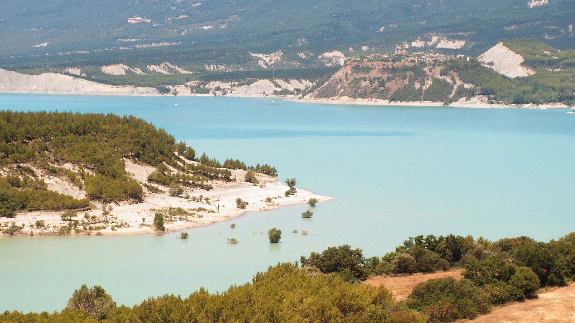
The Yesa Reservoir lies at the foot of the Sierra de Leyre in the Navarrese-Aragonese Pre-Pyrenees, with a water surface that can reach 2,089 hectares at full capacity. Known as the Sea of the Pyrenees, the reservoir was inaugurated in 1960 after the dam was built on the Aragón River in the Navarrese municipality of Yesa, although most of its surface area falls within the province of Zaragoza. Stretching 10 kilometres long and between 1 and 2.5 kilometres wide, it holds 447 cubic hectometres and is the largest navigable surface in Aragón.

The reservoir landscape shifts with the seasons and water level. In spring and early summer, when Pyrenean snowmelt fills the basin, the turquoise waters reflect the Sierra de Leyre to the south and the Pyrenean foothills to the north, with tones closer to an Alpine lake than a peninsular reservoir. In autumn, as the level drops after the irrigation season, the ruins of the village of Tiermas emerge and, if the reservoir falls below 29 per cent of capacity, the remains of an ancient Roman spa surface with its sulphurous thermal springs. This cycle of submersion and reappearance makes Tiermas one of the most singular landscapes in the Ebro basin.

Water sports are the reservoir's main draw. The cierzo — a north wind that blows strong and gusty through the sierra — creates reliable conditions for dinghy sailing, windsurfing and kitesurfing. Water skiing, powerboating and kayaking are also practised. Sport fishing attracts enthusiasts year-round: the reservoir supports populations of trout, carp, pike and perch. The shores, accessible at several points from the N-240 running along the right bank, offer informal swimming spots during summer, though there are no serviced beaches.

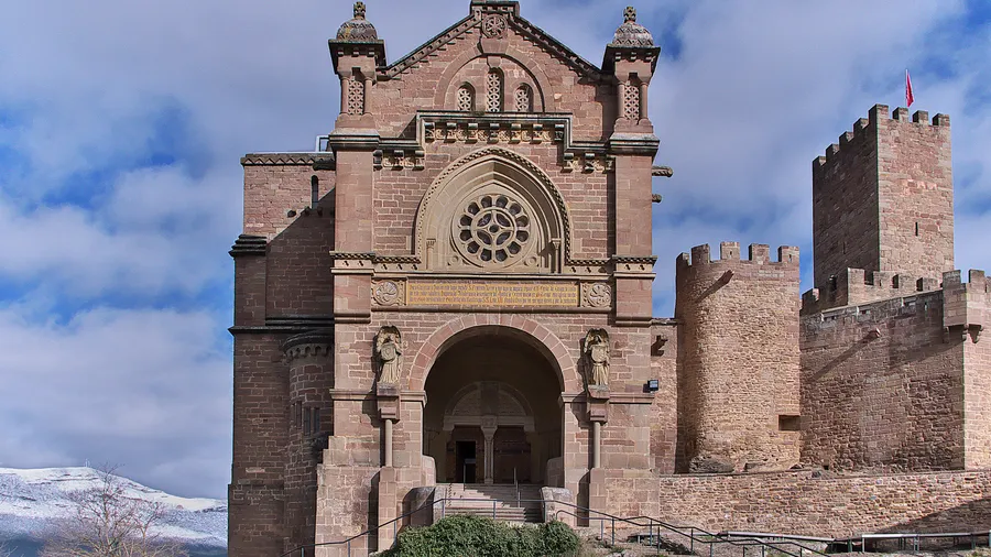
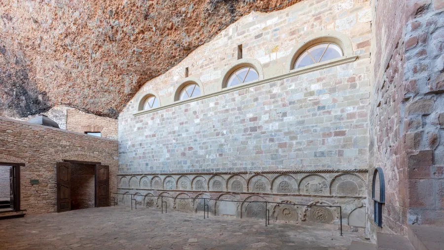
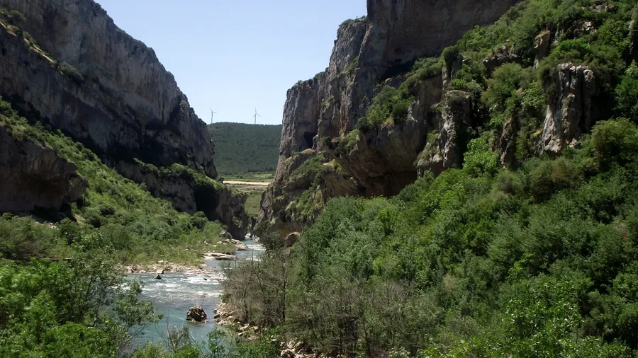
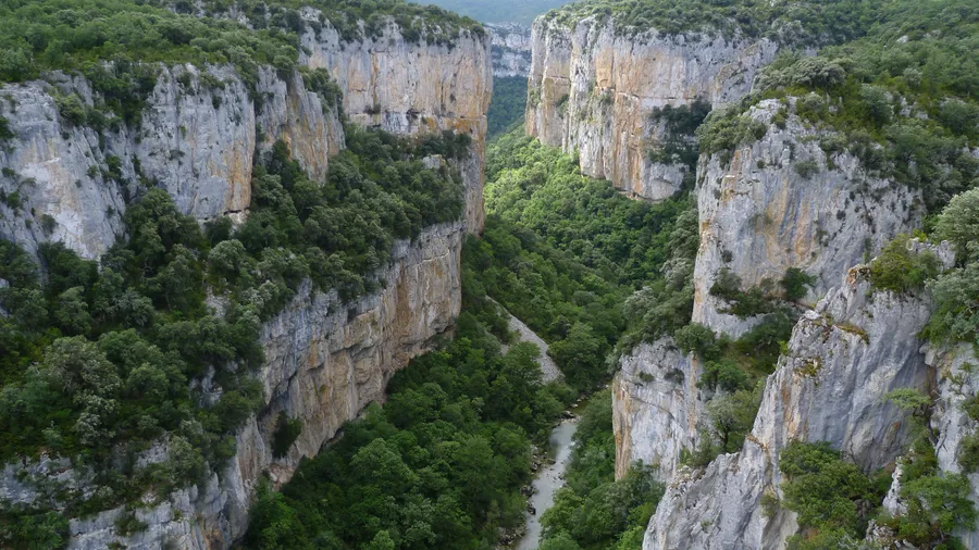
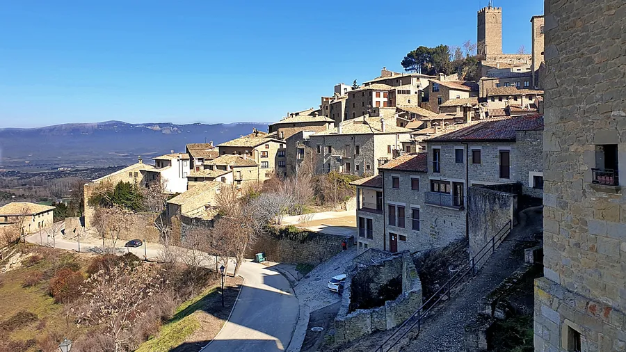
The reservoir surroundings connect to hiking and cycling routes following paths between the villages the dam left behind. From Artieda, a wooded stretch of the Aragonese Camino de Santiago runs along the shore to Ruesta, a village uninhabited since the 1960s that retains a Romanesque church and a restored pilgrim hostel. The Sierra de Leyre to the south offers trails through beech and pine woods with views over the reservoir, and the Monastery of Leyre — founded in the 9th century — is a 10-minute drive from the dam. The municipalities of Sigüés, Salvatierra de Esca and Sangüesa (16 km away) provide accommodation, dining and access to other local attractions such as the Foz de Lumbier and Foz de Arbayún gorges.

The reservoir's history is bound up with the villages it submerged. Construction of the dam between 1928 and 1960 forced the evacuation of over 1,500 people from settlements including Tiermas, Ruesta and Escó. The 8,528 expropriated hectares were shared among the municipalities of Sigüés, Urriés, Undués de Lerda and Los Pintanos. That memory of displacement is as much part of the landscape as the water itself: the walls that emerge in autumn are not just a curiosity but a reminder of communities relocated so that the Bardenas Canal could bring water to the fields of southern Navarra.

The Yesa Reservoir works as a rest point for families and watersports enthusiasts seeking an accessible mountain setting. The combination of water, Pre-Pyrenean landscape and medieval heritage creates a destination usable year-round: watersports and swimming in summer, fishing and hiking in autumn and spring, and winter scenery with the snow-capped sierra as a backdrop.

Practical information

Everything you need to know for your visit to Yesa Reservoir

How to get there
From Zaragoza, take the A-21 (Pyrenees motorway) towards Pamplona; the reservoir is around km 55, about 100 km away. From Pamplona, the A-21 towards Jaca reaches the reservoir in about 45 minutes (50 km). The N-240 runs along the right bank with several access points. Sangüesa, the nearest town with full services, is 16 km from the dam.
Area Information
Sangüesa (16 km) is the reference town with hotels, restaurants and supermarkets. Yesa has rural accommodation and a service area. The Monastery of Leyre offers a guesthouse and guided tours. In Ruesta, a restored pilgrim hostel serves walkers on the Aragonese Camino de Santiago.
Geography
10 km-long reservoir on the Aragón River, at the transition between the Pre-Pyrenees and the Ebro Depression. Flanked to the south by the Sierra de Leyre (1,300 m) and to the north by Pyrenean foothills. Limestone substrate with river gorges (foces) on tributary rivers. Dam elevation: 489 m above sea level.
Flora & Fauna
Hillsides with Aleppo pine, holm oak and Portuguese oak. Beech woods in the Sierra de Leyre. Riparian vegetation on tributary streams. Aquatic fauna: trout, carp, pike, perch. Birds: great cormorant, grey heron, red kite, griffon vulture in the sierra. Mammals: roe deer and wild boar in the surrounding forest.

Things to do

Find the best plans and things to do in Yesa Reservoir

20

Accommodations

Best accommodation options in Yesa Reservoir

Loading accommodation options...

Frequently Asked Questions

Get answers about Yesa Reservoir

It depends on the water level. The ruins of the village of Tiermas and its ancient Roman spa emerge when the reservoir drops significantly, usually in September and October after the irrigation season. For the Roman baths to be visible, the level must be below 29 per cent of capacity. These conditions do not occur every year; check the reservoir level before planning your visit.
The reservoir is suitable for dinghy sailing, windsurfing, kitesurfing, water skiing, kayaking and powerboating. The cierzo north wind blows frequently, creating reliable conditions for sailing sports. Motor boats require a navigation permit. Boat launch areas are accessible from the N-240 road.
Yes. The reservoir supports populations of trout, carp, pike and perch and is a regular sport-fishing destination. A regional fishing licence is required: from Navarra for the left bank and from Aragón for the right bank, as the reservoir straddles both regions. Seasonal closures apply in spring; check the official calendar before visiting.
From Pamplona, take the A-21 (Pyrenees motorway) towards Jaca/Huesca. The reservoir is about 50 kilometres away, roughly a 45-minute drive. The N-240 road runs along the entire right bank with several stopping points and water access. Sangüesa, 16 km from the dam, is the nearest town with full services.
The Monastery of Leyre (9th century), 10 minutes by car from the dam, offers guided tours and a guesthouse. The Foz de Lumbier, a limestone gorge with a vulture colony, is 20 minutes away. Sangüesa has a medieval old town with the Romanesque portal of Santa María la Real. And Jaca, capital of the Aragonese Pyrenees with its citadel and Romanesque cathedral, is 40 minutes north.