The essentials of Valle del Jerte

  • • Cherry blossom in March–April: over one million trees on slopes between 450 and 1,000 m
  • • Garganta de los Infiernos Nature Reserve: granite waterfalls and cold clear pools
  • • Picota del Jerte cherry with designation of origin since 1996, harvest in June
  • • Ruta de los Miradores: 30 km footpath along the Jerte linking seven granite villages
  • • Natural Jerte river pools accessible from the EX-203 road in July and August

Description

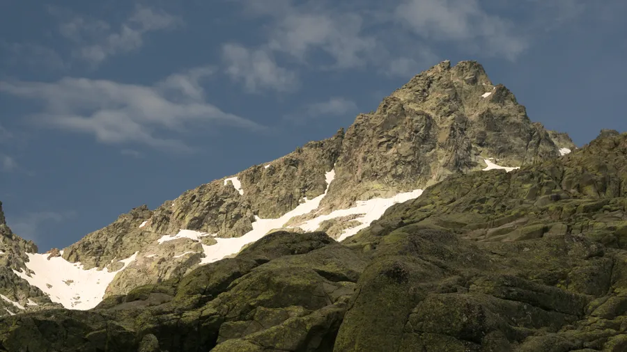
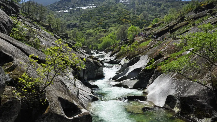
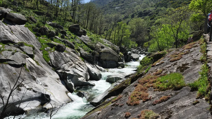
The Valle del Jerte stretches 75 kilometres through the north of the province of Cáceres, enclosed between the Sierra de Tormantos to the west and the Sierra de Gredos to the east, with altitudes ranging from 450 metres at the confluence with the Alagón river to 2,400 metres in the Cáceres sector of Gredos. The Jerte river rises at the Puerto de Tornavacas at 1,290 metres and runs 60 kilometres to join the Ambroz at Plasencia. Its cold, well-oxygenated water — staying below 12 °C even in August in fast-flowing sections — sustains one of the most stable wild trout populations in Extremadura.

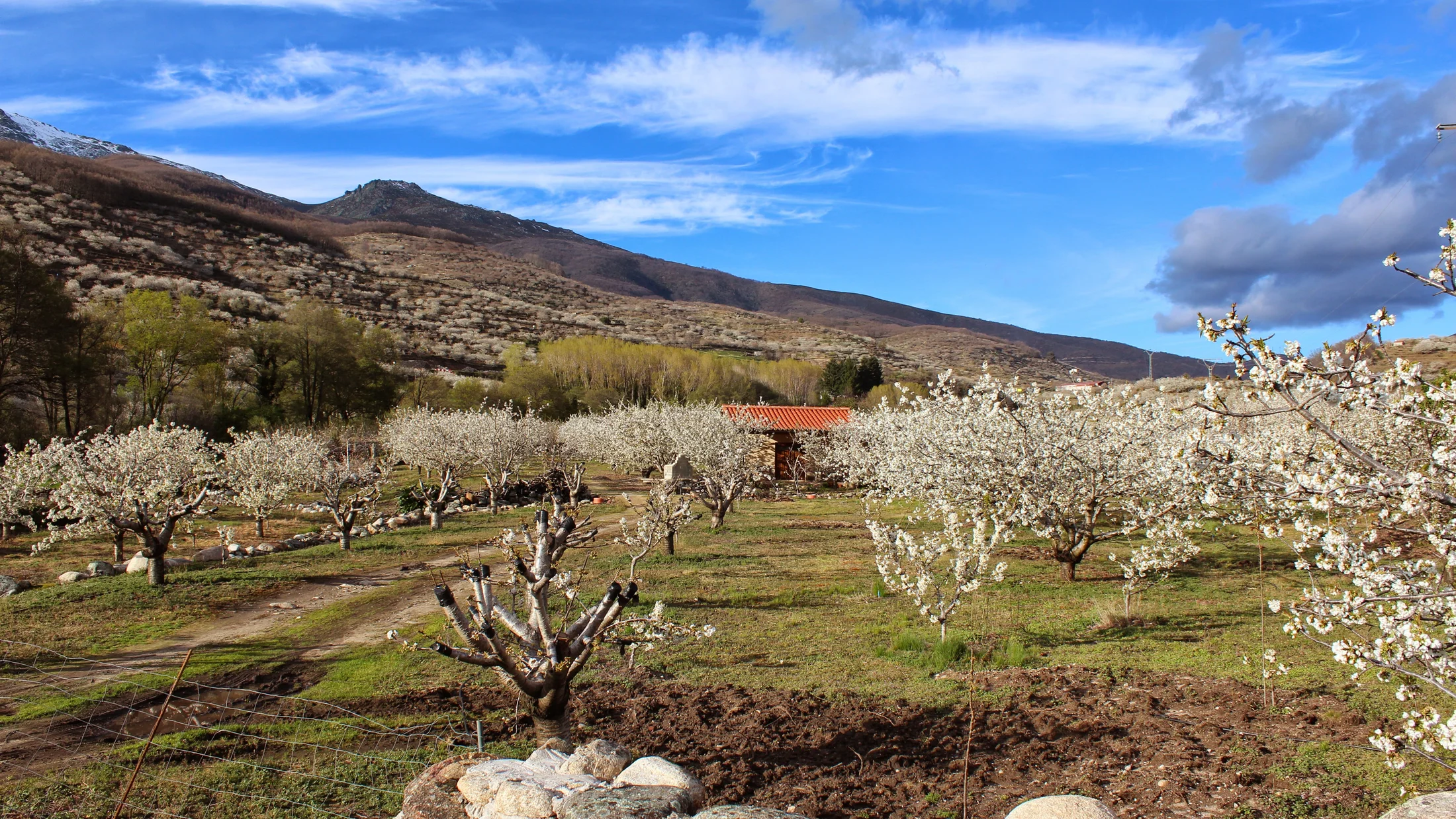
The valley's most distinctive feature is the cherry blossom, Prunus avium, in late March and early April. The Valle del Jerte holds over one million productive cherry trees on cultivation terraces covering slopes between 450 and 1,000 metres with a white canopy for two to three weeks, contrasting against the grey granite valley walls. Annual cherry production exceeds 25,000 tonnes, making the valley the largest cherry producer in central Iberia. The local picota del Jerte variety, with its own designation of origin since 1996, has a short stalk that detaches at harvest and firm, deep-red flesh; the harvest lasts barely two to three weeks in June. Outside blossom season, the same orchards show deep green in late spring and ochre and red tones in autumn.

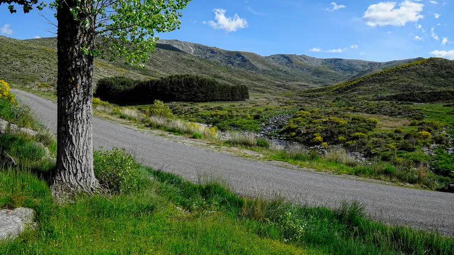
The valley's natural heritage extends to chestnut groves, Castanea sativa, on the mid-slopes, where the oldest trees reach trunk circumferences over four metres. At higher altitudes, broom heath of Cytisus oromediterraneus and creeping juniper form the plant cover above the treeline from around 1,800 metres. Griffon vultures, Gyps fulvus, soar over the granite outcrops in the upper valley, alongside short-toed eagle, Circaetus gallicus, and Egyptian vulture, Neophron percnopterus, on seasonal passage. Otter frequents riverbank sections with dense riparian vegetation.

The valley villages — Jerte, Navaconcejo, Cabezuela del Valle, Rebollar, Valdastillas, Casas del Castañar, Tornavacas — form a sequence of granite and timber architecture adapted to steep terrain over centuries. Stone wine-presses and arcaded timber balconies are the most characteristic elements. A 30-kilometre footpath along the left bank of the Jerte, the Ruta de los Miradores, links the villages and gives viewpoints over the orchards in every season. The main access to high-mountain terrain is the Puerto de Honduras at 1,430 metres, starting point for routes into the Garganta de los Infiernos Natural Reserve — with waterfalls over polished granite slides — and towards the high-mountain lagoons of La Vera.

Practical information

Everything you need to know for your visit to Valle del Jerte

How to get there
From Plasencia, the EX-203 climbs through the valley to Tornavacas (55 km, 1 hour). From Madrid, take the A-5 to Plasencia then the EX-203. During blossom season (late March–April), shuttle buses run from Plasencia on weekends to ease parking pressure in the valley.
Area Information
Valle del Jerte district, Cáceres province (Extremadura). Main towns: Plasencia, Cabezuela del Valle, Navaconcejo, Jerte, Tornavacas. Garganta de los Infiernos Natural Reserve accessible from Puerto de Honduras (1,430 m).
Geography
Valley enclosed between Sierra de Tormantos and Sierra de Gredos. The Jerte river runs 60 km north to south from Puerto de Tornavacas (1,290 m) to Plasencia. Granite and schist bedrock on the Variscan basement.
Flora & Fauna
Over one million cultivated cherry trees (Prunus avium). Chestnut (Castanea sativa) and oak woodland on mid-slopes. Broom heath and creeping juniper at altitude. Griffon vulture, short-toed eagle, Egyptian vulture, otter, and native trout in the Jerte.

Things to do

Find the best plans and things to do in Valle del Jerte

20

Accommodations

Best accommodation options in Valle del Jerte

Loading accommodation options...

Frequently Asked Questions

Get answers about Valle del Jerte

Cherry blossom starts in the lower valley around Plasencia (450 m) in late March and moves up the slopes, completing at around 1,000 metres in the first or second week of April. Peak blossom lasts two to four days depending on the year's weather. To avoid weekend crowds, the Valle del Jerte community organisation runs shuttles from Plasencia — the most practical option, allowing you to park outside the valley and ride in.
The Jerte forms clear natural pools between Tornavacas and Jerte village, with temperatures of 18–20 °C in August. The most-used swimming spots are signposted alongside the EX-203 road. The Garganta de los Infiernos also has pools reached by a short trail (1–2 km from the Puerto de Honduras car park), with colder water and stronger current than the valley-floor pools.
Yes. Puerto de Honduras (1,430 m), reached by paved road from Jerte, is the standard high-mountain starting point. Trails from there lead to the Garganta de los Infiernos, Laguna de los Caballeros, and the Lagunas del Trampal. Routes are waymarked but require mountain footwear, and between October and May there may be snow and ice above 1,600 metres.
The Ruta de los Miradores (30 km along the Jerte) can be done in short, accessible sections. The Jerte to Navaconcejo segment (5 km, minimal elevation gain) suits children from age 6–7. In spring the path runs through cherry orchards in bloom; in summer, chestnut shade keeps it cool. The river pools in the lower valley are the main draw for families in July and August.