The essentials of Sierra de las Cabras

  • • Pico Cabras at 1,283 m with views over the Vega de Antequera, El Torcal and the Córdoba Subbética
  • • 17.7 km circular route with rock scrambles and 430 m cumulative elevation gain
  • • Iberian ibex on the limestone crags and griffon vulture circling the vertical walls
  • • Jurassic dolomitic geology with karren, dolines and cliff-nesting raptor habitat
  • • Lightly trodden range with no official waymarking: self-reliant hiking territory

Description

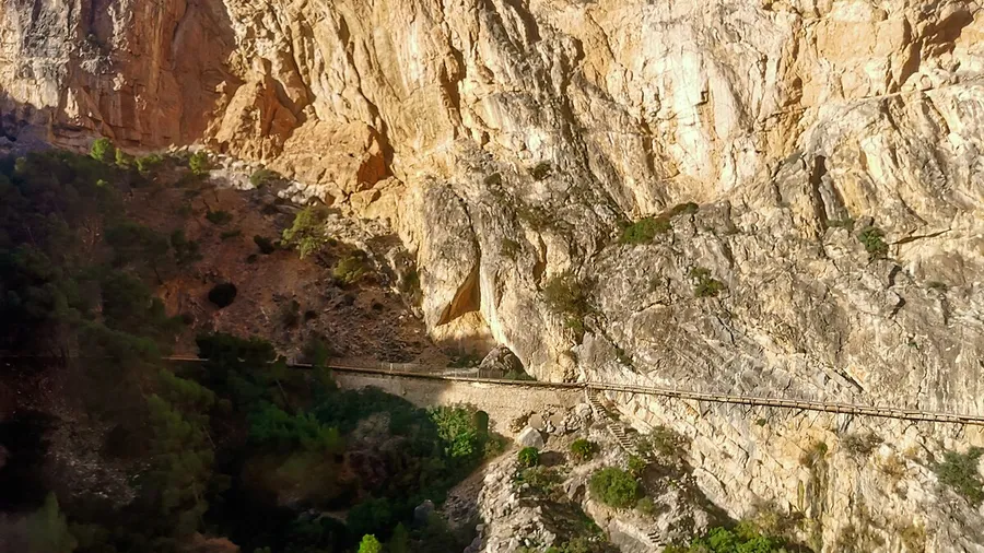
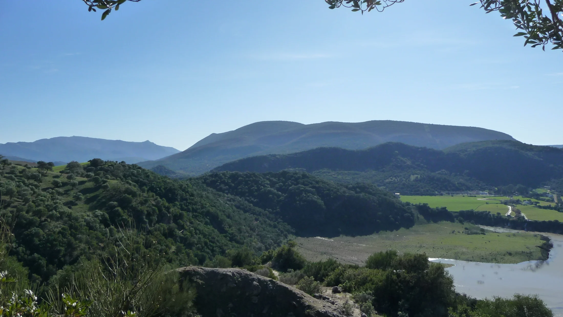
The Sierra de las Cabras rises north of Antequera in Málaga province, forming part of the Cordillera Antequerana, a limestone arc stretching roughly 50 kilometres east to west between the Puerto de los Alazores and the Gaitanes Gorge. Its main summit, Pico Cabras (also known as Cerro del Tajo Prieto), reaches 1,283 metres and from the top the view spans the Vega de Antequera, El Torcal to the south and the first ranges of the Córdoba Subbética to the northeast. The geology is Jurassic dolomitic limestone, with karren fields, dolines and vertical walls where raptors nest.

The hiking routes have a demanding profile. The most complete circular, at 17.7 kilometres, starts from the A-7075 road near Villanueva de la Concepción, climbs along goat tracks through gorse and thistle, crosses several livestock gates and requires scrambling on certain rock sections. Cumulative elevation gain is around 430 metres, with a minimum altitude of 908 metres and the maximum at Pico Cabras. A shorter option (10 km) ascends directly to the peak from Cortijo de la Alhajuela and returns the same way. There is no official waymarking on most of the route: a GPS track or prior knowledge of the terrain is needed.

The range's fauna includes griffon vulture, golden eagle, peregrine falcon and rufous-tailed rock thrush among the raptors and cliff-dwelling birds. Iberian ibex occupies the most inaccessible crags and is regularly seen in the early morning. Lower areas are home to wild boar, fox and badger. Vegetation combines juniper stands, low-profile holm oak, Portuguese oak and mixed formations with maples on shaded slopes. Sun-facing hillsides are dominated by esparto, gorse and rosemary, and rupiculous plants adapted to drought and wind grow in the cracks of the limestone. In March and April, rosemary blooms on the lower slopes and its sweet scent mixes with the dry air drifting up from the Vega.

The range has no official protection status or visitor centre. The most common access is from Villanueva de la Concepción, a town of around 3,200 people halfway between Antequera and the Puerto de las Pedrizas pass. Antequera, 15 kilometres away, serves as a logistical base with hotels, restaurants and direct AVE high-speed rail connections to Madrid (2 h 30 min) and Málaga (30 min). El Torcal de Antequera, 8 kilometres to the southwest, complements a visit with its karst landscape at lower altitude.

Sierra de las Cabras shares the same Jurassic geological base as El Torcal de Antequera, but the surface landscape differs: erosion here has not produced El Torcal's whimsical shapes but rather vertical walls and sharp ridges cutting the skyline. Marine fossils embedded in the limestone are a reminder that this entire relief was seabed 150 million years ago. Local shepherds still use the same goat paths connecting farmsteads to the high pastures.

Sierra de las Cabras is territory for technical, lightly trodden hiking. There are no water sources on the route, the sun is fierce in summer and navigation demands attention. That rugged character is precisely what draws those who want to walk without meeting other groups, in a setting where limestone and raptors set the pace for the day.

Practical information

Everything you need to know for your visit to Sierra de las Cabras

How to get there
From Antequera, A-7075 toward Villanueva de la Concepción (15 km, 20 min). From Málaga, A-45 to Antequera (45 min) or A-7 via the Puerto de las Pedrizas. Informal roadside parking on the A-7075. AVE train to Antequera-Santa Ana from Madrid (2 h 30 min) and Málaga (30 min).
Area Information
No visitor centre or tourist infrastructure on the range. Villanueva de la Concepción (pop. 3,200) at the trailhead with a bar and shop. Antequera 15 km away with hotels, restaurants and tourist information. El Torcal de Antequera 8 km to the southwest.
Geography
Limestone range in the Cordillera Antequerana, northern Málaga. Altitudes from 908 to 1,283 m (Pico Cabras). Jurassic dolomitic limestone with karren, dolines and vertical walls. Flanked by the Vega de Antequera and El Torcal.
Flora & Fauna
Griffon vulture, golden eagle, peregrine falcon and rufous-tailed rock thrush on the cliffs. Iberian ibex on the crags. Juniper, low holm oak, Portuguese oak and maple on shady slopes. Esparto, gorse and rosemary on sunny faces. Rupiculous plants in limestone cracks.

Things to do

Find the best plans and things to do in Sierra de las Cabras

20

Accommodations

Best accommodation options in Sierra de las Cabras

Loading accommodation options...

Frequently Asked Questions

Get answers about Sierra de las Cabras

The full 17.7 km circular route is rated difficult. Cumulative elevation gain is around 430 metres, but the main challenge lies in the limestone scrambling sections and narrow goat tracks through thorny vegetation. The direct route from Cortijo de la Alhajuela (10 km return) is shorter but keeps the technical summit sections. Previous mountain experience and shoes with good grip are recommended.
Yes, with patience. Iberian ibex inhabit the range's highest crags and can be seen fairly regularly, especially in the early morning and at dusk. Males are easier to pick out thanks to their large horns. Bring binoculars and move quietly. The rutting season (November-December) is when they are most active and most visible.
Yes, both form part of the same Cordillera Antequerana, a limestone arc crossing northern Málaga. They share Jurassic dolomitic geology, though El Torcal displays a more developed karst with its distinctive weathered formations. They sit about 8 kilometres apart and can be visited on the same day. El Torcal has signposted trails and a visitor centre, making it more accessible.
No. Sierra de las Cabras has no accessible water sources at any point on the circuit. The limestone terrain drains all water underground. You must carry at least 2 litres per person in winter and 3 litres in warmer months. Villanueva de la Concepción, the starting point, has a bar where you can fill bottles before setting out.
Yes, and it is the most practical approach. Antequera lies 15 kilometres away and offers accommodation, dining and historical heritage (the Alcazaba, the Menga and Viera dolmens, the collegiate church). The Pico Cabras route can be done early in the morning, leaving the afternoon for Antequera. The Antequera-Santa Ana AVE station connects directly with Madrid and Málaga, making a weekend trip straightforward.