The essentials of Alpujarras Granadinas

  • • Medieval Arab acequia irrigation system watering slate-terraced kitchen gardens
  • • Trevélez: Spain's highest municipality with DOP mountain-cured Iberian ham
  • • GR-7 trail between Capileira, Bubión and Pitres above the Poqueira gorge
  • • Summer access to Mulhacén (3,479 m) and Veleta (3,392 m) summits
  • • Vernacular architecture with launa clay terraos and whitewashed stone walls

Description

The Alpujarras Granadinas occupy the southern slopes of the Sierra Nevada, between 800 and 1,600 metres above sea level, in the south-east of Granada province. The territory stretches from the Guadalfeo river in the west to the Almería border in the east, covering a band of municipalities that descend in steps from the snowy peaks towards the low hills facing the Mediterranean. This geographical position — the south face of the Iberian Peninsula's highest range — creates a combination of microclimates where a few kilometres separate alpine meadows with winter snow from subtropical avocado and cherimoya crops at lower elevations. Annual mean temperature ranges from 6°C in the highest municipalities, such as Trevélez at 1,476 metres, to 15°C in the lower Guadalfeo valley.

The acequia irrigation system that distributes Sierra Nevada snowmelt across the slopes is a water management tool designed during the Arab and Berber presence in Al-Andalus, between the 9th and 15th centuries. The acequia madre canals, which draw water directly from rivers at high elevation, branch into networks of secondary channels that irrigate kitchen gardens arranged in terraces supported by dry-stone walls. Walking the paths that run alongside the acequias — such as the Acequia Gorda de Capileira or the channel descending from Bérchules to Alcútar — the sound of running water accompanies every step and the canal edges grow with watercress, mint and willow. The irrigation system still functions across most municipalities, managed by water communities with rules inherited from the medieval period.

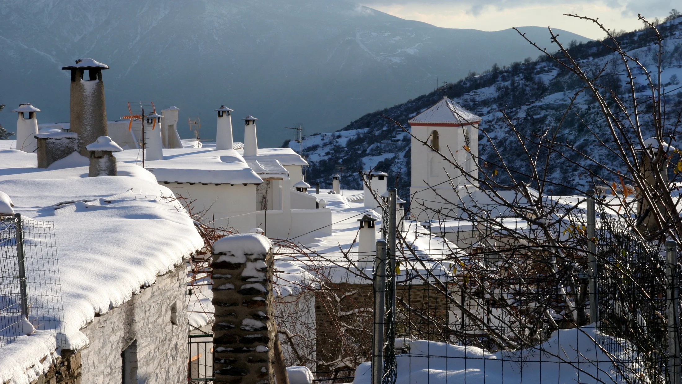
Alpujarras villages have an architecture of slate flagstones and whitewashed stone walls that resulted from adaptation to mountain climate and locally available materials. The flat house terraces, called terraos, are built with launa — a waterproof grey clay that is mixed with water and spread in layers over wooden beams — serving simultaneously as summer living space, curing area for cured meats, and as the downhill neighbour's roof. Trevélez, above 1,450 metres, is the highest municipality in Spain with permanent services and is known for Trevélez ham, cured at the low temperatures and low humidity of the mountain environment for a minimum of 14 months.

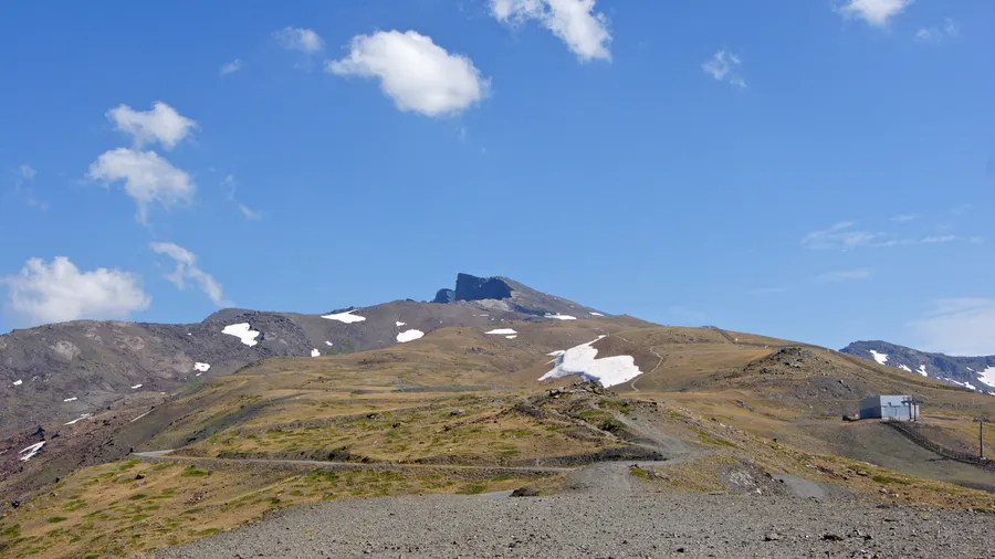
Hiking in the Alpujarras uses a network of mule paths and tracks that connected villages before roads existed. The Ruta de la Alpujarra, also known as the GR-7 in its Andalusian section, crosses the region east to west over several days. The section between Capileira, Pitres and Pórtugos (8-12 km daily) passes along acequias, ravines and chestnut forests with the villages of Bubión and Capileira perched above the Poqueira gorge. From the Alta Alpujarra, routes connect to the Sierra Nevada summits, allowing access in summer to Mulhacén (3,479 m) and Veleta (3,392 m) from the La Caldera mountain refuge.

Practical information for Alpujarras Granadinas

Everything you need to know for your visit to Alpujarras Granadinas

How to get there
From Granada, 75 km via A-44 to Lanjarón then A-348 towards Órgiva and the Alta Alpujarra. Capileira, the highest village of the Poqueira gorge, is 95 km from Granada. No direct public transport to the upper villages.
Area Information
Órgiva is the area capital with full services, 75 km from Granada. Lanjarón, known for its spa, is the western gateway. Sierra Nevada National Park borders the region to the north.
Geography
Southern slopes of Sierra Nevada between 800 and 1,600 m. Guadalfeo river valley at the base. Poqueira, Trevélez and Cádiar gorges cut into the massif. Border with Sierra Nevada National Park along the ridge.
Flora & Fauna
Chestnut groves at middle elevations, oak and pine woodland higher up. Broom, thyme and lavender scrub on dry slopes. Spanish ibex in Sierra Nevada. Golden eagle and goshawk in the gorges. Asphodel and mountain narcissus in spring.

Things to do in Alpujarras Granadinas

Find the best plans and things to do in Alpujarras Granadinas

20

What to see in Alpujarras Granadinas

Discover the must-see sights in Alpujarras Granadinas

Accommodations in Alpujarras Granadinas

Best accommodation options in Alpujarras Granadinas

Frequently asked questions about Alpujarras Granadinas

Get answers about Alpujarras Granadinas

The acequias are irrigation canals built and refined during the Arab and Berber presence in Al-Andalus (9th-15th centuries). They draw water from mountain rivers at high elevation and distribute it down the slopes to cultivation terraces through a system of water turns and rights managed by irrigation communities. Some acequia madre canals are over 800 years old and still operate under the same rules. Walking the acequia paths is one of the best ways to understand the Alpujarras landscape.
Trevélez ham is made exclusively from white or landrace pig, not Iberian breed, and its distinction lies in high-altitude curing: above 1,200 metres, mean annual temperature ranges from 4 to 12°C and humidity is low, which slows the curing process and produces a particular aromatic profile. Minimum curing period is 14 months. The Protected Geographical Indication delimits production to the municipalities of Trevélez, Juviles and Busquístar in the Alta Alpujarra.
The most common route departs from Trevélez (1,476 m) through the Siete Lagunas gorge to the glacial lakes and then to the Mulhacén summit (3,479 m). The round trip covers around 20 km with 2,000 m of elevation gain, requiring an early start before dawn and good physical condition. In summer, a bus service runs from Capileira to the Alto del Chorrillo, significantly reducing the access elevation. La Caldera refuge allows an overnight stay before a pre-dawn summit attempt.
The Poqueira Gorge circular route between Capileira, Bubión and Pampaneira is the most popular and accessible in the Alpujarras. It covers around 12 km with 400 m of elevation gain, passing alongside the acequia that irrigates the three villages, through chestnut woodland and viewpoints over the gorge. It can be completed in 4-5 hours and is suitable for most visitors with light trekking shoes. The three villages are barely 5 km apart in a straight line.