The essentials of Serra do Courel

  • • Devesa da Rogueira: 200 ha Atlantic mixed forest with over 800 catalogued plant species
  • • Chestnut groves with 500-year-old specimens and trunks exceeding 8 metres in girth
  • • Cova do Rei Cintolo, Galicia's largest cave with 6 km of underground passages
  • • Stone-and-slate hamlets with pre-Roman circular pallozas inhabited until the 20th century
  • • Stable presence of Iberian wolf, roe deer and wildcat in the sierra's forests

Description

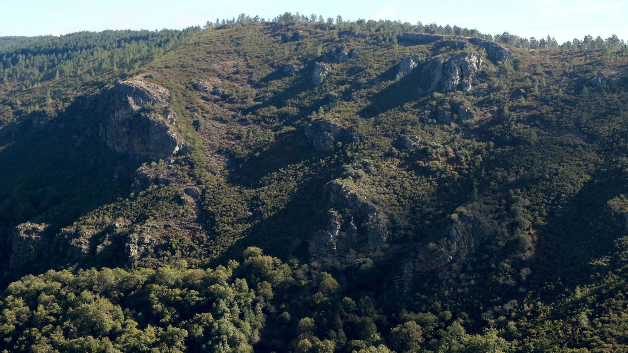
The Serra do Courel occupies the eastern edge of Lugo province, where the Galician mountains meet the León plateau. Its peaks, exceeding 1,600 metres at Pico Formigueiros, drop into deep valleys carved by the Lor, Selmo and Quiroga rivers, tributaries of the Sil. The elevation difference between ridges and valley floors reaches 1,000 metres in horizontal distances of just 5 km, a gradient that packs distinct vegetation belts into a compact space: from chestnut and oak woodlands on the valley floor to heathland and summit grasslands, passing through the Atlantic mixed forests that are the sierra's true botanical treasure.

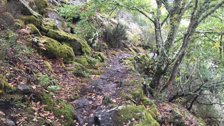
O Courel harbours the last native forests in Galicia close to their original state. Chestnut groves, some with specimens over 500 years old and trunks exceeding 8 metres in girth, cover the middle slopes and were for centuries the dietary backbone of the villages. Above them grow sessile oak and birch woodlands whose autumn colours grade from gold to copper across the hillsides. But the most distinctive ecosystem is the devesa, the Atlantic mixed forest where holly, yew, maple, rowan, hazel and ash share a canopy so dense that light reaches the ground filtered in green tones. The Devesa da Rogueira, on the northern flank of Formigueiros, is the best known and most intact: a 200-hectare forest functioning as a glacial refuge for relict flora, with over 800 catalogued plant species including several Macaronesian fern species.

The sierra's geology is complex and ancient. The dominant materials are Precambrian and Ordovician slates, quartzites and gneisses, some over 600 million years old. Tectonic activity has folded and fractured these layers, producing a landscape of sharp ridges and incised valleys. Karst caves in the Ordovician limestone, such as Cova do Oso, Cova da Pena and Cova do Rei Cintolo (the last being Galicia's largest cave, with over 6 km of passages), bear witness to an active underground hydrology. Waterfalls on the Selmo river and its tributaries dot the hillsides, some reachable only on foot along forest trails.

Wildlife matches the botanical richness. Roe deer and wild boar are the most frequent ungulates. The Iberian wolf maintains a stable presence in the sierra, and its howls carry through winter nights from the highest hamlets. Wildcat, pine marten and common genet inhabit the dense woodland. Among birds, northern goshawk, sparrowhawk and tawny owl are permanent residents of the forest canopy, while white-throated dipper and grey wagtail follow the mountain streams. The presence of the gold-striped salamander, endemic to the Iberian northwest, confirms the quality of the watercourses.

The Serra do Courel's hamlets retain a stone-and-slate architecture that blends into the landscape. Houses with wooden balconies, stone granaries and circular pallozas of pre-Roman origin define a rural heritage preserved in part by geographic isolation. Seceda, Visuña, Moreda and Paderne are among the most visited hamlets, with populations often below 20. The cuisine has peasant roots: caldo gallego, empanada, lacón con grelos, roast chestnuts and heather honey. The Magosto festival in November celebrates the chestnut harvest with communal roasts on village threshing floors. From Monforte de Lemos (30 km) or Quiroga (20 km), the sierra is reached by local roads winding through the valleys.

Practical information

Everything you need to know for your visit to Serra do Courel

How to get there
From Lugo, take the LU-546 to Monforte de Lemos and join the LU-651 to Folgoso do Courel (90 km, 90 min). From Ponferrada, via the N-120 to Quiroga and the LU-651 (50 km, 50 min). Narrow local roads within the sierra; in winter, snow chains may be needed above 1,200 m.
Area Information
Interpretation centre in Folgoso do Courel. Signposted trails to Devesa da Rogueira, Formigueiros and the waterfalls. Rural accommodation in Folgoso, Seoane and Quiroga. Restaurants with traditional cuisine in the main hamlets. No petrol stations within the sierra; refuel in Quiroga or Monforte.
Geography
Sierra in eastern Lugo between the Lor, Selmo and Quiroga rivers. Precambrian and Ordovician slates, quartzites and gneisses (600+ Ma). Elevation from 400 to 1,643 m (Formigueiros). Incised valleys with 1,000 m of relief. Karst in Ordovician limestone with cave systems.
Flora & Fauna
Atlantic mixed forests (devesas) with holly, yew, maple, rowan and hazel. Chestnut groves and sessile oak woodlands. Macaronesian ferns in Devesa da Rogueira. Iberian wolf, roe deer, wild boar, wildcat and pine marten. Goshawk, tawny owl, white-throated dipper. Endemic gold-striped salamander.

Things to do

Find the best plans and things to do in Serra do Courel

20

Accommodations

Best accommodation options in Serra do Courel

Loading accommodation options...

Frequently Asked Questions

Get answers about Serra do Courel

The Devesa da Rogueira is reached from the hamlet of Moreda via a signposted trail climbing the northern flank of Formigueiros. The full circular route covers about 12 km with 700 metres of elevation gain, taking an estimated 5 to 6 hours. The trail passes through distinct vegetation belts, from chestnut groves to Atlantic mixed forest. Hiking boots, water and a warm layer are recommended even in summer.
The Cova do Rei Cintolo is not set up for tourist visits. It is Galicia's longest cave, with over 6 km of passages, and exploring it requires caving equipment, experience and prior permission. Caving clubs organise periodic trips. The cave entrance can be seen from outside, reachable by a short trail from the hamlet of Vilamor.
The Iberian wolf has a stable presence in the sierra, but it is an elusive, largely nocturnal animal, so direct sightings are infrequent. The best chances are at dawn and dusk in the upper grassland areas. More commonly you find traces: tracks in mud, droppings or prey remains. In winter, their howls can be heard from the highest hamlets on clear nights.
Seceda is one of the best-preserved hamlets, with circular pallozas and restored stone houses. Visuña has a privileged position above the Lor valley. Moreda is the starting point for the Devesa da Rogueira trail. Paderne retains a group of stone granaries. Folgoso do Courel is the settlement with the most services and houses the interpretation centre. All are small hamlets, with populations rarely exceeding 20.
The Magosto takes place in November, coinciding with the chestnut harvest. Sierra hamlets organise communal roasts on their eiras (threshing floors), where chestnuts are toasted over large bonfires. It is a traditional, participatory celebration accompanied by aguardiente, queimada and Galician music. Folgoso do Courel and Seoane tend to draw the largest attendance, though many smaller hamlets hold their own Magosto.