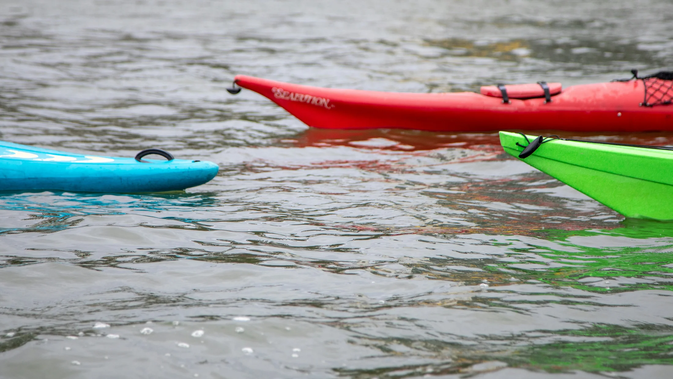
Why These 10 Sea Kayak Routes Show Spain at Its Best
If you type sea kayak Spain into your plans, you’ll find a coastline made for paddling. Spain offers granite headlands, volcanic coves, and calm bays where beginners thrive and experts test themselves. This selection brings together 10 kayak routes chosen for variety, scenic value, access, safety potential, and conservation importance, so you can match your day on the water to your level and the forecast. You’ll find route cards with clear logistics, an interactive map, practical safety notes, and tips to book with trusted local operators. Sun flashes on the blade as a cormorant lifts from the rocks and the hull hums on clear water. We balance inspiration with verifiable detail: distances, seasonal winds, typical timings, and when to skip a cape if the breeze rises. Each route acknowledges the communities that care for these coasts—fishers, rangers, and guides—and invites you to leave no trace. In this article you’ll get: concise route fiches, map filters by region and level, sustainability notes for protected parks, and guidance to rent gear or join a certified guide. Use it to explore coastal kayaking Spain at your own pace, from Costa Brava cliffs to Canary swell shadows, and to plan a safe, memorable paddle that respects the sea.
Picuco te puede ayudar
Does something here catch your eye?
Tell us.
Write to us on WhatsApp or email: we answer questions, find the best options and help you sort out the booking.
How to Read the Route Cards
Each route card starts with precise location and access, so you know where to launch and where to park. We include a price range for rentals or guided outings—always confirm with the operator—and the best season, because winds shift by month. The level note explains difficulty in plain language, while “ideal for” suggests who will enjoy it most. A short duration and distance range helps you set a realistic plan; expect slower speeds with headwinds or sightseeing stops. A gull’s cry bounces off rock and tells you the bay is still. Under “what to see,” look for cliffs, sea caves, wildlife, and beaches worth a pause. Logistics covers parking limits, permits, ferry options, and local rescue numbers if relevant. For example: if you read “2–3 hours, beginner, mornings with offshore Tramontana,” start early, pick a short out-and-back to a sheltered cove, and wear a PFD. If a route says “avoid afternoon Garbí,” launch at first light or choose a leeward alternative nearby.
Interactive Map: See the 10 Sea Routes at a Glance
Open the interactive map to spot pins for each route, grouped by region with color codes for level. On desktop, filter by “Mediterranean,” “Atlantic–Galicia,” or “Canary Islands,” and by “Beginner,” “Intermediate,” or “Advanced.” On mobile, tap a pin to preview highlights, read the route card, and jump to local booking options. The screen glows sea-blue as you pinch-zoom to trace a headland’s curve. Use the map to compare nearby routes—like Costa Brava coves you can link over two mornings—and to check ferry departure points for island trips. It’s designed for quick decisions: where to park, where to start, and how long to plan, all in one view.
10 Essential Sea Kayak Routes Along Spain’s Coasts
1) Cap de Creus: Cliffs, Calas and Open Water on the Costa Brava
Granite walls, fingerlike points, and the lighthouse at the end of the peninsula make Cap de Creus a classic. Launch from Cadaqués or Roses for options that suit wind and time. The sea smells of kelp and sun-warmed salt as you slide past honeycombed rock.
- Location and access:
- Launch: Cadaqués or Roses (Girona), within the Cap de Creus Natural Park.
- Access: Road to Cadaqués; pay attention to summer parking limits.
- Notable points: Far de Cap de Creus
42.324°N, 3.318°E, Cap Norfeu42.285°N, 3.264°E.
- Distance and time:
- Cadaqués–Faro loop: 12–16 km, 3.5–5 hours (intermediate).
- Roses–Cap Norfeu out-and-back: 10–14 km, 3–4.5 hours.
- Level and best season:
- Intermediate to advanced in swell or Tramontana (north wind); beginner in sheltered coves.
- Best: May–June, September–October; mornings calmer.
- Price (check with operator or see Picuco): 35–55 € rental (half day), 55–85 € guided (3–4 h).
- What to see:
- Sculpted schist cliffs, Cova de l’Infern sea cave, gannets and shags.
- Clear-water calas for snorkel stops.
- Logistics and safety:
- Watch Tramontana and reflected swell off capes; avoid committing to the tip in rising winds.
- Carry VHF or phone in waterproof case; tell someone your plan.
- Sustainability:
- Stay off nesting ledges; no landing on signed protected islets.
- Note: Illa Mateua lies south near L’Escala—often paired on a different day in calmer conditions.
2) Cala Montgó to Illa Mateua: Hidden Cove and Snorkel on the Costa Brava
This short coastal hop is perfect for a first taste of kayaking Costa Brava in mild weather. Set out from Cala Montgó at L’Escala and track the low cliffs to Illa Mateua’s turquoise apron. Sunlight patterns ripple on white sand as fish flicker beneath your hull.
- Location and access:
- Launch: Cala Montgó (L’Escala, Girona).
- Parking: Public lots above the beach; arrive early in summer.
- Distance and time:
- Cala Montgó–Illa Mateua out-and-back: 3–5 km, 1.5–2.5 hours.
- Level and best season:
- Beginner to intermediate; avoid strong Tramontana days.
- Best: Late spring to early autumn; mornings with light winds.
- Price (confirm locally or check Picuco):
- 25–45 € rental (2–3 h), 45–65 € guided (2–3 h, snorkel gear often included).
- What to see:
- Ledges and small caves, eelgrass meadows, snorkel-friendly clearings.
- Logistics and safety:
- Hug the coast for shelter; skip cave entries with swell or boat traffic.
- Use a tow line for kids’ kayaks in light chop; wear bright colors.
- Sustainability:
- Do not stand on posidonia seagrass; enter water on sand or rock slabs.
- Keep distance from cormorant roosts and avoid loud noise near cliffs.
3) Cabo de la Nao: From Jávea to Moraira, Cliffs and Calas of Alicante
A string of small headlands, archways, and bright coves lead toward the white lighthouse of Cabo de la Nao. Most paddlers start from Jávea/Xàbia and choose an out-and-back short of the cape, or a longer point-to-point toward Moraira. Heat shimmers off limestone as a swell thumps softly under a sea cave lip.
- Location and access:
- Launch: La Grava or Arenal (Jávea), or Cala Granadella for a wilder stretch.
- Exit options: Cala Ambolo, Cala Portitxol, Cala del Moraig (near Benitatxell), Moraira beach.
- Distance and time:
- Short scenic (Arenal–Cap Prim–Sardinera): 6–8 km, 2–3 hours (beginner+).
- Cape push (Arenal–Cabo de la Nao–Ambolo): 12–16 km, 4–5 hours (intermediate).
- Point-to-point to Moraira: 18–22 km, 5–6.5 hours (intermediate/fit).
- Level and best season:
- Intermediate in afternoon Garbí sea breeze; easier dawn paddles.
- Best: May–June, September–October; avoid Levante swell days.
- Price (verify locally):
- 30–50 € rental (half day), 50–85 € guided (3–4 h).
- What to see:
- White limestone cliffs, small caves, clear snorkel spots, occasional dolphins offshore.
- Logistics and safety:
- Plan rest at sheltered coves; watch rebound waves at capes.
- Car shuttle for point-to-point; carry plenty of water and sun protection.
- Sustainability:
- Respect beach capacity controls and seasonal closures.
- Keep distance from cave roofs; no scraping paddles on rock.
4) Cabo de Gata: Volcanic Shores and Virgin Calas in Almería
Dark tuff cliffs, ochre domes, and long sandy bays define this UNESCO Geopark on Andalucia’s southeast corner. Choose itineraries like Las Negras–Cala de San Pedro or Agua Amarga–Cala de Enmedio, adjusting to wind and swell. The sea smells mineral-clean, and the coast feels immense and quiet.
- Location and access:
- Launch options: Las Negras, Agua Amarga, San José (Los Genoveses/Monsul nearby).
- Inside the Natural Park; check parking limits in high season.
- Distance and time:
- Agua Amarga–Cala de Enmedio return: 6–8 km, 2–3 hours (beginner+).
- Las Negras–Cala de San Pedro return: 7–10 km, 2.5–3.5 hours (intermediate).
- San José–Monsul–Genoveses loop variants: 8–14 km, 3–4.5 hours.
- Level and best season:
- Beginner+ to intermediate; exposure rises around capes.
- Best: April–June, September–November; avoid strong Levante and heavy surf.
- Price (confirm or check Picuco):
- 30–50 € rental (half day), 50–80 € guided (3–4 h).
- What to see:
- Columnar basalt, sea caves, long beaches with dunes, fish in clear coves.
- Logistics and safety:
- Read forecast for Levante/ Poniente; choose leeward shore.
- Limited shade and services; carry water, hat, and spare layers.
- Sustainability:
- Some zones protect nesting birds; land only on permitted beaches.
- Pack out all trash; avoid trampling dune vegetation.
5) Cíes Islands and the Vigo Estuary: Wild Beaches and Atlantic Paddling
The Atlantic Islands National Park blends turquoise bays with brisk swell outside the barrier islands. Most paddlers mix a day circling the Cíes with a calmer session inside the Ría de Vigo. A low Atlantic roar breathes at the island’s ocean side as sand creaks under the keel.
- Location and access:
- Access: Ferry from Vigo, Cangas, or Baiona to Islas Cíes (seasonal).
- Permits: Park visitation authorizations required in peak periods; confirm kayak landing rules.
- Distance and time:
- Cíes coastal circuit (partial segments): 8–14 km, 3–5 hours (intermediate).
- Ría inner routes (sheltered): 6–10 km, 2–3 hours (beginner+).
- Level and best season:
- Intermediate on ocean side (swell and wind); beginner inside the ría on calm days.
- Best: Late spring–early autumn; choose neap tides for easier landings.
- Price (verify locally):
- Ferry 6–25 € each way (seasonal); guided kayak 45–80 € (3–4 h).
- What to see:
- Cormorants, gannets, and terns; white beaches like Rodas; granite bluffs.
- Logistics and safety:
- Cold water (14–18°C); wear a long-sleeve top or wetsuit in shoulder seasons.
- Check park rules; avoid crossing open channels in strong wind.
- Sustainability:
- No landing in bird-sensitive zones; use marked beaches.
- Zero waste; keep clear of resting seabirds.
6) Columbretes Islands: Volcanic Reserve off Castellón
Far offshore, the Columbretes rise as volcanic arcs in protected waters. Visiting by kayak usually means joining a boat trip with guided paddling near Illa Grossa, due to strict access rules and exposure. The air tastes of open sea, and the crater walls glow rust-red above glassy shallows.
- Location and access:
- 30–60 km off Castellón; access only by authorized boats.
- Landings tightly controlled by the Marine Reserve; check current regulations.
- Distance and time:
- On-site guided segments: 3–6 km, 1.5–3 hours (intermediate).
- Full-day excursion (including boat transfer): 6–9 hours total.
- Level and best season:
- Intermediate paddlers comfortable with swell; no self-guided coastal access.
- Best: Late spring to early autumn, in stable high-pressure windows.
- Price (confirm with operator or via Picuco):
- Boat + guided kayak typically 80–140 € p.p. (varies by season).
- What to see:
- Tuff cliffs, clear volcanic pools, seabream and barracuda in reserves.
- Logistics and safety:
- Weather-dependent; trips cancel with wind or swell.
- Bring anti-seasickness meds for crossings; sun protection essential.
- Sustainability:
- Strict “no take, no touch” in reserve; follow guides’ briefings exactly.
- Keep paddles off fragile rock and avoid landing outside designated areas.
7) Los Gigantes Cliffs: Sheer Sea Walls in Tenerife, Canary Islands
Paddle under 300–600 m cliffs that drop straight into deep blue water on Tenerife’s west coast. Launch from Los Gigantes harbor for a half-day along the base of the walls, with optional dolphin or pilot whale sightings offshore. Warm trade winds rustle the water skin while swallows stitch the air.
- Location and access:
- Launch: Puerto de Los Gigantes.
- Options: Out-and-back toward Barranco Seco; advanced teams extend toward Punta de Teno (only with perfect conditions and support).
- Distance and time:
- Standard outing: 6–10 km, 2–3.5 hours (beginner+/intermediate).
- Level and best season:
- Beginner+ mornings; intermediate in afternoon wind and rebound swell.
- Best: Year-round; calmest at sunrise; winter brings more swell.
- Price (verify locally or check Picuco):
- 35–55 € rental (2–3 h), 50–85 € guided (3 h).
- What to see:
- Basalt walls, caves, blowholes; offshore cetaceans on lucky days.
- Logistics and safety:
- Early departures avoid boat traffic; stay close to rock in wind shadows but away from fall lines.
- Strong currents near headlands; avoid the exposed Punta de Teno unless supported.
- Sustainability:
- Keep 60+ m from whales/dolphins; never chase wildlife.
- No landings on bird nesting ledges; respect local fishers’ space.
8) Dragonera and Sa Calobra, Mallorca: Caves, Cliffs and Torrent Mouths
Two iconic northwestern Mallorca experiences: the crossing from Sant Elm to Sa Dragonera and the cliff-lined approach to Sa Calobra and Cala Tuent. Many paddlers do them on separate days, pairing one sea day with a short hike. Pine resin scents the air while swell booms gently in far caves.
- Location and access:
- Dragonera: Launch from Sant Elm; short channel crossing to the island (Es Freu).
- Sa Calobra area: Launch from Port de Sóller or Cala Tuent for a remote-feel coastline.
- Distance and time:
- Dragonera coast segment: 10–14 km, 3–4.5 hours (intermediate).
- Sa Calobra/Tuent cliffs: 8–12 km, 3–4 hours (intermediate; swell-sensitive).
- Level and best season:
- Intermediate; NW swell wraps into caves, requiring judgment.
- Best: May–June, September–October; earliest starts for calm seas.
- Price (confirm locally or see Picuco):
- 35–55 € rental (half day), 55–90 € guided (3–4 h).
- What to see:
- Towering limestone, sea arches, cave mouths, Torrent de Pareis canyon at Sa Calobra.
- Logistics and safety:
- Dragonera crossing is exposed; go in groups, use hi-vis gear.
- Avoid cave entries with swell; stick to open ledges for rest stops.
- Sustainability:
- Respect park rules on Dragonera; no landing in restricted coves.
- Take all waste out; avoid anchoring on posidonia.
9) Formentera: Ses Illetes and Quiet Calas in Turquoise Water
Formentera’s north end offers sandbars, shallow channels, and the postcard sweep of Ses Illetes. Launch near La Savina and time your paddle with light winds and slack currents, especially around the Es Trucadors spit. The water gleams aquamarine like liquid glass over pale sand.
- Location and access:
- Launch: La Savina port area or beaches north toward Illetes.
- Options: Out-and-back along Ses Illetes; advanced paddlers may cross small channels toward Espalmador when permitted.
- Distance and time:
- 6–10 km, 2–3 hours (beginner+ in calm, intermediate if breezy).
- Level and best season:
- Beginner+ in light wind; currents can run in narrows.
- Best: May–June, late September–October to avoid peak crowds and heat.
- Price (verify locally):
- 30–50 € rental (2–3 h), 50–80 € guided (3 h).
- What to see:
- White sandbars, seagrass meadows, calm snorkeling in sheltered shallows.
- Logistics and safety:
- Beach access and parking may be restricted; arrive early or bike in.
- Watch boat traffic; use a tow flag or bright paddle blades.
- Sustainability:
- No anchoring or trampling on posidonia; step on sand or rock.
- Follow protected beach rules; keep music off near dunes.
10) Granadella and the Coves of Jávea/denia: Clear Mediterranean and Submarine Life
Cala Granadella is a tiny amphitheater of pebbles and sapphire water, with cliffy side trips and sea caves nearby. Link short segments toward Cala en Caló or plan a day to explore the Denia side, including the famous Cova Tallada. Pebbles click under the bow as you nose into gin-clear water.
- Location and access:
- Launch: Cala Granadella (controlled access in summer); on Denia side, Les Rotes for Cova Tallada.
- Permits: Cova Tallada may require prior booking; check current rules.
- Distance and time:
- Granadella–Caló–Ambolo area: 6–10 km, 2–3 hours (beginner+/intermediate).
- Denia–Cova Tallada return: 6–8 km, 2–3 hours (beginner+; calm seas essential).
- Level and best season:
- Beginner+ mornings; intermediate in afternoon breeze.
- Best: May–June, September–October; avoid swell on cave days.
- Price (confirm locally or see Picuco):
- 30–50 € rental (half day), 50–85 € guided (3 h).
- What to see:
- Sea caves, limestone ledges, abundant fish for snorkeling.
- Logistics and safety:
- Summer parking controls at Granadella; use shuttle where provided.
- Helmets recommended for cave ceilings; never enter with surge.
- Sustainability:
- Respect Cova Tallada capacity limits and signage.
- No touching stalactites or scraping hulls on rock.
Safety, Skill Levels and the Gear That Matters
Sea kayaking looks simple, but good planning makes it safe and enjoyable. Always wear a PFD, carry two forms of communication (phone in a waterproof case; VHF if you have training), and leave a float plan with someone on shore. A breeze brushes your cheek and hints at an earlier landing time. Check forecasts for wind, swell, and tides/currents; if the cape looks white-capped, don’t round it. Determine your level honestly: beginners stick to sheltered bays with easy landings; intermediate paddlers handle capes and 10–15 km; advanced paddlers manage surf, rescues, and navigation in wind. Pack this for half-day trips: PFD, paddle leash, 1–2 liters of water, hat, sunscreen, whistle, phone/VHF, towline, small first-aid kit, and a light windbreaker. For full-day outings add: spare paddle, bilge pump, spray deck, energy food, charts/GPS, headlamp, repair tape, and a warm layer. Adapt by region: Atlantic–Galicia is colder, with swell; wear neoprene outside midsummer. Mediterranean warms faster, but afternoon thermal winds matter. Canary Islands offer year-round paddling; trades and rebound swell demand judgment. Consider a basic coastal kayaking course to learn strokes and self/assisted rescues before tackling exposed routes.
Choosing the Right Route for Today
Great days align level, wind, and access. Start with wind reading: learn local patterns—Tramontana (north) on the Costa Brava, Garbí (SW sea breeze) in Valencia, Levante easterly episodes across the Med, and Alisios trades in the Canary Islands. Warm catspaws dimple the surface when sea breezes awaken. Prefer leeward shores: if Levante blows, choose coves sheltered from the east; if a strong north wind hits, hug southern aspects or postpone. Scan charts for capes that amplify chop and for enclosed bays that offer exits every 1–2 km. Check tide ranges and currents on Atlantic routes and narrow channels in Formentera or Dragonera. Think access and rescue: parking limits and ferry schedules shape your window; keep emergency numbers and nearest ports in mind. To adapt to you: beginners pick 4–6 km out-and-back in a protected bay with morning starts; intermediates plan 8–14 km segments with one committing point; advanced teams can link capes with slack-wind windows. Combine nearby routes over a weekend—Montgó one day, Cap de Creus coves the next—rather than forcing a long, windy traverse.
Rentals, Guides and Smart Booking
Look for operators with certified guides, proper PFDs, and safety briefings, and ask about guide-to-client ratios (ideally 1
–1 on calm coastal trips). Prices typically range 25–55 € for half-day rentals and 50–90 € for 3–4 hour guided outings; confirm current rates and inclusions. The plastic whiff of a new dry bag reminds you to check what’s included. Before reserving, ask about cancellation policies for wind or swell, whether helmets are provided for caves, and if photos or snorkel gear are included. For exposed areas—capes, island crossings, parks with strict rules—book a guided trip, especially on your first visit. Compare morning vs. sunset departures to dodge traffic and wind, and verify meeting points, parking, and mandatory permits.Keep Coves and Wildlife Safe
Gentle travel keeps these places wild for everyone. Do not land or anchor over posidonia seagrass; it’s a protected ecosystem that stabilizes beaches and clears the water. The sea smells sweeter when you leave no trace behind. Stay well back from nesting cliffs and resting birds; never approach dolphins or whales, and reduce speed and noise near wildlife. Pack out all waste, including organic peels, and use biodegradable sunscreen to protect reefs. Follow park signs, seasonal closures, and daily capacity limits at caves or beaches. When taking photos, avoid clapping or drones near birds and skip cave entries if surge can scrape rock. Launch and land where you won’t erode dunes or crush plants—choose sand tongues or rock slabs—and keep group sizes manageable in narrow coves.
Frequently Asked Questions
Do I need to be able to swim?
Yes. You should swim at least 25–50 meters unaided and be comfortable floating with a PFD. Stay close to shore on your first outings.
What is the minimum age for sea kayaking?
Many operators accept children from 6–8 years in double kayaks on calm days. Ask about weight limits, required PFD sizes, and wind thresholds.
Do I need a license to sea kayak in Spain?
No license for casual coastal trips. Permits may apply in parks (e.g., Cíes, Cova Tallada). Always check local regulations before launching.
How much does wind affect my plan?
A lot. Afternoon sea breezes and Tramontana/Levante episodes can double effort. Start early, choose leeward shores, and shorten distance if wind rises.
Can I bring my dog?
Some rentals allow dogs on stable sit-on-tops in calm conditions. Confirm PFD availability and avoid crowded beaches or wildlife areas.
What insurance do I need?
Personal accident/medical coverage recommended; some guided tours include insurance. Ask if liability insurance covers participants.
What should I wear?
In summer: hat, light top, sunscreen, and PFD. In shoulder seasons or Atlantic waters: neoprene or a thermal layer and wind shell.
How do I book a reliable operator?
Look for certified guides, recent reviews, safety briefings, and clear cancellation policies. Confirm what’s included and group ratios before paying.
Book your experience — discover verified outdoor activities across Spain with Picuco’s trusted providers.
Conclusion
Spain’s coastline rewards every paddler, from first strokes in calm coves to committed headlands with swell and wind. Pick a route that fits your level, read the forecast with care, and pack essentials so you can focus on rhythm and scenery. The scent of pine and salt lingers when you land with energy to spare. Respect parks, keep distance from wildlife, and leave coves cleaner than you found them. Now choose a region, open the interactive map to compare options nearby, and plan your next morning on the water with confidence.