Parque Natural de la Sierra de la Muela, Cabo Tiñoso y Roldán
The essentials of Parque Natural de la Sierra de la Muela, Cabo Tiñoso y Roldán
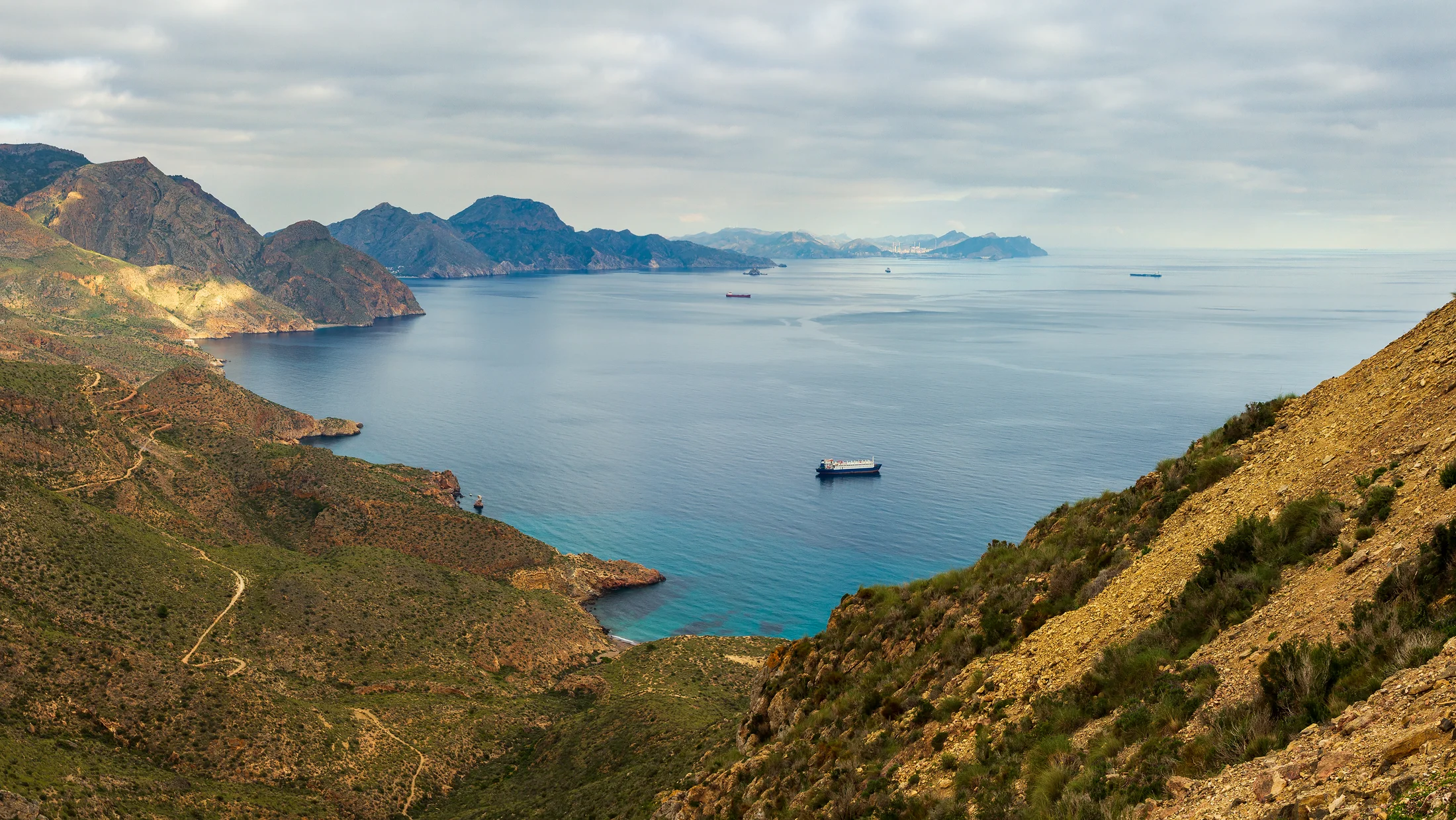
- • Cabo Tiñoso at 361 m with 1926–1936 artillery batteries perched above 150-metre cliffs
- • Posidonia oceanica meadows to 30 m depth with red coral colonies in submarine caves
- • Isolated chameleon population and spur-thighed tortoises on rocky scrubland slopes
- • Sendero de los Gigantes: 8.7 km with 520 m of elevation gain from summit to cape
- • Morrón de Matanzas at 878 m with views stretching to Peñón de Ifach and Cabo de Palos
Description
Practical information for Parque Natural de la Sierra de la Muela, Cabo Tiñoso y Roldán
Everything you need to know for your visit to Parque Natural de la Sierra de la Muela, Cabo Tiñoso y Roldán
How to get there
How to get there
From Cartagena (17 km), take road RM-F32 towards La Azohía; the El Portús visitor centre is at km 12. From Mazarrón (22 km), access via RM-332. Public buses on the Cartagena–La Azohía line run with reduced frequency in summer. The El Portús car park (free, 80 spaces) is the main starting point for the principal trails.
Area Information
El Portús visitor centre (RM-F32 road, km 12; Tue–Sun 09:00–14:00, tel. +34 968 50 94 28). Picnic area with tables and water at La Azohía. Military History Museum of Cartagena 17 km away. No accommodation inside the park.
Geography
Three ranges parallel to the coast: Muela (878 m), Roldán (448 m) and Tiñoso (361 m), formed from Maláguide Complex phyllites and schists over 250 million years old, with active faults accounting for the area's moderate seismic activity.
Flora & Fauna
Wild jujube (Ziziphus lotus), narrow-leaved silk vine (Periploca angustifolia), Sarcocapnos saetabensis (endemic). Fauna: common chameleon, spur-thighed tortoise, eagle owl, striped dolphin (May–September). Posidonia oceanica to 30 m, red coral in caves.
Accommodations in Parque Natural de la Sierra de la Muela, Cabo Tiñoso y Roldán
Best accommodation options in Parque Natural de la Sierra de la Muela, Cabo Tiñoso y Roldán
Frequently asked questions about Parque Natural de la Sierra de la Muela, Cabo Tiñoso y Roldán
Get answers about Parque Natural de la Sierra de la Muela, Cabo Tiñoso y Roldán
Can I visit the military batteries at Cabo Tiñoso?
Exterior access around the batteries is allowed on foot via the park's trails. Entry into the bunkers and military installations requires explicit authorisation from the Ministry of Defence, applied for at least two weeks in advance through the Murcia Defence Delegation. The exterior view from the trail already gives a compelling perspective on the interwar military engineering.
How fit do I need to be for the Sendero de los Gigantes?
The Sendero de los Gigantes (8.7 km, 520 m cumulative elevation gain) is rated medium difficulty. It requires reasonable baseline fitness and hiking boots with sturdy soles, as the terrain is rocky and uneven for most of the route. Estimated time is 3.5 to 4.5 hours. Carry at least 1.5 litres of water per person in summer—there are no springs on the trail—and apply high-factor sun protection from 10:00 onwards.
Are there organised diving activities in the park?
Yes. Several operators based in La Azohía, Cartagena and Mazarrón offer guided dives in the Cabo Tiñoso caves, where red coral colonies are found from 20 metres down. Typical visibility between October and May ranges from 15 to 25 metres. Prior registration at the Cartagena harbour master's office is mandatory; accredited operators usually handle this on behalf of their clients.
When is the best chance of seeing dolphins from land?
Striped dolphins frequent the waters off Cabo Tiñoso between May and September, particularly at dawn and dusk when following fish shoals. The best land-based vantage points are the Cabo Tiñoso summit and the Morrón de Matanzas viewpoint. Zodiac or sea-kayak excursions departing from La Azohía and Bolnuevo significantly increase the chances of an encounter.
What lens or camera setup works best for photography here?
For cliff and landscape photography, a wide-angle lens (16–24 mm) captures the scale of the vertical drops. A 300–400 mm telephoto is essential for raptors such as eagle owl and peregrine falcon. The golden hour in October, with low light catching the black phyllite faces on the eastern side of Cabo Tiñoso, produces directional light hard to replicate at other times of year. A polarising filter reduces sea glare in cliff-top shots.