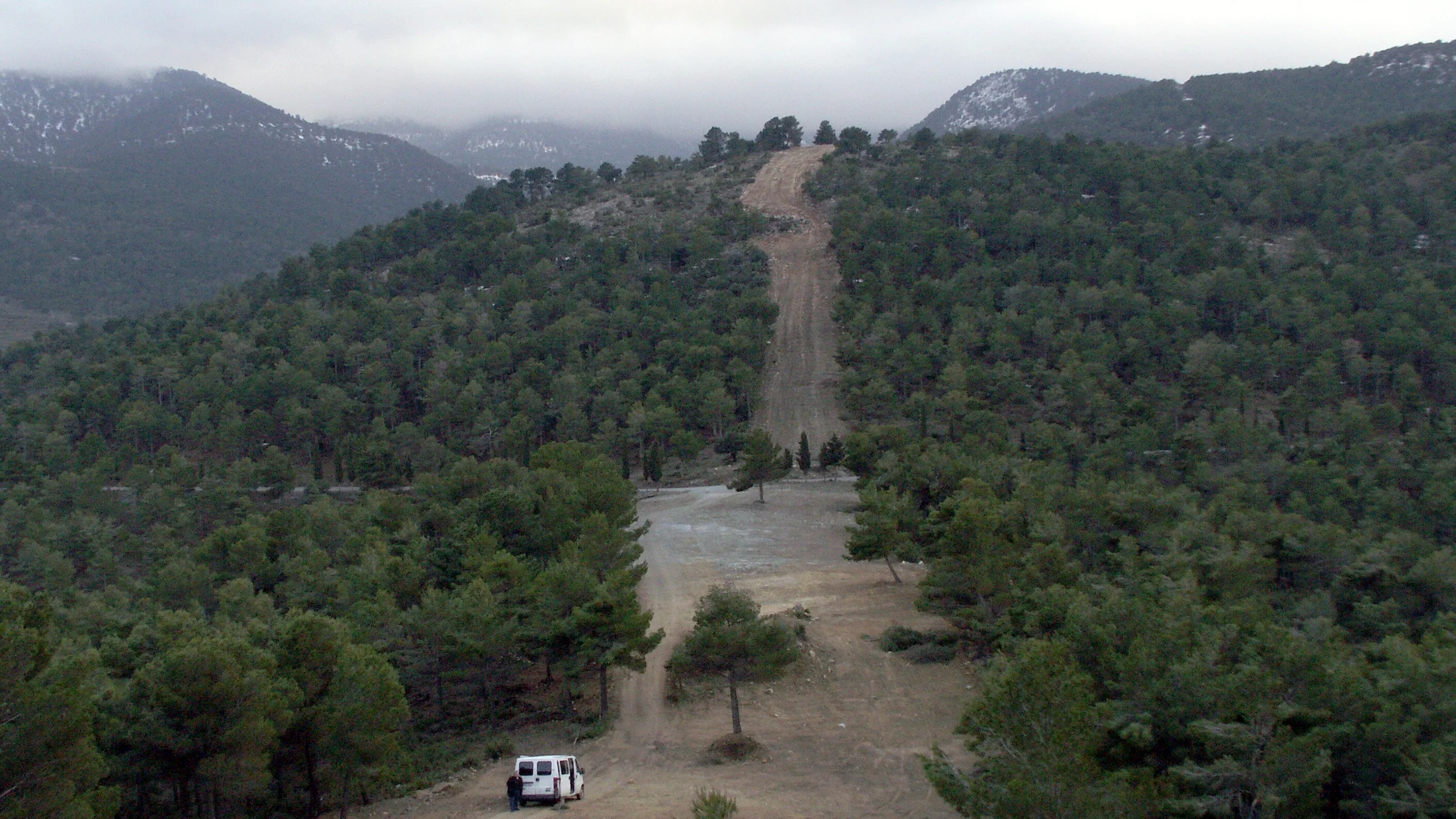
The Sierra de Baza Natural Park rises as an isolated massif in northeastern Granada province, between the Hoya de Baza and the Guadix depression, reaching 2,271 metres at Pico de Santa Bárbara. Its character as a biogeographic island—separated from surrounding ranges by wide semi-arid basins—has favoured the survival of woodland that contrasts sharply with the steppe landscape encircling the sierra. From the base at about 800 metres to the summits, vegetation changes dramatically across barely 15 kilometres of horizontal distance.
Lower slopes are covered by extensive pine plantations (Pinus halepensis, Pinus pinaster and Pinus nigra) established in the mid-20th century to curb erosion on deforested soils. Over the decades these woods have matured and now harbour a diverse understorey of juniper, savin, rosemary and thyme that scents the dry afternoon air in summer. At mid-elevations, between 1,200 and 1,800 metres, holm oaks (Quercus ilex), Portuguese oaks (Quercus faginea) and Montpellier maples intermingle with pines to form mixed forests of irregular structure where species diversity peaks. The coolest shaded slopes preserve Euro-Siberian relicts: hollies, yews and wild service trees that attest to a wetter climatic past.
Above 1,800 metres the landscape opens into broom scrub, creeping-juniper mats and high-altitude meadows where endemic plants have adapted to extreme conditions: night frosts even in June, persistent winds and solar exposure exceeding 3,000 hours a year. Sierra Nevada violet (Viola crassiuscula) and Alfacar sandwort are among the notable species that reach the Sierra de Baza at the edge of their range. Springs rising on the mid-slopes feed fountains and water sources that have historically determined the siting of farmsteads and mountain hamlets.
The fauna reflects a biogeographic crossroads between the Baetic ranges and the Granada high plateau. The Iberian ibex is the most visible herbivore, with a population exceeding 2,000 that can often be spotted on crags and high-altitude pastures. The golden eagle patrols the park's skies and nests on the cliffs of the Barranco del Relumbre. European wildcat, badger, beech marten and common genet inhabit the mid-mountain mixed forests, while wild boar is abundant in the lower pine woods. The steppe transition zones between the park and the Hoya de Baza support stone curlew, black-bellied sandgrouse and little bustard—birds characteristic of open pseudo-steppe environments.
The farmsteads and hamlets within the sierra—Narváez, Benacebada, Floranes—were inhabited until the 1960s and 1970s, when rural depopulation gradually emptied them. Some have since been restored as rural accommodation or interpretation centres, retaining their dry-stone, whitewash and pine-timber architecture. Threshing floors, communal bread ovens and irrigation channels that still cross the slopes record a mountain farming system that endured for centuries. The town of Baza, at the park's foot, preserves 13th-century Arab Baths and the Iglesia Mayor, built over the former mosque, as testimony to the multicultural heritage of the Granada high plateau.