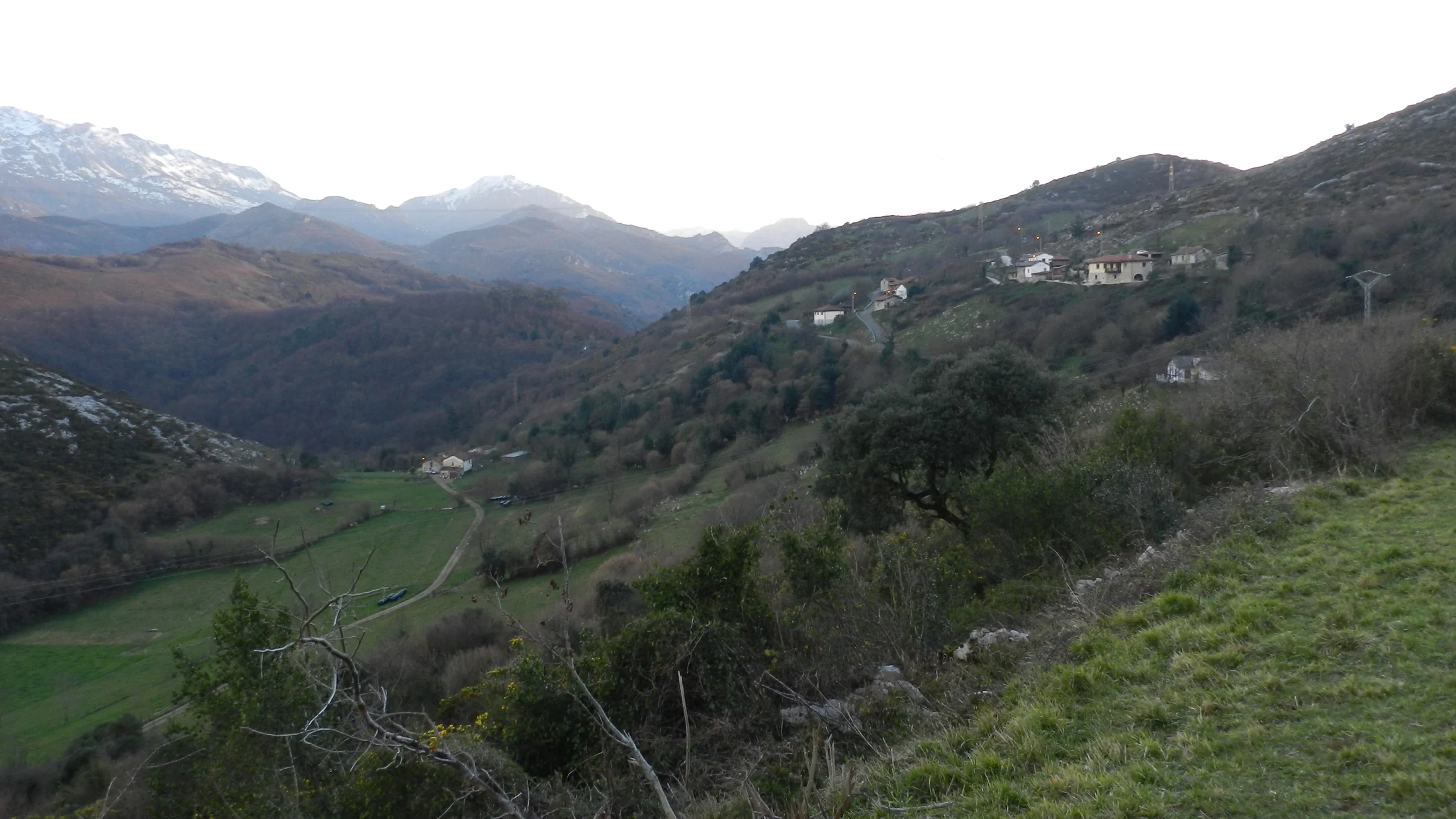
Sierra de Caranga extends across the municipality of Proaza in central-southern Asturias, forming part of the northern foothills of the Cantabrian Mountains. Its summits reach 1,300 metres at Pico Caranga, a point marking the divide between the Trubia river valley to the east and the Quirós valley to the west. The sierra sits just a few kilometres from the large mountain masses of the Las Ubiñas-La Mesa Natural Park, yet its independent character and lower visitor numbers give it the feel of a solitary mountain where you can walk for hours without encountering another person.
The landscape follows the typical Cantabrian altitudinal sequence. Lower elevations (300-600 m) are covered in hay meadows and patches of chestnut and pedunculate oak surrounding villages where families keep livestock on extensive grazing. Between 600 and 1,000 metres, beech forest dominates, with large specimens that transform the slopes in autumn into a succession of oranges, coppers and yellows. The beeches share space with hollies laden with red berries in winter and the occasional centuries-old yew sheltered in shaded ravines. Above 1,000 metres, the tree line gives way to grazed grassland with heather and blueberry where valley cattle are brought up for summer.
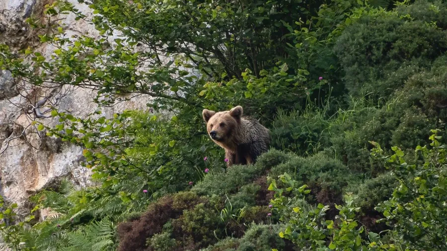
Wildlife reflects the richness of the Cantabrian corridor. The Cantabrian brown bear (Ursus arctos) uses the sierra's forests as a transit zone between the population nuclei of Las Ubiñas Natural Park and those of the Quirós municipality, and its tracks have been recorded several times in the upper zones. The Cantabrian capercaillie, critically endangered, maintains a residual presence in mature beech forests. The Iberian wolf patrols the forest edges, and the Cantabrian chamois shows itself on the rocky summit crests. In the rivers at the base, otters and dippers indicate water quality.
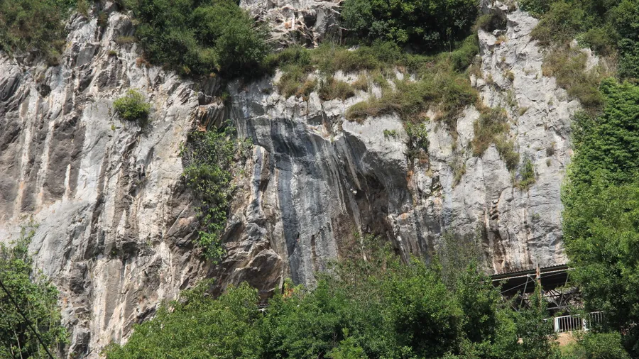
The most direct ascent route to Pico Caranga starts from the hamlet of Caranga de Abajo in the Trubia valley, climbing along a mountain path that gains 900 metres over 8 kilometres. The ascent passes successively through meadows, mixed woodland and beech forest before emerging onto summit grasslands, where the panorama opens towards the Las Ubiñas massif to the south, the Trubia valley and the Senda del Oso to the east, and the silhouette of the Aramo range to the northeast. The route is not an official waymarked trail, but paint marks and cattle traces keep it identifiable.
The Senda del Oso, Asturias' most popular greenway, runs along the Trubia valley floor at the foot of Sierra de Caranga. This former railway line converted into a cycle and pedestrian path connects Tuñón with Quirós over 36 kilometres, and its riverside course offers a bottom-up view of the sierra's wooded slopes. In the Proaza stretch, the enclosure of the bears Paca and Tola attracts family visitors. Combining the Senda del Oso as an accessible walk with Sierra de Caranga as a mountain route allows you to plan days of varying intensity in the same setting.
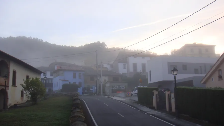
The hamlets of the Proaza municipality — Caranga, Bandujo, Proacina — preserve traditional Asturian stone-and-tile architecture, with granaries (hórreos and paneras) still serving their storage purpose. Bandujo, listed as a Historic Ensemble, retains a medieval tower, a 12th-century Romanesque church and a centuries-old yew in the square where community gatherings are held. Local cuisine centres on pote asturiano (bean stew), Casina beef, natural cider and Casín cheese, aged in hand-carved wooden moulds passed down through families.