The essentials of Parque Natural de las Hoces del Alto Ebro y Rudrón

  • • 200 m limestone canyons carved by the Ebro over 80 million years
  • • Colony of 400 breeding griffon vulture pairs nesting on the gorge cliff ledges
  • • Orbaneja del Castillo with its urban waterfall dropping over limestone houses
  • • 120 km of waymarked trails and class I–II canoe sections on the Ebro river
  • • 12th-century Burgos Romanesque at San Pedro de Tejada and Escalada collegiate church

Description

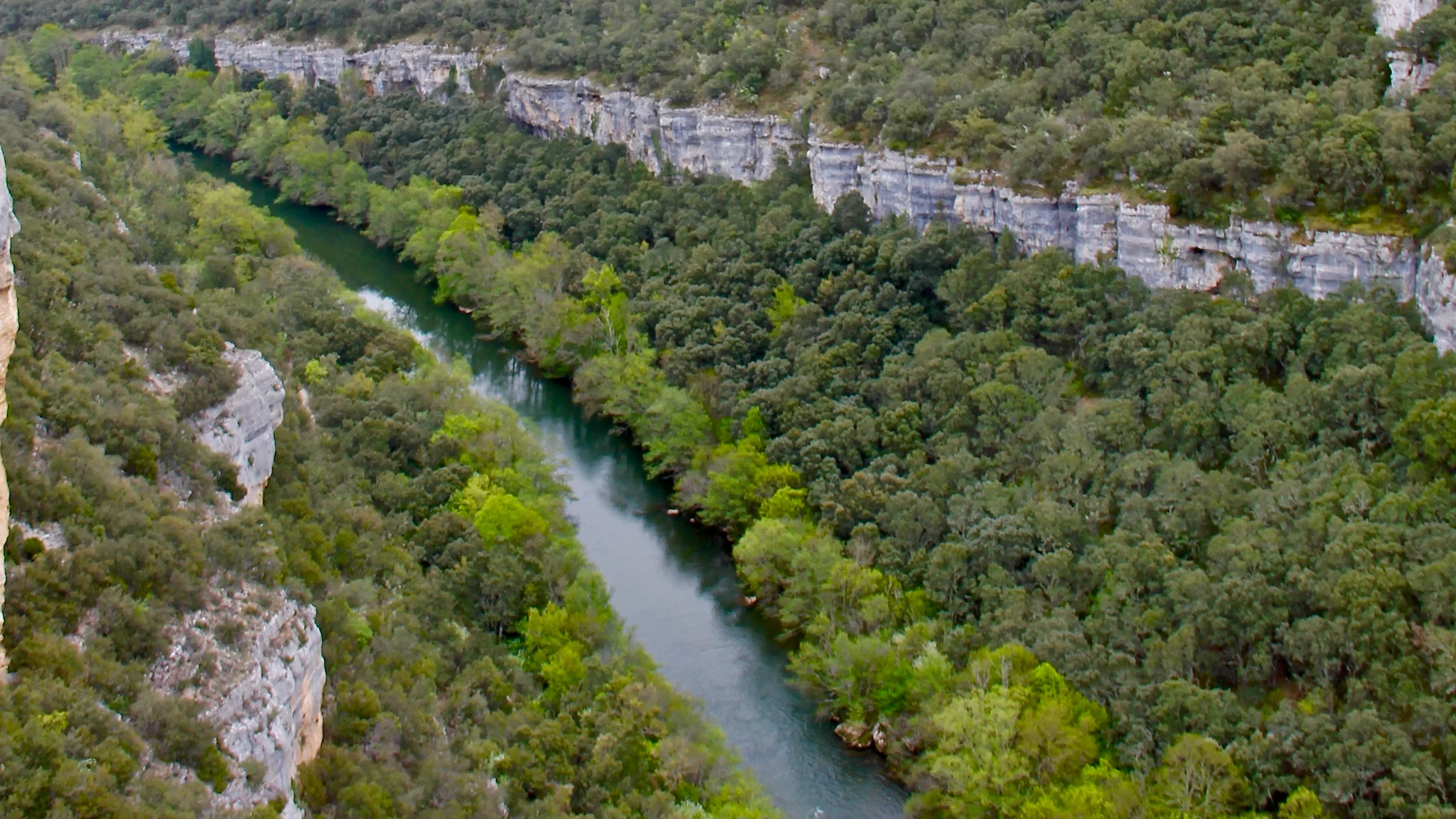
The Hoces del Alto Ebro y Rudrón Natural Park covers 46,474 hectares in northern Burgos province, between the Páramos and Sedano districts. Here, before the Ebro reaches the flatlands of Miranda and La Rioja, it has carved a limestone canyon system with drops exceeding 200 metres in certain stretches. The vertical walls of Upper Cretaceous rock, estimated at 80 million years old, form a corridor where light shifts in tone with every passing hour. At the base of the cliffs, karst springs feed pools of clear water that hold a near-constant temperature of around 10 °C year-round. The scent of damp moss and limestone fills the gorge floor, especially at dawn, when river moisture condenses on the rock faces.

The confluence of the Ebro and Rudrón rivers at Valdelateja marks the park's geographic heart. From this point the canyon narrows and griffon vulture colonies — some 400 breeding pairs recorded by the Junta de Castilla y León — occupy ledges on both sides of the gorge. It is one of the largest colonies of this species on the Iberian Peninsula. Egyptian vultures (present April to September), peregrine falcons and eagle owls also nest here. Riparian woodlands of poplars, willows and alders line the riverbanks and, in autumn, paint the gorge floor in deep yellows and ochres. The contrast against grey rock produces a landscape that wildlife photographers rank among the most photogenic in inland Spain. At night, the absence of light pollution allows clear views of the Milky Way from anywhere in the canyon.

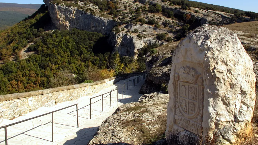
Orbaneja del Castillo, tucked beneath a rocky amphitheatre rising 100 metres, is the park's most visited village and one of the most photographed in Castilla y León. Its urban waterfall, fed by the Cueva del Agua — a karst spring draining an underground aquifer stretching several kilometres — drops directly over limestone houses before reaching the Ebro. Flow varies with the season: in spring it peaks after snowmelt from the páramos, with discharge that can exceed 50 litres per second. In summer the flow shrinks to a trickle barely wetting the rock. Other settlements such as Pesquera de Ebro, Cortiguera and Escalada preserve traditional limestone architecture with flagstone roofs and offer rural accommodation in restored houses. Burgos Romanesque heritage appears in chapels like San Pedro de Tejada (12th century, with a portal sculpted with over 30 figures) and the Escalada collegiate church, whose cloister retains historiated capitals.

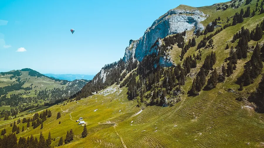
The waymarked trail network exceeds 120 km and links the canyon's main viewpoints. The route between Pesquera de Ebro and Orbaneja del Castillo (14 km, moderate difficulty, 4–5 hours) follows the cliff edge with unbroken river views and passes the vulture nesting sites, where birds can be watched from barely 30 metres away. For those who prefer the water, the Ebro is navigable by canoe on several sections from April to October, with class I–II rapids suitable for beginners. The most popular stretch, from Valdelateja to Pesquera de Ebro (8 km), takes 2–3 hours with stops. Sport climbing sectors at Valdelateja and Orbaneja offer over 80 routes from 6a to 7c on compact limestone.

In winter, fog rising from the river wraps the cliffs and cuts visibility to a few metres, creating a hushed atmosphere that entirely transforms the canyon experience. Villages empty out and the only sound is the Ebro striking rock. This is the season landscape photographers choose for capturing the canyon without human presence. The park's geology also includes active tufa formations — porous rock structures growing millimetre by millimetre where calcium-carbonate-laden water precipitates — visible at secondary waterfalls along the Rudrón. These tufas are classified as a priority habitat under the EU Habitats Directive, making the park a reference site for karst geology in southern Europe.

Practical information

Everything you need to know for your visit to Parque Natural de las Hoces del Alto Ebro y Rudrón

How to get there
From Burgos city (80 km), take the N-623 towards Santander and turn off at Escalada onto the BU-643 towards Orbaneja del Castillo. From Santander (100 km), the N-623 south connects to the same access road. Valdelateja, at the Ebro–Rudrón confluence, is another common entry point. No regular public transport; a private vehicle is recommended.
Area Information
Visitor centre at Valdelateja and park office in Sedano. Rural accommodation in Orbaneja del Castillo, Pesquera de Ebro and Escalada. Picnic areas with tables and fountains at several points. Active tourism companies offer canoeing, climbing and guided hikes.
Geography
46,474 ha of karst canyons carved into Upper Cretaceous limestone. Elevations range from 560 m (Ebro riverbed) to 1,044 m (páramos). Vertical cliffs up to 200 m. Springs, caves and active tufa formations classified as EU priority habitat.
Flora & Fauna
Griffon vulture (400 pairs), Egyptian vulture, peregrine falcon and eagle owl on the cliffs. Otter and brown trout in the Ebro. Holm oak, gall oak and juniper on slopes; poplars, willows and alders along the riverbanks. Wild orchids in clearings of the riparian forest.

Things to do

Find the best plans and things to do in Parque Natural de las Hoces del Alto Ebro y Rudrón

20

Accommodations

Best accommodation options in Parque Natural de las Hoces del Alto Ebro y Rudrón

Loading accommodation options...

Frequently Asked Questions

Get answers about Parque Natural de las Hoces del Alto Ebro y Rudrón

There is no regular bus service connecting Orbaneja del Castillo with Burgos or Santander. The only public transport option is hiring a taxi from Sedano (20 km) or from Burgos city (80 km). The BU-643 road is narrow but paved. If you visit in high season (June to September), note that parking in the village is limited to around 50 spaces and it is best to arrive before 10:00 in the morning.
Yes, several sections are navigable between April and October when water levels are sufficient. Rapids are class I–II, suitable for beginners when accompanied by a guide. Local active tourism companies offer canoe and kayak hire with transport included. The most popular stretch runs from Valdelateja to Pesquera de Ebro (about 8 km, 2–3 hours). A permit from the Ebro Hydrographic Confederation is required, which local operators arrange.
The most complete route links Pesquera de Ebro with Orbaneja del Castillo along the canyon rim: 14 km of moderate difficulty, roughly 4–5 hours of walking. It offers continuous river views from cliff-edge lookouts and passes the vulture colonies. It is a linear trail, so you will need a car at each end or must retrace your steps. A shorter alternative is the Valdelateja circular trail (6 km, 2 hours), which descends to the river and climbs to a panoramic viewpoint.
Yes, the park hosts around 400 breeding pairs of griffon vulture, one of the largest colonies on the Iberian Peninsula. They are visible almost daily from the canyon viewpoints, especially in mid-morning when thermal currents lift them. The best observation spots lie between Valdelateja and Orbaneja del Castillo. Besides griffon vultures, you may see Egyptian vultures (April to September), peregrine falcons and eagle owls. Binoculars of 8x42 or 10x42 are sufficient.
Yes, though choosing the right trail matters. Paths along the canyon rim have exposed sections without guardrails, unsuitable for young children without constant supervision. For families, the flat walk along the canyon floor between Valdelateja and the Rudrón confluence (3 km, flat) is the best option. Visiting Orbaneja del Castillo and its waterfall is also suitable for all ages. In summer, Ebro river pools allow paddling in shallow areas, although the water is cold (10–14 °C).