The essentials of Parque Natural de la Sierra de Castril

  • • Cerrada de Lézar: wooden walkways spanning the Castril River gorge at 50 m height
  • • Source of the Castril River, a permanent karst spring at 1,230 m altitude
  • • Iberian ibex sightings on the limestone cliffs of the main canyon
  • • Black pine and Salzmann pine forests between 1,000 and 1,600 m with waymarked trails
  • • Pico del Buitre (2,138 m), the highest point with views across the Granada plateau

Description

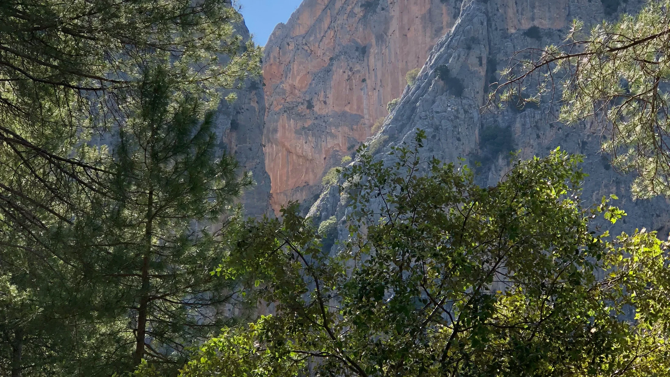
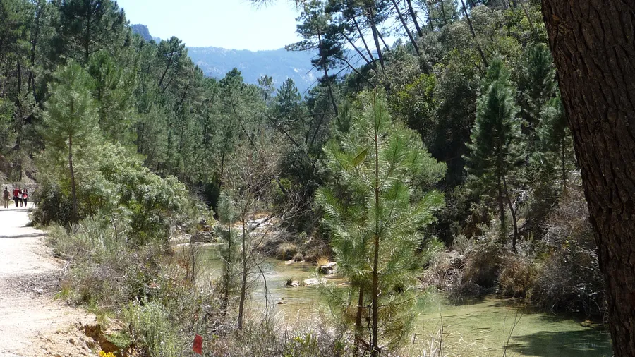
The Sierra de Castril rises in the northeast of Granada province as a limestone massif of 12,696 hectares whose most striking feature is the canyon the Castril River has carved over millions of years. Vertical walls exceed 200 metres in places, framing turquoise pools where the water rarely climbs above 14 °C even in August. The river's source, at roughly 1,230 m, emerges directly from rock through a karst spring that keeps the flow year-round — making this one of the few permanent rivers in eastern Andalusia. On still days the sound of water striking stone echoes between the canyon walls, audible dozens of metres away.

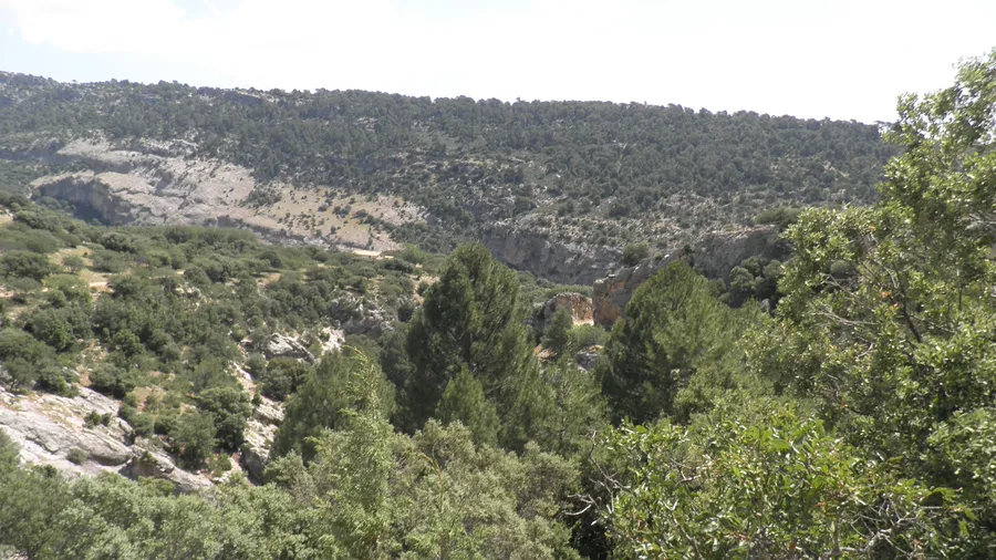
Vegetation layers sharply with altitude. Below 1,000 m, holm-oak and Portuguese-oak woodland predominates alongside an understorey of kermes oak, mastic and esparto grass. Between 1,000 and 1,600 m, dense stands of black pine and Salzmann pine clothe the north-facing slopes under a closed canopy that admits little direct sunlight. Above 1,800 m, near the 2,138 m summit of Pico del Buitre — the park's highest point — only hedgehog-broom cushion scrub, high-mountain grassland and isolated specimens of Saxifraga erioblasta, a Baetic endemic, survive in crevices. In spring, wild orchids scatter the forest clearings in shades of pink and violet, and the scent of pine resin saturates the trails that climb the north-facing slopes.

Wildlife mirrors that habitat diversity, with more than 140 catalogued vertebrate species. Iberian ibex navigate the cliff faces with gravity-defying ease — groups of females and young are often spotted on canyon ledges at first light. Griffon vultures patrol the thermals generated by the limestone walls and golden eagles nest on inaccessible ledges above 1,500 m. In the river, native brown trout — not restocked — hold the cold, well-oxygenated upper reaches, and otters maintain several territories along the watercourse, though their nocturnal habits make them hard to sight. In the low scrub at dawn, the song of Sardinian warblers and rock buntings is a regular companion, while at dusk horseshoe bats stream in columns from the karst caves that riddle the range.

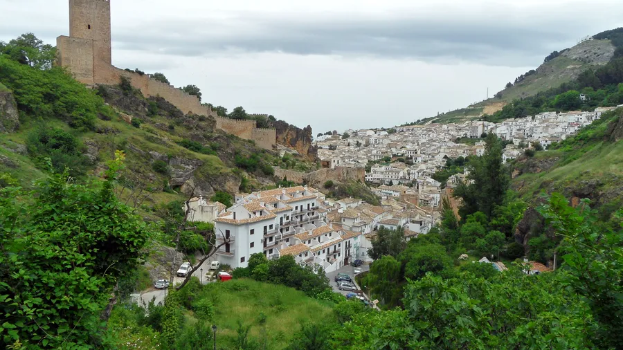
For the community of Castril — a village of roughly 900 inhabitants perched on a limestone crag at the canyon entrance — the park is part of everyday life, not merely a tourism asset. Shepherds still drive flocks of Segureña sheep to high-altitude pastures in summer along drovers' roads documented as far back as the eighteenth century. Historic irrigation channels fed by the river sustain local allotments of vegetables, almonds and cold-adapted olive trees. The local cuisine reflects that landscape: migas, gachas and charcoal-grilled Segureño lamb are the dishes served in the village restaurants.

Waymarked trails let visitors walk these landscapes without technical experience. The PR-A 336, which follows the Cerrada de Lézar gorge, is the most popular: a 2 km circular route with wooden walkways bolted to the cliff face roughly 50 metres above the river, where the passage narrows to barely a metre and spray from the water below reaches your arms. High-mountain routes to Pico del Buitre require a full day, good fitness and map navigation, but reward with views stretching from Sierra Nevada to the Cazorla range on clear days.

Practical information

Everything you need to know for your visit to Parque Natural de la Sierra de Castril

How to get there
From Granada city, take the A-92 towards Guadix then the A-326 to Castril (about 150 km, 1 h 50 min). From Baza, 50 km via the A-326. The town of Castril serves as the park gateway; parking is available near the visitor centre.
Area Information
Castril visitor centre with trail information and maps. Rural accommodation and restaurants in the town of Castril (pop. 900). Controlled camping area at the Nacimiento recreation zone. Limited mobile coverage inside much of the park.
Geography
Limestone massif of 12,696 ha ranging from 800 to 2,138 m (Pico del Buitre). Karst terrain with canyons, sinkholes, caves and springs. The Castril River crosses the park north to south through a gorge with vertical walls up to 200 m high.
Flora & Fauna
Black pine and Salzmann pine forests, holm oak, Portuguese oak and high-mountain cushion scrub. Wild orchids in spring. Iberian ibex, griffon vulture, golden eagle, native brown trout, otter, Sardinian warbler and horseshoe bats in karst caves.

Things to do

Find the best plans and things to do in Parque Natural de la Sierra de Castril

20

Accommodations

Best accommodation options in Parque Natural de la Sierra de Castril

Loading accommodation options...

Frequently Asked Questions

Get answers about Parque Natural de la Sierra de Castril

No, the Cerrada de Lézar trail (PR-A 336) is free to access year-round with no booking or permit required. It is a roughly 2 km circular route with wooden walkways over the gorge, suitable for families with children aged six and over. On spring weekends it is worth arriving before 10:00 to avoid congestion on the walkways, which are narrow and one-way in the tightest sections.
Swimming is prohibited at the river source area, which is a specially protected zone, but it is allowed in several pools downstream, outside the strict source perimeter. The water is very cold year-round, between 10 and 14 °C, so water shoes and a gradual entry are advisable. The most accessible pools are next to the recreation area, about a 15-minute walk from the town car park.
The route to Pico del Buitre (2,138 m) involves roughly 1,100 metres of cumulative elevation gain over about 18 km return. It is rated as hard, requiring good fitness, map or GPS navigation (signposting is sparse at the top) and a full day of walking. There are no technical climbing sections, but loose limestone scree crossings make the terrain unstable in places. Hiring a local guide is advisable if you lack mountain experience.
The town of Castril has several rural accommodation options (guesthouses and a small hotel) and three or four restaurants serving local dishes such as migas, gachas, Segureño lamb and river trout. Booking ahead is recommended on public-holiday weekends and in spring, as supply is limited. The nearest larger town is Baza, 50 km away, which has supermarkets, a petrol station and more accommodation choices.
Iberian ibex can be seen year-round, but the best chances come in autumn (October-November) during the rut, when males descend to more accessible elevations and are less wary. In summer they are also frequently visible at dawn on the canyon cliffs before the heat pushes them into shade. Binoculars of 8x42 or 10x42 and patience at the viewpoints along the PR-A 336 trail yield good sightings without straying from the main routes.