Natural Park of the Sierras de Cazorla, Segura and Las Villas
The essentials of Natural Park of the Sierras de Cazorla, Segura and Las Villas
- • Guadalquivir river source at Cañada de las Fuentes, 1,350 m altitude
- • Bearded vulture reintroduced from 1986, southernmost breeding nucleus in Europe
- • October deer rut with bellowing males heard across valleys at dawn
- • Cerrada de Elías trail: 9.5 km along the Borosa through a gorge with 100-metre walls
- • Tranco reservoir 12 km long, surrounded by pine forest and Mediterranean scrub
Description
Practical information for Natural Park of the Sierras de Cazorla, Segura and Las Villas
Everything you need to know for your visit to Natural Park of the Sierras de Cazorla, Segura and Las Villas
How to get there
How to get there
From Jaén city (48 km) via the A-316 to La Iruela and Cazorla. From Granada (150 km) via the A-44 and A-315. There is no direct public transport; a hire car from Jaén or Úbeda is recommended. The main road into the park interior is the A-319 from Cazorla toward the Tranco reservoir.
Area Information
The town of Cazorla (8,000 inhabitants) is the park's main gateway, with extensive rural accommodation, restaurants, and guiding companies. Úbeda and Baeza, UNESCO World Heritage sites, are 60 km away with higher-category hotels. The Torre del Vinagre interpretation centre has a botanical garden and wildlife exhibits.
Geography
Jurassic limestone and dolostone mountain massif in the province of Jaén. The highest peaks exceed 2,100 m at El Yelmo (2,147 m) and El Empanadas (2,107 m). The Guadalquivir rises here, and the Tranco reservoir (496 hm³ capacity) is the main water regulator of the territory.
Flora & Fauna
Relict Spanish fir (Abies pinsapo) on north slopes, replanted pine, and Mediterranean evergreen oak. Fauna highlights include the bearded vulture (Gypaetus barbatus), red deer (Cervus elaphus), Iberian ibex (Capra pyrenaica), golden eagle, and Eurasian otter. Plant endemics: Viola cazorlensis and Pinguicula vallisneriifolia.
Accommodations in Natural Park of the Sierras de Cazorla, Segura and Las Villas
Best accommodation options in Natural Park of the Sierras de Cazorla, Segura and Las Villas
Gallery of Natural Park of the Sierras de Cazorla, Segura and Las Villas
Photos and images of Natural Park of the Sierras de Cazorla, Segura and Las Villas
Frequently asked questions about Natural Park of the Sierras de Cazorla, Segura and Las Villas
Get answers about Natural Park of the Sierras de Cazorla, Segura and Las Villas
Do I need to book to enter the Cazorla Natural Park?
Most of the park is freely accessible by private vehicle. However, the reserve zone (southern sector, around the Guadalquivir source) requires a special permit obtained in advance from the provincial Environment office in Jaén. For camping areas, advance booking is essential, particularly at Easter and in summer.
What is the best route for spotting deer, ibex, and bearded vulture?
For red deer, the area around the Tranco reservoir at dawn in October is the most productive during the rut. Iberian ibex are regularly seen on the rocky walls near Enebral and along the Yelmo ridges. The bearded vulture has dedicated observation points around Nava de San Pedro, where recovery programme technicians set up feeding stations that can be visited with a specialist guide. The best window for all wildlife is between 6:30 and 9:00 in the morning.
What fitness level is needed for the Cerrada de Elías route?
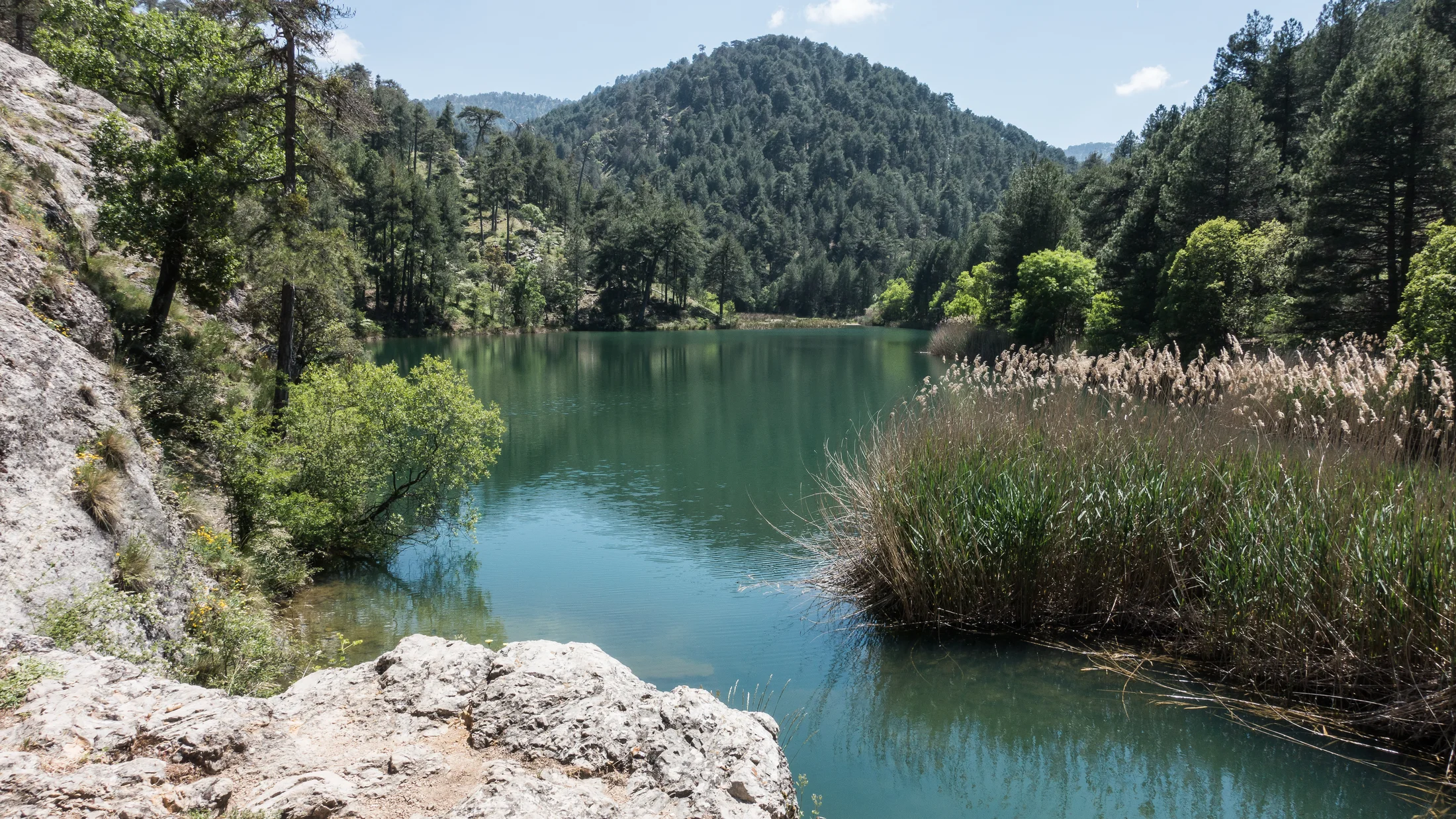
The standard round trip to Lago Valdeazores covers 19 km with around 400 metres of cumulative elevation. It is rated medium difficulty: the trail is well marked and the terrain is manageable, but the distance and summer heat require a reasonable base fitness. Carry at least 2 litres of water per person, sun protection, and grip-soled footwear. In summer, start before 8:00 in the morning.
Can you fish in the park and what species are caught?
Yes. Sport fishing is regulated and permitted with a valid fishing licence in designated stretches of the Guadalquivir, Borosa, and their tributaries. The main species is brown trout (Salmo trutta), which thrives in cold, well-oxygenated water. The season opens in spring and varies annually according to the Junta de Andalucía's resolution. Authorised stretches and exact conditions are available from the Andalusian Environment and Water Agency.
Is there public transport from Jaén or Úbeda?
Public transport to Cazorla is limited. From Jaén, Alsina Graells buses run with reduced frequency, especially on weekdays. The connection from Úbeda is similar. Once in Cazorla, there is no regular public transport into the park interior: you need a private vehicle, taxi, or a guided tour organised by a local company.