Why Map Skills Keep You Safe in the Mountains
A topographic map turns the landscape into a language you can read before you step outside. When you decode that language, you plan better, stay autonomous, and avoid avoidable mistakes. Pine resin lingers in the cool air as the ridge breathes a steady wind at your face.
Why a topographic map is more than lines and colors
A topographic map shows the shape of the land, not just roads and place names, so you can anticipate effort and risk. Contour lines sketch hills, valleys, and cliffs; streams, vegetation, tracks, and buildings add context to what your boots will meet. A faint “track” on paper may be washed out in spring runoff, gated on private land, or lost in broom and gorse by midsummer.
Because it encodes relief, a topographic map helps you avoid avalanche-prone slopes, cliff bands, flood gullies, and dead-end barrancos. It also points you to safer ramps, shoulders, and cols where travel is easier. Two identical distances can feel totally different if one crosses tight contour lines and the other follows a broad ridge. Mastering the topographic map means you make these decisions at home, not under stress on a windy saddle.
What you will learn in this visual walkthrough
By the end you will be able to:
- Identify slope steepness and landforms at a glance.
- Use map and compass together to set and follow a bearing.
- Calculate elevation gain and loss (“ascent” and “descent”) from contours.
- Convert map distances to ground distances using the map scale.
- Choose the right tools for the job (paper vs app vs GPS) and combine them.
You will also get quick drills and a printable checklist to practice how to read a topographic map before your next hike; use them on an easy loop to build confidence.
Picuco te puede ayudar
Does something here catch your eye?
Tell us.
Write to us on WhatsApp or email: we answer questions, find the best options and help you sort out the booking.
What a Topographic Map Shows and When to Use It
Think of a topographic map as a 3D model flattened onto paper. It represents relief with contour lines, shows water (rivers, springs, marshes), land cover (forest, scrub, rock), infrastructure (tracks, PR-15 trails, roads), and features like huts or viewpoints. The legend explains symbols; the grid lets you reference precise coordinates. Sun-warmed rock smells faintly of dust as a jay calls down in the pines.
Topographic maps differ from other maps because they privilege terrain over decoration. Tourist maps simplify for sightseeing; cadastral maps focus on property boundaries. A topo gives you the raw terrain data needed for mountain navigation: how steep, how complex, how passable. For Spain, the Instituto Geográfico Nacional (IGN) publishes MTN25 (1:25,000) and MTN50 (1:50,000) sheets; in many areas equidistance (vertical spacing between contour lines) is 10 m at 1:25,000 and 20 m at 1:50,000.
Types you will encounter:
- Large-scale hiking maps (1:25,000): detailed tracks, springs, contour density; best for foot travel.
- Smaller-scale overviews (1:50,000 to 1:100,000): broader context for cycling or multi-day traverses; less detail in rough ground.
- Military/orthophoto blends: high fidelity to surface features; good for off-trail navigation and identifying rock bands or scree.
- Digital elevation models (DEM/DTM) and shaded relief: great for planning profiles and visualizing slope angles; pair them with a proper map for symbols and names.
Common mountain uses include:
- Route planning: choose a ridge over a ravine, or trace a traverse that avoids energy-sapping gullies.
- Risk assessment: spot avalanche slopes (commonly 30–45°), stream crossings, cornice-prone crests, and cliff bands.
- Emergency navigation: when fog erases the trail, you can handrail a stream, aim off to a track, or contour into a gentler spur.
Real scenarios where a topo wins:
- Winter ascent in Sierra Nevada: the summer shortcut climbs a concave slope that loads with wind slab; topo lines warn you to take the broader rib.
- Gorge hike in the Picos de Europa: the “path” on a tourist leaflet skirts above a cliff; contours show the drop and the safer route on a ledge system.
- Crossing Dehesa country: tracks splinter and fade in oak pastures; the topo shows the drainage pattern you can follow to the main arroyo exit.
Local communities keep these paths open—shepherds, forest crews, and volunteers who waymark GR-11 and GR-10—and the topo map is how you read their landscape with respect.
Key Elements You Must Recognize on the Map
A handful of elements do most of the work: contour lines, the scale, the legend and symbols, plus the coordinate grid. Learn these once and every sheet starts to make instant sense. Sun flashes on a tin roof in a far valley like a tiny beacon.
Contour lines: what they mean and how to spot them
Contour lines are closed lines that connect points of equal elevation above sea level. Thick “index” or “master” contours appear every fourth or fifth line and carry printed elevations; thinner intermediate contours fill the steps in between. The equidistance is the vertical gap between adjacent contours (for example, 10 m on many MTN25 sheets).
Reading contours quickly:
- Close contours mean steep ground; wide spacing means gentle slope.
- A “V” or “U” shape points upstream in a valley; the inverted shape points down a spur or ridge.
- Closed rings with higher numbers toward the center are hills; with lower numbers are depressions.
- Even spacing suggests a uniform slope; sudden bunching hints at a break like a scarp or cliff.
Examples:
- A valley: contours “V” upstream, crossing a blue line (stream).
- A ridge: contours “V” downhill, with longer, smoother spurs.
- A rounded hill: concentric rings that tighten toward the summit.
Map scale: measuring distance and converting to the ground
The scale of the map tells you how map distances convert to real distances. A numeric scale like 1:25,000 means 1 unit on the map equals 25,000 of the same units on the ground (1 cm = 250 m). A graphic scale bar lets you measure quickly with a ruler or a folded strip of paper.
How to use it:
- Lay a scrap of paper along your route, bending at corners to follow the path.
- Mark start and end ticks; step the paper against the scale bar to read distance.
- Convert with the ratio if needed: at 1:25,000, 4 cm on the map = 1,000 m (1 km); at 1:50,000, 4 cm = 2,000 m (2 km).
- Add 10–25% for switchbacks and micro-wiggles you cannot trace exactly.
Practical example:
- You measure 7.2 cm at 1:25,000. That’s 7.2 × 250 m = 1,800 m. If the route zigzags heavily, budget ~2.0–2.2 km.
Legend and symbols: turning drawings into decisions
The legend decodes the symbology: dashed lines for footpaths, double lines for tracks, green for forests, blue for water, triangles or dots for summits, and small hut or refuge icons. On a topographic map, subtle differences matter—solid vs dashed tracks, seasonal streams vs perennial, fenced boundaries vs walls. Always check the legend on your specific sheet to avoid assuming a symbol means the same across brands.
In the field, match what you see to the map’s symbol order: first the big landform (ridge, valley), then water and vegetation, then human features. That sequence reduces confusion when trails braid or disappear.
Grid and coordinates: precise references without guesswork
Most modern Spanish topo maps use the UTM grid (Universal Transverse Mercator), often labeled by 1000 m squares with easting (x) and northing (y) values. You will also see geographic coordinates (latitude-longitude) along the margins. The datum—mathematical model of Earth—on IGN sheets is commonly ETRS89; older maps may use ED50. Always read the marginal notes.
Using the grid:
- Read right (easting) then up (northing): “read right up” helps remember the order.
- A 6-digit easting and 6-digit northing pinpoints you to 100 m; 7-digit pairs to 10 m.
- Example:
30T 447200 4528100(UTM zone30T) or42.605°N, 0.523°W(lat/long). - Grid references let you share locations with rescue or align with GPS/phone apps; confirm your app and map use the same datum and coordinate format.
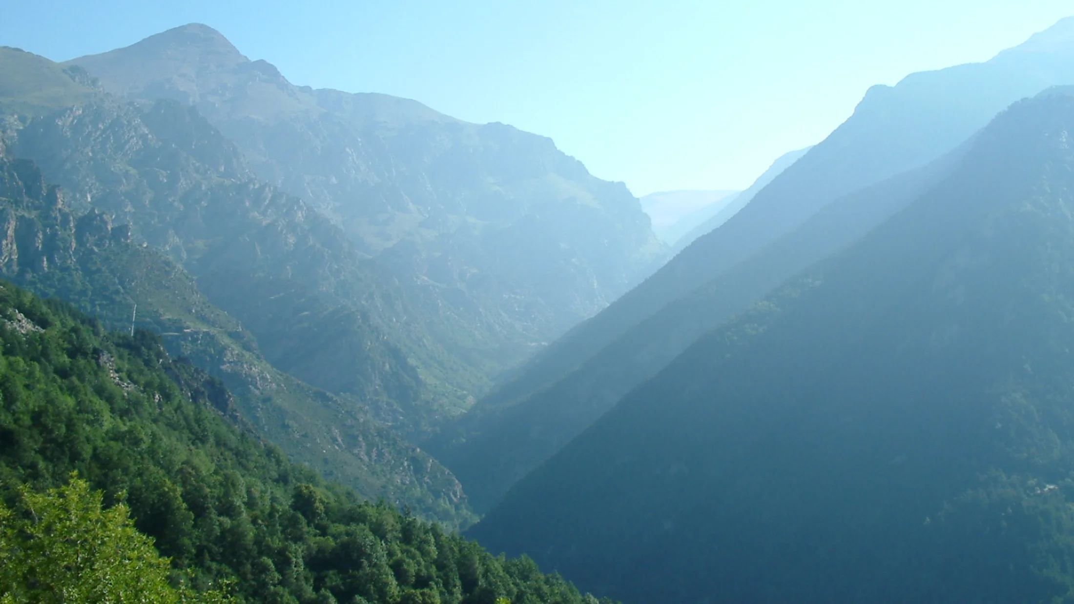
Reading Terrain and Slope from Contours
Contours are the script; terrain shapes are the story. Once you see crests, saddles, and benches on paper, you can choose lines that walk well. A raven’s croak bounces off the slope like a drumbeat in clear morning air.
Identifying landforms: ridges, valleys, and saddles
To read ridge-and-valley structure, look for patterns:
- Summits: closed loops with the highest index label centered or uphill from surrounding lines.
- Valleys: contours form “V” or “U” that point upstream; the tighter the “V,” the narrower the ravine.
- Ridges/spurs: contours bulge outward; “V” shapes point downhill along the crest.
- Saddles/cols: two nearby highs with a low between; contours pinch inward on two sides and open on the other two.
Typical examples:
- A rolling crest: broad, evenly spaced contours with occasional minor summits; good for steady travel and views.
- A knife-edge: extremely tight contours on both flanks; exposure likely and slower going.
- Incised gullies: sharp “V”s that slice into a slope; crossings may be awkward or dangerous in spate.
When you ask how to read a topographic map to pick the best line, favor terrain that naturally funnels you forward: climb spurs, descend gentle ribs, and contour across broad benches. Avoid gullies in storm rain, convex breaks in avalanche season, and cliffy reentrants that trap you.
Evaluating slope: when an ascent or descent stays safe
Contour spacing encodes steepness: the closer the lines, the steeper the slope. A fast field estimate:
- At 1:25,000 with 10 m equidistance, five lines crossed per 100 m on the map equals 50 m vertical per 250 m horizontal ≈ 11° (about a 20% grade).
- If contours touch or are nearly on top of each other, expect bluffs or impassable rock.
Quick methods to gauge:
- Count lines crossed over a measured horizontal distance (use the scale bar).
- Convert rise/run to angle or percent: angle ≈ arctan(rise/run); percent = 100 × rise/run.
- Heuristics: 30–35° (avalanche-prone snow slopes), >40° (very steep; often rocky), <20° (generally walkable for most hikers).
Decide suitability by your team’s experience, ground condition (wet grass, loose scree), and season. A 25° grassy slope can be benign when dry and treacherous after frost; the map shows steepness, but you choose timing and tactics.
Hazard cues and ground conditions you can see on the map
Danger often hides where several clues align:
- Very tight contours plus a blue line in a concavity: flood gully or slot—avoid in storms.
- Close contours with short tick marks or rock hachures: cliffs, scarps, or break lines.
- Long convex slopes above lee aspects in winter: typical wind-loading zones for slabs.
- Alluvial fans at ravine mouths: braided crossings that shift after heavy rain.
Combine map reading with field observation:
- If the map shows a streamless reentrant but you hear water, snowmelt is running—expect soft snow bridges or undermined banks.
- If vegetation transitions from forest to white, you may be entering alpine rock or scree; footing slows and route-finding gets subtle.
Plan alternatives in advance: a lower traverse, a rib instead of a gully, or a retreat via a known track to a hut or road.
Coordinates, North, and the Compass
A compass turns the map into a steering wheel. With a bearing, you can thread gullies or cross a misted plateau with confidence. The smell of wet granite rises when cloud drops onto the ridge.
Compass and map: basic steps to align them
Use compass and map together so features line up with reality.
- Lay the map flat; rotate it until terrain features match what you see.
- Place the compass on the map with its edge along a north-south grid line; turn the map until the needle’s red end (magnetic north) aligns with the map’s grid north arrow, adjusting for declination (see below).
- To set a bearing to a feature, place the compass edge between your position and the target on the map; rotate the bezel until orienting lines match the map’s grid; read the bearing.
- In the field, hold the compass level, rotate your body until the needle sits in the orienting arrow; move along the travel arrow, picking visible landmarks (“aiming off” slightly if needed to find linear features like streams or tracks).
Tips for beginners:
- Keep the map oriented as you walk; fold to the area you need.
- Reconfirm bearings after obstacles, rests, or strong winds.
- Use large, obvious handrails (ridges, rivers, fences) to check progress.
Magnetic North vs true north: making declination work for you
Declination is the angle between magnetic north (where your compass points) and true/geographic north (top of the map). In Spain, the value is modest but non-zero and changes over time and by location. Check the declination diagram and table on your map’s margin or consult a current magnetic model from reputable sources (NOAA, BGS, IGN).
How to correct with numbers:
- Suppose declination is 2°W (magnetic west of true). To convert a map/grid bearing to a field (magnetic) bearing, subtract 2°: Grid-to-Magnetic = Grid − Declination.
- If declination is 3°E, add 3°: Grid-to-Magnetic = Grid + Declination.
- Many compasses let you set a declination offset so you read corrected bearings directly; follow your compass manual.
Remember: when going from field (magnetic) to map (grid/true), reverse the sign. Write the local declination on your map border before you leave the house.
Coordinates (utm/lat–long) and triangulation
Coordinates let you pin your location or a waypoint exactly. To read UTM:
- Find the 1000 m grid lines; note the easting (right) and northing (up) values.
- Interpolate your position within the square using the compass edge as a scale.
- Quote zone, easting, northing: e.g.,
30T 447200 4528100.
To read latitude–longitude:
- Use tick marks on the map’s margins; some maps print light graticules across the sheet.
- Record in degrees and decimal minutes (e.g.,
42°36.3'N, 0°31.4'W) or decimal degrees.
Triangulation (to locate yourself without GPS):
- Identify two or three obvious features (summit, church spire, col).
- Take magnetic bearings to each with your compass; correct for declination to get true/grid bearings.
- On the map, from each feature, draw a line along the back-bearing (bearing ±180°).
- Your location is near the intersection; a triangle forms if your readings have small errors.
Practice this in clear weather so you can use it calmly in fog.
Route Planning with Distance, Ascent, and Time
Good plans make flexible days. You will measure real distance, compute total ascent and descent, and estimate time you can trust. Dry thyme crushes underfoot, releasing a sharp, green smell.
Measuring distance on the map and adjusting for terrain
Map distance rarely equals walking distance because paths wiggle and terrain slows you.
- Use the graphic scale with a paper strip; bend it around corners and mark cumulative ticks.
- Follow the exact line of the path where possible; add 10–25% for micro-bends you cannot capture.
- Adjust for terrain:
- Gentle, smooth terrain: +0–10%.
- Rocky, bushy, or off-trail: +15–30%.
- Snow, talus, or scree: +25–40%.
Example:
- On a 1:25,000 map, you measure 5.6 cm = 1.40 km. The path zigzags on a steep spur; add 20% → 1.68 km expected walking distance for that segment.
Calculating elevation gain from contour lines
Use equidistance to total ascent and descent.
- Mark key points: trailhead, cols, summits, junctions.
- Count how many contours you cross uphill between points; multiply by the equidistance for ascent. Do the same downhill for descent.
- Add partial intervals where the path reaches mid-way between contours (estimate by position).
- Sum each segment for day totals.
Worked example (equidistance 10 m):
- Trailhead (1,200 m) to ridge crossing (1,500 m): climb crosses 30 contours → 300 m ascent.
- Ridge undulates: +40 m, −30 m.
- Final summit push: crosses 12 contours → +120 m.
- Totals so far: ascent 460 m; descent 30 m.
Record these in a simple table on the map margin; it keeps your head clear when you’re tired.
Estimating times: Naismith, Tobler, and practical tweaks
Rules of thumb turn distance and ascent into hours. Start with Naismith’s Rule:
- Base: 5 km per hour on flat ground.
- Add: 1 hour for every 600 m of ascent.
Adjustments:
- Descent: add time if steep or technical (e.g., +10–30 minutes per 600 m descent).
- Terrain: add 10–30% for rough trails, snow, heat, or heavy packs.
- Fitness and group size: slower pace with kids or large groups.
Examples:
- 12 km with 800 m ascent on good trails:
- Flat time: 12/5 = 2.4 h.
- Ascent time: 800/600 ≈ 1.3 h.
- Base total: ~3.7 h; add 10% for roughness → ~4.1 h.
- Tobler’s Hiking Function (for map geeks) models speed by slope; practical takeaway: expect peak speed around gentle downhills (~5–6% grade), slower on steep ups and downs.
Write segment times next to waypoints (GR-11 junction, 42.605°N, 0.523°E col) so you can compare plan vs reality during the day.
Tools, Visual Drills, and Safety
Paper maps, apps, and GPS each excel at different tasks; combining them gives redundancy. Smoke from a distant farmhouse curls straight up in the still evening air.
Paper maps vs apps and Gps: strengths and trade-offs
Choose tools that complement each other. Here’s a quick comparison:
| Tool | Offline reliability | Battery dependence | Precision/track log | Weather resilience | Scale control | Best use |
|---|---|---|---|---|---|---|
| Paper topographic map | Excellent | None | None (manual) | Good if laminated/map case | Fixed by sheet (1:25k, 1:50k) | Planning, big-picture, fail-safe |
| Phone app with offline maps | Good if downloaded | High | Good; depends on GPS and settings | Sensitive to cold/wet | Flexible zoom; mind loss of scale sense | Quick location checks, recording |
| Handheld GPS | Good with spare batteries | Medium | Very good | Ruggedized | Flexible; can load custom maps | Poor visibility, winter, long traverses |
Practical notes:
- Always carry a paper topographic map and a baseplate compass as your safety net.
- Before leaving, download offline map tiles and the GPX route; test airplane mode.
- Carry a power bank; cold saps battery life fast.
Visual exercises and field practices that build skill
Skill comes from short, focused practice:
- Map-to-ground drill: stand at a viewpoint; identify 3–5 features (ridge, saddle, stream bend) on the map and in the landscape.
- Contour sketch: trace a 1 km segment and draw a quick elevation profile; compare to your app’s profile later.
- Triangulation: in a familiar area, take bearings to two features and plot your position; check with GPS coordinates.
- Slope guess: predict slope angle from contour spacing; verify with an inclinometer app or by counting pole-plant steps on a known incline.
Progression tips:
- Start in a park or low hills; practice even when the trail is obvious.
- Add complexity: light fog, off-trail legs between easy handrails, night navigation near a refuge or road.
- Debrief after each outing: what you predicted vs what you found; update your map notes.
Safety and preparation before you go
A few habits anchor safe days and respectful travel in rural landscapes:
- Check the weather and avalanche bulletin; note the latest magnetic declination for your area.
- Tell a trusted person your route, group size, and return window.
- Pack a paper map, compass, headlamp, extra layer, emergency bivy, and spare battery.
- Identify alternatives: lower routes, escape valleys, public transport nodes, and refuges.
- Respect closures, grazing lands, and seasonal restrictions; local shepherds and trail crews keep these mountain corridors alive.
In orientation in the mountains, redundancy matters: two ways to navigate, two ways to stay warm, two ways to call for help.
Frequently Asked Questions About Topographic Maps
Do I need to know the compass to read a topographic map, and when is it essential?
You can start reading a topographic map without a compass: learn contours, scales, and symbols first. In clear weather on marked trails, keeping the map oriented with terrain and using obvious handrails often suffices. But the moment visibility drops, trails braid, or you must cross featureless ground, the pair—compass and map—moves from helpful to essential.
Situations where compass skills are non-negotiable:
- Fog or whiteout on plateaus and broad ridges where few features stand out.
- Night navigation, especially across heather, scrub, or snow where paths vanish.
- Aiming to a precise col, spur, or hut in complex terrain.
- Relocating after losing the trail in forests or dehesa pastures.
Beginner steps to integrate brújula y mapa:
- Orient the map with the compass so grid north and the needle align (declination corrected).
- Take a bearing to a visible feature; set the bezel; handrail toward it while keeping the map oriented.
- Practice “aiming off”: intentionally aim a few degrees to one side of a linear feature (stream/track) so you know which way to turn when you hit it.
Common errors to avoid:
- Forgetting declination; write it on your map’s margin.
- Letting metal objects or phones near the compass needle.
- Rotating the bezel in your pocket and trusting a stale bearing.
Compass skills transform orientation in the mountains from “hope and follow” to “plan and confirm.”
How do I calculate a route’s elevation gain using only the topographic map?
Use the contours’ equidistance to sum vertical change. Here’s a simple, repeatable method:
- Confirm the equidistance on the legend (e.g., 10 m on 1:25,000).
- Break your route into logical segments: trailhead → col → summit → refuge.
- For each uphill segment, count the number of contour lines you cross climbing; multiply by the equidistance to get ascent. For each downhill, do the same to get descent.
- For partial intervals (e.g., you climb halfway to the next line), estimate proportionally (half a line at 10 m equidistance ≈ 5 m).
- Add segment totals for the day’s ascent and descent.
Worked example:
- Segment A: 1,200 m to 1,480 m via a ridge at 1:25,000 (10 m equidistance) crosses 28 contours → 280 m ascent.
- Segment B: rolling traverse: +40 m (four partial rises), −30 m (three partial drops).
- Segment C: final push to 1,620 m crosses 14 contours → +140 m.
- Day totals: Ascent 460 m; Descent 30 m.
Tips that keep numbers honest:
- Count along the actual line you plan to walk; detours around bluffs can add extra mini up-and-downs.
- On deep valleys where contours “stack,” zoom in (magnifier or phone photo) to avoid double-counting.
- Record ascent/descent by segment next to coordinates or
PR-15/GR-11junctions; it speeds checks mid-day.
Curvas de nivel convert paper lines into energy planning: ascent taxes legs and lungs; descent taxes knees and attention.
What map should I download or carry for a one-day hike, and how do I choose the right scale?
Pick scale by terrain complexity and your plan. For most hikers, 1:25,000 delivers the best balance: enough contour detail for micro-Navigation and symbols for springs, huts, and path types. In rolling terrain or on long, straightforward tracks, 1:50,000 can suffice and shows more context.
Guidelines:
- Short, steep, or off-trail days: 1:25,000 (e.g., IGN
MTN25), equidistance often 10 m. - Long traverses with good waymarking: 1:50,000 (e.g., IGN
MTN50), equidistance often 20 m; bring a 1:25,000 inset for cruxes if available. - Winter trips: prioritize detailed contours and avalanche terrain shading if offered.
For carrying:
- Maps on paper: waterproof print or a map case; fold to the day’s area and mark waypoints with pencil.
- Apps and GPS: download offline tiles at multiple zoom levels, store GPX routes, and set the correct datum (ETRS89) and format (UTM or lat–long) to match your paper map.
App choices and formats to consider:
- Offline-capable apps with topo layers from national cartography or open sources.
- GPX/KML files for your planned route and escapes.
- A handheld GPS if you expect cold, wet conditions; pack spare AA/AAA batteries.
Remember redundancy: one paper map plus one digital source covers you if either fails.
How do I correct magnetic declination on my compass and bearing in practice?
First, know your local declination and whether it’s east (E) or west (W). Find it in the map margins or via a reputable source; write the value and the date on your map. Then decide whether to correct in the compass (set-and-forget) or by arithmetic on each bearing.
Set-and-forget method (compass with adjustable declination):
- Turn the small screw or bezel scale until the orienting arrow is offset by the local declination (e.g., 2°E).
- From now on, when you align the needle in the orienting arrow, the bearing you read is already corrected to true/grid (depending on your compass’ reference).
Arithmetic method (no adjustment feature):
- Grid to magnetic (to walk a bearing): Magnetic = Grid + Declination(E) or Magnetic = Grid − Declination(W).
- Magnetic to grid (to plot on the map): Grid = Magnetic − Declination(E) or Grid = Magnetic + Declination(W).
Examples:
- Declination 3°E, map bearing 72°: Magnetic = 72° + 3° = 75° to walk.
- Declination 2°W, field bearing 210°: Grid = 210° − (−2°) = 212° to plot.
Field tips:
- Rehearse the correction at home with three practice bearings so it’s muscle memory.
- Keep a tiny “cheat strip” taped to your compass: “E add, W subtract (G→M).”
- Recheck declination annually; values drift slowly.
With a small number and a clear rule, declination stops being mysterious and becomes a reflex.
Book your next experience — discover active nature adventures in Spain with providers verified by Picuco.
Conclusion
Reading a topographic map gives you a quiet advantage: you see the mountain’s shape before your boots touch the trail. You learned to interpret contour lines, use the map scale, decode the legend, work with UTM and latitude–longitude, and bring compass, bearings, and declination together. Evening light combs the ridges in gold as the day’s plan clicks into place.
Route planning now becomes a series of grounded choices: measure honest distance, total ascent and descent, and estimate times with Naismith while adjusting for terrain and season. You know how to spot ridges, saddles, and valleys, read hazard cues, and select safer alternatives ahead of time. Your tools—paper, app, and GPS—now complement each other with redundancy.
Next steps are simple and practical:
- Print the checklist, mark a short local loop, and practice the drills.
- Trace a profile, set three bearings, and test a grid reference in the field.
- Share your plan with a friend and debrief your day with notes on the map.
Each outing grows your fluency until the topo’s lines speak as clearly as the landscape itself.