Málaga province has routes for every level: El Torcal de Antequera's Green Route (a 1.5 km loop, free and with no booking), the paths on Monte Calamorro, reached by the Benalmádena cable car (from €17.90 online), the Hoz del Arroyo Marín gorge, the Caminito del Rey (€10, booking required) and the Torrecilla, the highest point of the Sierra de las Nieves (1,919 m). From autumn to spring, car access to El Torcal Alto is closed on weekend and holiday mornings as soon as the car park fills up. The river walk along the Chíllar, in Nerja, remains closed.
Before you set off
Access to the middle and upper stretches of the Chíllar river, in Nerja, has been banned by a municipal decree since August 2023 and the river remains closed, with no reopening date. At the Torcal de Antequera, access to the Torcal Alto is cut off once the upper car park fills up, and it usually reopens between 13:30 and 14:30.
Prices checked on 19 November 2026.
Easy routes: under 2 hours and little elevation gain
El Torcal de Antequera, Green Route. A 1.50 km loop with +40 m of elevation gain, an estimated 45 minutes and low-to-moderate difficulty; it is a signposted trail you can visit freely. Entry to the Natural Area and to the Torcal Alto Visitor Centre is free and there is no charge for parking. The green, yellow and orange routes are open access and need no permit or booking; only groups have to notify their visit. From Málaga city it's about 48.6 km and around 59 minutes by car. There is no public transport to El Torcal: without your own car, your options are a taxi from Antequera or a guided tour with transport included, and you can get there with Uber but not back, because there is no authorised service in Antequera.
Guadalhorce river mouth. Two signposted itineraries, the Río Viejo and La Laguna Grande trails, neither longer than 2 km, starting from the same point: you can walk them separately or combine them into one circuit. The Río Viejo trail is 1.6 km long. Both lead to the Natural Area's five observation points. It's about 11.5 km and around 18 minutes by car from the centre of Málaga, and by public transport you take EMT line 5 from Alameda Principal towards Guadalmar and get off at the Manuel Curros Enríquez street stop.
Monte Calamorro, in Benalmádena. At the summit, at 770 m, the signposted paths to the three viewpoints add up to 2,750 metres of walking. The cable car goes up in 15 minutes, and the cable car ride to Monte Calamorro costs €15.90 return, with an audio guide in the cabin. The cable car's official 2026 fares start at €17.90 online and €21.90 at the ticket office for a general ticket, with children under 3 and under 1 metre free. The birds of prey display at the summit is not included in the ticket and is paid in cash at the entrance to the area. By car you get there on the A-7, exit 1003 Benalmádena-Arroyo de la Miel; by commuter train, the stop is Arroyo de la Miel.
Hoz del Arroyo Marín, in Archidona, the short version. The short stretch described by Diario Sur is 2.9 km one way only, takes roughly 1 hour one way only and is low difficulty, between 619 and 722 m in altitude. It is linear: you come back the same way. You park in the area around the Fernando Rodríguez municipal sports centre and cross to the signposted lane without going into the town centre. From Málaga city it's 56.6 km and around 49 minutes by car to Archidona.
Picuco can help you
Does something here catch your eye?
Tell us.
Write to us on WhatsApp or email: we answer questions, find the best options and help you sort out the booking.
Write to us
We guide you based on the type of plan you have in mind and reply by WhatsApp or email.
Medium-difficulty routes: 2 to 5 hours
El Torcal, Yellow Route. A 3 km loop that starts in the upper car park and ends at the Torcal Alto Visitor Centre. The Natural Area sits at over 1,200 m above sea level, and the official website recommends mountain boots, warm clothing, a rain jacket, water and food, and not straying from the marked trails, because the ground is very rocky and slippery when wet. There are two accessible trails: the Mirador de las Ventanillas path, 100 m long, and the Monumento Natural del Tornillo path, 500 m each way; the rest is not passable for pushchairs or wheelchairs. Drone flights are not allowed, as this is a Special Protection Area for Birds (SPA).
Sierra de Mijas. The municipal network includes the Fuente de la Adelfa Circular Trail, 6.7 km, with 375 m of ascent and 375 m of descent, in 2 h 25 min; the Ermita del Calvario Circular Trail, 4.0 km, with 318 m of ascent and descent, in 1 h 50 min; the Cruz de la Misión Trail, 7.8 km, with 524 m of ascent and descent, in 3 h 15 min, out and back; and the Cerro Málaga Trail, 7.4 km, with 533 m of ascent and descent, in 3 h 10 min, out and back. The self-guided trails run along the southern slope and start from the Mirador de Mijas Pueblo. From Málaga city it's about 34.7 km and around 36 minutes by car to Mijas Pueblo. By bus, the Consorcio de Transportes M-112 line links the Málaga Bus Station with Mijas Pueblo: Monday to Friday it leaves Málaga at 06:35, 09:50, 13:00 and 21:00, and on Saturdays, Sundays and public holidays at 15:25, under the timetable in force from 01/03/2025 to 31/12/2030. For the return trip, Monday to Friday there are departures from Mijas Pueblo at 07:50, 11:30, 19:25 and 22:20, and on Saturdays, Sundays and public holidays at 11:20. The easy guided walk in the Sierra de Mijas costs €17 and lasts 3 to 4 hours.
Valle del Genal. The PR-A-222 links Cartajima and Parauta on a 4.5 km linear route that takes an hour and a half. The PR-A 226 Parauta-Igualeja is linear, 4 km one way, 1 h 30 min one way, medium difficulty. The PR-A 224 between Cartajima and Júzcar is linear, 2,900 metres, an estimated hour, and easy enough for the whole family. From Málaga city to Parauta it's 113.7 km and 1 h 49 min by car. The guided hike in the Genal Valley covers up to 14.5 km through chestnut woods and to the source of the river Genal, from €20 to €40 depending on the option.
Hoz del Arroyo Marín, full route. The approved PR-A 157 trail is linear, 13,800 metres, an estimated 4 to 5 hours, medium difficulty. It's a gorge carved by the Arroyo Marín, around 662 ha, with native Aleppo pine forest and protected species such as Bonelli's eagle and the Eurasian eagle-owl. The guided route through the Hoz del Arroyo Marín covers 8.7 km with 150 m of ascent in 4 hours for €8.
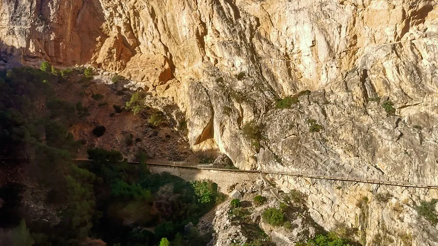
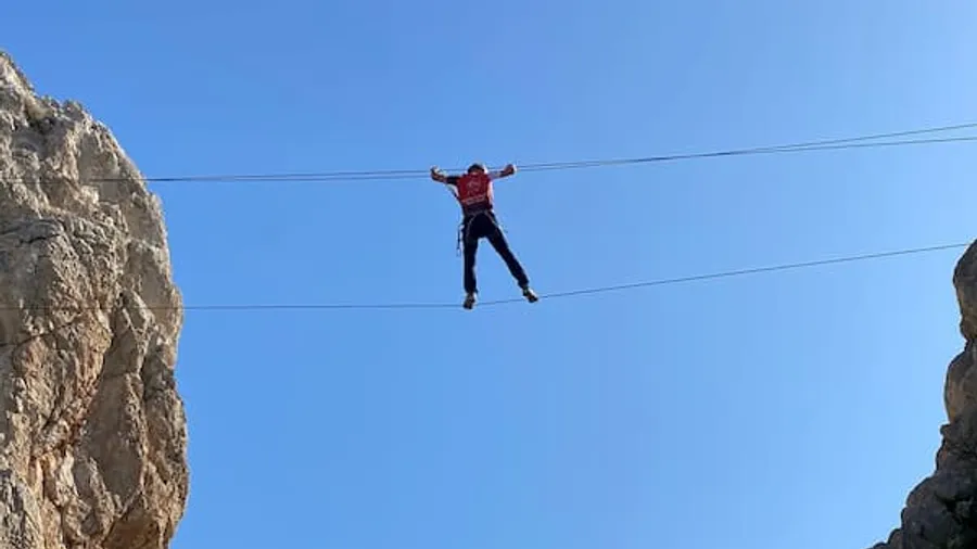
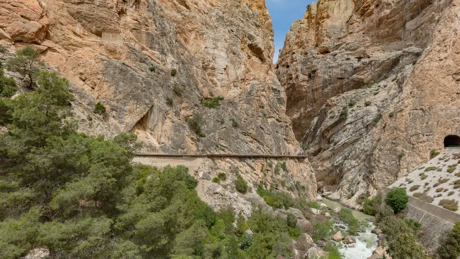
Caminito del Rey. The route is linear and one-way, descending from north to south; it starts in Ardales and ends in Álora, is 8 km long and takes 3-4 hours. General admission costs €10 and the official guided tour €18, with a maximum group of 30 people in Spanish and English. Opening hours run from 9:00 to 14:50 or 17:20 depending on the season. You can't buy tickets at the Visitor Reception Centre: they're booked on the official website or at the north access ticket office, subject to availability. Parking costs €2/day and the shuttle bus €2.50 per person, valid in both directions all day, from 07:40 to 20:00, with a 15-20 minute journey. From Málaga city you get there via the A-357 towards the MA-5403, passing through Cártama, Pizarra, Carratraca and Ardales: 59.1 km and a little over 50 minutes. Children under 8 are not allowed in, and under-18s must be accompanied by an adult. In June 2026 a 110-metre suspension bridge opened on the final stretch, creating an alternative route and saving almost a kilometre of descent. The Caminito del Rey ticket with guided tour, also available as a day trip from Málaga, has options from €29.90 to €150.
Demanding routes: full-day hikes and elevation gain
Pico Torrecilla, in the Sierra de las Nieves. The Quejigales-Torrecilla trail climbs to the summit of the Sierra de las Nieves, the Torrecilla (1,919 m), through high-mountain terrain that becomes more demanding with snow. No permit or booking is needed: you can hike freely along the trails and tracks, with restrictions only for groups depending on the area and the number of people. Drones are not allowed in the park. The usual starting point is the Los Quejigales recreation area, at over 1,200 m, with tables, parking, running water, barbecues and toilets, just a few metres from the start of the trail. From Málaga city it is about 118 km and around 2 h 48 min by car to Los Quejigales. The guided ascent of the Torrecilla costs €18 and takes about 5 hours.
Works at Conejeras
The Conejeras Recreation Area remains closed to the public due to construction of the Sierra de las Nieves National Park Visitor Centre. For questions about access and visiting conditions, the Park Office provides the phone number 670 948 894 and the email pnsierranieves.csma@juntadeandalucia.es.
Sierra de Mijas, Pico Mijas. The Sendero Pico Mijas is 9.6 km long, with 750 m of ascent and 750 m of descent, taking 4 h 20 min, there and back. The peak appears on the official map at 1,148 m above sea level. The Pista Forestal Sur "Panorámica Mijas" is a 12.4 km traverse, with 348 m of ascent and 512 m of descent, taking 3 h 20 min.
Montes de Málaga. The park covers 4,996 hectares north of the municipality of Málaga, on the left bank of the Guadalmedina basin, and was declared a Natural Park by Law 2/89 on 18 July 1989. As well as the trails, there are two signposted cycle routes: Lagar de Contreras, 16.9 km, medium difficulty, about 4 h 50 min and +460 m, and Picapedreros-Boticario, 6.7 km, medium difficulty, about 2 h 10 min and +355 m, according to the Junta de Andalucía catalogue with 2016 data. From Málaga city to the Lagar de Torrijos Ecomuseum it is 22.7 km and about 41 minutes by car. The park has no bus stop of its own: EMT line 37 runs up the Camino de Colmenar to Colmenar-Santa Clara, with stops such as Colmenar-Los Antonios and Camino Colmenar-Cuesta Tasara, already on the Montes road. There is a free camping area that requires prior permission from the Málaga Territorial Delegation. The guided hike in the Montes de Málaga costs from €6 to €50 depending on the option.
The Chíllar river: a closed water route
The Chíllar is the only river in the Axarquía declared a Fluvial Nature Reserve by the Government of Spain, and the area forms part of the protected Sierras de Tejeda, Almijara y Alhama. The water route along the riverbed to Los Cahorros and the Vado de los Patos is about 6 km one way (around 12 km there and back), with about 200 m of elevation gain one way and an estimated duration of 5-6 hours, according to the trail sheet on senderosandalucia.com, a private, unofficial guide. From Málaga city to Nerja it is about 58.8 km and around 53 minutes by car.
Today you can't hike it: the municipal decree of August 2023 banning access to the middle and upper sections is still in force, and the regional government is processing a procedure to regulate recreational use after the previous one stalled in March. The latest notice from Nerja Town Council, dated 5 August 2025, keeps the closure as a precautionary measure against the risk of forest fire, with daily checks by the Local Police and Civil Protection volunteers. By June 2026 two business proposals had been accepted to manage it with controlled access, but the river remained closed with no reopening date. To find out whether it reopens, check the notices from Nerja Town Council and the Regional Government of Andalusia.
In the catalogue there is a water hiking route in the Río Chillar, but you can't book it while the riverbed remains closed.
Which route to choose depending on the season
From June to October, the heat rules. From 1 June to 15 October, the regional government activates annual restrictions in forest areas: lighting fires and having barbecues are banned during the high fire-risk season. During that period, motor vehicle traffic is also restricted in forest areas and on land within 400 metres of the woodland, with exceptions that require authorisation. In summer, prioritise short routes with water or shade: the Ruta Verde del Torcal, the trails of the Desembocadura del Guadalhorce and Monte Calamorro. In the Torcal, get up early: access to the Torcal Alto closes once the upper car park is full, with no fixed time.
In winter, the Torcal and the Sierra de las Nieves come into their own. The Torcal is at over 1,200 m and the official website recommends warm clothing and a raincoat. The Quejigales-Torrecilla trail is especially appealing when there is snow on the landscape. At the mouth of the Guadalhorce, winter is one of the two times of year with the highest number of birds: ducks and other waterfowl overwinter there, along with between two and four ospreys. In spring, by contrast, you'll see migratory birds such as the bar-tailed godwit.
With kids and for beginners
The Ruta Verde del Torcal is a circular route of 1.50 km, with +40 m of elevation gain, an estimated 45 minutes and medium-low difficulty, and it is a signposted trail you can visit freely. In the same spot there are two accessible trails: the Mirador de las Ventanillas trail, 100 m long, and the Monumento Natural del Tornillo trail, 500 m each way. At the Desembocadura del Guadalhorce, the Río Viejo and La Laguna Grande trails are no longer than 2 km and start from the same point, so you can walk them separately or combine them into a loop. In the Valle del Genal, the PR-A 224 between Cartajima and Júzcar is linear, measures 2,900 metres, takes an estimated hour and has a difficulty suitable for the whole family. In the Hoz del Arroyo Marín, the short section measures 2.9 km one way only, lasts approximately 1 hour one way only and has low difficulty. At the Caminito del Rey there is a clear limit: children under 8 cannot enter. The easy guided walk in the Sierra de Mijas is designed for light physical activity from the age of 12.
When a guide is worth it
In El Torcal, a guide is compulsory on the unmarked trails: the Ruta de los Ammonites (4.50 km circular, about 3 hours, from 10:30 to 13:30, weekends and public holidays from September to May, 13.50 € and 11 € for under-12s) is described as an unmarked trail with a compulsory guide. On the other waymarked routes you don't need one, but a guided visit solves the car-free logistics in El Torcal and adds interpretation of the landscape. On the Caminito del Rey, the official guided visit costs 18 € with a maximum group of 30 people. In the Sierra de las Nieves, hiking is free and restrictions apply only to groups.
Frequently asked questions
What is the easiest hiking route in the province of Málaga?
The Ruta Verde del Torcal, a signposted trail you can visit freely and complete in about 45 minutes. If you need an obstacle-free route for a pushchair or wheelchair, the same Natural Area has the Mirador de las Ventanillas, 100 m long. Another low-difficulty option is the short section of the Hoz del Arroyo Marín, 2.9 km one way only.
Can you climb Torrecilla peak without a booking?
Yes, you can do it on your own. The rules of the Sierra de las Nieves National Park allow hiking along trails and tracks without prior authorisation, and they only set conditions for groups depending on the area and their size. The summit is at 1,919 m and you reach it via the Quejigales-Torrecilla trail.
Do you have to book for the Caminito del Rey?
Yes, and it's best to do it in advance: the ticket office at the north access only sells subject to availability. You buy online on the official website or at that ticket office; there is no sales desk at the Visitor Reception Centre. The official guided tour, with groups of up to 30 people in Spanish and English, costs 18 €.
Can you do the río Chíllar route today?
No, the riverbed is still closed. The municipal decree of August 2023 banning the middle and upper sections remains in force and there is no reopening date. The regional government is processing a controlled-access model, but there is still no booking or quota you can use.
Which Málaga route can I do in winter?
Any of the mountain ones, as long as you take warm clothing: El Torcal rises above 1,200 m and its official website recommends a raincoat and warm clothes, and the Quejigales-Torrecilla is more spectacular with snow. If you prefer the coast, swans winter at the mouth of the Guadalhorce, along with between two and four ospreys.
How do I get to the Montes de Málaga without a car?
You can only get close, not reach the trails. EMT line 37 goes up the Camino de Colmenar to Colmenar-Santa Clara, with stops such as Colmenar-Los Antonios and Cmno. Colmenar-Cuesta Tasara, already on the Montes road. From those stops, the starting points of most trails are far away, so consider a car or a guided visit with transport.