Lanzarote is explored on foot among lava flows, craters and cliffs, but not just anywhere and not just anyhow: some routes are open to all, others require a guide and a booking, and one stretch of trail has been cut off since May 2026. Almost all of them are free and open access; the national park's two guided walks are free too, but must be booked 25-30 days ahead. These walks are ordered by area — from Timanfaya to the north of Famara, from the centre to the south — with the distance and difficulty of each one, and with the elevation gain wherever official sources provide it; we also tell you where you need a permit and what you should know before setting out.
Before you set out: three current warnings
- On the Risco de Famara, the stretch of trail between the Casa del Agua and the climb up to Guinate remains restricted, closed by the Cabildo after the landslide of 12 May 2026; as of 19 November no reopening has been announced.
- At Los Hervideros, access to the viewpoints has been prohibited since December 2021 on the basis of hazard reports, and the fences have still not been replaced.
- In the Parque Natural de Los Volcanes, (Caldera Blanca, Volcán del Cuervo), the Cabildo announced on 17 November 2026 that non-residents will leave their car in Mancha Blanca and take a shuttle bus; the start date has not been announced yet.
Prices checked on 19 November 2026.
Timanfaya: how to hike in the national park
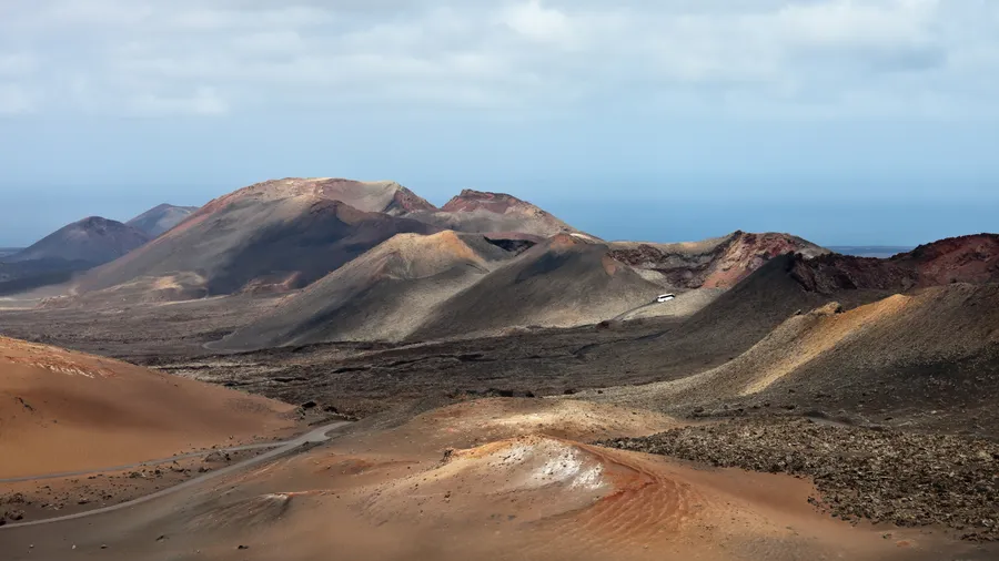
In Timanfaya National Park you cannot hike freely: access and movement are only allowed on authorised roads and paths, and the visiting rules ask you not to leave them. Of the walking routes, only the long coastal route is open and unguided; the Tremesana Route and the short coastal route are compulsory guided tours with advance booking.
The long coastal route is linear, 9.75 km and 5-6 hours, high difficulty, with 231 m of cumulative ascent and 252 m of descent, between 5 and 45 m above sea level; it runs from Playa de la Madera (Tinajo) to Punta del Jurado and ends at El Golfo. You walk among lava flows that make progress difficult, so you need boots, water and food, sun protection and a windproof layer; on many stretches there is no phone signal and rescue is only possible on foot.
The Tremesana Route is guided, linear, 3.5 km and 3 hours, low difficulty, with 38 m of ascent and 84 m of descent, between 125 and 217 m above sea level, and is offered five days a week. It requires booking at least 25-30 days in advance through the booking centre, it is free, aimed at over-16s, with closed footwear compulsory and a meeting point at the Plaza de los Remedios in Yaiza 15 minutes before departure. The short coastal route is guided and requires booking, linear, 2 km and 2.5 hours, medium difficulty, with 111 m of ascent and 101 m of descent, and runs from El Golfo to the area near Playa del Paso. Both guided routes may be cancelled if there is a weather alert for adverse conditions.
The Route of the Volcanoes is not a walking trail: it is a bus tour through the inside of the park that needs no permit, only the Montañas del Fuego Tourist Centre ticket, sold online for a set day and time at €30 per adult (free up to age 6); it includes parking, the geothermal demonstrations on the Islote de Hilario and the route.
2026 opening hours: the Mancha Blanca Visitor and Interpretation Centre is open every day from 9:00 to 16:00; the Montañas del Fuego Tourist Centre from 9:00 to 17:00 according to the park, although the CACT, which run it, sell tickets from 9:00 to 15:45; and the Echadero de los Camellos from 9:00 to 15:00. The park is reached via the LZ-67 road between Tinajo and Yaiza; no public transport enters the park, but there are buses to Tinajo and Yaiza (for example, Line 16 Arrecife–La Santa) and from there you can take a taxi. You can see the full visit on the Timanfaya National Park page.
Picuco can help you
Does something here catch your eye?
Tell us.
Write to us on WhatsApp or email: we answer questions, find the best options and help you sort out the booking.
Write to us
We guide you based on the type of plan you have in mind and reply by WhatsApp or email.
Caldera Blanca: the crater of the Parque Natural de Los Volcanes
Caldera Blanca is in the municipality of Tinajo and is not part of Timanfaya National Park: its trail runs through the Parque Natural de Los Volcanes. Access is free and open, with no ticket, permit or booking.
The start and finish point is on the LZ-67 road, kilometre 13, with parking at the end of the dirt track that leaves Mancha Blanca 150 metres after leaving the village in the direction of Timanfaya National Park. That car park is the one the planned regulation will replace with the shuttle bus: non-residents will have to park in the Los Dolores site, in Mancha Blanca, and use the shuttle bus, while residents and authorised companies will have specific car parks in Tinguatón and Montaña Colorada; the Volcán del Cuervo car park closes completely. Intercity Lanzarote already lists the service as line P3 (Los Dolores car park – Volcán del Cuervo – Montaña Colorada), Monday to Sunday every 30 minutes from 10:00 to 16:30; as of 19 November 2026 the start date is still pending and no fare has been published.
If you'd rather do the crater with a guide, there's the volcanic route through Caldera Blanca: a guided 4-5 hour route through the crater and the lava fields, suitable from age 7.
Volcán de La Corona: the northeast, between vineyards and malpaís
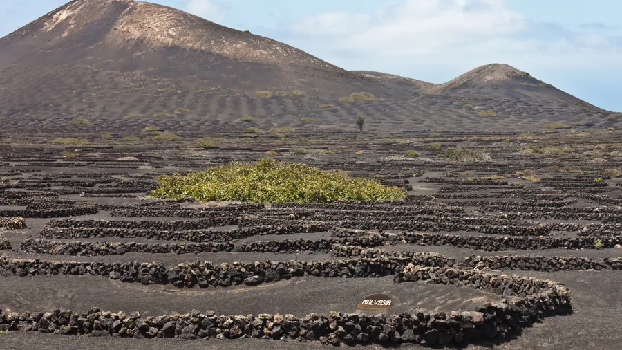
The walking route to the Volcán de La Corona, in Haría, starts at the Ermita de Ye and reaches the volcano: 2.7 km, 2 hours 30 minutes and low difficulty, on a gentle slope up to the summit, with views over the fields of artificial sand mulch on the malpaís. The climb from the chapel is 134 m of elevation gain, on a linear route. The natural monument comprises the volcano, about 600 m high, and the malpaís created by its eruption 21,000 years ago, in the northeast of the island within the municipality of Haría. Signage in the area warns about drone use and moving off the authorised trails.
Without a car, bus line 08 (Arrecife–Yé) passes through Haría and Máguez and terminates at the "Yé" stop; at weekends you have to use line 07 to Máguez and the Taxi-Bus service to reach Ye. By car, Arrecife is about 31.3 km and 35 minutes from Ye.
If you'd rather walk with a guide, there's the volcanic trekking in northern Lanzarote, which covers the Volcán de La Corona and the Famara cliffs with views over the Chinijo Archipelago.
Risco de Famara: the cliff trail
The Risco de Famara can be walked: Turismo Lanzarote describes an 18.6 km, 5-hour route of medium-high difficulty from Teguise to Guinate along the Risco de Famara, without giving elevation gain. The Camino de Los Gracioseros, the old route that connected La Graciosa with Lanzarote along the cliffs, is 4.5 km and of medium to high difficulty depending on whether you're going down or up. The cliff is part of the Parque Natural del Archipiélago Chinijo, protected since 1986 and declared a Special Protection Area for Birds in 1994, in the municipalities of Teguise and Haría.
The stretch between the Casa del Agua and the climb up to Guinate — the Camino de Los Caleteros, between the beaches of Famara and El Risco — has been closed since the landslide of 12 May 2026 on the Gallo slope (Haría), about 25 metres wide and which reached almost down to the coast. As of 19 November 2026, the Cabildo de Lanzarote has not announced its reopening.
If you want to walk in this area with a guide, there's the hiking in La Corona and the Famara cliffs, which combines the climb up the volcano with the walk along the cliffs; check the page for options, durations and prices.
Montaña Roja: the southern crater, next to Playa Blanca
The most common circular route up Montaña Roja, in Yaiza, is about 3.3 km, with around 115 m of cumulative elevation gain, low difficulty and under 2 hours; it suits anyone used to some walking. If you only walk the loop around the crater rim, it is about 3 km and around 1 hour, with about 140 m of ascent in a single steep climb and stretches of loose, slippery trail.
The route starts in the residential streets of western Playa Blanca, next to the base of the volcano (landmark: the phone mast); by car you reach it via the streets off Avenida de Papagayo, such as Calle Francia, Calle de los Claveles or Calle Noruega, and park at the end of the street nearest the volcano. Without a car, Intercity Lanzarote line 30 (Interior Playa Blanca) runs through all of Playa Blanca, from Faro Park to Las Coloradas, with stops at Avenida Papagayo 1 and 2 and at Virginia Park, the closest to the start; it leaves the Playa Blanca bus station every 30 minutes between 06:30 and 22:00 and at 23:00.
If you'd rather climb with a guide, there's the volcanic route on Montaña Roja: 2 to 2.5 hours around the inactive volcano from Playa Blanca, with a professional guide, suitable for all ages and 40 €.
El Golfo, Los Hervideros and Playas de Papagayo: the southwest coast
In El Golfo you can walk around the village and the Charco de los Clicos. Los Hervideros, by contrast, can't be visited inside: access to the viewpoints has been prohibited since December 2021 on the basis of reports warning of the danger, nothing has been done since then and the fences that should prevent access are lying knocked over. The site is still there: it's on the southwest coast, between El Golfo and the Janubio salt pans, and its lava from the 1730-1736 eruptions cooled over the sea, forming caves and tunnels.
In the Los Ajaches Natural Monument, the official Turismo Lanzarote route that includes Playa el Papagayo is the Los Ajaches one: on foot, starting and finishing in Femés, 19 km long and of medium-high difficulty. Driving into the monument costs 3 euros, and non-residents of Lanzarote can only pay by card, physical or on a phone, according to Yaiza Town Council; the beach car park is open from 09:00 to 19:00. There are seven coves, from Playa Mujeres, the longest, to the Caletón de San Marcial, which can only be reached on foot.
If you want to explore the coast with a guide, there's the coastal hiking in Papagayo, a guided 4-5 hour route through the monument that takes in white-sand beaches and coves. In El Golfo, the Lago Verde and Los Hervideros route lasts 3 hours along volcanic trails, with panoramic views of the Lago Verde and the sound of the sea at Los Hervideros; the Los Hervideros viewpoints remain closed, so check on the activity page where the route goes.
Tajaste and the centre: the Tinajo Histórico trail
The official trail no. 8 of the Tinajo Trail Network, "Tinajo Histórico", passes through Tajaste: circular, about 7.8 km, around 3 hours, low difficulty and suitable for all, with 140 m of positive elevation gain; it starts and finishes at the Plaza de Tinajo and its route enters the fertile plain from which you can see the Tinache mountain, next to Tajaste. The municipal page confirms the low difficulty, the approximate 3 hours, parking south of the square opposite the pharmacy and that it is not a Protected Natural Area. Tajaste is at 248 m above sea level, in the flat area between Montaña Tinache and the land leading towards Mancha Blanca, next to the LZ-56 road that links Tinajo with Mancha Blanca.
If you'd rather walk with a guide in this area, there's the hiking through the volcanic landscape of Tajaste, a guided 3 to 5 hour route among craters and solidified lava with views of Timanfaya National Park.
Weather alerts and risks before you go
The guided walking routes in Timanfaya National Park may be cancelled due to force majeure or a weather alert for adverse conditions (yellow, orange or red alert), according to the booking conditions for the Tremesana Route. Before setting out, check the forecast and the official Aemet alerts for Lanzarote and the status of the route you've chosen.
On volcanic terrain, the park's recommendations call for boots, water and food, sun cream, a cap and a windproof layer, and for knowing the state of the sea and the level of sun exposure; on many stretches there is no phone signal and rescue is only possible on foot.
Guided routes by area
If you'd rather walk with a guide, there are options in several areas of the island. In Timanfaya, a guided 3-4 hour excursion through lava flows and craters with geological and historical commentary, for 45 €: guided hiking in Timanfaya. In Caldera Blanca, a volcanic route through Caldera Blanca of 4-5 hours through the crater and the lava badlands, suitable from age 7. In Montaña Roja, a volcanic route on Montaña Roja of 2 to 2.5 hours, suitable for all ages.
In the north, there's the self-guided hiking on the Volcán de La Corona of 3 to 4 hours, the hiking with children in La Corona of 3.8 km and 3-3.5 hours, and the volcanic trekking in northern Lanzarote of 3 to 8 hours. On the southwest coast, the Lago Verde and Los Hervideros route lasts 3 hours. In Papagayo, the coastal hiking in Papagayo covers the Los Ajaches Natural Monument over 4-5 hours. And in Tajaste, the hiking through the volcanic landscape of Tajaste runs from 3 to 5 hours.
How to choose according to your level and who you're going with
If you don't walk much or you're with children, you have three low-difficulty options: the route to Montaña Roja, about 3.3 km and under 2 hours; the climb to Volcán de La Corona from the hermitage of Ye, 2.7 km and 2 hours 30 minutes; and the Tinajo Histórico trail, a loop of about 7.5 km and around 3 hours, suitable for all ages. For an outing with children, the hiking with children in La Corona guide covers 3.8 km in 3-3.5 hours.
If you want to walk inside Timanfaya National Park without any technical difficulty, the Ruta de Tremesana is guided, 3.5 km and 3 hours, low difficulty and with 38 m of cumulative ascent. For a long-distance challenge, the long coastal route totals 9.75 km and 5-6 hours of high difficulty, and the Risco de Famara traverse from Teguise to Guinate, 18.6 km and 5 hours of medium-high difficulty.
If you'd rather not deal with access or booking, guided routes take care of it: the Ruta de Tremesana and the short coastal route are booked in advance and come with a guide.
Frequently asked questions
Can you hike freely in Timanfaya?
Only on one stretch. The long coastal route is done on your own, while the Tremesana and short coastal routes require a guide and a booking. The long route is linear, 9.75 km and 5-6 hours, with high difficulty.
How much does the Tremesana Route cost and how do you book it?
It costs nothing, but you have to request a place 25-30 days in advance through the booking centre. The meeting point is at the Plaza de los Remedios in Yaiza, 15 minutes before departure.
Is Caldera Blanca inside Timanfaya?
No, it lies outside the national park and its trail runs through the Parque Natural de Los Volcanes. You climb it without paying or booking, and the starting car park is at kilometre 13 of the LZ-67.
Can I walk around Los Hervideros?
No, the viewpoints have been prohibited since December 2021 because of the risk identified in the technical reports. You can see the site from outside, but you can't walk through it.
Which route is the easiest to do with children?
The Tinajo Histórico trail, circular and of low difficulty, is suitable for all. If you'd prefer a crater, the Montaña Roja loop takes under 2 hours and is also low difficulty.
Is any stretch of trail closed right now?
Yes, on the Risco de Famara you cannot pass between the Casa del Agua and the climb up to Guinate since the landslide of 12 May 2026. There is no date for reopening.
Guided hiking in Timanfaya National Park, Lanzarote — A guided 3-4 hour excursion through lava flows and craters, with geological and historical commentary.