The essentials of Valle de Aguas Tuertas

  • • Impossible meanders of the Aragón Subordán River in glacial meadow
  • • Largest glacial plain in the Spanish Pyrenees
  • • Prehistoric dolmens and semi-wild horses
  • • Magical dawn and dusk with mist over the meanders
  • • Access from Selva de Oza (7 km, 2 h on foot)

Description

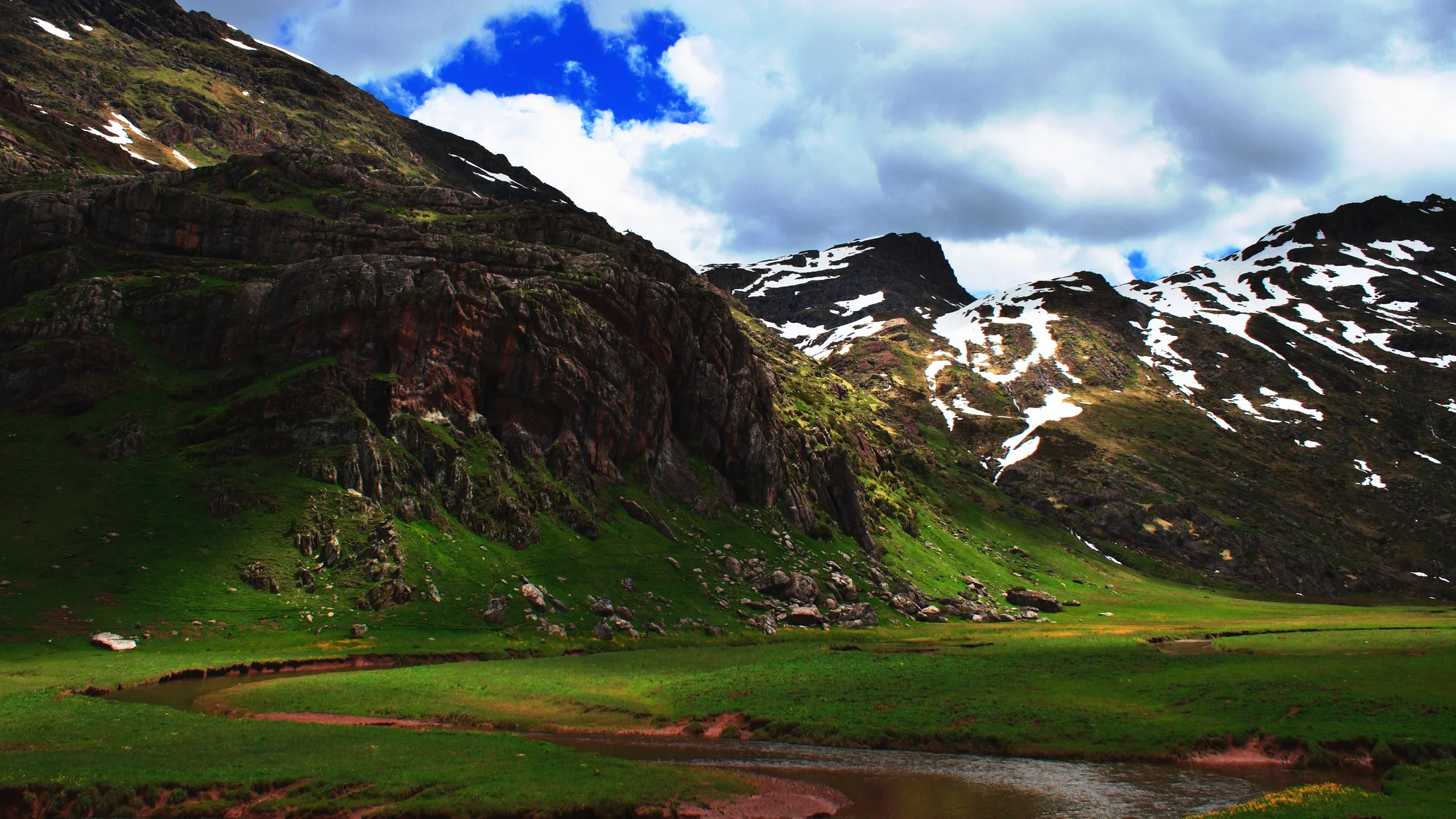
The Valle de Aguas Tuertas is one of the most beautiful and serene landscapes in the Aragonese Pyrenees: a glacial plain of green meadow at an altitude of 1,620 meters where the Aragón Subordán River winds in impossible meanders before disappearing among the mountains. The name comes precisely from those meanders — "aguas tuertas", or twisted waters.

The valley, located in the municipality of Hecho (Valle de Hecho, Huesca), is the largest glacial plain in the Spanish Pyrenees. Surrounded by peaks over 2,000 m with beech and pine forests, it houses prehistoric dolmens, semi-wild horses, and fauna that includes marmots, chamois, and golden eagles.

The most popular access route starts from Selva de Oza (parking) via a 7 km forest track (2 hours on foot). It is also possible to reach it by 4x4 with authorization. Once in the valley, the walk through the meadow among the meanders is flat and magical — one of those places where time seems to stand still.

Aguas Tuertas is especially photogenic at dawn and dusk, when the mist rises from the meanders and the low light illuminates the meadow. In autumn, the colors of the beech forest surrounding the access are spectacular.

Practical information for Valle de Aguas Tuertas

Everything you need to know for your visit to Valle de Aguas Tuertas

How to get there
To reach the Valle de Aguas Tuertas, the most common option is to take the A-2606 road from the town of Jaca, which is the nearest city and has public transport services. From Jaca, you can access by car or bus to the start of the trail leading to the valley. The road is accessible for most of the year, although there may be restrictions in winter due to snow. It is advisable to check road conditions before traveling, especially in the winter season.
Geography
The Valle de Aguas Tuertas is situated at an altitude of 1,620 meters, in the heart of the Aragonese Pyrenees. This valley is a glacial plain that features a landscape of green meadows and meanders formed by the Aragón Subordán River, which winds through the plain. The geology of the area is marked by glacial erosion, which has resulted in formations such as moraines and prehistoric dolmens. The presence of sedimentary and metamorphic rocks is common, contributing to the diversity of the landscape. The surrounding mountains, which exceed 2,500 meters, provide a notable contrast to the plain, creating a diverse and attractive natural environment for visitors.
Flora & Fauna
The flora of the Valle de Aguas Tuertas includes grassland meadows, shrubs, and some conifer species in the higher areas. Notable species include black pine and fir, as well as wildflowers such as edelweiss and various orchids. Regarding fauna, the valley is home to emblematic species such as the bearded vulture, the griffon vulture, and deer. It is also possible to observe semi-wild horses, which add a cultural element to the landscape. The diversity of habitats in the valley allows for the coexistence of numerous species, both on the ground and in the air.

Things to do in Valle de Aguas Tuertas

Find the best plans and things to do in Valle de Aguas Tuertas

Accommodations in Valle de Aguas Tuertas

Best accommodation options in Valle de Aguas Tuertas

Frequently asked questions about Valle de Aguas Tuertas

Get answers about Valle de Aguas Tuertas

From Selva de Oza (Valle de Hecho) via a 7 km forest track. On foot: 2 hours. By 4x4: with authorization from the Park. You cannot reach it by regular car.
The forest track is easy but long (7 km). Once in the valley, the walk is completely flat. Minimal elevation change.
June to October. Dawn for mist over the meanders. Autumn for the colors of the beech forest. Winter closed due to snow.