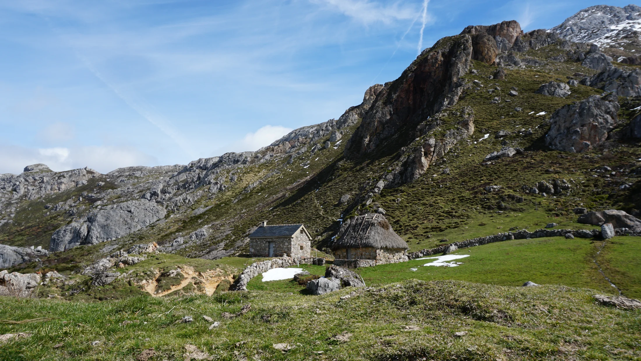
The Parque Natural de las Ubiñas-La Mesa covers 45,162 hectares at the heart of the Asturian Cantabrian Range, spanning five municipalities: Quirós, Teverga, Proaza, Santo Adriano, and Yernes y Tameza. It is one of the largest nature parks in Asturias and, since 2003, a UNESCO Biosphere Reserve. The terrain drops sharply from valley floors at around 700 metres to the summit of Pico Ferreirúa at 2,192 metres. The Trubia and Teverga rivers, along with their tributaries, have carved over millions of years the gorges that define the park's interior landscape.
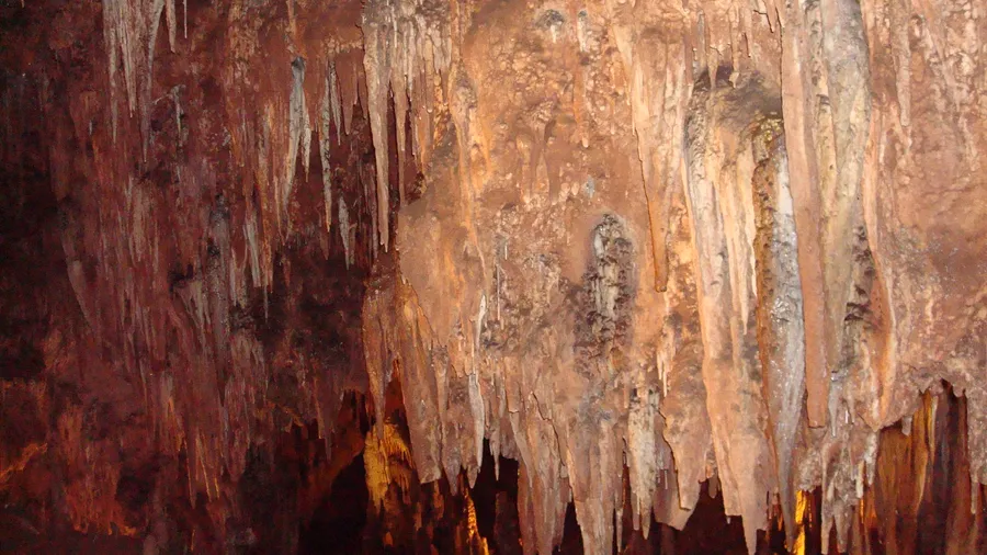
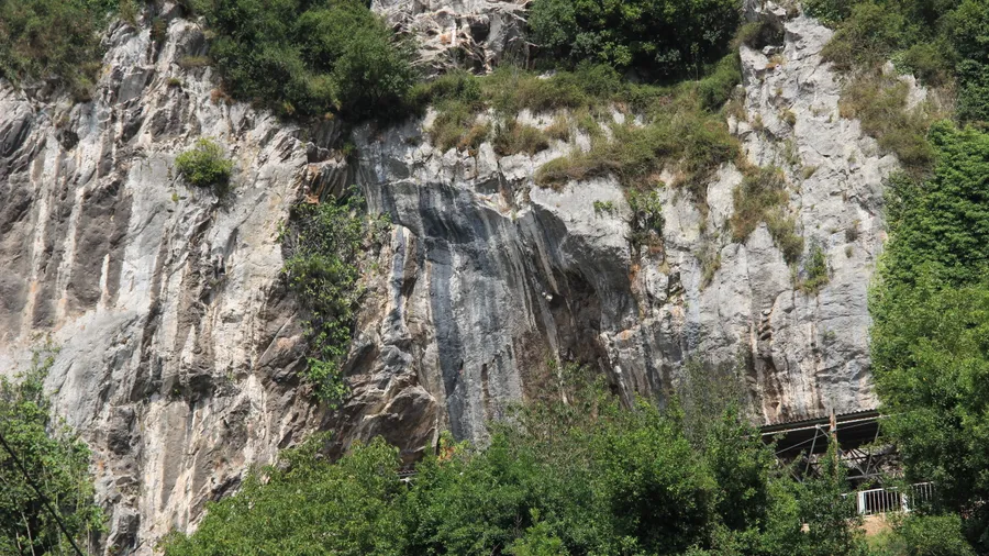
The limestone and quartzite geology produces dramatic landforms. The Hoces del Trubia — a five-kilometre gorge with vertical walls up to 500 metres high — forms the most striking gateway into the park. On the high plateau of La Mesa, a gently undulating erosion surface contrasts with the alpine peaks to the west, where Quaternary glaciers left behind cirques and basins now filled by sphagnum bogs. These peatlands act as carbon sinks and water reservoirs, feeding cold streams that run through beech forests on north-facing slopes. The limestone karst adds sinkholes and caves, some with active speleothem growth, that hold scientific and speleological interest.
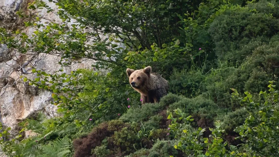
The park holds the highest recorded density of Cantabrian brown bear in Asturias, with regular presence in the western massifs. Iberian wolf occupies the least disturbed territories. Among birds, the Cantabrian capercaillie — a critically endangered subspecies — finds one of its last refuges here, tied to mature beech forests and high-altitude heathland. Golden eagle, peregrine falcon, and griffon vulture are common over limestone cliffs. In the rivers, Eurasian otter and Pyrenean desman — a semi-aquatic insectivore endemic to the Iberian Peninsula — signal water quality. Cantabrian chamois grazes on grasslands above 1,600 metres and moves to north-facing slopes in spring as snow retreats.
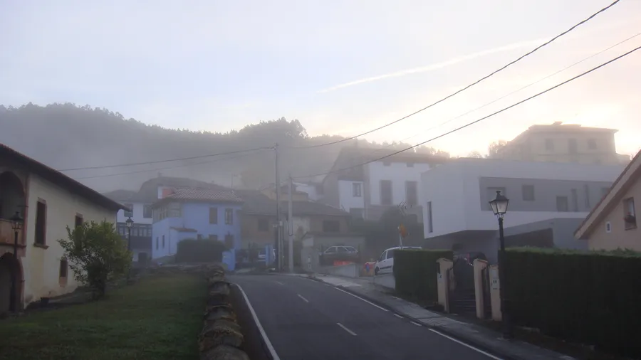
Vegetation follows a clear altitudinal gradient. Riverside alder, ash, and willow line the streams at valley floors. On north-facing slopes, centuries-old beech forest creates a dense canopy where autumn leaf-fall carpets the ground in copper. On sunnier aspects, oak woodland and heather moor alternate with gorse. Above 1,600 metres, mat-grass swards of Nardus stricta and Calluna heathland that turns purple in August cover the summits. Protected yew trees appear on inaccessible limestone outcrops, some centuries old. Villages such as Caranga, Tuñón, and Entrago preserve vernacular Asturian architecture — granaries on stone stilts, arcaded farmhouses, water mills — alongside a cattle-farming tradition that has shaped this landscape for centuries. Over 200 km of marked trails connect settlements with the park's key natural features.