Why These Waterfalls and Walls Deserve Your Next Descent
If you are planning rappel in Spain, you’re in for a spectrum of vertical descents that range from volcanic ravines to pine-shadowed Pyrenean gorges. This list curates 10 outstanding sites where you can lower into rock, water and wind with clarity and care. We focus on options where access, safety, and seasonal conditions are known, because choosing the right line matters more than ticking off a name. Cool spray on your face at a safe stance beats a risky edge any day.
You’ll find practical detail for each spot: parking and approaches, rappel heights, typical flow, best season, permits, estimated time, guided options, and price ranges. We picked places that combine scenery and logistics, from Mediterranean canyons to granite steps in the northwest. We also balanced levels so mixed groups can decide who goes where and when.
Use this article as a planning tool, not a substitute for a topo or local guidance. For weather and flow, consult official sources like AEMET (Agencia Estatal de Meteorología) and basin authorities, and for access rules, check local park pages (e.g., Junta de Andalucía for Cazorla, Gobierno de Navarra for Pyrenean canyons, Cabildo de Tenerife for ravines). When in doubt, hire a qualified guide; you’ll learn faster and reduce risk. The scent of wet rock and thyme on a spring breeze is a lovely reward when the plan is solid.
What’s inside:
- A ranked list of 10 sites with key facts for vertical descents in Spain
- Notes on permits, conservation areas, and typical conditions
- A map workflow to visualize coordinates, access, and difficulty
- A decision checklist, gear guidance, and a clear FAQ on rappel safety and bookings
Scan it, pick a descent suited to your skills, then confirm specifics through local authorities and guides. For curated experiences, you can compare guided canyoning Spain options and prices with verified operators on Picuco. Choose well, go with a margin, and keep the landscape—and those who care for it—in mind.
Picuco te puede ayudar
Does something here catch your eye?
Tell us.
Write to us on WhatsApp or email: we answer questions, find the best options and help you sort out the booking.
Rappel in Spain: 10 Waterfalls and Walls for Vertical Descents
1) Barranco de Guayero (tenerife): volcanic steps above the Atlantic
Black basalt walls and dry falls lead you toward the ocean cliffs, where warm wind smells faintly of salt. This ravine lies in the municipality of Guía de Isora (southwest Tenerife), with approaches from villages like Chío via the TF-38 and local lanes; park only at established pull-outs to avoid fines.
- Location and access:
- Southwest Tenerife, Guía de Isora.
- Approach 20–40 min on volcanic terrain; scree sections demand steady footing.
- Parking: limited roadside bays; never block farm tracks.
- Rappels and rope:
- Series of short to mid rappels, many 8–20 m; one or two can reach ~25–30 m.
- Two 60 m ropes cover most variations and add margin for rigging.
- Level and season:
- Dry canyon most of the year; flash-flood risk after rare heavy rain.
- Best Oct–May; avoid summer heat and midday sun.
- Permits and protection:
- Check Cabildo de Tenerife guidance for ravine use and fire risk restrictions.
- Duration:
- 3–5 h depending on group size and exit choice.
- Guided options and prices:
- Qualified local operators offer volcanic canyon descents; expect ~55–95 € p.p. (confirm current prices in Picuco or with your chosen operator).
- Safety and specifics:
- Sharp basalt edges: use rope protectors and robust anchor inspections.
- Loose rock common on ledges—helmets on all day and manage stance spacing.
- Mobile coverage is patchy; carry a whistle and a basic first-aid kit.
2) Barranco de Biniaraix (mallorca): a Mediterranean classic with easy logistics
You descend between ancient stone terraces, where rosemary and citrus drift on warm air after rain. Set in the Serra de Tramuntana (UNESCO-listed), this ravine begins near the hamlet of Biniaraix, just outside Sóller; access is straightforward on paved lanes with signed trailheads.
- Location and access:
- North-west Mallorca, Tramuntana range; trail starts from Biniaraix.
- Approach 20–30 min on cobbled path; good for fit beginners with supervision.
- Parking in Sóller/Biniaraix; arrive early on weekends.
- Rappels and rope:
- Typically a sequence of 6–10 m drops, with a few up to ~15–20 m.
- Two 40–50 m ropes are usually sufficient; ring anchors present on popular lines.
- Flow and season:
- Often dry or low flow; water appears after rain fronts and in late winter.
- Best late winter to spring when pools hold water but flood risk subsides.
- Level and suitability:
- Good for “advanced initiation” with an experienced leader; edges can be polished.
- Permits and rules:
- No specific permit typically required, but the Tramuntana has environmental rules; check Consell de Mallorca notices and fire-risk alerts.
- Duration:
- 3–4.5 h for the descent; shuttle not required.
- Guided options and prices:
- Local canyoning Spain operators run outings most of the year; ~50–85 € p.p., depending on water and group size.
- Safety and logistics:
- Polished limestone is slick—wear shoes with sticky soles.
- Avoid days after heavy rain; narrow sections can funnel sudden flow.
3) Cañón de Artazul (navarra): technical walls in the western Pyrenees
The rumble of a hidden waterfall grows as you edge toward a clean, exposed stance. Artazul sits above the Arteta springs in the Valle de Ollo, about 25 km from Pamplona; park near the Manantial de Arteta facilities (signed) and follow marked paths.
- Location and access:
- Navarra, Sierra de Andía; trailhead near Arteta spring complex.
- Approach 30–45 min; return 30–40 min.
- Rappels and rope:
- Sustained progression with a major final cascade around 40–45 m.
- Two 60 m ropes are standard; modern bolts on key stations, but inspect.
- Difficulty and exposure:
- Technical canyon with exposed starts and possible awkward re-belays.
- Solid intermediate to advanced skills required, including team rigging.
- Flow and season:
- Highly rain-dependent; after storms, currents and hydraulics can be serious.
- Best summer to early autumn in low-flow windows; always check recent rainfall.
- Permits and coordination:
- Rules vary by season; consult Gobierno de Navarra and local councils (Concejo de Arteta) for current access notes.
- Duration:
- 4–6 h, efficient teams may move faster.
- Guided options and prices:
- Regional specialists guide this canyon in season; ~80–130 € p.p., book a week ahead in peak times.
- Safety notes:
- Cold water even in summer; bring neoprene and gloves.
- Backup anchors and knot passes are common—carry extra slings and maillons.
4) Barranco del Río Verde (otívar, Granada): turquoise pools and Mediterranean flow
Sunlight scatters across emerald potholes as cicadas buzz above white limestone. Río Verde lies near Otívar in the Sierras de Tejeda, Almijara y Alhama; access from the N-340 via Almuñécar or from A-4050 (Carretera de la Cabra) toward the “Junta de los Ríos” control points.
- Location and access:
- Granada province, between Almuñécar and Otívar.
- Approaches vary: shuttle setups or longer circulars; parking may be regulated.
- Rappels and rope:
- Classic sequence of 8–15 m cascades, slides, and jumps; longest around ~12–15 m.
- Two 40–50 m ropes usually suffice; steel anchors at popular drops.
- Flow and season:
- Perennial but moderate flow; strongest in late spring after rains.
- Best April–October; avoid thunderstorms and check local advisories.
- Level:
- Suitable for fit beginners with a guide, and great fun for intermediates.
- Permits and regulation:
- In a protected area; some access points are controlled—check Diputación de Granada and park notices.
- Duration:
- 4–6 h depending on route and crowding.
- Guided options and prices:
- Daily guided trips in season; ~50–90 € p.p., including wetsuit and shuttle in many cases.
- Safety and specifics:
- Deep pools hide boulders—never jump without visual inspection.
- Slick travertine around cascades; manage clips and stance to avoid slips.
5) Barranco de Núria (girona, Pyrenees): alpine water and sustained drops
The cold, tea-colored stream hums under firs as mist beads on your sleeves. The Núria canyon sits above Queralbs in the eastern Pyrenees; arrive by rack railway (cremallera) from Ribes de Freser or hike in on the GR-11 to the start zones.
- Location and access:
- Vall de Núria, Girona province.
- Access via
cremallera(tickets/time-table) or 1.5–2 h hike; exit returns you toward Queralbs.
- Rappels and rope:
- Many 8–20 m drops with a few larger features; sustained progression.
- Two 60 m ropes recommended for flexibility and contingency.
- Climate and flow:
- Snowmelt and storms drive flow; cold water year-round.
- Best late summer to early autumn in stable weather; avoid peak melt.
- Level and duration:
- Intermediate–advanced; swift-water management needed in higher flows.
- 5–7 h; moving efficiently keeps you warm.
- Permits and norms:
- Check local municipal rules and Parc Natural notices; respect signage and closures.
- Guided options and prices:
- Experienced guides operate seasonally; ~75–120 € p.p., book in advance for weekends.
- Safety notes:
- Dress for cold: full neoprene, hood, and gloves; bring hot drink in a thermos.
- Exits are committing; know the escape points and monitor group energy.
6) Barranco de Barrosa (bielsa, Huesca): sculpted walls of the central Pyrenees
Pine resin and cold spray mingle as the canyon narrows between grey-gold schist. The Barrosa valley lies near Bielsa, with trailheads close to Parzán on the A-138; the approach follows a well-trodden path before you drop into the streambed.
- Location and access:
- Sobrarbe region, Huesca; start near Parzán.
- Approach 15–25 min; exit 20–30 min back to the valley path.
- Rappels and rope:
- Sequence of 10–20 m cascades with sculpted basins; occasional tight starts.
- Two 50–60 m ropes are a good standard; anchors are generally solid but varied.
- Flow and season:
- Stronger in late spring; cold water even in heat waves.
- Best summer to early autumn; avoid spates after storms.
- Level and duration:
- Intermediate; swift-water awareness required in higher flows.
- 3–5 h depending on pace and water.
- Permits and notes:
- No special permit usually required; check comarca advisories and fire-risk closures.
- Guided options and prices:
- Local guides in Bielsa and Aínsa valleys; ~65–110 € p.p. depending on section and flow.
- Safety tips:
- Hydraulics form under certain falls; set guided-rap lines and keep communication tight.
- Water is cold—use 5 mm neoprene and consider gloves for grip.
7) Pozo de los Humos (salamanca): thunderous drop for viewers and specialists
A plume of mist rises from a 50 m fall that roars like a passing train. This famed waterfall sits between Masueco and Pereña de la Ribera in Arribes del Duero Natural Park; signed viewpoints are accessible by short walks from both villages with designated parking.
- Location and access:
- Province of Salamanca; viewpoints from Masueco and Pereña sides.
- Easy approaches on marked trails; barriers protect cliff edges.
- Rappel feasibility:
- Vertical descents Spain specialists occasionally abseil the cliff, but only with explicit authorization from the Natural Park and municipalities.
- Lines vary by side and water; anchors are not public infrastructure—temporary rigging may be used by permitted teams.
- Flow and season:
- Peak flow in winter–spring; summer can be low.
- Spray makes edges slick; wind can swing ropes.
- Level and duration:
- Advanced only, due to exposure, public presence, and regulation complexity.
- Time on-site 2–3 h plus approaches; contingency plans essential.
- Permits and enforcement:
- Strictly regulated area; unauthorized descents risk fines and closures.
- Guided options and prices:
- When permitted, specialized operators may run projects; prices vary widely—expect advanced pricing (100 €+ p.p.) and long lead times.
- Safety and etiquette:
- Expect onlookers—manage rope fall lines and keep a low visual impact.
- Confirm closure notices with Castilla y León park authorities before any plan.
8) Salto del Sallent (rupit, Barcelona): a weekend-accessible big wall
The falls ribbon off a high lip into the Collsacabra cliffs as swallows knife through spray. Located by Rupit i Pruit, about 100 km from Barcelona, the viewpoint trail is popular; parking is signed near the village with a short walk to the rim.
- Location and access:
- Osona, Barcelona province; well-signed paths from Rupit.
- Approach 15–25 min; public foot traffic common.
- Rappels and rope:
- A big waterfall of roughly 90–115 m depending on line and season.
- Commonly done in multiple pitches; plan for 2×60–2×70 m ropes for safe rigging and retrieval.
- Flow and season:
- Strong after rains in spring/autumn; summer often a trickle.
- Wind exposure at the lip can complicate rope control.
- Level and duration:
- Advanced; big-wall stance management and multi-pitch transitions required.
- 3–5 h on the line plus setup and crowd management.
- Permits and land:
- Confirm with Rupit i Pruit municipality and landowner rules; respect closures and nesting seasons posted by local authorities.
- Guided options and prices:
- Experienced outfits run it when conditions and permissions align; ~90–150 € p.p.
- Safety and etiquette:
- Spectators near the rim—use clear signage/tape for the fall zone.
- Build abrasion protection and knot pass plans; avoid windy days.
9) Cascada del Caozo (valle del Jerte, Cáceres): polished granite and spring water
Cherry blossoms scent the air in spring as water veils over dark granite. The Caozo waterfall sits near Valdastillas in the Jerte Valley; a short, well-built path leads from a small parking area to the falls.
- Location and access:
- Extremadura, Jerte Valley; signed road from Valdastillas.
- Approach 10–15 min on stone steps and walkways.
- Rappels and rope:
- Rappelling is possible on low-flow days via side lines of ~25–30 m.
- Two 50–60 m ropes allow flexible positioning to avoid the main sheet.
- Flow and season:
- Strongest in spring with snowmelt and rains; summer reduces to manageable levels.
- Slick rock year-round; algae forms on shaded slabs.
- Level and duration:
- Intermediate–advanced due to exposure, visitors, and variable anchors.
- 1.5–3 h including setups and crowd pauses.
- Permits and protection:
- Environmental restrictions apply in peak seasons; check Valle del Jerte tourism board and local ayuntamiento for current rules.
- Guided options and prices:
- Select operators run seasonal descents; ~55–95 € p.p., confirm when water is low.
- Safety and local advice:
- Avoid peak blossom weekends when paths overflow with walkers.
- Protect vegetation at stances; do not trample moss or cut branches.
10) Borosa River Falls (cazorla, Jaén): protected waters and selective lines
Water glows green under limestone walls as trout flick through sunlit pools. The Borosa is a signature hike in the Parque Natural de Cazorla, Segura y Las Villas; access from the La Iruela area, with signed parking at the visitor center for the classic route.
- Location and access:
- Jaén province; start from the Borosa trailhead near the trout hatchery.
- Approach on the well-known path toward Cerrada de Elías and upstream features.
- Rappel feasibility:
- Standard hiking areas, walkways, and signature cascades are not open to abseiling.
- Limited vertical lines on upper tributaries and certain falls may be authorized case-by-case by park authorities.
- Flow and season:
- Perennial river; higher flows winter–spring.
- Best to consider late summer or autumn for any permitted verticals.
- Level and duration:
- Intermediate for permitted short drops; advanced planning due to regulation and environmental sensitivity.
- 4–7 h if combining hike + select descents.
- Permits and enforcement:
- Strict regulation by the Junta de Andalucía; always secure written authorization and respect fishing-reserve rules.
- Guided options and prices:
- Park-qualified guides lead allowed routes; ~60–110 € p.p., depending on scope.
- Safety and combinations:
- Ideal plan: hike to scenic points, then tackle a permitted side cascade.
- Carry neoprene for cold pools and a discreet kit to minimize impact.
Map of Key Locations
To visualize distances, approaches, and difficulty, build an interactive map with pinned coordinates for each descent, color-coded by level (green: initiation, blue: intermediate, red: advanced). Add layers for parking, approach paths, and regulated areas, and attach notes linking to official resources like park notices, municipal pages, and weather (AEMET). Use the map to check shuttle needs, confirm trailheads, and plan time windows around daylight and forecast. Before you go, re-check access updates and any temporary closures, and export an offline copy to your phone in case coverage drops.
Choose the Right Descent: Level, Safety, and Logistics
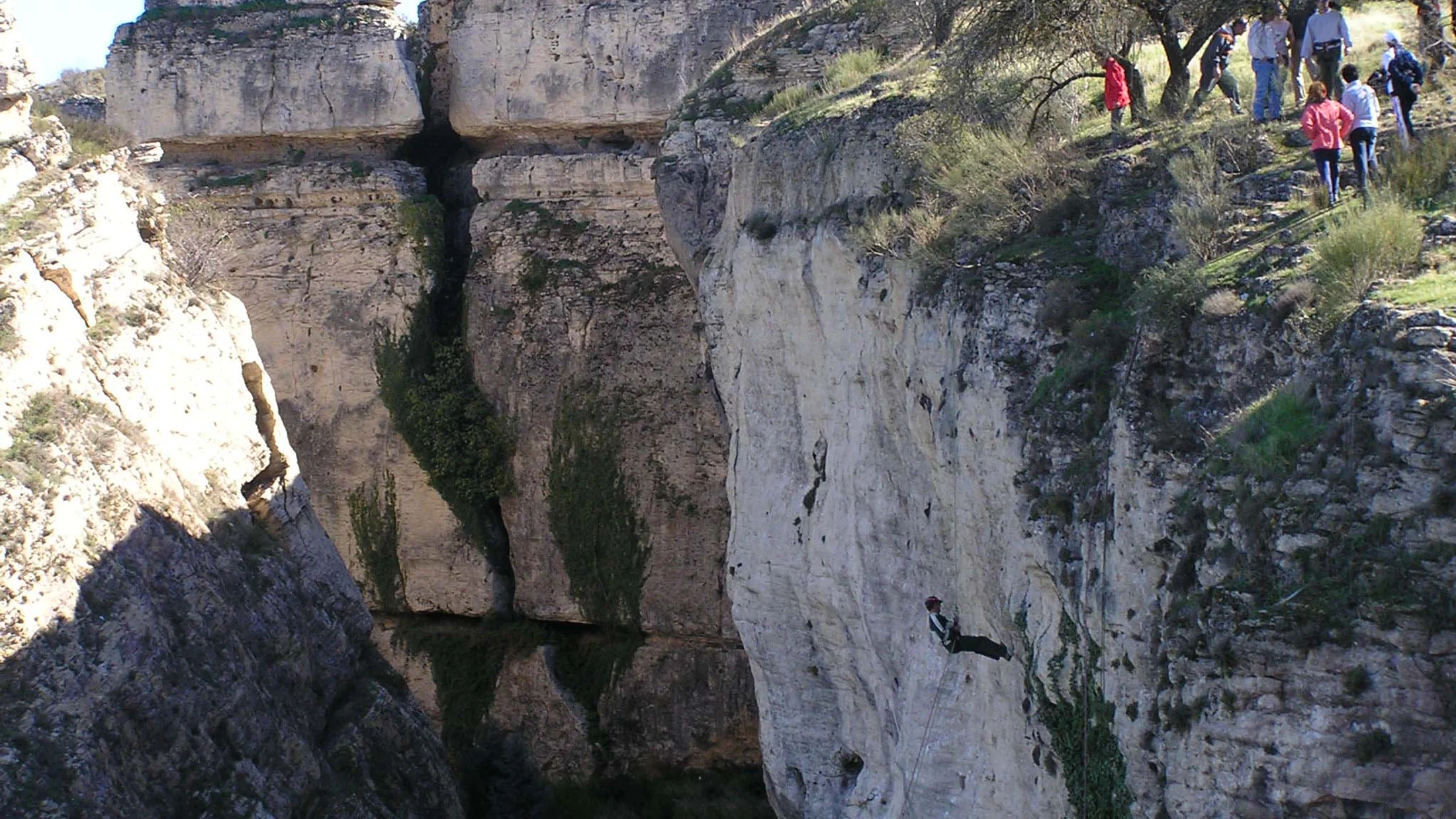
Match the descent to your team, not your ambition. Start with honest self-assessment: who can rig, who can manage a stuck rope, and who keeps calm in cold water? Then read the canyon “data sheet” carefully—height, number of drops, exposure (how airy or committing it feels), typical flow, anchors, and escape points. One cool, smooth outing beats a hero story with a rescue call.
Key checks before you commit:
- Team and skills:
- Can two people build and evaluate anchors?
- Is at least one person proficient with releasable systems and guided rappels?
- Route and conditions:
- Longest drop length and rope plan (two ropes = retrieval and redundancy).
- Flow forecast: snowmelt, recent rain, dam releases (consult basin authorities).
- Temperature: cold water and shade demand thicker neoprene and faster systems.
- Safety systems:
- Releasable master point for each cascade.
- Rope protection for edges; spare maillons and slings.
- Communication plan: whistles, simple hand signals, charged phones in dry bags.
- Escapes and timing:
- Identify exits beforehand and carry a printed topo.
- Daylight margin: plan to be out at least 1 hour before dark.
- Permits and regulation:
- Confirm rules with park or municipality; some sites require written authorization or seasonal closures.
- Transport and shuttles:
- Parking legality and shuttle logistics; avoid illegal roadside stops.
For mixed groups (beginners + advanced), choose canyons with optional bypasses or split the day: half the team completes a shorter section with a guide while advanced climbers add extra pitches. Always keep the slowest team member’s comfort as the benchmark. If your plan feels “tight,” it’s not the right day; pick an easier line and come back stronger.
Essential Gear and Guided Options
A solid kit transforms a vertical descent from sketchy to smooth. At minimum, bring:
- Personal gear:
- Canyon harness with low attachment point, locking carabiners, and a descender (e.g., figure-eight or canyon-specific device).
- Helmet, canyoning shoes with sticky soles, gloves.
- Wetsuit (3–5 mm) and neoprene socks for aquatic canyons; wind layer for dry ravines.
- Team gear:
- Two ropes sized to the longest drop plus margin, rope protectors, prusiks, and progress-capture options.
- Slings, rings/maillons for backup anchors, knife, whistle, first-aid kit, headlamp.
- Dry bag with spare warmth, snacks, and a printed topo or route notes.
You can often rent wetsuits, harnesses, helmets, and even ropes from local operators; buy your own descender, gloves, and footwear for fit and familiarity. Choose a qualified guide by checking certifications (e.g., AEGM or UIAGM/IFMGA equivalents), insurance coverage, group ratios, and recent route reports. Expect ~45–75 € p.p. for half-day initiation canyons and ~80–140 € p.p. for advanced or big-water lines; confirm current prices with your chosen operator. Guided outings add route knowledge, safety margins, and coaching, while also ensuring your plan respects local communities and protected habitats.
Practical Tips for a Smooth Rappel Day
Preparation keeps a good day good. Check weather (AEMET) and recent rain, then look for flow updates from local park or basin authorities the evening before. Pack simple but complete: permit copy, ID, map/topo, first-aid kit, thermal layer, headlamp, extra sling and maillon, and a charged phone in a dry case. Warm up before the first descent, and agree on commands so your team speaks the same language at the edge.
- In protected areas:
- Stay on paths, use existing anchors, and avoid vegetation damage.
- Keep noise low near villages, farms, and nesting cliffs.
- With other users:
- Yield courteously on narrow trails; never block viewpoints with ropes.
- If swimmers are present, pause and manage fall lines to avoid dropping ropes on people.
- Emergency readiness:
- Share your plan with a contact and set a latest return time.
- Carry a whistle and know the local emergency number (112 in Spain).
A respectful pace, quiet rigging, and a clean exit leave only wet boot prints—and goodwill.
Frequently Asked Questions
Is rappel dangerous?
It carries inherent risk, but you can manage it with training, the right gear, and conservative decisions. Use releasable systems, double-check anchors, protect sharp edges, and avoid high flows. A guide accelerates learning and adds safety layers.
Do I need prior experience?
For beginner-friendly canyons with short drops and low flow, no—if you go with a certified guide. For technical or big-water lines, you’ll need experience with multi-pitch rigging, guided rappels, and self-rescue. Practice in controlled settings before committing.
How much does a guided outing cost?
Typical prices range from 45–75 € per person for half-day introductions and 80–140 € for advanced or big-wall descents, depending on season, group size, and gear included. Confirm current prices with your chosen operator or compare options on Picuco.
Do I need a permit or reservation?
Some canyons have seasonal restrictions, quotas, or require written authorization (e.g., specific waterfalls in natural parks). Many popular areas also manage parking or shuttle access. Always check the local park or municipal website and book early in peak season.
What happens with weather and cancellations?
Operators usually monitor forecasts and flows; if conditions turn unsafe, they’ll postpone or switch venues. Read cancellation policies before paying, and keep a “Plan B” nearby with lower flow and shorter commitment.
What equipment is essential?
Helmet, harness, descender, gloves, suitable ropes, slings/maillons, rope protectors, first-aid kit, whistle, and headlamp. In aquatic canyons, add a wetsuit, neoprene socks, and sometimes gloves and hood.
Can children join a canyon descent?
Yes, in select beginner canyons with low flow and short rappels, when led by family-focused guides and within age/weight guidelines. Ask about minimum age, equipment sizes, and route alternatives.
Book your experience — discover active tourism in Spain with Picuco-verified providers.
Conclusion
From volcanic gullies in Tenerife to alpine streams in Núria and the polished steps of the Jerte, these 10 sites sketch a true picture of rappel in Spain: varied, beautiful, and rewarding when matched to your level. Choose a route with generous margins, check permits and flows, and consider a guide if you want skills and serenity in the same day. If you’re ready to plan, explore verified options and current conditions through trusted local sources and Picuco’s activity pages. Go steady, leave no trace, and let the land’s caretakers—and the rock itself—guide your pace.