Why These Day Rides Matter If You Love Dirt Near Madrid
You asked for MTB routes near Madrid you can ride in a day, and this list does exactly that. We’ve selected ten circuits within about 30–90 minutes of the city that balance scenery, access, and ride quality so you can decide fast and roll sooner. Dust hangs sweet on pine needles at dusk as wheels hum over granite and gravel.
To make the cut, each route meets tangible criteria: day-trip feasibility from Madrid; clear access by car or public transport; varied difficulty (beginner to advanced); landscape interest (forests, ridgelines, rivers); maintained or rideable surfaces; and safety, with bailout options where possible. Distances range roughly 20–60 km, with elevation gain (desnivel: total meters climbed) from 300 to 1,800 m, and timing from 1.5 to 7 hours depending on pace. You’ll find approachable urban–suburban options like the Anillo Verde cycling ring, mid-mountain rides in El Pardo or Colmenar, and full-on Sierra de Guadarrama mountain bike days from Cercedilla to the south flank of Cuerda Larga.
We cross-checked official and community sources to ensure credibility and currency: Parque Nacional de la Sierra de Guadarrama regulations and maps, Comunidad de Madrid resources (including Anillo Verde Ciclista), Patrimonio Nacional (El Pardo), municipal mobility pages, and rider communities on Wikiloc, Komoot, and Strava. Always confirm seasonal rules, reservations, and track conditions before you go, as weather and park policies can change. The dry rub of granite under your palm at a viewpoint reminds you why details matter.
Expect practical route cards: where to start, how to get there, when to ride, who it suits (including e-bikes), and what highlights to look for. Many routes have variants to shorten or add spice; we point those out so couples, families, and groups can pick a comfortable line. Ride with local etiquette—yield to hikers and horses, keep speeds controlled on shared paths—and you’ll be welcomed as part of the community that sustains these landscapes. If you want to browse guided options later, keep Picuco in mind to compare certified providers by region and activity.
Picuco te puede ayudar
Does something here catch your eye?
Tell us.
Write to us on WhatsApp or email: we answer questions, find the best options and help you sort out the booking.
How to Read the Route Cards and Plan Your Ride
Each route card uses the same fields so you can compare quickly, choose well, and adapt on the fly. Pine shade smells cool at midday as tires pop over roots in a steady rhythm.
- Level: Beginner, Intermediate, Advanced (technical skill plus fitness). We flag “High-mountain” when weather and exposure meaningfully raise the stakes.
- Distance: Total kilometers for the suggested loop or out-and-back.
- Elevation gain: Total meters climbed (also called “desnivel” in Spanish).
- Time estimate: Typical moving time for a fit rider; add 15–25% for breaks and photos.
- Price: Parking fees, reservation requirements, or tolls if applicable; if unknown or variable, we point you to the official source.
- Best time: Seasons and time-of-day tips considering heat, snow, and trail traffic.
- Ideal for: Solo riders, couples, families with teens, e-bikes, hardtail (front suspension), or full-suspension (dual suspension).
- What to expect: Terrain mix (pista/forest road, singletrack—narrow trail, rock slabs, fast descents), must-see spots, and prudent cautions.
Planning essentials:
- Nutrition and water: Carry 500–750 ml per hour in warm months; refill at towns or known fountains where indicated, but never rely solely on seasonal springs.
- Weather plans: In the Sierra, storms and wind change fast; pack a light shell and thermal layer year-round above 1,600 m.
- Alternatives: We list variants for shortening or skipping the spiciest segments; use them if conditions or energy dip.
- Logistics: Trains and buses often take bikes off-peak; check the Consorcio Regional de Transportes de Madrid schedules the day before. On busy weekends, start early to secure trailhead parking.
- Adapting difficulty: Reduce distance, avoid the most technical singletrack, and choose forest-road detours to match your group’s level.
At a Glance: Distance, Difficulty, and Time
Use this quick comparison to match your time window and energy to the terrain. Heat shimmers over the M-607 while a breeze cools oak shade on the next rise.
| Route | Distance | Elevation Gain | Difficulty | Time | Terrain |
|---|---|---|---|---|---|
| Cercedilla – Fuenfría classics | 32–42 km | 900–1,200 m | Intermediate | 3.5–5 h | Forest roads, some sanctioned singletrack, granite |
| Cuerda Larga (south flank) | 40–55 km | 1,400–1,800 m | Advanced | 5–7 h | High-mountain tracks, rock, exposed weather |
| La Pedriza loop | 25–35 km | 800–1,100 m | Advanced (tech) | 3.5–5 h | Rocky tracks, technical sections, protected zones |
| Anillo Verde segment | 18–32 km | 150–300 m | Beginner | 1.5–2.5 h | Paved/packed paths, urban–suburban |
| El Pardo forest loop | 30–50 km | 300–700 m | Beginner–Interm. | 2–4 h | Forest roads, smooth singletrack, wildlife area |
| El Escorial–Abantos | 28–40 km | 1,000–1,300 m | Interm.–Advanced | 3.5–5.5 h | Steady climbs, forest roads, viewpoints |
| Hoyo de Manzanares–La Najarra area | 30–38 km | 700–1,000 m | Intermediate | 3–4.5 h | Mixed singletrack, fast pistas, granite |
| Rascafría–Valle del Lozoya | 35–48 km | 900–1,200 m | Intermediate | 3.5–5.5 h | Forest roads, riverside paths, shade |
| Colmenar Viejo–Cerro del Aire | 28–36 km | 400–650 m | Beginner–Interm. | 2.5–4 h | Rolling tracks, open views |
| Valdemorillo–Robledal de Chapinería | 34–44 km | 700–950 m | Intermediate | 3.5–5 h | Oak woods, varied singletrack |
Pick beginner options for short, low-stress spins; intermediate for fitness-and-fun rides; advanced for all-day efforts with technical or high-mountain elements. If you have two hours, choose Anillo Verde or a short El Pardo loop; with a full day, Cuerda Larga’s south flank or Abantos deliver big-mountain satisfaction.
Ten Day-trip Mtb Circuits Close to Madrid
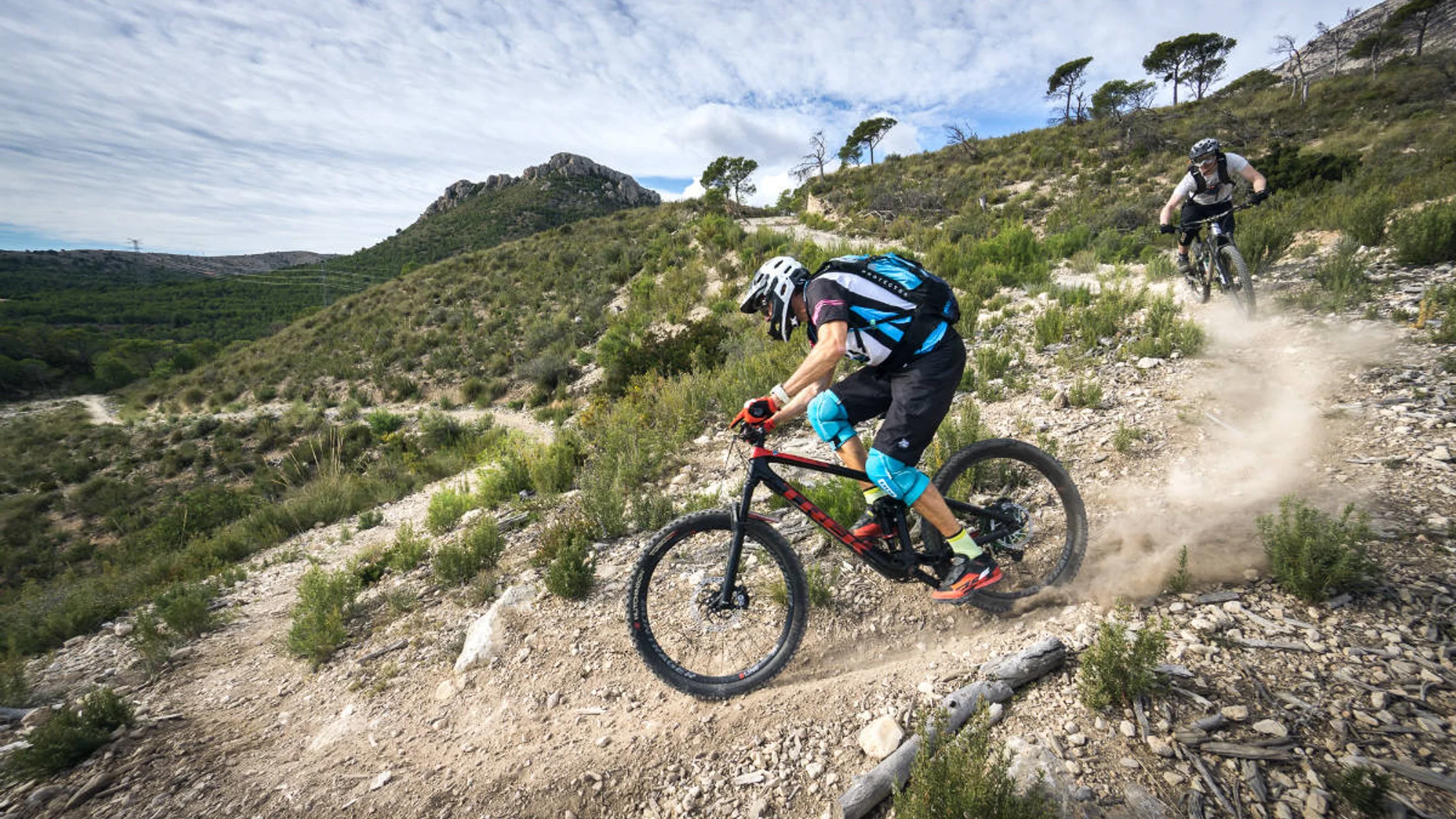
Cercedilla: Classic Singletrack in the Guadarrama Foothills
Start in Cercedilla for a quintessential Sierra de Guadarrama mountain bike day with cool pines and granite textures under wheel. Train whistles fade as the forest swallows city noise in minutes.
- Location and access: Cercedilla station
40.740°N, -4.060°W. By train: CercaníasC-8from Madrid (Atocha/Chamartín) to Cercedilla. By car:A-6toM-614/M-622(60–75 min). - Price/parking: Free street or designated parking; on busy weekends, use train or arrive early.
- Best time: Spring and autumn; winter can bring ice/snow above 1,600 m; summer is rideable with early starts.
- Ideal for: Fit intermediates; e-bikes welcome; families with teens if you shorten distance.
- Route idea: Climb the Carretera de la República (broad forest road) to Puerto de la Fuenfría, add a sanctioned singletrack loop via Marichiva or Collado Ventoso, and return by the Roman Road. Avoid footpaths signed for hikers-only to respect park rules.
- Distance/elevation/time: 32–42 km; 900–1,200 m; 3.5–5 h.
- Highlights: Miradores de los Poetas, old-way stonework, shaded fountains (seasonal—don’t rely on them).
- Tips: “Cercedilla MTB route” searches surface many variants; confirm they remain within authorized bike trails in the Parque Nacional. Wet roots and polished granite demand smooth braking and neutral body position.
Why it stands out: It’s one of the most convenient MTB routes near Madrid with true mountain feel, clean logistics, and the option to bail to Cercedilla by multiple pistes if weather turns.
Cuerda Larga (south Flank): A Full-day High-mountain Challenge
This is a big Sierra de Guadarrama MTB day skirting the famed ridge between Navacerrada and Morcuera on the sunnier, slightly more rideable south side. Wind tastes of stone and sky above the tree line.
- Location and access: Start from Puerto de Navacerrada or La Barranca (
M-607>M-601; 75–90 min). Public transport toPuerto de Navacerradacan be seasonal; confirm schedules with the Consorcio. - Price/parking: Parking often fills early on weekends; arrive pre-9:00. No fee on public lots, but restrictions appear seasonally.
- Best time: Late spring to early autumn; avoid snow, rime, or high winds; never during storms.
- Ideal for: Advanced riders with solid fitness and technical confidence; e-bikes only with ample battery and thermal management.
- Route idea: Climb from La Barranca to Collado del Piornal on forest roads, contour below Cabeza de Hierro on south-side tracks, and link toward Puerto de la Morcuera before returning via lower-elevation pistes.
- Distance/elevation/time: 40–55 km; 1,400–1,800 m; 5–7 h.
- Highlights: Huge panoramas over the Manzanares basin, ibex sightings, big-gravel descents.
- Safety: Weather exposure is real; bring thermal/wind layer, map/GPS redundancy, and extra calories. Stay off signed hiker-only ridge footpaths; bikes are generally limited to roads and designated tracks inside the National Park.
Why it stands out: It’s the high, wild side of day mountain bike routes Madrid riders dream of—serious, rewarding, and unforgettable when conditions align.
La Pedriza, Manzanares el Real: Granite, Technique, and Iconic Rocks
La Pedriza’s labyrinth of granite domes hosts some of the most technical La Pedriza bike trails—but with strict protection rules you must respect. Sun-warmed stone radiates late-afternoon heat into your palms.
- Location and access: Manzanares el Real (50–60 min by
M-607+M-608). Bus724from Plaza de Castilla stops in town; ride in from there. - Price/parking: Vehicle access to Canto Cochino is capacity-controlled; in peak seasons/weekends a reservation system or closure may apply—check Parque Nacional Sierra de Guadarrama updates. No typical entry fee, but expect controls.
- Best time: Autumn and spring for grip; avoid midday summer heat; winter can be icy/shady.
- Ideal for: Technical riders; advanced hardtail or full-suspension. E-bikes are common but manage torque and traction on rock slabs.
- Route idea: From Manzanares el Real, take the main pista toward Canto Cochino, loop via Collado de los Pastores, and return by authorized forest roads. Skip narrow hiking-only singletracks inside the protected core.
- Distance/elevation/time: 25–35 km; 800–1,100 m; 3.5–5 h.
- Highlights: Views to Yelmo and Torres, polished granite steps, photo-worthy river pools.
- Tips: Run slightly lower tire pressures for grip; walk delicate, eroded sections to reduce impact. Early starts minimize crowding on shared paths.
Why it stands out: Few rutas mountain bike Madrid areas deliver as much character per kilometer—ride it right, tread lightly, and you’ll remember the rock’s rhythm.
Anillo Verde Ciclista: Urban–suburban Segment for Easy Access
The Anillo Verde ciclista Madrid is a 64-km ring of bikeable paths circling the city, perfect for quick spins or building fitness with low logistics. Freshly cut grass and café aromas mingle as you thread parks and neighborhoods.
- Location and access: Multiple entry points; try Casa de Campo to Madrid Río to the north segment near Sanchinarro for a 20–30 km sample.
- Price/parking: Free; on-street parking may be regulated—use Metro/Cercanías to hop on/off the ring.
- Best time: Year-round; avoid rush-hour crossings; night rides feasible with lights.
- Ideal for: Beginners, families with older kids, and anyone wanting day mountain bike routes Madrid can access in minutes. E-bikes very welcome.
- Route idea: Start at Lago de Casa de Campo, follow the signed green ring east/north, and bail at convenient Metro Cercanías stations. Add short dirt detours in Casa de Campo for a bit of MTB flavor.
- Distance/elevation/time: 18–32 km; 150–300 m; 1.5–2.5 h.
- Terrain/services: Paved and compact gravel, frequent fountains, cafés, and bike shops along the way.
- Tips: Expect junctions with roads; ride predictably, use bells near pedestrians, and follow local cycling rules.
Why it stands out: It’s the most accessible of our MTB routes near Madrid and a springboard to fitness or family-friendly rides with zero car time.
El Pardo: Forest Loops on Madrid’s Doorstep
Monte de El Pardo offers rolling forest tracks, wildlife, and quick loops that feel wild just minutes from the city center. Eucalyptus and pine carry a dry, resinous scent as the Manzanares murmurs nearby.
- Location and access: Northern edge of Madrid near El Pardo town; by car from
M-30/M-40toM-612; bus601from Moncloa. - Price/parking: Free, but parking is limited; do not block gates or tracks.
- Best time: Year-round; best in spring/autumn. Summer shade helps; in winter, trails drain well.
- Ideal for: Beginners to intermediates; families (shorter loops); e-bikes; hardtail or gravel bikes also work on many sections.
- Route idea: Loop from Mingorrubio area, follow perimeter forest roads, add short sanctioned singletrack, and return along river corridors.
- Distance/elevation/time: 30–50 km; 300–700 m; 2–4 h.
- Restrictions: Patrimonio Nacional land; stay on authorized tracks, respect signs, and watch for deer and boar at dawn/dusk.
- Variants: Link with Casa de Campo or Colmenar tracks via
M-607service roads to extend or shorten.
Why it stands out: Fast to reach, forgiving terrain, and calming woodland—ideal when you have a morning window and need a nature reset.
El Escorial and Monte Abantos: A Classic Climb with Wide Views
El Escorial’s cobbles and Monte Abantos’ switchbacks pair culture with a stout climb and sweeping summits. The monastery’s slate roofs glint like fish scales when the sun breaks through cloud.
- Location and access: San Lorenzo de El Escorial (50–60 min via
A-6>M-600). Trains (C-3ato El Escorial) plus a short warm-up spin into town. - Price/parking: Town parking regulated; use public lots or park outside the historic core.
- Best time: Spring and autumn; summer heat demands early starts; occasional winter ice near the top.
- Ideal for: Fit intermediates and advanced riders; e-bikes good for repeat climbs; hardtail or full-suspension both fine.
- Route idea: Climb the Abantos “zetas” (zigzags) on forest roads, visit Mirador de los Alerces, then descend via wider pistas to San Lorenzo. Add a second loop if legs allow.
- Distance/elevation/time: 28–40 km; 1,000–1,300 m; 3.5–5.5 h.
- Highlights: Monastery vistas, shaded beech/pine pockets, well-built switchbacks.
- Tips: Weekends get busy; start before 8:30. Control speed on descents near walkers; dust hangs over corners late in summer.
Why it stands out: One of the most balanced Guadarrama mountain bike circuits—big vertical, tidy logistics, and satisfying views in every direction.
Hoyo de Manzanares and La Najarra: Comfortable Loop with Technical Sections
Southwest of La Pedriza, Hoyo’s serrated granite delivers flowy tracks with spicy interludes and easy bailouts. Dry thyme brushes your calves as you crest low granite spines.
- Location and access: Hoyo de Manzanares (35–45 min via
A-6>M-618). Bus611from Moncloa stops in town. - Price/parking: Free roadside parking at trail entries; be considerate near residences.
- Best time: Autumn/spring; avoid heavy rain days—granite gets slick.
- Ideal for: Intermediates looking to sample tech features with escape options; e-bikes fine with careful torque control.
- Route idea: From Hoyo, loop through Dehesa de Moncalvillo, skirt La Berzosa, and sample signed singletrack segments that rejoin forest roads, keeping within permitted trail network.
- Distance/elevation/time: 30–38 km; 700–1,000 m; 3–4.5 h.
- Highlights: Mixed “flow” (smooth, curvy singletrack) and rock steps, broad Med. oak woodlands, glimpses of La Pedriza’s skyline.
- Tips: After rains, avoid cutting corners to protect soils; lower tire pressure slightly for grip. Thunderstorms can build fast in summer afternoons.
Why it stands out: An inviting blend of comfort and challenge with quick access, perfect for refining skills without committing to a high-mountain day.
Rascafría and the Lozoya Valley: Mountain Scenery and Riverside Forests
Rascafría offers classic mid-mountain riding beside clear water and deep shade, with long forest climbs and satisfying returns. The river smells cold and clean where trout hold in shadow.
- Location and access: Rascafría (70–90 min via
A-1>M-604). Interurban buses run from Plaza de Castilla; confirm current line/timetable with the Consorcio. - Price/parking: Free street/lot parking; peak-season parking around recreational areas may be regulated—check municipal updates.
- Best time: Late spring through autumn; winter brings snow/ice near
Puerto de Cotoselevations. - Ideal for: Intermediates; strong beginners for shorter variants; e-bikes very suitable; family options along flat riverside greenways.
- Route idea: Circular from El Paular, climb forest roads toward Morcuera foothills, traverse shaded tracks along the Lozoya, and return via the Puente del Perdón area.
- Distance/elevation/time: 35–48 km; 900–1,200 m; 3.5–5.5 h.
- Highlights: Riverside beech/pine mosaics, monastery grounds (respect access rules), steady climbs with cool shade.
- Tips: Watch for hikers near recreation areas; ride early for quiet trails. Snowmelt can leave mud pockets—ride through, not around, to protect edges.
Why it stands out: It’s a cooling, scenic counterpoint to the city’s heat, with plentiful forest roads and clear wayfinding.
Colmenar Viejo and Cerro del Aire: Close-in Riding with Big Vistas
Colmenar’s open country gives quick rolling rides and far-sky views, a favorite among rutas mountain bike Madrid for weekday spins. Larks spiral over tawny grass as your chain buzzes on the small ring.
- Location and access: Colmenar Viejo (25–35 min via
M-607). CercaníasC-4to Colmenar Viejo station, then short ride to dirt. - Price/parking: Free at trailheads and near the station.
- Best time: Year-round; avoid midday summer heat; windy days can be gusty on ridgelines.
- Ideal for: Beginners pushing distance and intermediates polishing cadence; e-bikes and gravel bikes welcome.
- Route idea: Loop out to Cerro del Aire on rolling pistas, add a viewpoint spur, and weave back on signed tracks toward the Arroyo de Tejada corridor.
- Distance/elevation/time: 28–36 km; 400–650 m; 2.5–4 h.
- Highlights: Big-sky panoramas to the Sierra, quick rolling terrain, wildlife corridors.
- Variants: Shorten with out-and-back to the hill; lengthen by linking to Tres Cantos service roads or toward Soto del Real.
- Tips: Exposed terrain—bring sun coverage and enough water. After rains, small clay patches turn sticky.
Why it stands out: It’s your near-Madrid confidence builder—fast logistics, flexible length, and a satisfying sense of space.
Valdemorillo and the Chapinería Oakwoods: Varied Forest Trails
Sierra Oeste blends oakwoods, granite shelves, and quiet valleys for a ride with character and calm. Sunlight flickers like coins across the robledal as you thread between old stone walls.
- Location and access: Valdemorillo and Chapinería (45–60 min via
M-501/M-600). Buses from Moncloa serve both towns; check the latest timetables. - Price/parking: Free in town approaches; park considerately near residential areas.
- Best time: Autumn and spring; winter rides are fine; after heavy rains, clay holds moisture.
- Ideal for: Intermediates wanting a day out with minimal crowds; e-bikes ideal for layering loops.
- Route idea: Start in Valdemorillo, traverse pistas into the Robledal de Chapinería within the Regional Park of the middle-lower Alberche and Cofio rivers, then loop back on varied singletrack and lanes.
- Distance/elevation/time: 34–44 km; 700–950 m; 3.5–5 h.
- Highlights: Stone-walled lanes, shaded oak canopies, occasional granite ledges, birdlife.
- Tips: Respect private fincas and close gates; when wet, stay centered on muddy stretches to avoid widening trails. Phone service can be patchy—download maps offline.
Why it stands out: A peaceful west-of-Madrid option with authentic countryside vibes and excellent loop potential.
Interactive Map: Start Points and Downloads
Before you head out, open our interactive map to visualize all ten start points, parking suggestions, and quick notes on access and seasonality. The cartographic palette—greens, browns, a blue river thread—calms the pre-ride jitters.
- What you’ll find: Pins for each route with start coordinates, surface types, and difficulty filters (Beginner/Intermediate/Advanced). Tap a route to preview the line and identify water points and scenic stops where relevant.
- GPX downloads: Each pin includes a GPX link you can save to your phone or cycle computer; a brief note tells you when a track deviates onto hiker-only paths so you can stay compliant by choosing the alternate.
- Using it on mobile: Pinch to zoom, toggle the difficulty filter, and use “Open in app” to send the route to Komoot or Wikiloc. Save offline if cell coverage is uncertain.
- Using it on desktop: Compare routes side-by-side, print a simple cue sheet, and share start points with your group in one click.
- Why it helps: You pick a ride faster, avoid surprises at trailheads, and arrive with a backup in case weather, closures, or energy levels nudge you to a variant.
Check the map the night before to align expectations and confirm transport/parking, then start early to own the quiet hour.
Choose the Right Route for Your Level and the Season
Match today’s energy and conditions to a route, then you’ll enjoy every pedal stroke. Cool dawn air beads on your top tube before the first climb warms your shoulders.
- Skill level:
- Beginner: Anillo Verde segment; El Pardo short loop; Colmenar (short). Prioritize wide forest roads and predictable surfaces.
- Intermediate: Cercedilla classics; Hoyo de Manzanares; Rascafría; Valdemorillo. Mix of climbs and light technical features.
- Advanced: Cuerda Larga south flank; La Pedriza; Abantos big loop. Combine fitness, bike handling, and mountain judgement.
- Fitness window:
- 1.5–2.5 h: Anillo Verde; El Pardo short; Colmenar short.
- 3–4.5 h: Cercedilla medium; Hoyo standard; Rascafría compact; Valdemorillo compact.
- 5–7 h: Cuerda Larga; Abantos extended; La Pedriza tech day.
- Season:
- Winter: Favor El Pardo, Anillo Verde, Colmenar; watch for ice in shaded Sierra routes.
- Spring: Prime time almost everywhere; trails firm up; snow lingers high—carry layers.
- Summer: Start at sunrise; prioritize shaded forests (Rascafría, Cercedilla); avoid exposed midday ridges; carry extra water.
- Autumn: Ideal grip and temps; early sunsets—plan turnarounds with daylight buffer.
- Weather factors:
- Mud: Ride through the center of puddles to protect trail edges; avoid clay-heavy sectors in Valdemorillo after big storms.
- Snow/wind: Skip high-mountain lines (Cuerda Larga) in strong winds or snow; choose lower, wooded routes instead.
Make your choice, screenshot the key data, and set a conservative turnaround time to keep the day enjoyable.
Transport, Parking, and Access from Madrid
Reaching dirt fast is half the fun and keeps the day relaxed. Brake rotors ping softly as they cool in a quiet trailhead lot at sunrise.
- Car:
- Typical drive times: 25–35 min (Colmenar, El Pardo); 45–60 min (Hoyo, Valdemorillo, El Escorial); 60–90 min (Cercedilla, La Pedriza, Rascafría, Navacerrada).
- Parking: Use official lots or marked roadside pullouts; never block emergency gates. Some areas (La Pedriza, Navacerrada) enforce capacity controls on busy days; arrive early.
- Costs: Most trailhead parking is free; town centers may have regulated zones—check municipal signage.
- Train (Cercanías):
- Cercedilla via
C-8; El Escorial viaC-3a; Colmenar Viejo viaC-4. Off-peak carriages accommodate bikes; platforms display bike-friendly cars. - Tips: Avoid peak commuter hours; secure your bike; confirm weekend/holiday schedules with the Consorcio Regional de Transportes de Madrid.
- Cercedilla via
- Bus:
- Manzanares el Real/La Pedriza via
724(Plaza de Castilla); Hoyo via611(Moncloa); El Escorial via661/664(Moncloa); Rascafría via interurban lines—confirm current line and frequency. - Tips: Drivers may limit bikes at capacity; bring a lightweight cover; arrive early at stops.
- Manzanares el Real/La Pedriza via
- Getting from stop to trail:
- Plan a calm 2–5 km warm-up on local roads or bike lanes; download offline maps; use lights through tunnels and at early starts.
When in doubt, pick rail-accessible starts for weekend predictability and minimal parking stress.
Essential Gear and Safety on the Trail
Pack light but smart to turn small problems into non-events. The rubbery smell of a fresh tube and a quiet ratchet click promise self-reliance.
- Essentials:
- Helmet, gloves, glasses; front/rear lights if dawn/dusk.
- Repair kit: multitool with chain breaker, spare quick link, 1–2 tubes (or tubeless plugs), mini-pump/CO₂, tire levers.
- Navigation: charged phone, bar-mounted GPS or offline maps, small power bank.
- Hydration/nutrition: 500–750 ml per hour in warm months; salts on long climbs; real food for morale.
- Clothing: windproof shell, thin thermal layer above 1,600 m year-round; sun sleeves/hat for exposed routes.
- Protections:
- For technical descents (La Pedriza, Hoyo): knee pads and full-finger gloves; lumbar pack keeps weight low.
- For high mountain (Cuerda Larga): extra layer, thin gloves, survival blanket, whistle.
- Good trail manners:
- Yield to hikers and horses; call out politely; control speed where sightlines shrink.
- Keep groups compact; avoid skidding to reduce erosion; ride through puddles, not around.
- Pack out all trash; close gates; respect private property and posted restrictions.
- Safety habits:
- Tell someone your plan and turnaround time.
- Carry ID and basic first-aid (gauze, tape, antiseptic wipes).
- Check bolts, brakes, and tire sealant the night before; a 5-minute pre-flight prevents trailhead surprises.
Small systems—checklists, layers, calories—make big days feel smooth and safe.
Gpx Tracks, Apps, and Local Resources
Solid navigation keeps focus on flow, not phone screens. The steady beep of a GPS lock is the day’s quiet green flag.
- Trusted platforms:
- Wikiloc, Komoot, Strava, and OpenRunner have abundant community tracks.
- Filter by “recent,” “verified,” or “official” where available; prioritize routes with multiple positive reviews and clear descriptions.
- Quality check before loading:
- Scan for forbidden footpath segments inside the Parque Nacional Sierra de Guadarrama; many good tracks include legal alternates—choose those.
- Confirm distance/elevation vs. your plan; err on the conservative side for heat or altitude days.
- Loading to devices:
- Export GPX; test it in your GPS app before departing.
- On phones, use offline maps and battery-saving modes; mount the device where you can glance safely.
- Official references and community:
- Parque Nacional Sierra de Guadarrama official maps and regulations.
- Comunidad de Madrid mobility and Anillo Verde Ciclista resources.
- Local MTB clubs and forums for trail condition updates after storms.
Keep a paper or cached map as plan B; devices fail just when the view gets good.
Frequently Asked Questions
A faint scent of wet earth after a brief shower signals perfect traction for curious first-timers.
What difficulty levels do these routes cover?
They span Beginner (Anillo Verde, short El Pardo/Colmenar) through Intermediate (Cercedilla, Hoyo, Rascafría, Valdemorillo) to Advanced (La Pedriza tech, Cuerda Larga high-mountain, longer Abantos). Choose based on both skill and fitness.
Can I ride these routes with an e-bike?
Yes—most routes suit e-bikes on the same legal tracks as analog bikes. Manage battery on long climbs (Cuerda Larga, Abantos) and use eco/trail modes to protect traction on granite (La Pedriza, Hoyo).
Are there options for families or new riders?
Yes: Anillo Verde segments and short El Pardo or Colmenar loops offer predictable surfaces, services, and quick bailouts. Start early to avoid crowds and heat.
Do I need permits or reservations?
Typically no permits, but some areas (La Pedriza parking, Navacerrada lots) apply capacity controls or reservations on peak days; check park or municipal pages the day before. Always respect signs restricting bikes to roads/tracks in the National Park.
When is the best time to ride?
Spring and autumn are most forgiving. In summer, start at sunrise and seek shade (Rascafría, Cercedilla); in winter, choose lower routes and avoid high ridges when snow or wind is present.
Are singletracks allowed everywhere?
No. Inside Parque Nacional Sierra de Guadarrama, bikes are generally limited to roads and designated trails; many narrow footpaths are hiker-only. Our route notes point to legal lines and alternates.
What bike should I bring?
A modern hardtail suits most routes; full-suspension adds comfort on La Pedriza and Hoyo’s rocky bits. Gravel bikes work well on El Pardo, Anillo Verde, and some Colmenar loops, but expect to bypass tech sections.
How do I handle bad weather on the day?
Drop to lower, wooded options (El Pardo, Colmenar) and shorten the loop. Avoid exposed ridges (Cuerda Larga) in storms or strong winds, and reschedule technical granite rides (La Pedriza) after heavy rain.
Book your experience — discover active tourism activities in Spain with vetted providers on Picuco.
Conclusion
Madrid’s backyard is a layered playground: fast forest roads, granite puzzles, river shade, and, when you want it, high-mountain grandeur. Dried pine needles crackle under tread as the city fades to a distant hum.
You now have ten day-trip circuits with clear logistics, distances, elevation gain, and the best windows to ride them well. Pick a route that fits your level and the day’s conditions, download the GPX, and carry the small extras—layer, light, spare link—that turn unknowns into stories. Ride with care for hikers, wildlife, and the communities that steward these places, and you’ll help keep the welcome warm for everyone. When you’re ready to go deeper or try a guided outing, remember you can explore options by activity and region with Picuco, then share your photos and notes so the next rider chooses well.