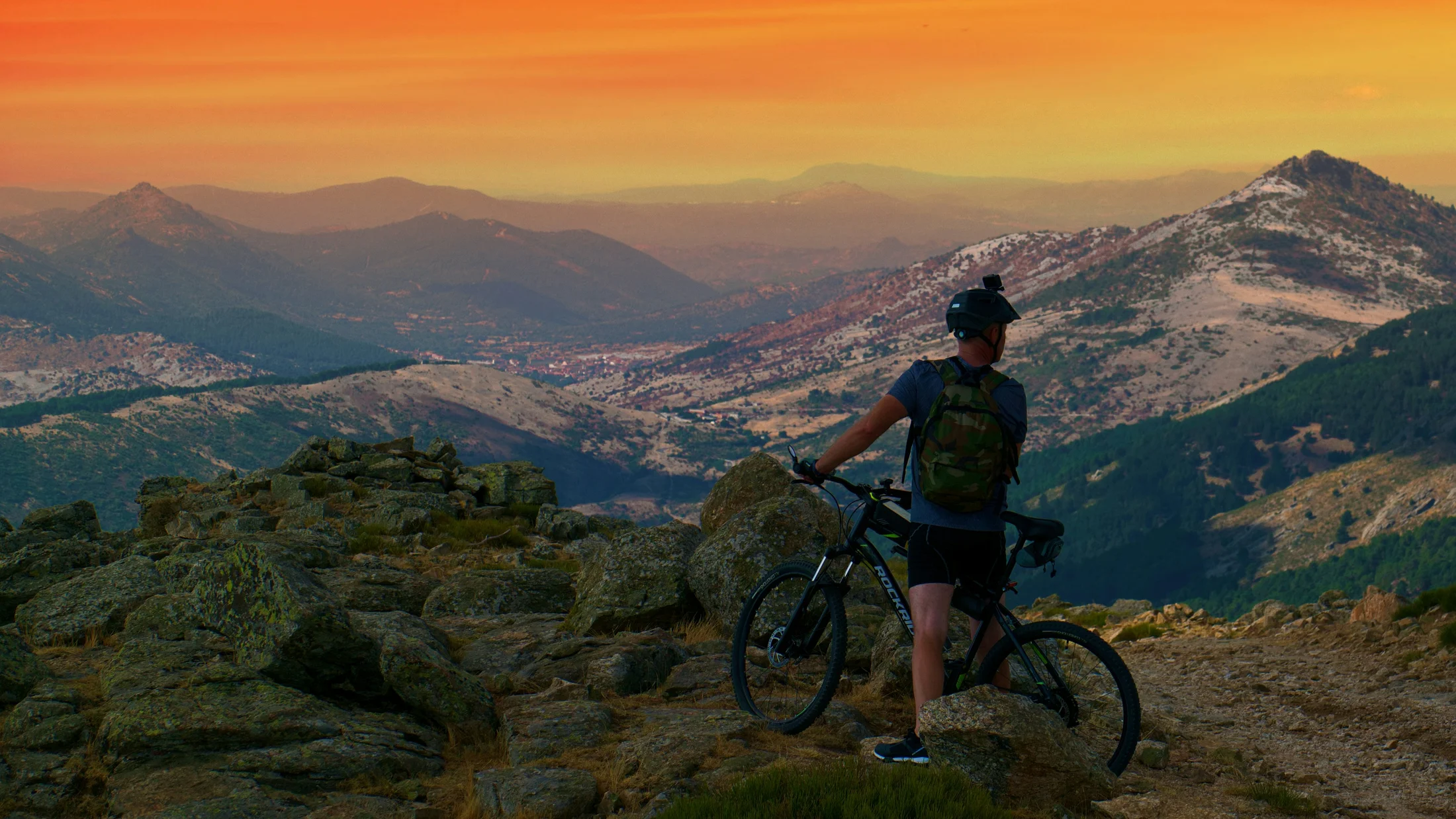
Why These Mtb Routes in Spain Stand Out
You’re here to find MTB routes in Spain that match your level, terrain taste, and time window. We selected ten mountain bike circuits that balance technical challenge, scenery, access, and safety so you can plan confidently. A thin breeze over pines or grit crunching under tires can turn a ride into a memory.
We built this list using clear criteria you can verify and use anywhere. We looked at: technical level (from flowing XC to expert-grade rock gardens), terrain type (alpine, semi-arid, volcanic, coastal, forest), access and logistics (public transport, airports, parking), rider services (bike-friendly stays, rentals, shuttles), and scenic interest (protected areas, viewpoints, heritage). We also prioritized areas with public GPS tracks from reliable sources and clubs, and with clear park regulations to support low-impact riding. For weather and altitudes, we cross-referenced AEMET (Spain’s national meteorology service) and official park pages; for mapping, we relied on IGN base maps, regional cartography, and established platforms like Wikiloc and Komoot.
Your intent matters: you want routes that fit your fitness and skills without surprises. This list covers riders moving from beginner trail rides to advanced enduro and “pro” technical lines, always with plain warnings where exposure, remoteness, or regulations raise the stakes. If you enjoy numbers, each circuit offers distance, elevation, and duration ranges to help you gauge effort. If you ride by feel, each also describes how the terrain rolls, grips, and brakes. Dust in the late sun, the cool of a beech corridor, the hiss of brake rotors—expect that mix across Spain’s varied mountains. Pick a circuit that suits your bike and time, then save the GPX to ride safer and at your own pace.
Picuco te puede ayudar
Does something here catch your eye?
Tell us.
Write to us on WhatsApp or email: we answer questions, find the best options and help you sort out the booking.
Read This First: Levels, Symbols, and Safer Riding
You’ll see four levels across the article so you can self-select and avoid overcommitting. “Easy” suits riders comfortable on gravel paths and mellow singletrack; “Intermediate” adds steeper climbs, tighter corners, and small rock steps; “Advanced” expects solid bike handling on sustained technical sections; “Pro” includes exposure, big rock features, or long, committing descents. If you’re between sizes on skill, size down a level and enjoy the day. Picture your thumb pressing a tire sidewall in cool morning shade—traction and control are your allies.
Each circuit includes a compact data block:
- Distance (km): total loop or point-to-point length
- Elevation gain (m+): total climbing
- Time: moving time for a steady rider, add stops
- Terrain: rock, forest loam, semi-arid clay, volcanic ash, cobbles
- Profile: XC (efficiency), Trail/All-mountain (mixed), Enduro (downhill focus), E-bike friendly
- Season: best weather window
- Access: car, train/bus, nearest city/airport
- Tracks: where to find a GPX (e.g., IGN viewer exports, Wikiloc/Komoot community tracks, local clubs)
Riding rules keep trails open. Yield to hikers and livestock, never skid through switchbacks, and respect closures; those are IMBA “Rules of the Trail” adapted to local norms. In protected areas, stick to authorized paths; Spanish national and natural parks publish bike access pages—check them the day before. For weather and storms, AEMET provides regional forecasts with mountain warnings; at altitude, temperatures drop roughly 0.6–1.0°C per 100 m. We’ll point to gear and prep later, including spares, pressure ranges by terrain, and basic maintenance. Bring a charged phone, a paper map as backup, and a small light if your route touches dusk.
Ten Standout Mountain Bike Circuits Across Spain
1) Picos de Europa: alpine ridgelines and technical rock
High limestone massifs, narrow balconied trails, and chunky steps define this corner of the Cantabrian Mountains. Expect ledgy limestone, occasional exposure, and fast weather swings that can flip sun to fog in minutes. A bell from a distant cow pasture can feel like a metronome on long climbs.
- Location: Asturias/Cantabria/Castile and León (Picos de Europa)
- Recommended level: Advanced to Pro (technical rock, exposure)
- Terrain: Limestone slabs, karst rock, alpine meadows, forest connectors
- Distance & elevation: 20–40 km; 1,200–2,000 m+
- Duration: 4–7 hours moving time
- Profile: All-mountain/Enduro; limited XC options along valleys
- Season: Late June–September (snow/ice possible shoulder seasons)
- Ideal for: Skilled riders seeking technical lines and big-mountain feel
- Access: Car to Arenas de Cabrales, Potes, or Posada de Valdeón; buses reach main towns seasonally
- Permits/fees: No general fees, but bike restrictions apply in some protected zones; check the national park’s official site
- Points of interest: Miradores, high meadows with stone huts, karst viewpoints
- Navigation: Intersections can be confusing in fog; carry GPX plus paper map (IGN 1:25,000 recommended)
- Tracks (GPX): Look up Picos all-mountain loops on community platforms and cross-check with park rules; IGN and regional maps show authorized paths
Tips: Weather changes fast—pack layers, a shell, and lights. If exposure and rock steps are new to you, downsize your loop or choose valley XC tracks.
2) Sierra Nevada (granada): altitude lungs and rocky Xc
Rides here mix wide vistas and sustained climbs at 1,800–2,600 m, with rocky singletrack and forest roads on the flanks. The air feels thin and dry, like crisp paper under your gloves at dawn. Plan for effort at altitude and bring more water than usual.
- Location: Andalusia, Granada province
- Recommended level: Intermediate to Advanced (altitude adds difficulty)
- Terrain: Rocky singletrack, high-altitude tracks, pine forest roads, scree
- Distance & elevation: 25–55 km; 900–1,800 m+
- Duration: 3.5–7 hours moving time
- Profile: XC/All-mountain; E-bike friendly on many tracks
- Season: Late May–October above 1,800 m; winter for lower slopes; heat caution July–August
- Ideal for: XC fitness riders, E-MTB tours, altitude acclimatization
- Access: 40–60 min drive from Granada; limited buses to mountain villages
- Permits/fees: National Park zoning restricts bikes to designated tracks—check official maps
- Points of interest: High viewpoints, old irrigation channels (acequias), ski-area flanks outside winter
- Navigation: Clear tracks but multiple branches; GPX helps, especially near ski domain borders
- Tracks (GPX): Search “Sierra Nevada XC/Trail” on Komoot/Wikiloc and verify with park layers; IGN topo maps show permitted roads
Notes: Altitude amplifies dehydration—drink 500–750 ml/hour and add electrolytes. E-bikes thrive here; carry a spare battery or plan a mid-route charge in villages.
3) Bardenas Reales (navarra): desert edges and open singletrack
Semi-arid badlands sculpted by clay and sandstone offer rolling mesas, gullies, and infinite horizons. Expect little shade, fast erosion-prone surfaces, and wind that hums across the flats. The sun glints off pale ridges like brushed copper at noon.
- Location: Navarra, near Tudela
- Recommended level: Easy to Intermediate (exposure to heat/wind adds challenge)
- Terrain: Clay/sandstone tracks, open singletrack, some wash crossings
- Distance & elevation: 35–60 km; 400–900 m+
- Duration: 3–5.5 hours moving time
- Profile: XC/Gravel-friendly; light trail options
- Season: March–May, September–November; avoid midday summer heat
- Ideal for: Efficient pedaling, big-sky landscapes, photography
- Access: Car to Arguedas/Tudela; train to Tudela + taxi
- Permits/fees: Entry is generally free; closures occur after heavy rain or in military zones—check Junta de Bardenas updates
- Points of interest: Castildetierra formations, plateaus, birdlife in early/late season
- Navigation: Clear tracks; respect signed closures and keep to main routes in wet conditions
- Tracks (GPX): Find “Vuelta a las Bardenas” style loops on community platforms; cross-check with official visitor center maps
Tires: Run slightly lower pressures for grip on hardpack over dust, but avoid pinch flats on rocky edges; 2.3–2.4” tires shine here.
4) Val d’aran / Central Pyrenees: shuttle-ready enduro and technical singletrack
Alpine forests, old mule paths, and steep, hand-built lines make the Aran valley a magnet for enduro. Roots thread through beech and fir, and water whispers along stream cuts beside the trail. Expect punchy climbs and sustained descents with optional shuttle support.
- Location: Catalonia, Lleida province (Val d’Aran)
- Recommended level: Intermediate to Advanced (with Pro lines available)
- Terrain: Rooted forest singletrack, rocky steps, alpine meadows
- Distance & elevation: 18–40 km; 1,000–1,800 m+
- Duration: 3–6 hours moving time
- Profile: Enduro/All-mountain; shuttles available in season; XC valley paths exist
- Season: June–October; snow and mud early/late season
- Ideal for: Riders who love long descents and lift/shuttle logistics
- Access: Car or bus to Vielha; nearest airports: Lleida-Alguaire, Toulouse, or Barcelona
- Permits/fees: None for general trails; respect private land signage and forestry works
- Points of interest: High meadows above Baqueira, stone hamlets, Romanesque churches
- Services: Bike-friendly lodgings, workshop support, seasonal shuttles; confirm summer lift operations in advance
- Tracks (GPX): Search “Enduro Aran” or “Aran trails” on trusted platforms; verify latest closures with the tourism office
Pro tip: Wet roots change everything—take a recon lap mindset and modulate braking. Carry a derailleur hanger; rocks and roots punish drivetrains.
5) Girona / Empordà: Mediterranean flow and year-round networks
Girona has a bike-welcoming culture, a dense trail web, and varied loops rolling from cork oak forests to coastal viewpoints. The air smells like pine resin and sea breeze when the Tramontana calms. Expect well-maintained singletrack and friendly logistics.
- Location: Catalonia, Girona province (Les Gavarres, Vall de Llémena, Empordà)
- Recommended level: Easy to Advanced (stacked loops by skill)
- Terrain: Mediterranean dirt, granite outcrops, forest loam, occasional rock steps
- Distance & elevation: 20–55 km; 500–1,300 m+
- Duration: 2.5–6 hours moving time
- Profile: Trail/XC/All-mountain; E-bike friendly
- Season: All year; best March–June, September–December
- Ideal for: Mixed-skill groups, training blocks, guided day rides
- Access: Trains to Girona; airports at Girona/Barcelona; coastal towns by bus/car
- Permits/fees: None general; respect closures for fire prevention days
- Points of interest: Medieval villages, coastal overlooks, vineyard lanes
- Services: Rentals, clinics, and bike-friendly cafes abound; mechanical support is easy to find
- Tracks (GPX): “Girona trail,” “Gavarres singletrack,” and “Empordà gravel-trail” searches yield curated loops; cross-check with municipal maps
Maintenance note: Mediterranean grit accelerates drivetrain wear—lube dry, clean often, and carry a quick link.
6) Sierra de Guadarrama (madrid): quick access and classic passes
Just an hour from central Madrid, Guadarrama blends fire roads, conifer singletrack, and historic mountain passes. On cool mornings, the scent of wet granite and pine needles lingers at trailheads like Cercedilla. Expect options from family-friendly loops to long ridgeline days.
- Location: Community of Madrid/Castile and León
- Recommended level: Easy to Advanced (routes by valley and pass)
- Terrain: Granite slabs, pine singletrack, gravel/fire roads, high passes
- Distance & elevation: 18–50 km; 500–1,500 m+
- Duration: 2.5–6 hours moving time
- Profile: XC/Trail; some enduro-style descents exist
- Season: April–June, September–November; summer heat in valleys; winter snow up high
- Ideal for: Day trips from Madrid, public transport riders, mixed groups
- Access: Cercanías train to Cercedilla, Navacerrada bus lines; car parking at main passes
- Permits/fees: National Park rules apply—stay on authorized trails; weekend restrictions can affect certain tracks
- Points of interest: Puerto de la Fuenfría, Siete Picos viewpoints, historic
GR-10/PRconnectors - Tracks (GPX): Search “Cercedilla trail loop,” “Fuenfría XC,” or “Siete Picos” on community platforms; validate with park maps
Public transport combo: Train up, ride loop, and descent back to a station—great for linear fun with easy returns.
7) Sierra de Gredos (ávila): granite steps and demanding trail craft
Gredos rewards skill and fitness with rugged beauty, rock gardens, and big-country ambiance. Granite boulders warm under the sun, radiating a dry, clean heat you feel on exposed climbs. Descents often feature tight switchbacks and technical steps.
- Location: Castile and León, Ávila province
- Recommended level: Advanced to Pro (sustained technical riding)
- Terrain: Granite slabs, rocky singletrack, scrubland connectors, mountain paths
- Distance & elevation: 20–40 km; 1,000–1,800 m+
- Duration: 3.5–6.5 hours moving time
- Profile: All-mountain/Enduro; some XC valleys with rough sections
- Season: May–October; snow/ice possible shoulder seasons
- Ideal for: Skilled riders who enjoy granite and steep, physical trails
- Access: Car to Hoyos del Espino, Navarredonda; buses from Ávila with connections
- Permits/fees: None general; respect high-mountain restrictions and livestock fences
- Points of interest: Circo de Gredos viewpoints (bike-legal approaches vary), river pools for post-ride dips
- Lodging: Rural guesthouses familiar with riders; confirm bike storage
- Tracks (GPX): Search “Gredos enduro/trail” and confirm legality with municipal or park guidance
Prep: Strong tires (EXO+/DoubleDown equivalents), 2.4–2.5”, and robust brakes (200 mm rotors) pay dividends on long, rocky descents.
8) Serra de Tramuntana (mallorca): stone paths and sea-to-summit classics
Mallorca’s Tramuntana offers terraced stone tracks, tight climbs, and sweeping sea views. The breeze tastes slightly saline on ridgelines as goat bells echo in limestone folds. Expect cobbled empedrat sections and stout gradient ramps.
- Location: Balearic Islands, Mallorca
- Recommended level: Intermediate to Advanced (technical cobbles/climbs)
- Terrain: Stone-paved paths, rocky singletrack, forest roads
- Distance & elevation: 25–50 km; 900–1,600 m+
- Duration: 3.5–6 hours moving time
- Profile: Trail/All-mountain; XC along valleys; mixed legality on some
GR-221segments—verify before riding - Season: October–May; avoid peak summer heat
- Ideal for: Riders combining MTB with island travel
- Access: Palma airport; rentals available in Palma and north-coast towns
- Permits/fees: Some estates and
GR-221sections restrict bikes; check Consell de Mallorca updates - Points of interest: Coastal viewpoints between Deià and Sóller, terraced olive groves, stone villages
- Tracks (GPX): Search “Tramuntana trail XC/AM” and verify bike access per segment
Logistics: Renting a bike is easy; for travel with your own, airlines require packed cases and prior booking—arrive early for check-in.
9) Somiedo Natural Park (asturias): long climbs and deep green
Beech and oak forests, long valley climbs, and open high pastures define Somiedo’s riding. Moist loam and chalky rock alternate under a canopy where birdsong rides the air. Wildlife protection shapes access, so ride respectfully and quietly.
- Location: Asturias, Cantabrian Mountains
- Recommended level: Intermediate to Advanced (endurance focus)
- Terrain: Forest doubletrack, technical singletrack connectors, rocky steps
- Distance & elevation: 25–45 km; 1,000–1,700 m+
- Duration: 3.5–6.5 hours moving time
- Profile: Trail/XC; some all-mountain descents
- Season: May–October; frequent showers—pack waterproofs
- Ideal for: Nature lovers, photographers, endurance climbers
- Access: Car via AS-227; buses to Pola de Somiedo less frequent—check schedules
- Permits/fees: Natural Park rules; stick to authorized tracks, keep noise low for fauna
- Points of interest: High brañas (shepherd hamlets), lake viewpoints, bear interpretation centers
- Traction: Choose tires with good wet grip; brake pads rated for moisture perform better here
- Tracks (GPX): “Somiedo trail loop” and “brañas XC” searches provide options; validate with park info
Community note: Local shepherding traditions shape these landscapes—close gates, yield widely to livestock, and leave no trace.
10) La Palma (canary Islands): volcanic ribbons and fast fall-line
Volcanic cones, black ash, and laurel forests deliver fast, grippy lines and dramatic views. Ash muffles sound so your tires whisper as you snake down dark slopes. Expect quick transitions from humid forest to open cinder fields.
- Location: Canary Islands, La Palma
- Recommended level: Intermediate to Advanced (with Pro descents)
- Terrain: Volcanic ash, lava rock, laurel forest loam
- Distance & elevation: 20–45 km; 900–1,700 m+ (big vertical via shuttles)
- Duration: 3–6 hours moving time
- Profile: Enduro/All-mountain; classic long descents; E-bike friendly on forest roads
- Season: Year-round; watch for heat in caldera zones and post-eruption closures
- Ideal for: Descent-focused riders and winter sun seekers
- Access: Flights via Tenerife/Gran Canaria; ferries from Tenerife; car hire recommended
- Permits/fees: National and natural park restrictions apply; some singletracks off-limits—check Cabildo/park advisories
- Points of interest: Pine forests, coastal lava cliffs, caldera rims
- Tracks (GPX): Search “La Palma enduro” and cross-check current closures and access; recent volcanic activity changed segments
Braking tip: Volcanic ash can overheat brakes—use bigger rotors, fresh pads, and pulse braking on long fall-line runs.
Where They Are: Map and Start Points
Use an interactive map to visualize the ten circuits and decide what suits your time and travel plan. Toggle layers for Level (color-coded Easy/Intermediate/Advanced/Pro), Terrain (rocky, forest, semi-arid, volcanic, coastal), and Start Points (parking, bus/train stops). A gull’s-eye view of coast and mountains helps you spot the ride that fits the day.
Click a pin to see the core data (distance, elevation, time, profile) and a short terrain note (e.g., “limestone slabs” or “ash/gravel mix”). Download a GPX for watches and bike computers or a KML for Google Earth; most modern devices read both. If you use a phone app, save the map offline and bring a power bank. Remember that GPX lines don’t override park rules—always check the latest access notes on official pages, especially in national and natural parks. If your device offers route recalculation, turn it off on technical trails to avoid being rerouted onto closed paths.
Quick Comparison by Level and Terrain — Mtb Routes Spain
Here’s a side-by-side to help you filter quickly before diving into details.
| Circuit | Region | Level | Terrain | Profile | Distance (km) | Elevation (m+) | Best season |
|---|---|---|---|---|---|---|---|
| Picos de Europa | Asturias/Cantabria/Castile and León | Advanced–Pro | Rocky alpine/limestone | All-mountain/Enduro | 20–40 | 1,200–2,000 | Jun–Sep |
| Sierra Nevada | Andalusia (Granada) | Intermediate–Advanced | Rocky high-altitude | XC/All-mountain | 25–55 | 900–1,800 | May–Oct |
| Bardenas Reales | Navarra | Easy–Intermediate | Semi-arid clay/sandstone | XC/Trail | 35–60 | 400–900 | Mar–May, Sep–Nov |
| Val d’Aran | Catalonia (Lleida) | Intermediate–Advanced | Forest/rock technical | Enduro/All-mountain | 18–40 | 1,000–1,800 | Jun–Oct |
| Girona/Empordà | Catalonia (Girona) | Easy–Advanced | Mediterranean mixed | Trail/XC | 20–55 | 500–1,300 | Mar–Jun, Sep–Dec |
| Guadarrama | Madrid/Castile and León | Easy–Advanced | Granite forest/mid-mountain | XC/Trail | 18–50 | 500–1,500 | Apr–Jun, Sep–Nov |
| Gredos | Castile and León (Ávila) | Advanced–Pro | Granite rocky | All-mountain/Enduro | 20–40 | 1,000–1,800 | May–Oct |
| Tramuntana | Mallorca | Intermediate–Advanced | Stone paths/rocky | Trail/All-mountain | 25–50 | 900–1,600 | Oct–May |
| Somiedo | Asturias | Intermediate–Advanced | Forest/rock mix | Trail/XC | 25–45 | 1,000–1,700 | May–Oct |
| La Palma | Canary Islands | Intermediate–Advanced (Pro options) | Volcanic ash/rock | Enduro/All-mountain | 20–45 | 900–1,700 | Year-round |
Quick picks:
- Newer riders who climb steadily: Bardenas (XC), Girona lower loops, Guadarrama valley tracks.
- Fitness-focused XC: Sierra Nevada flanks, Girona trail/XC, Bardenas long loops.
- Enduro hunters: Val d’Aran, Gredos, La Palma, select Picos lines.
- Year-round options: Girona (avoid midsummer heat), La Palma (watch closures), Tramuntana (shoulder seasons).
- Scenic nature focus: Somiedo, Picos, Tramuntana coastal ridges.
A single breath of cool forest air or warm desert wind can be your tiebreaker—choose the feel you crave.
Gear, Safety, and Bike Care on the Trail
Match the route to your bike and skill to keep the day fun. XC bikes (100–120 mm) shine on Bardenas, Girona XC, and Sierra Nevada tracks; trail bikes (120–140 mm) suit Girona trail, Guadarrama, Tramuntana, and Somiedo; enduro bikes (150–170 mm) excel in Picos, Gredos, Aran, and La Palma. E-bikes broaden options but still require good handling on tech sections. The faint scent of chain lube on a cool morning can signal a smooth day ahead.
Pack a compact checklist:
- Protection: Certified helmet, full-finger gloves, knee pads (add elbow pads for enduro)
- Carry: 2–3 L hydration, electrolytes, snacks (30–60 g carbs/hour)
- Tools/spares: Multi-tool with chain breaker, pump/CO2, two tubes or plugs, tire boots, quick link, spare hanger, brake pads
- Navigation: Phone with offline maps, bike computer, paper map, small light
- Clothing: Shell layer, thermal for altitude, buff; sun protection for semi-arid zones
- First aid: Basic kit, emergency blanket, whistle
On-route practices:
- Start earlier than you think; storms and heat build later (AEMET forecasts help)
- Pace nutrition and drink regularly; set 15–20 min reminders
- Brake smoothly; avoid skidding to protect trails
- Yield widely to hikers and livestock; close gates
- Group spacing: leave line-of-sight gaps on technical descents
Basic maintenance:
- Pre-ride: Check tire pressure (adjust by terrain), brake pad thickness, rotor rub, sag/rebound settings
- Post-ride: Wipe drivetrain, relube as needed, inspect sidewalls, tighten critical bolts (stem, axle, caliper)
- Terrain pressures (guideline for 2.35–2.5”): rocky 23–28 psi (heavier riders higher), loam 20–25 psi, semi-arid hardpack 22–26 psi; tubeless recommended
Plan the Trip: Transport, Bike Hire, and Stays
Getting there is half the planning and saves energy for the ride. For mainland trips, combine trains (Renfe) with regional buses and short car hires; Cercanías trains reach trailheads like Cercedilla for Guadarrama. For island circuits, fly to Palma (Tramuntana) or La Palma via Tenerife/Gran Canaria, or use inter-island ferries; pre-book bike spaces and arrive early for check-in. The rumble of a luggage cart on airport tiles is often the first note of a good ride.
Bike options:
- Bring your bike: Airline rules require a box/bag, deflated tires to airline spec, and protected rotors/derailleur; pack spares not easy to find (pads, hanger)
- Rent locally: Girona, Mallorca, Aran, and Granada offer trail/enduro/E-MTB rentals; reserve sizes early in peak months
- Shuttles/lifts: Seasonal shuttles operate in enduro hubs like Aran and La Palma; confirm days and capacity
Where to stay:
- Bike-friendly hotels/rural stays with secure storage, hose/wash area, basic tools, early breakfast, and laundry
- Apartments in trail towns for self-catering and flexible schedules
- Mountain villages for immediate access and quieter evenings
Booking windows:
- Peak seasons: May–June and September–October (mainland), October–May (Mallorca), winter sun (Canaries)
- Reserve accommodation and rentals 3–6 weeks ahead; for long weekends/holidays, add buffer time
- Check local events (marathons, festivals) that fill rooms and trails
Local services:
- Workshops and parts: Larger hubs (Girona, Palma, Granada, Vielha) stock more sizes; call ahead for brake pads/rotor standards
- Guides/instruction: Helpful for first visits to technical terrain (Picos, Gredos, Aran, La Palma)
- Food/water: Plan resupplies in valleys; carry extra in semi-arid zones like Bardenas
Environmental respect:
- Stick to open trails, manage noise, and support local cafes and bakeries that keep mountain towns alive.
Frequently Asked Questions
Do I need permits to ride these routes?
Generally no, but national and natural parks restrict bikes to designated tracks. Check each park’s official page the day before, especially in Sierra Nevada, Picos, Tramuntana, and La Palma.
When is the best time to ride Mtb in Spain?
Spring and autumn dominate on the mainland; summer at altitude; winter on the Canaries. Avoid midday heat in Bardenas and lower Andalusian slopes; expect afternoon storms in Pyrenees/Picos.
Are these routes suitable for e-bikes?
Most listed circuits work well on E-MTBs, especially Sierra Nevada, Girona, Guadarrama, and La Palma. Respect trail etiquette and battery range; carry a charger if you plan a mid-ride cafe stop.
Where can I download reliable Gpx tracks?
Use IGN viewer exports, municipal/regional cartography, and established platforms like Wikiloc or Komoot. Cross-check with park rules and recent ride reports to avoid closures or private land.
What safety basics should I follow?
Wear a helmet and pads, carry spares and a light, hydrate, and check AEMET forecasts. In technical zones, ride within sight lines and avoid skidding to protect trails and tires.
Do I need special insurance?
Travel insurance that covers MTB on marked trails is sensible; verify crash, rescue, and equipment coverage. For alpine terrain, confirm that altitude and technical trails are included.
How technical are “advanced” and “pro” labels?
Advanced means sustained tech: rocks, roots, steps, and steeper grades; Pro adds exposure, big features, or long committing descents. If unsure, choose one level down.
Book your experience — discover active tourism activities in Spain with providers verified by Picuco.
Conclusion
Spain’s mountains invite every style of rider, from first gravel‑singletrack transitions to committed enduro lines with thousand‑meter drops. You’ve now seen how these MTB routes in Spain vary by level, terrain, access, and season, and how to filter them quickly with distance, elevation, and profile. One cool breath in a beech forest or a warm gust over desert clay might decide your next ride.
Choose a circuit that matches your bike and skills, save a GPX, and print a map backup. Pack the essentials—pads, spares, layers—and respect trail rules so paths stay open for everyone. If you’re building a long weekend, pair rides with bike-friendly stays and confirm rentals or shuttles in peak months. For weather and safety, check AEMET and park advisories the day before, then adjust start times to dodge heat or storms.
Whether you want Girona’s year‑round flow, Sierra Nevada’s altitude XC, Aran’s shuttled descents, or La Palma’s volcanic ribbons, the combination of clear data and on‑the‑ground common sense keeps days smooth. Share this guide with your riding crew, bookmark the circuits that fit, and return to update your shortlist as seasons turn. When you’re ready, use these routes as a planning springboard, keep the “MTB routes Spain” comparisons handy, and ride at your own pace toward the view that pulls you forward.