Why Gr Trails Work for Stage Hiking All Year
GR trails in Spain make multi-day hiking surprisingly simple and safe to plan. If you want flexible stages, reliable waymarking, and year-round options, these routes deliver across coasts, sierras, and valleys. Picture a red-and-white blaze appearing just as the morning mist lifts from a village square. You’ll use this article to pick stages that suit your time, fitness, and the season without guesswork.
What Gr trails are and why they suit stages
GR trails (Gran Recorrido) are long-distance routes signed with red-and-white marks, designed for multi-day journeys. Unlike PR (short routes) or SL (local routes), GR itineraries connect regions over tens to hundreds of kilometers, which makes stage hiking straightforward. In practice, you move between towns or refuges each day, keeping logistics light. These are the backbone of long-distance trails in Spain, with consistent waymarking, official topoguides, and alternative variants. Imagine the scrape of trekking poles on old stone while a red-and-white stripe confirms you’re right on track.
Why choose them over historic paths like the Camino or unsignposted mountain traverses? GR routes blend the best of both worlds: dependable signage, varied landscapes, and the freedom to tailor daily distances. For most hikers, GR trails Spain means less time hunting for turns and more time enjoying the countryside.
How we chose the 10 routes and how to use this list
We selected 10 GR routes Spain by balancing five factors that matter on the ground: landscape quality, public transport access, stage infrastructure (towns, refuges, shops), seasonal appeal, and a diversity of difficulty levels. Together, they work for stage hiking Spain in any month if you pick the right section. Think of this list as a menu of stages, not a fixed itinerary. The river breeze, pine resin, or sea salt will be the day’s subtle companion.
Each route card below includes: scope and region, typical duration if done fully, suggested stage clusters (2–6 days), estimated cost per stage (basic lodging + simple meals + local transport), best season, ideal hiker profile, highlights, logistics notes, and where to confirm details (federations and park authorities). To turn a card into a plan: 1) choose a 2–5 day window, 2) pick a town-to-town segment with daily 15–25 km, 3) book lodging, 4) save official GPX/KML files (digital track formats used by GPS apps), and 5) set bail-out points and bad-weather options. For the best GR in Spain experience, verify stage updates with regional mountaineering federations before you go.
Picuco te puede ayudar
Does something here catch your eye?
Tell us.
Write to us on WhatsApp or email: we answer questions, find the best options and help you sort out the booking.
Where These 10 Gr Routes Are on the Map
Finding the right start and finish makes or breaks a stage plan, so map work comes first. Our GR map Spain layout for these 10 trails shows their spread across the Pyrenees, the Cantabrian north, the Ebro and Duero valleys, the Mediterranean coast, and Mallorca. An interactive map is ideal: pins mark recommended gateway towns, rail or bus nodes, and logical stage endpoints. A static image with pins also works if you annotate access points and overnight options. One practical variant is a table of coordinates for each stage start, but most hikers prefer a web map they can open on their phone.
Use the map in three passes. First, zoom out to choose a region that fits your season—coast in winter, foothills in spring or autumn, and high mountains in summer. Second, zoom in on transport nodes (train corridors like the Mediterranean coast, or bus-linked valleys in the Pyrenees) to align stages with your arrival/departure. Third, mark backup exits every 10–15 km, especially where weather or river levels can change plans. Picture a blinking blue dot sliding along a red line while waves hiss against a breakwater below the cliff.
For downloadable files, confirm GPX/KML with the trail’s official pages from regional federations, national park authorities, and municipal tourism offices. Many provinces publish printable stage sheets and elevation profiles; keep them offline. When you select a 2–4 day window, place your pins on towns with at least one lodging and a morning bus, and you’ll hike with calm margins.
The 10 Gr Routes: Stage-by-stage Essentials
1) Gr 11: Senda Pirenaica (the Pyrenean Traverse)
The GR 11 threads the Spanish Pyrenees from the Bay of Biscay to the Mediterranean, crossing Gipuzkoa, Navarre, Huesca, Lleida, and Girona. Most thru-hikers take 40–50 days; for stages, aim for 3–6 day chunks around valleys like Baztan, Hecho, Ordesa, Benasque, or Vall de Núria. Dawn frost crunching underfoot at 2,000 meters will sharpen your focus. Among senderos GR, this is the classic high-mountain epic.
- Scope and length: Atlantic–Mediterranean, roughly 820 km
- Suggested stage clusters (3–6 days):
- Baztan–Roncesvalles (rolling foothills)
- Benasque–Estós–Aigualluts (glacial cirques and passes)
- Ordesa–Góriz–Añisclo (iconic canyons; check park rules)
- Best season: late June–September in high mountains; May/October for lower valleys
- Ideal for: fit hikers with solid mountain skills; comfort with 1,000 m elevation gain days
- Estimated cost per stage: 50–90 € (refuge/hostel + simple meals + local bus/taxi), confirm latest locally
- Highlights: refuges like Góriz and Estós, ibón lakes, peaks accessible as side trips (e.g., Tuc de Mulleres)
- Logistics: frequent buses in major valleys; carry microspikes early season if snow lingers; always check avalanche bulletins in spring
- Useful sources: regional federations and national park visitor centers for weather, huts, and stage updates
Tip: if storms threaten, switch to a lower-valley variant or use a bus leap to skip a high pass; senderismo por etapas is about smart margins, not forcing a line.
2) Gr 92: Sendero del Mediterráneo (eastern Coast)
GR 92 follows the Mediterranean, with especially mature waymarking in Catalonia and growing continuity south through Valencia, Murcia, and Andalusia. Think 2–5 day coastal hops linking rail-served towns and protected coves. The smell of pine and sea salt rides the onshore breeze at sunrise. It’s among the friendliest GR routes Spain for winter and shoulder seasons.
- Scope and length: Catalonia core ~560 km; extended coastal continuations south; check province by province
- Suggested stage clusters (2–5 days):
- Costa Brava (Calella de Palafrugell–Llafranc–Tamariu–Begur)
- Costa Daurada (Torredembarra–Altafulla–Tamarit–Tarragona)
- Valencia coast (Cullera–Gandía–Dénia; combine promenades and dunes)
- Best season: spring and autumn ideal; winter feasible (milder microclimates); summer heat requires earlier starts
- Ideal for: families and hikers wanting gentle profiles, beaches, and fishing villages
- Estimated cost per stage: 60–120 € (coastal lodging + meals + train/bus), varies by seaside town
- Highlights: camins de ronda cliff paths, coves for swims, seafood taverns, Greco-Roman sites near Tarragona
- Logistics: excellent rail links in Catalonia; south of there, rely on regional buses; book summer weekends early
- Useful sources: coastal natural park offices, municipal tourism boards with GPX for each local tramo
Tip: pair hiking with short swims and keep stages 12–20 km for time to explore; these senderos GR shine when you slow down for coves and cafés.
3) Gr 7: Tarifa to Andorra (longitudinal Spine)
Part of the European E4, GR 7 crosses Spain from the Strait of Gibraltar to the Pyrenean border near Andorra, stitching together Andalusia, Murcia, Valencia, Catalonia, and interior sierras. Expect an evolving palette—cork oak groves, karst plateaus, dry valleys, and finally green foothills. In a quiet olive valley, cicadas pulse like a metronome at dusk. It’s a classic for long-distance trails Spain.
- Scope and length: roughly 1,900 km in Spain (section updates vary by region)
- Suggested stage clusters (3–6 days):
- Sierra de Grazalema (Andalusia): Zahara–Grazalema–Benaocaz–Ubrique
- Alto Palancia (Valencian interior): Segorbe–Jérica–Montanejos
- Pre-Catalan foothills: Horta de Sant Joan–Arnes–Paüls
- Best season: spring and autumn overall; winter in low Andalusian sections; avoid peak summer heat inland
- Ideal for: experienced hikers who enjoy cultural villages and varied terrain more than sustained alpine days
- Estimated cost per stage: 45–85 € (rural guesthouse + meals + local bus/taxi), confirm regionally
- Highlights: white villages, Moorish heritage, thermal waters in Montanejos, Ports de Beseit rock walls
- Logistics: plan public transport by province; some gaps need pre-booked taxis; carry extra water in semi-arid tramos
- Useful sources: regional mountaineering federations and natural park centers for detours/closures
Tip: combine two mellow 18–22 km days with a rest afternoon for village heritage visits; GR España sections reward an unhurried pace.
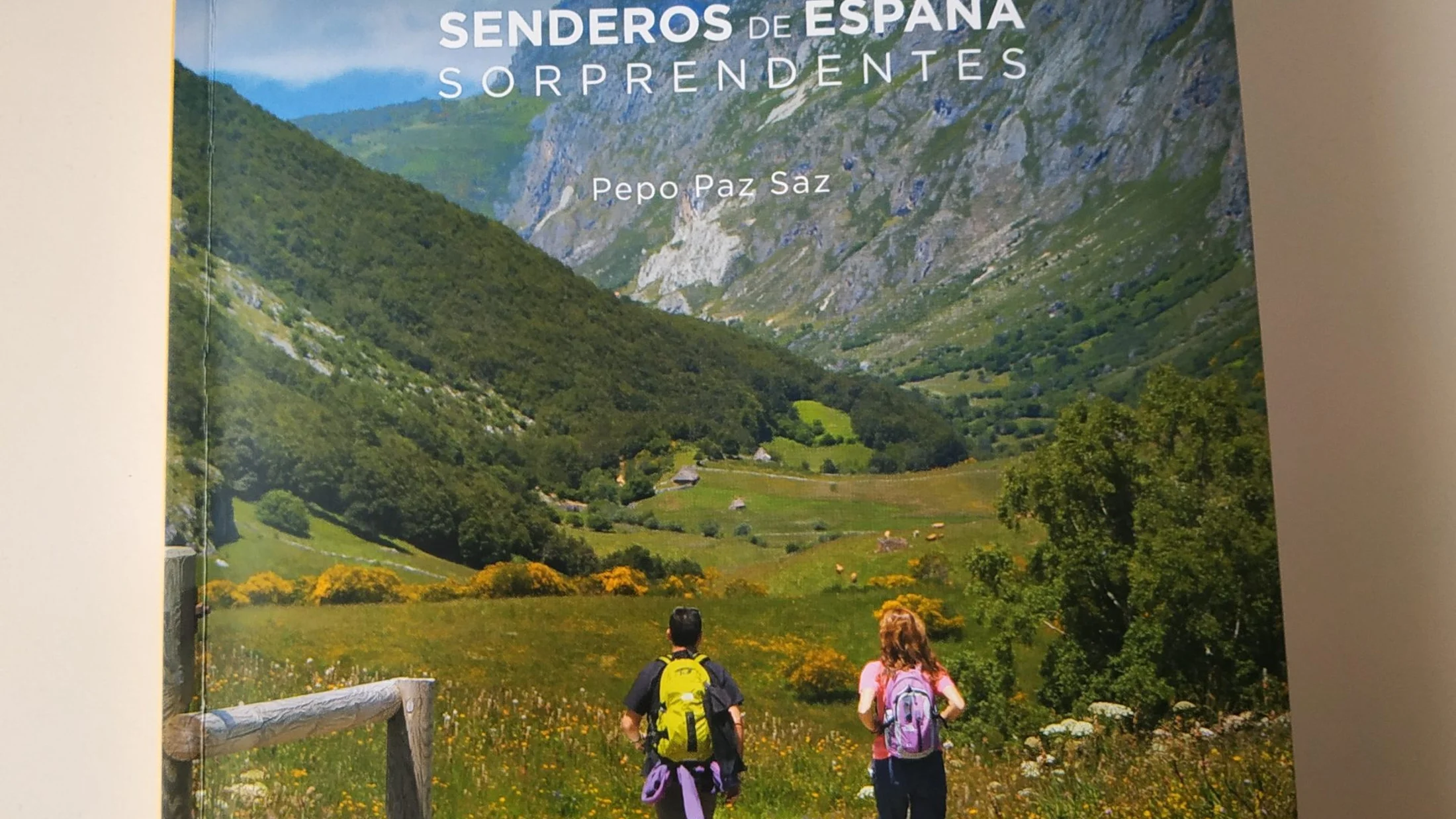
4) Gr 221: Ruta de la Pedra en Sec (serra de Tramuntana, Mallorca)
GR 221 crosses the Serra de Tramuntana along Mallorca’s north, using restored dry-stone paths and linking mountain villages like Deià, Sóller, and Pollença. Expect waymarked stone steps, olive terraces, and occasional rights-of-way variations—always confirm stage status locally. Lemon-scented breezes drift through terraces at sunset. It’s compact and perfect for 3–5 day stage hiking Spain.
- Scope and length: around 150 km including variants; main line typically planned in 6–8 stages
- Suggested stage clusters (3–5 days):
- Port d’Andratx–Estellencs–Valldemossa
- Valldemossa–Deià–Sóller–Lluc
- Lluc–Pollença coastal finish
- Best season: October–May; summer heat is manageable with early starts and short stages
- Ideal for: hikers comfortable with rocky paths and 600–900 m daily ascent, seeking Mediterranean landscapes
- Estimated cost per stage: 70–130 € (guesthouse/refuge + meals + bus), prices higher in holiday periods
- Highlights: cobbled mule tracks, UNESCO-listed cultural landscape, citrus orchards, Cala Tuent detour
- Logistics: TIB buses connect many trailheads; some refuges offer meal plans; luggage transfers are available via local services—book ahead
- Useful sources: Consell de Mallorca (official stage statuses, refuge bookings)
Tip: keep daily distances 12–20 km to enjoy towns and heritage sites; reserve refuges early in spring holidays.
5) Gr 99: Senda del Ebro (ebro Valley)
GR 99 follows the Ebro from its Cantabrian source to its delta on the Mediterranean, moving through river forests, vineyards, gorges, and historic towns. Expect gentle to moderate profiles and frequent access to services. Grey herons lift silently as you pass riverside poplars. As senderos de largo recorrido go, it’s a flexible all-season choice—with flood awareness.
- Scope and length: approx. 1,280 km from Fontibre (Cantabria) to Deltebre (Tarragona)
- Suggested stage clusters (2–5 days):
- La Rioja–Álava vineyards (Haro–Labastida–Laguardia area)
- Zaragoza’s river parks and sotos (riparian forests)
- Lower Ebro: Tortosa–Amposta–Deltebre (delta channels and birdlife)
- Best season: spring and autumn ideal; winter feasible on many sections; avoid spate periods during heavy rains
- Ideal for: walkers mixing nature with towns, families seeking flat paths, and hikers who may combine stretches by bike
- Estimated cost per stage: 45–85 € (pensión/rural house + meals + train/bus), confirm locally
- Highlights: bodegas visits, medieval bridges, riverbank habitats, delta birdwatching
- Logistics: good train lines parallel parts of the river; check river level advisories after storms
- Useful sources: regional environment departments and tourism boards for stage sheets and seasonal notes
Tip: in flood season, pivot to higher terrace alternatives or leap downstream by train; rutas por etapas are easier when you build in these plan B’s.
6) Gr E-9: Cantabrian Coastal Path (northern Coast)
Often referred to as the coastal GR in Spain, the E-9 links coastal trails across the Basque Country, Cantabria, Asturias, and Galicia, with local GR segments and signage. Expect cliff paths, beaches, and fishing harbors with frequent rail/bus connections. Sea foam blows across boardwalks like scattered lace. It’s a humid, green route that balances scenery and services.
- Scope and length: Spanish E-9 coastline sections total well over 1,000 km, signed variably as GR in regions
- Suggested stage clusters (2–5 days):
- Basque flysch coast (Zumaia–Deba–Mutriku)
- Eastern Asturias (Llanes–Ribadesella–Lastres)
- Western Galicia (Muros–Noia–Ría de Arousa variants)
- Best season: late spring to early autumn; winter storms enhance drama but shorten safe windows
- Ideal for: hikers who love coastlines, moderate ups and downs, and daily cafés/lodging
- Estimated cost per stage: 55–110 € (pensión/hostel + meals + train/bus), increase budget in peak summer
- Highlights: Jurassic coast flysch, blowholes, lighthouse viewpoints, seafood markets
- Logistics: narrow-gauge rail (e.g., Euskotren/Cantabrian lines) and regional buses make stage exits easy
- Useful sources: provincial federations and coastal park offices for detours and cliff safety info
Tip: keep a tide chart handy for beach alternatives and use boardwalk detours in storm swell events; coastal senderos GR reward flexibility.
7) Gr 109: Asturias Interior (cantabrian Highlands Inside Line)
GR 109 traverses Asturias from east to west through interior valleys, forests, and foothills, away from the busiest coast. Expect steady climbs, quiet villages, and stone paths with mountain backdrops. Morning cowbells carry softly through misty hayfields. It suits hikers seeking Cantabrian moods without constant cliff exposure.
- Scope and length: about 600+ km across Asturias, typically planned in 27–31 stages
- Suggested stage clusters (3–6 days):
- Ponga–Amieva foothills (beech forests and limestone)
- Tineo–Cangas del Narcea (oak woods and wine country)
- Oscos area (granite hamlets near Galicia)
- Best season: May–October; winter feasible on low stages but watch for mud and short daylight
- Ideal for: intermediate hikers comfortable with 600–1,000 m daily ascent, seeking rural immersion
- Estimated cost per stage: 45–85 € (casa rural/pensión + meals + bus/taxi), confirm in each comarca
- Highlights: beech and oak forests, ethnographic museums, traditional dairies and ciders
- Logistics: buses link county seats; plan cab shuttles for remote stage ends; carry rain gear year-round
- Useful sources: Principality of Asturias hiking portals and local councils for GPX and lodging lists
Tip: break longer official stages into 15–20 km days to spend time in villages; senderismo por etapas is also about conversations on porches.
8) Gr 247: Bosques del Sur (sierra de Cazorla, Segura y Las Villas)
GR 247 is a 478 km circular route in Jaén’s vast natural park, Spain’s largest protected forested area. Expect high plateaus, pine forests, rivers, and remote valleys with well-distributed shelters and towns. Warm resin scents rise from sunlit pines at noon. It’s an exemplary regional GR for multi-day hiking Spain with abundant variants.
- Scope and length: 478 km loop with 21 main stages and multiple links/variants
- Suggested stage clusters (3–6 days):
- Cazorla–Coto Ríos–Siles (rivers and forest tracks)
- Segura de la Sierra–Pontones–Hornos (historic hill towns)
- Hornos–Villacarrillo link (lake vistas)
- Best season: spring and autumn most pleasant; winter viable on many sections; summer can be hot—start early
- Ideal for: intermediate hikers keen on forest scenery and comfortable with long dirt-track days
- Estimated cost per stage: 45–80 € (rural lodging/refugio + meals + local taxi), confirm in park villages
- Highlights: source of the Guadalquivir, Tranco reservoir panoramas, wildlife (ibex and raptors)
- Logistics: buses to main towns; some refugios are basic—verify water points and carry filters
- Useful sources: park visitor centers and provincial federation topoguides for current variants
Tip: pair two forested stages with a rest day in Segura de la Sierra for heritage views; senderos GR in this park are a masterclass in long, quiet lines.
9) Gr 15: Senda Prepirenaica (forests and Foothills of Aragón)
GR 15 runs along the Aragonese Pre-Pyrenees, connecting valleys and ridgelines with steady elevation swings and deep beech woods. Expect a wilder feel than some coastal routes, with fewer cafés but rich mountain culture. A cool beech canopy hushes your footsteps like a soft blanket. It’s a forest-and-highland blend perfect for 3–5 day blocks.
- Scope and length: roughly 240–260 km across Jacetania and Sobrarbe, with variants linking villages and the
GR-11 - Suggested stage clusters (3–5 days):
- Hecho–Ansó–Zuriza (border forests and limestone)
- Aínsa–Boltaña–Fiscal (old bridges, river terraces)
- Nocito–Belsué–Arguis (Sierra de Guara foothills)
- Best season: May–October; spring flowers and autumn colors shine; snow possible in shaded passes early/late
- Ideal for: intermediate-to-advanced hikers who like 700–1,100 m daily ascent
- Estimated cost per stage: 45–85 € (casa rural/hostal + meals + occasional taxi), confirm per valley
- Highlights: beech and fir forests, ermitas, Romanesque churches, wildlife tracks
- Logistics: stage starts often reached by provincial buses to valley hubs; stock up on food before longer stretches
- Useful sources: Aragon mountaineering federation and park offices for seasonal advisories
Tip: in spring, shorten a planned high pass day if snow lingers and link to a lower alternative; keep crampons/microspikes if freeze–thaw is forecast.
10) Gr 14: Senda del Duero (culture and Rural Landscapes)
GR 14 traces the Spanish sections of the Duero from Soria’s pine uplands to the Portuguese border at the Arribes, with vineyards, cereal plains, and river canyons. Expect moderate gradients, cultural stops, and frequent lodging. Fresh bread scent drifts from village ovens on crisp mornings. For culture-first rutas por etapas, it belongs among the best GR in Spain.
- Scope and length: around 750–780 km within Spain, Duruelo de la Sierra to the border near Barca d’Alva
- Suggested stage clusters (2–5 days):
- Soria pines and river meadows (Duruelo–Soria city)
- Ribera del Duero vineyards (Aranda de Duero–Peñafiel–Pesquera)
- Arribes del Duero canyons (Aldeadávila–Fermoselle)
- Best season: spring and autumn; winter is feasible in lowland stretches; hot summers call for dawn starts
- Ideal for: walkers mixing heritage, wine regions, and mellow terrain; great for first multi-day
- Estimated cost per stage: 50–95 € (pensión/rural lodging + meals + train/bus), confirm locally
- Highlights: Romanesque churches, castle towns, winery visits, cliff viewpoints in the Arribes
- Logistics: rail serves several hubs (e.g., Valladolid corridor); buses fill gaps; book harvest season weekends early
- Useful sources: provincial tourism boards and natural park offices for maps and winery-visit rules
Tip: schedule shorter mileage on tasting days and use public transport to hop between winery towns responsibly; the route rewards curiosity more than speed.
How to Choose Sections by Season and Level
Season and fitness should drive your picks, not the dream of a single linear traverse. In winter, choose lowland river routes (GR 99, GR 14) and coastal stretches (GR 92, GR E-9) on calm forecasts; reserve high Pyrenees (GR 11, parts of GR 15) for summer. In shoulder seasons, foothills and forested interiors (GR 109, GR 247) shine with flowers or fall color. Picture a sunlit beech leaf trembling like a tiny flag on a calm October morning.
Use these quick checks:
-
Season match:
- Winter: coast and low rivers; avoid flood-prone sections after storms
- Spring: foothills and forests; watch for late snow in shaded passes
- Summer: high mountains and breezier ridges; start early for heat
- Autumn: vineyards, forests, and coastal calm
-
Fitness and experience:
- New to stages: 12–18 km/day, 300–600 m ascent, towns each night
- Intermediate: 18–25 km/day, 600–1,000 m ascent, occasional remote spans
- Advanced: 25–30+ km/day, 1,000 m ascent, self-reliance in variable weather
-
Stage design:
- Fix a 2–4 day window with a rail/bus node at each end
- Cap daily ascent based on your history (e.g., max 800 m/day if unsure)
- Build a 10–20% time buffer for storms or delays
- Pin bail-outs every 10–15 km
-
Gear by season:
- Winter: waterproofs, warm layers, headlamp by 16:30, microspikes if frost
- Summer: 2–3 L water capacity, sun hat, early starts
- Shoulders: light gloves, windproof, flexible footwear for mud/scree
Example: GR 11 in late spring—choose a foothill stretch (e.g., Navarra valleys), carry microspikes after late snow years, and pre-identify a bus link to skip a lingering snowed-in pass. Reducing risk keeps stage hiking enjoyable.
Stage Logistics: Transport, Stays, and Gear
Good logistics turn ambition into a relaxed rhythm. Transport first: Spain’s rail grid anchors many coastal and valley routes (GR 92, GR 99, GR 14, GR E-9). Inland, provincial buses connect county seats to villages; where gaps remain, share or pre-book taxis. Private transfers exist in mountain hubs, but ask for licensed providers and confirm prices in advance. The clack of a local train on river bridges sounds like a reliable heartbeat.
Lodging types vary by region:
- Mountain refuges (guarded huts) on high routes (GR 11, GR 15): dorms, dinner/breakfast, reservations advised
- Rural guesthouses and pensiones: common on river and interior routes (GR 99, GR 109, GR 247)
- Hostels and small hotels: frequent in coastal towns (GR 92, GR E-9)
- Basic shelters (bothies/cabañas): exist on some forest routes (GR 247); confirm water sources
Luggage transfer: available in well-visited areas like Mallorca’s GR 221 and some coastal stretches; arrange at least 48 hours ahead, especially outside peak months. In remote interiors, plan to carry all kit or design circular day-hikes from a base.
Reservations and seasons: book weekends and holidays 2–4 weeks ahead, longer for summer coasts and Easter in Mallorca. In quieter valleys, call lodgings a few days in advance to confirm opening hours and meal availability.
Budget per stage varies widely. Typical ranges:
- Coastal/insular: 60–130 € (lodging + meals + local transport)
- River/interior: 45–95 €
- High-mountain hut nights: 50–90 € (half-board options vary)
To reduce costs:
- Hike shoulder seasons outside holidays
- Aim for towns with multiple lodgings
- Share taxis among hikers for remote exits
- Picnic lunches from local groceries; one hot meal in the evening
Essential gear checklist for several days:
- Navigation: offline GPX/KML on your phone + paper overview map
- Safety: headlamp, whistle, small first-aid kit, emergency blanket
- Weather: waterproof jacket, insulating layer, sun hat/cream
- Feet: broken-in shoes/boots, blister treatment, spare socks
- Hydration: 1.5–3 L capacity, filter if using natural sources
- Admin: ID, health insurance, cash for rural areas, charger/power bank
Finally, set daily start and cutoff times based on daylight, and keep a margin to reach lodging before dusk. Smart logistics create freedom on the trail.
Frequently Asked Questions
How do I divide a Gr into sensible stages?
Pick a 2–5 day window, then chain towns or huts 12–25 km apart with 300–1,000 m ascent per day, matching your fitness. Use transport nodes at each end, and add a 10–20% time buffer for weather. Our route cards suggest compact clusters.
Do I need permits to hike these routes?
Most GR sections require no permit, but some protected parks control camping, hut bookings, or sensitive areas. Always check each park’s rules; reserve guarded huts and avoid wild camping where prohibited.
Can I trust the waymarking?
Generally yes, but never rely on blazes alone. Bring offline GPX/KML and a backup power source. After storms or works, marks can be missing; your track and a paper overview map close gaps fast.
How do I plan if I travel only by public transport?
Choose corridors with trains or reliable buses: GR 92 coast, parts of GR 99 and GR 14, and E-9 coastal towns. For interior sierras, combine provincial buses with short taxi links to stage starts/finishes.
What insurance is recommended for stage hiking?
Carry health travel insurance that covers hiking and remote evacuation. Many hikers also use mountaineering federation coverage for rescue and hut discounts. Keep policy numbers offline on your phone.
Book your experience — explore outdoor activities in Spain with Picuco-verified providers.
Conclusion
GR trails Spain make stage hiking practical, flexible, and inspiring year-round, from coastal boardwalks and vineyard paths to high Pyrenean passes. With reliable waymarking, frequent towns, and clear maps, you can match days to your fitness and the season. A single red-and-white stripe can carry you from a harbor café to a mountain pass by week’s end.
Pick one of the ten routes above, save the official GPX files, and pencil in a 2–4 day window that fits your calendar. If you prefer to weave hikes with local culture—wineries, villages, or birdwatching—choose rivers and interiors; if you crave altitude, target summer in the Pyrenees. Share your plan with a friend, add simple safety margins, and step onto the line with confidence. When you return, jot what worked and what you’d change, then plan the next stage—because long-distance hiking grows best, one thoughtful section at a time.