Why Walking Near Valencia Feels Effortless and Rewarding
Hiking trails near Valencia pack surprising variety into short travel times. You can wander river canyons, climb Mediterranean sierras, cross the historic huerta, or follow coastal dunes—often within an hour of the city. The contrast is striking: urban skyline one moment, birdsong and rosemary-scented air the next.
This guide focuses on Valencia hiking routes you can do in a half day or a full day, plus a few options to stitch into a long weekend. You’ll find family-friendly paths, flat rails-to-trails, classic summits, and canyon walks with technical sections clearly noted. Expect compact route profiles with distance, time, difficulty, and highlights, all written to help you decide fast and go prepared. The sea breeze at El Saler cools the skin while rice fields shimmer like a mosaic of mirrors.
Access is direct by car via the CV-35, A-3, and A-23/A-7 corridors, and public transport reaches key trailheads (Cercanías trains to Sagunt/Segorbe/Caudiel and Utiel/Requena, regional buses to Chelva/Chulilla—always check timetables). By walking here, you protect your time, your budget, and your energy; you also support rural communities who maintain paths, water channels, and olive terraces through seasons of drought and rain.
You’ll also get practical safety advice—how to read waymarks, manage heat and water, choose footwear for sandstone vs marls, and what to do if weather turns. Where exact pricing applies (bike rental on the Vía Verde or wine tastings in Requena), verify on the operator’s page or consult Picuco. Choose one of these routes for a simple plan today, and add two more for a layered escape at your own pace.
Picuco te puede ayudar
Does something here catch your eye?
Tell us.
Write to us on WhatsApp or email: we answer questions, find the best options and help you sort out the booking.
10 Routes Through Ravines, Sierras and the Huerta
Chulilla: Turia Gorge and the iconic suspension bridges
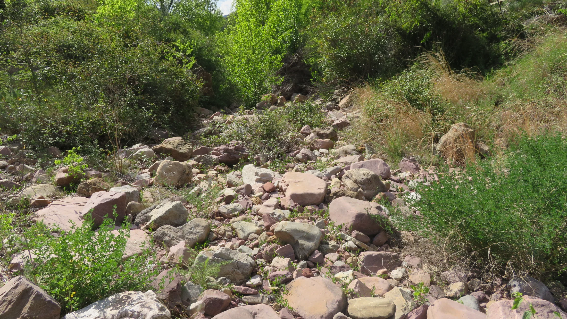
The Turia River cuts a sandstone canyon at Chulilla, where airy walkways and the famed Chulilla suspension bridges link both sides. This loop—often called “Ruta de los Calderones”—is a Valencia classic for drama without alpine exposure. Sun-warmed cliffs glow ochre while the river murmurs below like a constant, cool breath.
- Distance and time: 8–10 km loop, 2.5–4 hours depending on detours (Charco Azul adds time).
- Elevation gain: ~250–350 m; many steps and short ramps.
- Difficulty: Moderate; not recommended in strong winds for those uneasy with heights.
- Highlights: Two suspension bridges, Turia pools, canyon views, optional detour to Charco Azul and the dam walkway.
- Access and parking: From Valencia via CV-35 to Losa del Obispo, then local road to Chulilla; park at signed areas near the dam or village outskirts—arrive early on weekends.
- Public transport: Regional buses run on limited schedules (weekday-biased); reconfirm times before you go.
- Best season: Autumn to spring; summer at first light.
- Cautions: Avoid or postpone after heavy rain—flash flooding risk and slippery paths; carry water year-round.
If you search for rutas senderismo Valencia, this route appears at the top for good reason: it blends scenery and infrastructure seamlessly. Combine the hike with the medieval castle and a coffee in the plaza to support local bars and bakeries.
Chelva: Ruta del Agua and easy viewpoints
Chelva’s “Ruta del Agua” is a signed circuit linking springs, shaded gorges, and the bathing spot La Playeta—simple in navigation and rich in detail. It’s an ideal family route when the Turia (Tuéjar) tributaries flow, and a gentle winter sun keeps the day inviting. Cold spray at La Playeta kisses your face as walnut leaves rustle overhead.
- Distance and time: 7–9 km loop, 2–3 hours at an easy pace.
- Elevation gain: ~150–200 m, mostly gentle.
- Difficulty: Easy to easy-moderate; short rocky steps and narrow ledges require handholding for young children.
- Highlights: La Playeta bathing cove, Molino Puerto, tunnels by the river, historic fountains.
- Waymarking: Clear local signs; pick up the town map at Chelva’s tourism office for variants.
- Access: CV-35 from Valencia; ample parking in signed lots—please avoid blocking farm access.
- Public transport: Regional buses serve Chelva on limited schedules; check updated times the day before.
- Best season: Late winter through spring for flow; autumn for stable weather.
Balance nature with culture: walk the Ruta del Agua Chelva in the morning, then wander the Jewish, Arab, and Christian quarters. For picnic days, pack a towel and water shoes; currents change after storms, so supervise kids closely.
Vía Verde Ojos Negros: rail trail for bikes and relaxed walkers
The Vía Verde Ojos Negros follows Spain’s longest rail-to-trail conversion from Teruel to Sagunt, with smooth gravel and gentle grades. While cyclists love the long roll, walkers can cherry-pick scenic, train-accessible segments for an easy day out. The rhythm of wheels on fine gravel sounds like soft rain on canvas.
- Character: Historical railway bed; near-flat gradients, wide path; shade varies.
- Recommended walking segments:
- Navajas ↔ Jérica: 10–12 km round trip; train stops at both ends (C-5 line).
- Segorbe ↔ Jérica: 16–20 km round trip; extendable for ambitious walkers.
- Time: 2–5 hours depending on distance and breaks.
- Difficulty: Easy; perfect for strollers with sturdy tires and “easy hikes Valencia” seekers.
- Surface: Compacted gravel/asphalt; sports shoes fine in dry weather.
- Access: Drive A-23 or take Renfe Cercanías C-5 (Valencia–Sagunt–Segorbe–Jérica–Caudiel); start from stations to simplify logistics.
- Best season: Year-round; choose sunrise/sunset in summer.
- Options to shorten: Do out-and-backs from a midline station; turn around at scenic cuttings or viaducts.
This route pairs well with a café stop in Segorbe or Navajas’ Salto de la Novia waterfall viewpoint (short detour on foot).
Sierra Calderona: the Garbí ascent and Mediterranean views
The Sierra Calderona rises just northwest of the city, with El Garbí as its best-known balcony over the sea and the huerta. Multiple paths climb through pines and kermes oak to easy scramble viewpoints, perfect when you want a summit feel without big mileage. Warm resin scents linger while the breeze carries a hint of salt from the coast.
- Route idea: Serra village circular to El Garbí and back via ridge paths.
- Distance and time: 8–10 km, 3–4 hours.
- Elevation gain: 350–500 m; short rocky steps near the mirador.
- Difficulty: Moderate; brief hands-on rock sections if you explore the ledges.
- Highlights: “Sierra Calderona Garbí” viewpoints, Mediterranean scrub, distant skyline of Valencia.
- Shade and water: Limited shade on ridges; no fountains—carry 1.5–2 L per person in warm months.
- Access: A-23 to Serra/Segart or CV-310 from Moncada/Náquera; signed pull-outs and village parking.
- Summer note: Start at dawn or late afternoon; midday heat reflects off rock slabs.
For longer days, link trails toward Pico Rebalsadors or Rodana peaks. In dry summers, obey fire restrictions and stick to marked paths to protect fragile scrub.
Sierra de Espadán: cork oak groves and red sandstone trails
Though just over the provincial border in Castellón, the Sierra de Espadán sits close enough to count among hiking trails near Valencia. Its rodeno (red sandstone) and cork oak forests create soft, springy paths, with villages tucked into folds like Aín, Almedíjar, and Eslida. Cork bark feels cool to the touch as needles release a peppery pine scent.
- Option 1: Aín – Pico Espadán loop.
- 11–13 km, 600–700 m gain, 4–5 hours; steady climbs, rocky in places.
- Option 2: Almedíjar – Nevera (icehouse) and springs.
- 9–11 km, 400–500 m gain, 3–4 hours; mixed forest, heritage stops.
- Difficulty: Moderate; rough sandstone demands grippy soles.
- Terrain: Rock slabs and loose gravel; trekking poles recommended for descents.
- Access: A-23 to Segorbe then local roads; village parking is limited—arrive early.
- Best season: Spring and autumn; winter is crisp and clear; summer viable at dawn under tree cover.
Combine hikes with local produce—almonds, cheeses, and olive oil—sold by small shops that keep these valleys lively.
L’albufera and El Saler: coastal paths and birdwatching
South of the city, L’Albufera’s freshwater lagoon meets the Devesa’s dune forests and El Saler’s beaches, perfect for relaxed walking and wildlife spotting. Flat loops on boardwalks and sandy paths welcome families, with hides for quiet birdwatching and wide skies for photographers. Reeds whisper as herons lift off like folded kites at dawn.
- Routes: Devesa boardwalk circuits (2–6 km), Gola de Pujol to the lookout (3–5 km), Racó de l’Olla trails (short).
- Difficulty: Easy; prams manageable on boardwalks; sand slows the pace on beach stretches.
- Time: 1–3 hours; add time for hides and shoreline breaks.
- Best times: Sunrise and sunset for light, fewer people, and active birds.
- Access: V-15/El Saler road; seasonal parking fills fast—arrive early or use bus lines to El Saler/Perellonet.
- Combine with: A swim from late spring to early autumn, or sunset photography boat trips from the village of El Palmar.
- Note: These are truly senderos cerca de Valencia—close enough to pair with a city lunch or evening paella.
Carry binoculars and keep noise low around hides; you’ll likely see egrets, terns, and seasonal migrants.
Hoces del Cabriel: canyons, cliffs and wide river bends
On the western edge of the province, the Hoces del Cabriel Natural Park showcases Spain’s largest protected river system meandering between cliffs and piney plateaus. Trails weave to lookouts, down to pebbly banks, and across airy edges where caution matters. The river gleams like a green ribbon while wind drums gently on juniper.
- Sample routes:
- Mirador circuits near Villargordo del Cabriel: 6–10 km, 2–3.5 hours, moderate.
- Vadocañas bridge approach and riverbank segments: 8–12 km, 3–4.5 hours, moderate with short steeps.
- Elevation: 200–450 m gain depending on variants; exposed sections near drop-offs.
- Difficulty: Moderate; families okay on shorter lookout loops with strict supervision at edges.
- Access: A-3 toward Requena; reach Villargordo del Cabriel or Venta del Moro, then signed park roads.
- Season: Spring and autumn shine; winter is crisp; avoid peak-heat hours in summer.
- Safety: Respect barriers, watch footing on marls after rain, and avoid storm days in ravines.
Pair your walk with a cultural stop in Requena’s old town on the way back, or a picnic on legal river terraces away from fragile vegetation.
Requena–utiel: vineyard paths and hidden karst
Between Requena and Utiel, broad vineyard tracks roll beneath big skies, punctuated by patches of pine and outcrops of karstic limestone. These circuits are gentle, scenic, and ideal when you want space, easy navigation, and local flavors. Grapevines rattle softly as a light breeze carries the scent of earth and must.
- Route ideas:
- Vineyard loop from San Antonio (Requena): 8–12 km, 2–3.5 hours, easy.
- Utiel country tracks toward Sierra de Negrete foothills: 10–16 km, 3–5 hours, easy-moderate.
- Terrain: Farm tracks and occasional rocky lanes; minimal shade away from pines.
- Difficulty: Easy to easy-moderate; good for building endurance.
- Access: A-3 or Renfe Cercanías C-3 to Requena/Utiel; start from town edges to avoid driving.
- Best season: Spring and autumn; winter clear days; avoid midsummer midday heat.
- Combine with: Winery visits (Bobal grape), Requena’s caves and historic quarter—book tastings ahead and walk or designate a driver.
Carry extra water and sun protection; distances feel longer in open country without shade.
Huerta ravines and rivers: rural paths and traditional ways
Valencia’s peri-urban landscape hides flat, family-friendly routes along irrigation channels, riverbanks, and shallow ravines. These paths reveal the living huerta—farmers tending artichokes, citrus, and chufa—and the web of traditional roads that predate highways. The earthy smell of tilled soil mixes with orange blossom in spring.
- Options:
- Turia River Park (Parque Fluvial del Turia): choose 6–20 km out-and-backs near Manises, Paterna, or toward Vilamarxant.
- Barranc del Carraixet green corridor: flat walking from Almàssera/Bonrepòs seaward; watch for post-rain mud.
- Marjal dels Moros (near Sagunt): short wetland loops on firm tracks.
- Difficulty: Easy; perfect for prams and bikes on selected sections.
- Time: 1–4 hours; tailor to kids’ pace.
- Access: MetroValencia and buses reach many trailheads; parking plentiful but respect farm gates.
- Season: Year-round; avoid rainy days in ravines due to flash flooding and mud.
These are the simplest senderos cerca de Valencia to fit into a busy weekend, with cafés and bakeries never far away.
Quiet serrano paths: lesser-known, peaceful alternatives
When you want solitude, head to smaller ranges away from headline spots—still close, but with fewer boots on the trail. Two ideas balance tranquility with satisfying terrain. A kestrel hangs in the still air as thyme brushes your calves with a resinous touch.
- Sierra de Martés (Yátova): Crest route via forest tracks and narrow paths.
- 11–13 km, 500–700 m gain, 4–5 hours; moderate; expansive views, occasional rough footing.
- La Murta valley (Alzira): Monastery ruins and ridge spurs.
- 7–10 km, 400–600 m gain, 3–4 hours; moderate; brief scrambles optional.
- Waymarking: Local
PR-CVnetworks; check signage status with municipal websites or onsite boards. - Access: A-3 toward Buñol (for Martés); AP-7/A-7 toward Alzira (for La Murta).
- Best season: Autumn to spring; early summer possible at dawn.
These alternatives shine when Chulilla or El Garbí feel busy; they’re also good candidates for wildlife watching at quiet hours.
Getting There, When To Go, and Services You’ll Actually Use
Travel logistics for Valencia’s trail network are refreshingly simple. By car, radiating corridors connect quickly: CV-35 to Chelva and Chulilla, A-23 to Sierra Calderona and the Vía Verde stations, and A-3 to Requena–Utiel and Hoces del Cabriel. In under 40 minutes, you can leave the city grid behind and step into pine shade or dune scrub. The metallic scent after a brief rain hints at desert freshness on the CV-35.
Public transport works well for several hubs. Renfe Cercanías C-5 serves Sagunt, Segorbe, Jérica, and Caudiel for the Vía Verde Ojos Negros; C-3 reaches Requena and Utiel for vineyard loops. MetroValencia and regional buses link the city with El Saler and the Devesa boardwalks. For Chelva and Chulilla, regional buses run limited timetables (often weekday-focused), so verify schedules one day prior; if the return is tight, plan out-and-backs or arrange a pick-up.
Parking fills early at hotspot trailheads. Practical habits help:
- Aim for sunrise arrivals on weekends at Chulilla, El Saler, and Serra.
- Use signed parking lots; never block farm tracks or irrigation channels.
- In small villages, park once at the entrance and walk in to reduce traffic in narrow streets.
Seasonality steers comfort and safety. Coastal and wetland walks (El Saler, L’Albufera) excel at sunrise and sunset year-round; midsummer midday heat and glare are harsh, so bring a hat, sunglasses, and extra water. Sierra and canyon routes (Calderona, Espadán, Hoces del Cabriel, Chulilla) shine in spring and autumn; in summer, go at dawn, choose shady, forested options, and cap activities by late morning. Winter delivers clear air, low crowds, and early nightfall—carry a headlamp if your turnaround is late.
Rain changes canyon dynamics and farm-track conditions. Deluge makes ravines risky for flash floods and slippery marls; postpone Chulilla, Chelva tunnels, and Carraixet after heavy rain. In the huerta, clay paths clog with mud; stick to paved service lanes. After storms, wind brings falling branches to pinewoods—scan treetops in gusty conditions.
Protected area rules vary, but some basics hold across Valencia’s parks:
- No open fires; seasonal high-risk periods often come with total bans on outdoor flames.
- Stay on signed paths to protect dunes, wetlands, and fragile scrub.
- Drones are restricted or banned in natural parks; check local rules before flying.
- Park hours may limit vehicle access to certain tracks; obey gates and signage.
Finally, carry essentials even on short routes: water, snacks, a wind layer, and a charged phone with offline maps. Small towns along the way sustain these landscapes; plan to stop for coffee, buy bread, or sample olive oil—those euros keep rural services open through the quiet months.
Where To Stay and What You’ll Need Nearby
Choosing a base makes days smoother and supports communities that care for trails and water channels. Think in clusters:
- Chulilla/Chelva: Rural houses and small hotels place you at canyon and river routes with minimal driving.
- Serra/Naquera (Sierra Calderona): Quick access to El Garbí and shaded forest loops, with city proximity.
- Requena/Utiel: Vineyard paths on your doorstep and easy hops to Hoces del Cabriel.
- El Saler/El Palmar: Coastal and wetland walks plus sunset boat options.
Accommodation ranges from family-run casas rurales to small hotels and simple hostels; campsites serve coastal and mountain corridors. Book weekends and spring/autumn holidays early, especially in Chulilla and Espadán, where village capacity is limited. A faint woodsmoke smell at dusk signals a village easing into quiet after day hikers head home.
Useful services for hikers and cyclists cluster around trail towns:
- Water and food: Supermarkets and bakeries in Chelva, Chulilla, Serra, Requena, Utiel, Segorbe; many close midday and on Sundays—stock up in advance.
- Tourist information: Town offices provide printed maps and current trail conditions; they also advise on temporary closures.
- Bike rentals and repairs: Available in towns along the Vía Verde Ojos Negros corridor (Navajas, Segorbe, Jérica); confirm hours and models in advance.
- Taxis/transfers: Handy for point-to-point Vía Verde segments or late bus gaps—ask at tourist offices for local contacts.
- Camping and day facilities: Coastal sites near El Saler offer shade, showers, and beach access; inland campgrounds dot Espadán and Calderona approaches.
Pick lodging based on your highest-priority outing. If the Chulilla bridges and Chelva’s Ruta del Agua anchor the weekend, stay upriver to avoid CV-35 shuttling. For mixed days—one summit, one wetland sunrise—split nights between Serra and El Saler. When in doubt, pack light layers, quick-dry towels for river dips, and a soft cooler for orchard purchases.
What Else To Do: Lookouts, Bridges, Pools and Flavors
Hiking days around Valencia pair naturally with small adventures and slow pleasures. Photographers chase slanting light in canyons, birders collect species lists across rice paddies, and families cool tired legs in river pools. Sun gilds the Garbí cliffs at golden hour while egrets stitch white lines across L’Albufera.
Add these activities to round out a route:
- Landscape photography:
- Chulilla canyon: early light on cliff faces; compose with bridges for scale.
- El Garbí: wide views over the huerta and sea; bring a polarizer to manage glare.
- Vía Verde cuttings and viaducts: repeating lines for minimalist frames.
- Birdwatching:
- Racó de l’Olla and Gola de Pujol (L’Albufera): hides for herons, egrets, terns, and seasonal ducks.
- Marjal dels Moros: waders and raptors, especially in migration seasons.
- Tip: Carry binoculars, move slowly, and dress in muted colors.
- River bathing and play:
- La Playeta (Chelva): family-friendly when flows are gentle; watch footing.
- Turia pools near Chulilla: short detours from the main trail; observe posted safety notices.
- Always avoid swimming after heavy rain and check water clarity/current.
Culture and taste deepen the day:
- Villages and heritage:
- Chelva’s historic quarters (Jewish, Arab, Christian) reward an hour’s stroll.
- Chulilla’s castle and narrow lanes offer shade and stories.
- Requena’s caves and old town connect wine history to geology.
- Food and drink:
- Paella and seasonal rice dishes in El Palmar link plate to paddy fields.
- Orchard snacks: oranges, almonds, and horchata made from local chufa.
- Wineries in Requena–Utiel pour Bobal reds and fresh rosés; book tastings and arrange a driver or go on foot.
Day planning ideas:
- Canyon + village: Chulilla bridges in the morning, castle visit and lunch, Charco Azul siesta, easy stroll at dusk.
- Summit + wetland light: Garbí at dawn, city lunch, El Saler boardwalk for a sunset bird session.
- Rail trail + café culture: Train to Navajas, Vía Verde loop to Jérica, late lunch in a plaza, return by train.
Keep impact low: pack out litter, skip drone flights in colonies, and step softly around wetland edges where invisible nests shelter new life.
Practical Tips and Safety for Valencia’s Trails
Mountains and marshes near Valencia invite spontaneity, but a light plan keeps days smooth and safe. The first cool breeze at dawn often predicts a comfortable outing; the second tells you to drink. One deep breath in the pines tastes faintly of resin and salt.
Gear basics:
- Footwear: Grippy trail shoes for sandstone and loose marls; avoid slick soles on Espadán rodeno slabs.
- Clothing: Layered approach—sun hat, breathable top, wind layer; in winter add gloves and a light fleece.
- Water and food: In mild weather, carry 0.5–0.75 L per hour; in summer heat, 0.75–1 L per hour. Pack saltier snacks than you think you need.
Navigation and waymarks:
- Trail signs:
GRred/white = long-distance routes.PRorPR-CVyellow/white = short/medium regional routes.SLgreen/white = local paths.
- Apps and maps: Use IGN’s “Mapas de España” for official layers and offline downloads; cross-check user tracks (Wikiloc, AllTrails) with topos before committing.
- Battery and backup: Keep phones in airplane mode when not navigating; carry a small power bank for routes over 3 hours.
Heat, weather, and terrain:
- Summer strategy: Start at dawn, target shade (Espadán, river corridors), and finish before late morning. Wet your cap, rest often, and watch kids for early heat signs.
- Rain and wind: Avoid ravines after storms and on days with severe wind warnings; marls turn to grease and pine branches fall.
- Cliffs and canyons: Respect barriers, keep children within arm’s reach at ledges, and avoid crowding suspension bridges.
Family specifics:
- Route selection: Choose under-6 km, <200 m gain, and loop formats (Chelva, El Saler boardwalks, Turia River Park).
- Pace: Use landmarks (bridges, hides, springs) as short-goals; stop often for snacks and shade.
- Water play: Only where flows are gentle and access is signed; bring water shoes for sharp pebbles.
Emergencies:
- Dial 112 in Spain for rescue.
- Give your location using phone GPS coordinates (decimal degrees) or a nearby landmark and trail name.
- Before you go: Share your plan and turnaround time with someone, especially on lesser-known serranos.
Trail etiquette sustains the places we love: greet farmers, close gates, leave no trace, and buy from small shops when you can—the exchange keeps paths alive.
Frequently Asked Questions
What fitness level do I need, and which routes match it?
Start from honest self-assessment and build gradually. If you want easy hikes Valencia can deliver flat or nearly flat options: El Saler boardwalks, Turia River Park sections, and short Vía Verde Ojos Negros segments (2–10 km) suit beginners and families. Soft sand underfoot in El Saler slows the pace but relaxes the stride.
Moderate routes add elevation without technicality: Chelva’s Ruta del Agua (7–9 km, ~150–200 m gain), Chulilla’s bridges loop (8–10 km, ~250–350 m gain), and a Serra-to-Garbí circular (8–10 km, ~350–500 m) reward with views and variety. For a harder day, choose Espadán’s Pico loop (11–13 km, 600–700 m) or longer Hoces del Cabriel circuits with mixed surfaces. Progress by increasing one variable at a time—distance, then elevation, then roughness—and keep weekly consistency over heroic single days. If you finish your chosen walk still smiling, you picked well; if you finish depleted, step back next time and add more shade, water, and rest.
When is the best season for each route, and what should I avoid?
Match route to season. Coastal and wetland outings (El Saler, L’Albufera) excel year-round, with sunrise and sunset the safest, prettiest summer windows for light, breeze, and birdlife. Evening warm air at the lagoon smells faintly of salt and grass.
Sierra and canyon paths (Sierra Calderona Garbí, Chulilla, Ruta del Agua Chelva, Hoces del Cabriel) shine in spring and autumn for mild temperatures and stable footing. Winter offers crystal views and quiet trails; bring a warm layer and consider earlier turnarounds. Avoid canyons after heavy rain—flash floods and slick marls make them treacherous—and skip midday summer climbs on bare ridges. The Vía Verde Ojos Negros is a shoulder-season star and a dawn/sunset friend in summer. In all cases, check local advisories for fire risk or temporary closures, and recalibrate your plan if wind warnings rise.
How do I get there and where can I Park without stress?
From Valencia city, driving times are short: 30–40 minutes to Serra/Naquera (Calderona), 35–50 to Sagunt/Segorbe/Jérica (Vía Verde), 60–75 to Chulilla and Chelva via CV-35, and 80–100 to Hoces del Cabriel via A-3. Early arrival saves you from circling narrow village streets.
Public transport is practical for specific hubs. Take Renfe Cercanías C-5 to Segorbe/Jérica/Caudiel for the Vía Verde Ojos Negros, and C-3 to Requena/Utiel for vineyard loops; buses reach El Saler frequently and serve Chelva/Chulilla on limited schedules—verify outward and return times the day before. Park only in signed lots or along wide verges where permitted, never across farm gates or irrigation ditches. In Chulilla and Chelva, consider parking once at the village entrance and walking in to reduce congestion; at El Saler, aim for sunrise to secure coastal spaces and walk boardwalks to the quieter dunes.
Can I bring my dog on these routes, and what should I consider?
Yes, many routes welcome leashed dogs, but responsibilities change with terrain and season. In natural parks and sensitive habitats (wetlands, dunes), keep dogs on a short leash and away from bird hides and reedbeds to avoid disturbance. A wagging tail flicks sand as paws patter softly on boards.
Choose cooler hours—dawn and dusk in warm months—and carry extra water and a collapsible bowl. Avoid hot sand and bare rock at midday; test surfaces with your hand. Flat, shaded paths suit most dogs: Turia River Park, El Saler boardwalks, and vineyard tracks. Skip suspension bridges with mesh decks if your dog dislikes gaps, and avoid steep, exposed canyon ledges on windy days. Pick up waste and pack it out; on farm tracks, give wide berth to livestock and ask before crossing active fields. Finally, check signage: some beaches and certain zones have seasonal dog restrictions.
Do I need specific maps or apps, and how do I use trail markings?
Use a mix of official maps and trusted apps. Spain’s national mapping agency offers the “Mapas de España” app with IGN layers and offline downloads; pair it with user-friendly platforms like Wikiloc or AllTrails for recent track insights and photos. Phone in your palm, a thin blue line hums quietly under your thumb as you follow the trail.
Before leaving, load your intended GPX, download offline basemaps, and confirm the route’s start/end logistics. Learn the color codes: GR red/white for long-distance, PR or PR-CV yellow/white for short/medium, and SL green/white for local loops. On intersections, remember: two parallel stripes mean “correct,” an “X” means “wrong way,” and a 90-degree bend in the stripes signals a turn. Carry a power bank for days beyond three hours, and stash a paper map or printed screenshot as insurance. In villages, tourism offices often provide free route leaflets with waymark updates—grab one, and take a photo of the kiosk map at the trailhead.
Book your experience — explore active tourism across Spain with providers verified by Picuco.
Conclusion
Valencia’s backyard holds a full spectrum of walking days: coastal boardwalks at El Saler, family-friendly rivers like the Ruta del Agua, balcony summits on the Sierra Calderona, rail-trail rambles on the Vía Verde Ojos Negros, and canyon drama at Chulilla and Hoces del Cabriel. With short travel times, generous light, and a living huerta at the doorstep, you can weave nature into your week without complicated logistics. A faint orange blossom note on the air reminds you how close city and countryside truly are.
Plan with simple tools and good habits. Download IGN basemaps, confirm bus and train timetables, and check natural-park advisories from the Generalitat Valenciana before you go. Book rural stays in Chulilla, Chelva, Serra, or Requena early for spring and autumn weekends. At the trailhead, carry water, read waymarks, avoid ravines after heavy rain, and keep your footprint light by staying on signed paths.
If you want to go further, ask local tourism offices for printed route sheets, look for PR-CV and SL updates on municipal sites, and keep a small list of sunrise and sunset spots for flexible plans. Choose one trail for this weekend, and sketch the next two—Valencia’s network will keep you walking, learning, and returning with new stories.