Why Hiking Around Granada Captures So Many Kinds of Journeys
Granada is a rare place where high summits, river valleys, and whitewashed villages sit within an hour’s reach. If you’re planning hiking Granada, this guide gathers ten routes that show Sierra Nevada’s granite ridges, the Genil’s green corridor, and the Alpujarra’s terraced hillsides. Morning air smells of thyme on the slopes, and river spray cools your face in the gorges. Use this list to match a day’s ambition with clear data on distance, ascent, timing, and access.
The landscape at a glance
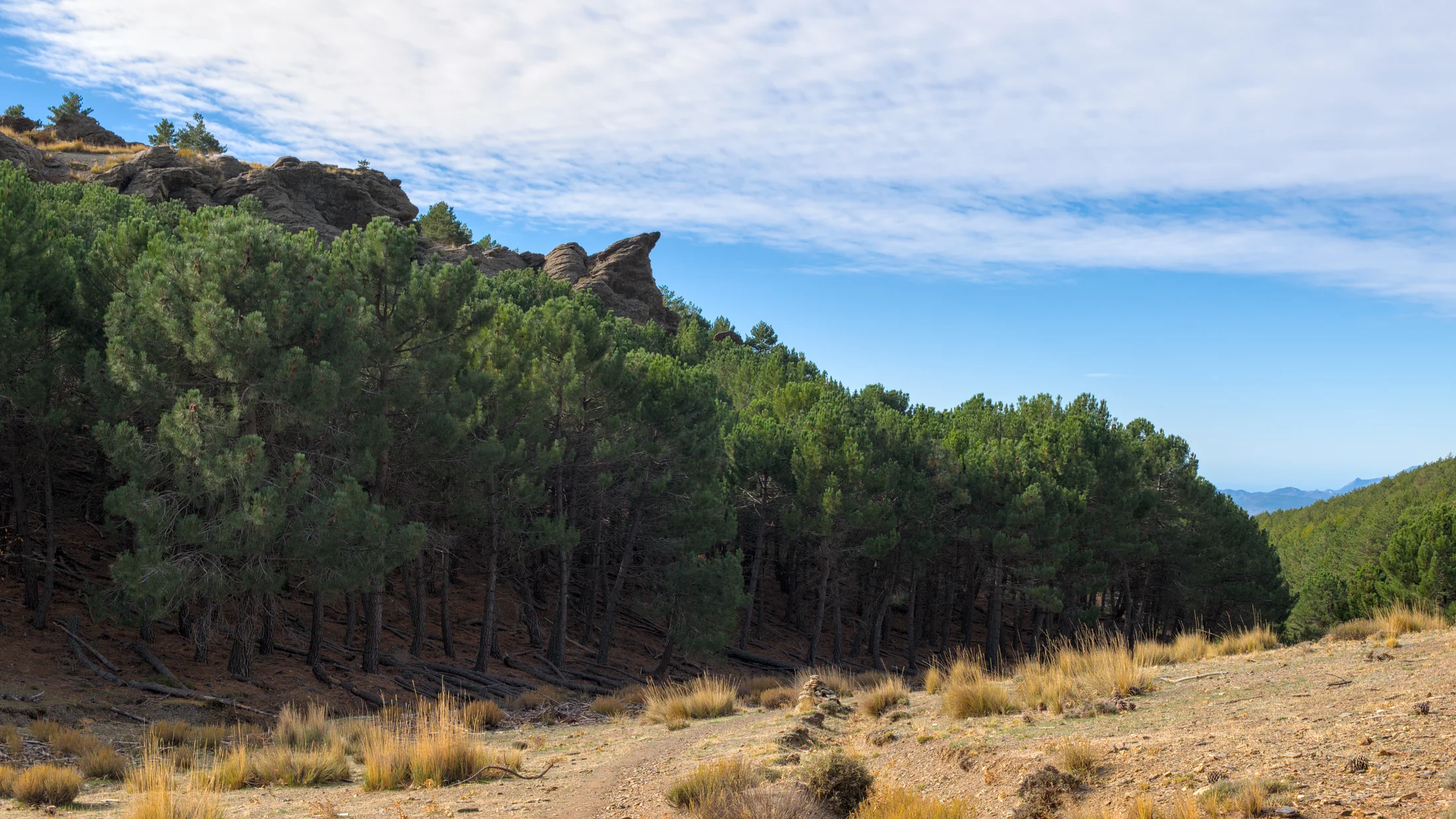
From the 3,479 m Mulhacén to the orchards of the Vega de Granada, the province sits on a clean gradient of altitude and climate. You can wander easy, shady tracks by the Genil one day and step onto high-mountain paths above 2,500 m the next. In summer, start early and favor river or forest routes; in winter and spring, expect snow and ice on Sierra Nevada hikes above 2,000–2,300 m. Sun warms south-facing terraces in the Alpujarra while the north faces hold cold, so kit up accordingly. The late light paints the ridges copper as foxgloves nod in the evening breeze. Always check the weather forecast (AEMET), carry layers, water, and a map or GPS track, and tell someone your plan.
How we chose these 10 routes
You’ll find variety: family-friendly river strolls, interpretive paths, balcony trails with mining history, and summit pushes for experts. We prioritized:
- Quick access from Granada (≤ 90 minutes by car; several with public transport).
- Manageable durations (2–9 hours) and a range of elevation gains.
- Strong landscape/cultural interest (gorges, acequias, Moorish villages).
- Marked paths or well-trodden lines, with options to download GPX.
- Practical logistics (parking, shuttles, refuges) where relevant.
Cork oaks, chestnuts, and the high serranía all make an appearance, and you’ll meet the Grenadine communities who keep these paths clear and traditions alive.
Picuco te puede ayudar
Does something here catch your eye?
Tell us.
Write to us on WhatsApp or email: we answer questions, find the best options and help you sort out the booking.
10 Hiking Routes Near Granada
1.Los Cahorros (monachil): Sierra Nevada Within City Reach
Swinging suspension bridges, limestone walls, and river-cooled shade make Los Cahorros a classic close to town. The route threads narrow catwalks and duck-through ledges in the Monachil gorge, yet stays friendly for families used to uneven ground. Water hums under the planks as swifts stitch the air above the cliffs.
- Location: Monachil (8–12 km from Granada center)
- Distance/Time: 8–9 km circular; 2.5–3.5 hours
- Elevation gain: ~250–300 m; Difficulty: Easy–Moderate
- Best season: Spring and autumn; summer early/late for shade; winter after rains can be slippery
- Access: Local bus or car to Monachil village; limited free parking near trailheads—arrive early
- Highlights: 55 m suspension bridge, slot-gorge passages, light “via ferrata–style” rails, river pools
- Notes: Short ledges with handholds may unsettle vertigo-prone hikers; supervise children closely; avoid high water days
Tips: Walk counterclockwise to face the ledge sections head-on, and carry a small daypack to squeeze through overhangs. This Los Cahorros hike is one of the most popular in hiking Granada, so go midweek if possible.
2.Vereda de la Estrella (güéjar Sierra): Big Views and Mining Echoes
The Vereda de la Estrella contours high above the Río Genil, offering grandstand views of Alcazaba, Veleta, and Mulhacén while passing rusted ore-wagon remains. It is long but gentle, an “out-and-back” you can tailor to daylight and energy. Pine resin and cold river scent drift up on afternoon thermals.
- Location: Güéjar Sierra – trailhead at Barranco de San Juan
- Distance/Time: 18–21 km out-and-back (turn whenever you wish); 5–7.5 hours
- Elevation gain: ~700–900 m; Difficulty: Moderate (length more than steepness)
- Best season: Autumn for stable weather and color; spring for snow-capped panoramas
- Access: Car to Güéjar Sierra (parking at end of road; fills fast); limited bus service to village then taxi
- Highlights: Historic mine ruins, chestnut groves, viewpoints of the North Face ridges, old stone bridges
- Connections: Links with the
GR-240(Sulayr) stages in the upper Genil basin - Notes: Narrow sections above drop-offs—watch footing; carry 2 L water per person; sturdy shoes essential
Start early to catch alpenglow on the high summits and turn around at a clear time marker (e.g., 3 hours out) to ensure a safe return before dark. Among Sierra Nevada hikes, it’s a benchmark balcony trail.
3.Old Tramway Path/greenway (canales–río Genil): A Riverside Stroll
The Vía Verde del Tranvía traces the alignment of the historic Sierra tramway that once connected Granada to Güéjar Sierra. Expect a smooth gradient, river views, bridges, and short tunnels, perfect for families, runners, and cyclists. Sunlight flickers through poplars like a metronome over the water.
- Location: Cenes de la Vega to Pinos Genil/Güéjar Sierra (choose a section)
- Distance/Time: 10–14 km one-way; 2.5–4 hours walking (shorter family segments available)
- Elevation gain: Minimal; Difficulty: Easy
- Best season: Year-round; summer mornings/evenings for shade near the Genil
- Access: Frequent buses from Granada to Cenes/Pinos Genil; linear route works well with two cars or bus return
- Highlights: Old tram bridges, stone cuttings, riverside picnic spots, gentle grades ideal for kids’ bikes
- Notes: It is a linear path—plan transport; carry lights for short tunnels if with kids; keep right on shared sections
For a simple plan, start in Cenes de la Vega, walk to Pinos Genil for a break, and bus back. This is the Genil river trail segment many locals use for everyday nature time within the wider hiking Granada scene.
4.Poqueira Gorge (pampaneira–bubión–capileira): Alpujarra Essentials
White villages step up the Poqueira Gorge, linked by cobbled mule paths, irrigation channels, and terrace edges. You can craft a loop visiting the three villages, dipping into museums and fountains between sections of high-banked trail. Smoke from wood ovens sometimes hangs in the cool gullies like a memory.
- Location: Barranco de Poqueira, Alpujarra (Pampaneira, Bubión, Capileira)
- Distance/Time: 9–12 km loop; 3–4.5 hours
- Elevation gain: ~450–600 m; Difficulty: Moderate (uneven stone and short steeps)
- Best season: Autumn for chestnut color; spring for flowing acequias and flowers
- Access: Bus or car via A-4132; parking areas at village edges—respect signed zones
- Highlights: Moorish architecture, terrace farming, acequia paths, cliff-edge viewpoints
- Notes: Narrow terraces and cobbles can be slick; trekking poles help; check inter-village bus times if you make it linear
This route anchors Alpujarra hiking trails with culture: stop for local cheeses in Bubión or a textile workshop in Pampaneira. Safety-wise, mind exposed bends after rain, and keep children on the inside of terraces.
5.Alpujarra Village Loops: Circuits Between Cliffs and Hamlets
If you love variety, two representative circulars stitch together time-polished paths and sociable stops. Option A circles Mecina Fondales–Ferreirola–Atalbéitar in the Taha valley; Option B links Soportújar and Pampaneira on old GR-7 lines. The scent of rosemary and woodsmoke threads the lanes.
-
Option A (La Taha Classic):
- Distance/Time: 7–9 km loop; 2–3 hours
- Elevation gain: ~250–350 m; Difficulty: Easy–Moderate
- Highlights: Stone bridges, shady barrancos, tiny hamlets with carved portals
-
Option B (Soportújar–Pampaneira Loop):
- Distance/Time: 11–13 km loop; 3.5–4.5 hours
- Elevation gain: ~450–550 m; Difficulty: Moderate
- Highlights: Balcony views into the Poqueira, hermitage viewpoints, sections on the
GR-7
-
Best season: Spring and autumn; winter sunny days can be superb; summers can be hot—start early
-
Access: Bus or car to each village; parking is limited in historic centers
-
Notes: Cobblestones and irrigation crossings can be slippery; pack sun protection and 1.5–2 L water
These loops exemplify senderismo in the Alpujarra: you move at your own pace between living villages, with cafés and fountains for authentic pauses.
6.Route of the Ancient Olive Trees (órgiva): Family-friendly and Cultural
Órgiva’s low hills hold centuries-old olive trees with trunks like knotted sculptures, reachable on signed farm tracks and lanes. The route blends short slopes, rural views, and interpretive panels on traditional agriculture. Warm dust puffs underfoot and crushed olive leaves give a peppery scent.
- Location: Órgiva, western Alpujarra
- Distance/Time: 5–7 km loop; 1.5–2.5 hours
- Elevation gain: ~150–200 m; Difficulty: Easy
- Best season: Late winter to spring for blossom; autumn for harvest atmosphere
- Access: Regular buses or car via A-348; parking on the town’s outskirts
- Highlights: Millenary olive specimens, terraces, viewpoints over the Guadalfeo valley
- Notes: Mostly on wide paths and lanes; suitable for active seniors and children; sun-exposed—bring hats and snacks
Combine the stroll with a local market stop or a visit to small mills when open. For hiking Granada with extended family, this is a soft, meaningful option that connects landscape and livelihood.
7.Laguna de la Caldera (from Capileira): High-mountain Tarn
Laguna de la Caldera sits in a rocky cirque just below Mulhacén, often rimmed with snow into early summer. From Capileira, you either hike up from Hoya del Portillo or use the seasonal high-mountain shuttle to Alto del Chorrillo and traverse to the basin. Wind carries the clean chill of granite and meltwater.
- Location: Sierra Nevada, above Capileira
- Distance/Time:
- From Alto del Chorrillo: 10–12 km out-and-back; 3.5–5 hours
- From Hoya del Portillo: 16–20 km out-and-back; 6–7.5 hours
- Elevation gain:
- From Alto del Chorrillo: ~500–650 m; Difficulty: Moderate (altitude)
- From Hoya del Portillo: ~900–1,100 m; Difficulty: Moderate–Challenging
- Best season: July–September (most snow-free); late spring for snow patches—microspikes may be needed
- Access: Summer shuttle from Capileira (advance booking required); otherwise drive to Hoya del Portillo trailhead
- Highlights: High-alpine flora, ibex sightings, sweeping views to the Poqueira
- Notes: High mountain conditions—rapid weather shifts; carry warm layers, map/GPS, and extra water (no reliable sources late summer)
This is among the classic Sierra Nevada hikes for strong hikers not seeking a summit day. Check the Parque Nacional y Natural de Sierra Nevada and the Capileira visitor information for shuttle status and restrictions.
8.Mulhacén Summit: A Route for Experienced Hikers
At 3,479 m, the Mulhacén is the Iberian Peninsula’s highest point, and the most direct non-technical ascent in Spain—yet still a serious mountain day. Two frequent approaches are from Hoya de la Mora near Sierra Nevada ski area, and from Alto del Chorrillo above Capileira. The air thins to a clean, metallic cool as scree whispers under boots.
- Location: Sierra Nevada High Sierra
- Main approaches:
- Hoya de la Mora (via Veleta–Carihuela–La Caldera): 25–30 km round trip; 1,200–1,400 m gain; 8–11 hours; Difficult (length/altitude)
- Alto del Chorrillo (Capileira shuttle): 12–14 km round trip; 700–900 m gain; 5–7.5 hours; Moderate–Difficult (altitude)
- Best season: July–September; June/October possible in settled weather; avoid winter without alpine skills
- Access: Bus or drive to Hoya de la Mora; summer shuttle from Capileira to Alto del Chorrillo (book ahead)
- Refuges: Guarded Refugio Poqueira (book in advance) for two-day plans; basic emergency shelter at Refugio de la Caldera (no services)
- Notes: No permit generally required for the Mulhacén summit hike, but park regulations apply (group sizes, bivouac rules, protected areas); carry GPS, windproof layers, sun protection, 2–3 L water; turn back in storms
This is the capstone of hiking Granada. If you lack high-mountain experience, hire a certified guide, watch forecasts, and build acclimatization with routes 2 or 7 first.
9.Route of Water (recommended section): Springs, Acequias and River Life
“Ruta del Agua” itineraries in Granada celebrate traditional irrigation and mountain hydrology; a fine, accessible section circles Lanjarón’s acequias and fountains. Waymarks lead between chestnut shade, masonry channels, and cascades near town. Water chatters in cuts and troughs while mint cools the air along damp banks.
- Location: Lanjarón, western Alpujarra
- Distance/Time: 6–8 km loop; 2–3 hours
- Elevation gain: ~250–350 m; Difficulty: Easy–Moderate
- Best season: Spring for flow and greenery; autumn for mellow temperatures
- Access: Bus or car to Lanjarón; start near town’s upper quarters—ask at the tourism office for current signage
- Highlights: Historic acequias, interpretive panels, viewpoints over the Guadalfeo, fountains
- Notes: Narrow, occasionally exposed sidehill paths; avoid after heavy rain; great educational outing for families
Combine this with a short museum or spa-culture visit in Lanjarón. For current flows, trails teams, or family-friendly detours, consult the town’s visitor info or Granada provincial resources before setting out.
10.Genil Riverside Path (cenes–quéntar): Shaded Valley to Reservoir
This stretch follows the Genil and then climbs gently toward the Quéntar reservoir through poplars, orchards, and chestnut pockets. It suits warm days thanks to abundant shade and regular water glimpses. Dappled light ripples over the river like fish scales as you move upstream.
- Location: East of Granada, Cenes de la Vega to Quéntar
- Distance/Time: 10–13 km one-way; 2.5–4 hours
- Elevation gain: ~250–350 m; Difficulty: Easy–Moderate
- Best season: Summer for shade; autumn for colors; winter on clear days
- Access: Bus or car to Cenes; arrange pickup in Quéntar or return by bus if timings align
- Highlights: Riparian vegetation, small dam/reservoir views, bridges, birdlife
- Notes: Mixed surfaces and some unsigned junctions—use a GPX; respect private land and crops along short connectors; keep dogs leashed near livestock
For a loop alternative, start in Quéntar, visit the reservoir’s edge, and return on higher farm tracks to vary scenery. It’s a practical Genil river trail close to the city, ideal for a half-day.
Map of Trailheads and How to Use It
A single, interactive map brings these ten routes together so you can plan at a glance. We recommend a base map with terrain shading and three optional layers: starting points, difficulty color-coding (green easy, blue moderate, red challenging), and average time windows. Think of it as a day-planning board: quick to scan, easy to filter. One blue pin might read “Vereda de la Estrella — 18–21 km — 5–7.5 h,” while a green pin marks “Órgiva Olive Trees — 6 km — 2 h.” A cool breeze over contour lines is the closest thing to fieldwork from your desk.
- Include for each route:
- Start/finish locations with brief access notes (parking, bus stop)
- Distance, elevation gain, estimated time, difficulty
- A short list of highlights (e.g., “suspension bridge,” “acequia,” “summit day”)
- For navigation:
- Provide links to download GPX tracks from reputable platforms (Komoot, AllTrails, Wikiloc) or municipal sources where available
- Mark refuge locations (e.g., Refugio Poqueira, Refugio de la Caldera) and seasonal shuttle pickup points
- Accuracy note: GPS coordinates can drift a few meters depending on device and canopy; verify critical junctions against official park or municipal maps, and read recent user reports
Use the map to balance travel time from Granada with your planned route time, and to pair linear routes with bus stops for an efficient car-light day.
How to Choose the Right Route: Ability, Season, Logistics and Safety
Start with your honest fitness baseline. If you comfortably walk 10 km on rolling ground in 3 hours, you can consider moderate routes up to 12–15 km with 400–600 m gain in 4–5 hours. If your recent hikes are under 2 hours, pick easy, riverside options and build gradually. A simple rule of thumb: plan 3–4 km per hour on easy paths, plus 30–45 minutes for each 300 m of climb. Air that smells like cold stone at dawn usually signals a day when layers matter.
Season matters in Granada. Summer heat bites low and west-facing slopes by late morning, so choose river shade (Los Cahorros, Genil paths) and start at sunrise. In winter and spring, Sierra Nevada hikes above 2,000–2,300 m may hold snow or ice; carry microspikes and poles if you have any doubt, and be ready to turn around. Autumn is prime for Alpujarra hiking trails, with chestnuts, apples, and calmer temperatures. Wind amplifies cold above treeline even on sunny days—pack a shell and gloves year-round for high routes.
Logistics can make or break the day. For linear trails, pair buses with your route or use two cars. Parking in historic villages is limited; park on designated edges and walk in. Seasonal high-mountain shuttles from Capileira transform routes like the Mulhacén and Laguna de la Caldera into manageable days—book early in peak months. Consider splitting the Mulhacén summit hike over two days with a night in Refugio Poqueira to reduce risk and fatigue.
Safety is non-negotiable. Check the local mountain weather (AEMET/Parque Nacional Sierra Nevada) the evening before and the morning of your hike. Carry:
- Navigation: map and compass, and a GPX on your phone plus a power bank
- Clothing: insulating mid-layer, waterproof/windproof shell, hat and gloves at altitude
- Essentials: 2–3 L water per person (refill options are scarce high up), food, small first-aid kit, headlamp
- Communication: charged phone; tell someone your route and return time
For families, pick shaded, short loops with interest points every 30–45 minutes (bridges, fountains, picnic rocks), and pack extra snacks. For experts, respect Sierra Nevada’s fast weather changes and consider rope/axe only in winter mountaineering contexts under qualified guidance. The warmth you feel from a village café after a safe day on the trail comes from people as much as sunlit stone—support local shops and respect closures, livestock, and irrigation channels.
Frequently Asked Questions
Do I need permits to hike in Sierra Nevada or climb Mulhacén?
For day hikes, including the Mulhacén summit, no individual permit is generally required. Park rules apply on group sizes, bivouac zones, and protected habitats; overnight stays outside refuges are regulated. Always check current regulations with the Parque Nacional y Natural de Sierra Nevada before you go.
Are the trails well marked and maintained?
Popular routes like Los Cahorros, Vereda de la Estrella, and village loops are signed at key junctions, though markings vary by municipality. High-mountain lines rely more on cairns and worn tread; fog or snow can obscure them. Carry a GPX and paper map, and don’t depend solely on paint blazes.
How do mountain refuges work in this Area?
Refugio Poqueira is a staffed hut with meals and bunks; advance booking is essential in peak season. Basic emergency shelters like Refugio de la Caldera exist but offer no services. Check opening dates, meal times, and payment methods on official refuge channels before committing to a two-day plan.
Can I reach trailheads by public transport?
Several routes are bus-accessible, including Monachil (Los Cahorros), Cenes/Pinos Genil (Vía Verde del Tranvía), and Alpujarra villages like Pampaneira–Capileira. Schedules change seasonally; confirm times the day before and plan your finish around the last return service.
What’s the best way to get reliable tracks?
Download GPX files from reputable platforms (Komoot, AllTrails, Wikiloc) and cross-check with official park or municipal maps. Read recent comments for detours, closures, or water scarcity. Save tracks for offline use and bring a power bank to avoid battery issues.
What conduct rules should I follow?
Stay on marked paths, close gates, keep dogs leashed near livestock and wildlife, and yield to farmers on working tracks. Pack out all waste, avoid walking on canal edges (acequias) unless the route explicitly uses them, and keep noise low. During high fire risk periods, follow all restrictions.
Book your experience — discover outdoor activities across Spain with providers verified by Picuco.
Conclusion
Granada’s trails run like threads between three worlds: the Genil’s green floor, the white villages of the Alpujarra, and Sierra Nevada’s wind-bright heights. In one long weekend you can balance an easy riverside amble, a cultural village loop, and a high-mountain panorama, adjusting to the season and your energy. The smell of pine, the echo of a gorge, and the taste of a local cheese plate are different chapters of the same story.
If your eyes are on altitude—Laguna de la Caldera or a Mulhacén summit hike—respect weather, pace, and acclimatization, and consider a certified local guide for added safety and insight. For family days, Los Cahorros or the Genil river trail deliver shade, bridges, and bright water without long drives. When you’re ready to turn the plan into a trip, book rural stays near your chosen trailheads, download verified GPX tracks, and support local cafés and shops that keep these landscapes alive.