Why Castilla-la Mancha Keeps Surprising Hikers
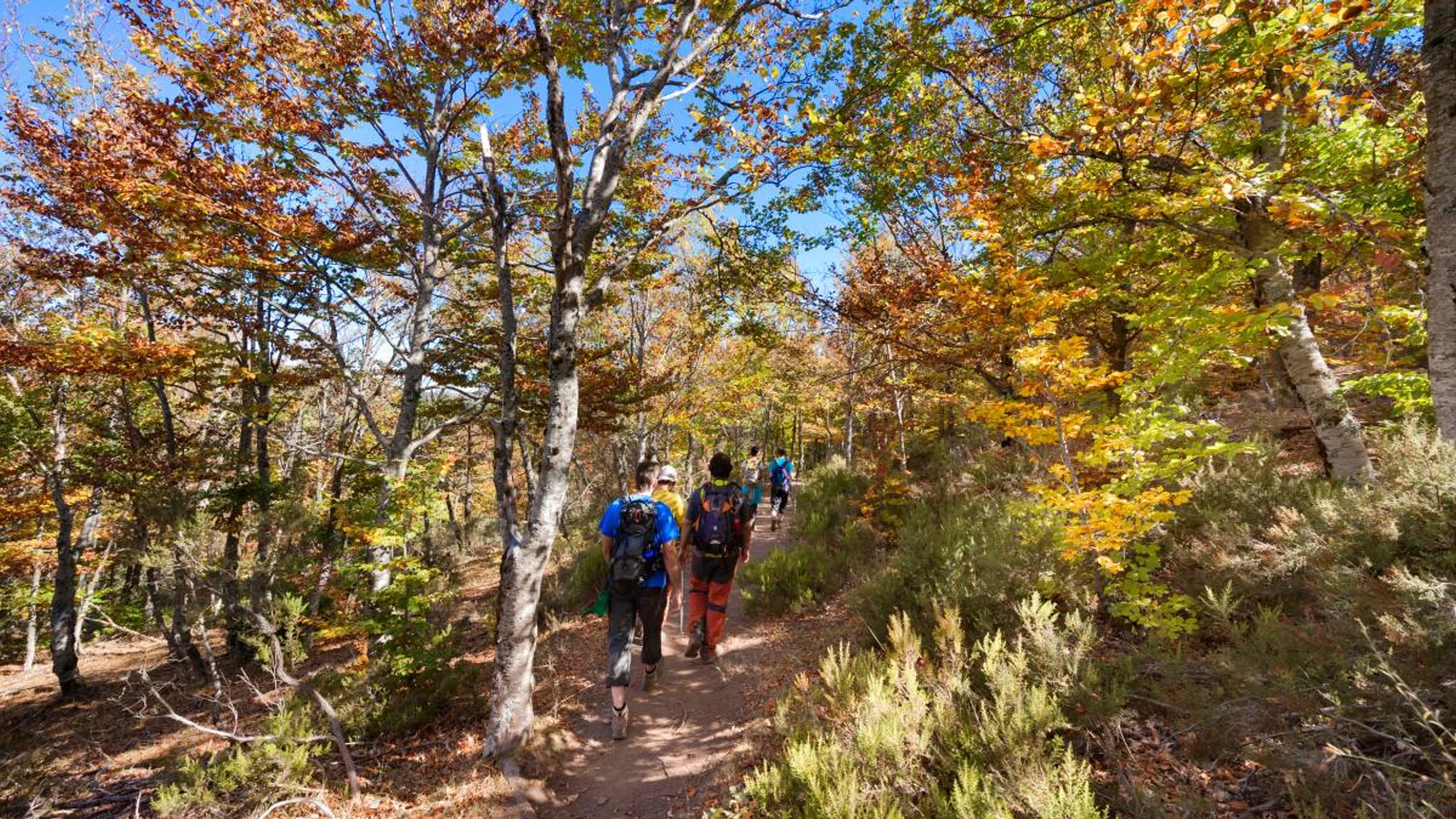
Castilla‑La Mancha stretches wide and quiet, and that’s exactly why hiking here rewards patient explorers. You’ll find gorges, forests, and lagoons stitched between limestone sierras and river valleys, making hiking Castilla‑La Mancha a year‑round plan for most skill levels. Spring and autumn bring mild days and cool nights, while summers get hot at low elevations, so early starts and shady routes matter (AEMET seasonal norms). Think of the region as a mosaic of sandstone canyons, karst plateaus, and slow, glassy waters.
A breeze carries the scent of pine resin and wet rock as river light flickers across canyon walls. Families choose short lagoon loops, photographers chase gold light over viewpoints, and experienced hikers link summits and gorges in long circuits. This article collects 10 routes across Cuenca, Guadalajara, Albacete, Ciudad Real, and the borderlands, with distances, access, and best seasons. Use it to pick safe, rewarding outings that match your time and energy, and to travel respectfully through landscapes cared for by local villages and park teams.
What sets the routes in this list apart
We chose routes using clear, practical criteria that make sense on the ground. Distance and total time come first, with honest notes on elevation gain (the “uphill” sum) and technical difficulty. Access and parking weigh heavily, because a great trail is only great if you can reach it and get back before dark. We value natural and cultural interest—lookouts, waterfalls, rock formations, wildlife hotspots, and historic paths—along with services nearby: water points, cafés, and accommodation in working villages.
We also checked permits and regulations in protected areas (Serranía de Cuenca Natural Park, Alto Tajo Natural Park, Hoces del Cabriel), and flagged seasonal rules where relevant. Safety and sustainability guided final picks: signed routes, stable footing, and alternatives for heat or snow days. Cross‑checking with official park sources and municipal tourism boards helped validate access and seasonality; when in doubt, we recommend you confirm locally before setting off.
A jay’s call snaps across the forest edge as your boots scuff dust into sunbeams. You’ll see a mix of classic highlights—Hoces del Júcar, Laguna de Uña, Nacimiento del río Mundo—and lesser‑known summits and rivers so you can build a balanced trip.
Picuco te puede ayudar
Does something here catch your eye?
Tell us.
Write to us on WhatsApp or email: we answer questions, find the best options and help you sort out the booking.
The 10 Routes at a Glance
Want the essentials fast? Here’s a quick index with location and why each route stands out. Skim it, choose your vibe—gorge, lagoon, summit, waterfall—and jump to the details below.
- Hoces del Júcar (Cuenca, various trailheads) — Canyon rims and river bends with big limestone walls and birdlife.
- Laguna de Uña (Cuenca, village of Uña) — Easy lagoon loop with boardwalk feel and forest shade, great for families.
- Serranía de Cuenca — Ciudad Encantada and surrounds (Cuenca) — Rock labyrinths and viewpoints near signed circuits.
- Nacimiento del río Mundo (Albacete, Riópar) — Spectacular spring waterfall and high‑mountain mood after rains.
- Salto de Poveda (Guadalajara, Alto Tajo) — River pools and a dramatic man‑made drop in a wild canyon setting.
- Lagunas de Ruidera (Ciudad Real/Albacete) — Chain of turquoise lagoons with gentle linking paths and swim spots.
- Alto Tajo Natural Park (Guadalajara) — River‑hugging trails, cliffs, and pinewoods with quiet, long‑view scenery.
- Hoces del Cabriel (Cuenca/Valencia border) — Clear waters, beachy riverbanks, and ridge miradores for wide horizons.
- Sierra de Alcaraz (Albacete) — Soft summits and oak valleys with pastoral landscapes and historic byways.
- Sierra Norte de Guadalajara — Pico Ocejón (Guadalajara) — Iconic slate‑village ascent with commanding 360° views.
A kestrel hangs on the wind over chalk‑pale cliffs while willow shade cools riverside pauses. Use this list to match time, heat tolerance, and goals—photos, swims, big climbs—to a route that suits your day.
1) Hoces Del Júcar: Canyon Rims and Sky‑wide Lookouts
Sheer walls fold the Júcar into green curves, and the light changes by the minute. In Cuenca province, classic access points sit near the city of Cuenca and along the river road toward Villalba de la Sierra, with signed routes that trace rim‑top miradores and drop to meanders below. Expect 8–14 km circuits with rolling ups and 250–500 m cumulative gain; allow 3–5 hours, plus stops for photos.
No permit is usually required, but you’re in and around protected landscapes—respect closures and signage from the Serranía de Cuenca Natural Park. Spring and autumn are ideal for temperature and bird activity; winter can be crisp and quiet. Photographers and viewpoint lovers get the most here, with frequent stops at balconies over the river. Bring firm‑soled shoes: limestone can polish slick, and short steeps appear without warning.
- Best for: photographers, hikers comfortable with moderate ups, birdwatchers.
- Highlights: cliff‑edge lookouts, river meanders, griffon vulture sightings.
- Tips: carry 1.5–2 L water per person; start early in summer heat; mind edges in windy conditions.
Sun flashes off the water like a moving mirror beneath pale ramparts. For a longer day, link a rim circuit with a riverside segment and finish at a shaded picnic area; always check return time to avoid dusk on cliff paths.
2) Laguna De Uña: A Forested Circuit Around a Glacial Lagoon
Reedbeds stir and carp rings ripple the surface as dragonflies skim the margins. Laguna de Uña sits by the village of Uña (Cuenca), within the Serranía de Cuenca Natural Park, with easy access and informal parking by designated areas at the village edge. A popular loop traces the lagoon perimeter and adjacent pinewoods: 5–7 km, scarcely 100 m gain, 1.5–2.5 hours at a family pace.
Entrance is free; follow local signs for protected zones and wildlife buffers. Spring and autumn bring migrating birds and calmer temperatures, while summer mornings are pleasant before midday heat. Some small coves invite toe‑dips, but treat it as a wildlife space first—ask locally before swimming and keep to signed spots if allowed. A short interpretive circuit explains lagoon ecology; bring binoculars for grebes and herons.
- Best for: families, casual walkers, photographers at golden hour.
- Highlights: mirrored waters, reedbeds, pine and juniper scent, easy footing.
- Tips: light trail shoes are enough; carry insect repellent; avoid shoreline trampling during nesting.
The lagoon’s edge smells of damp earth and resin, and every step brings a new angle of light. From Uña, you can extend into nearby viewpoints or combine with short routes toward the nearby karst balconies of the Serranía de Cuenca Natural Park for a half‑day.
3) Serranía De Cuenca: Rock Labyrinths and Panoramic Balconies
Wind‑carved boulders crowd together like a stone forest, and trails duck between them. The Ciudad Encantada sits about 28 km from Cuenca city, with a signed circuit through remarkable limestone forms; it’s a controlled site with regulated access and an entrance fee—check current schedules and prices on official channels before you go. The loop is short, around 3 km and 1 hour, with well‑maintained paths suitable for most visitors.
To turn the area into a fuller day, string together nearby miradores and forest paths, adding 5–10 km on soft pine needles and occasional rocky steps. Spring and autumn deliver the best temperatures; winter can dust the rocks with frost, sharpening edges for striking photos. Families and amateur hikers like the predictability and services, while enthusiasts can tack on longer loops outside the enclosed site.
- Best for: families, geology fans, casual photographers.
- Highlights: named rock shapes, interpretive panels, scenic viewpoints nearby.
- Tips: wear shoes with grip—smooth limestone is slippery when wet; arrive early to avoid crowds; confirm opening times and parking rules.
A cool hush settles between stone corridors where sunlight stripes mossy ledges. Pair the Ciudad Encantada with a sunset viewpoint on a nearby ridge and a relaxed dinner in Cuenca city to round out the day.
4) Nacimiento Del Río Mundo: Waterfall Power in a High‑country Amphitheater
Spray drifts like misted glass as the Río Mundo explodes from its cave mouth into a broad plunge. Near Riópar (Albacete), access roads guide you to signed parking areas and a short approach to the viewing platforms. The main path is straightforward for most walkers: around 2–4 km round trip, modest elevation, with optional steeper sections to higher terraces for fit visitors.
The spectacle peaks in spring and after heavy rains, when the famed “reventón” (sudden surge) can occur; winter brings cold, occasional ice, and short days. No permit is typically needed for the basic path, but authorities may regulate access or close upper sections temporarily for safety—follow on‑site directions from the Calares del Río Mundo y de la Sima Natural Park. Keep well behind railings; rock ledges are slick with algae.
- Best for: photographers, families with caution, nature lovers chasing flow.
- Highlights: tiered falls, cave emergence, forested canyon walls.
- Tips: waterproof layer for spray; stable footwear; picnic at signed spots only; confirm conditions after storms.
The falls thunder like distant drums, and the air tastes faintly mineral and cold. Combine the waterfall visit with a forest walk on nearby high‑country trails for a half‑day, or explore Riópar Viejo’s hilltop ruins for a cultural capstone.
5) Salto De Poveda: Pools and Canyon Drama in Alto Tajo
Water braids through boulders, gathering itself before leaping a broken weir in a white sheet. The Salto de Poveda lies in the Alto Tajo Natural Park (Guadalajara), near Poveda de la Sierra, with approaches from signed parking along local roads. A classic out‑and‑back or small loop to the falls and pools runs 6–9 km with minor ups and downs; allow 2–3 hours plus swim time in warm months.
Summer brings inviting pools but also more visitors; shoulder seasons mean quieter banks and crisp air. Families and moderate hikers do well here, staying mindful of rocks polished by water and frequenting safe, low‑flow pools only. On peak days, local authorities may manage parking—arrive early and bring cash if a seasonal fee applies; always pack out trash and avoid stepping on river vegetation.
- Best for: families (with supervision), swimmers in summer, relaxed walkers.
- Highlights: the Salto de Poveda drop, emerald pools, pine‑framed canyon views.
- Tips: water shoes for rocky entries; do not jump from heights; watch kids near currents; avoid slippery dam remains.
Warm stones hold the day’s heat while the river threads silver into deeper greens. Link the Salto with a short cliff‑edge mirador nearby, or fold it into a wider Alto Tajo day with cultural stops in tiny slate‑roof villages.
6) Lagunas De Ruidera: A Chain of Turquoise and Easy Linking Trails
Sunlight scatters in blues and greens across gentle drops between lagoons. The Lagunas de Ruidera Natural Park straddles Ciudad Real and Albacete provinces, with multiple access points near Ossa de Montiel and Ruidera village. A flexible walking plan links 2–5 lagoons on signed paths and roadside shoulders: 6–12 km total, minimal gain, 2–4 hours depending on stops and swims.
Summer suits water activities—kayak hires and designated swim areas appear—while spring paints shores in bloom and lowers crowds. Some zones have parking regulation or seasonal traffic limits; check on arrival and respect protected shorelines. Families and casual walkers thrive here, building the day around swim breaks and viewpoint detours. Accommodation is plentiful in nearby villages, with options from simple guesthouses to rural cottages.
- Best for: families, swimmers, photographers of reflections.
- Highlights: cascading lagoon thresholds, reedbeds, gentle paths.
- Tips: bring sun protection; confirm swimming rules for each lagoon; avoid midday heat; consider a sunrise or sunset lap for color.
A reed warbler rasps from the margins as your shadow slips over clear water. Add a kayak session between short walks, or pick a mid‑chain terrace for a leisurely picnic with wide‑angle views.
7) Alto Tajo Natural Park: Long Views and Quiet River Miles
Pine scent rides the wind as cliffs step down toward the river’s green ribbon. The Alto Tajo spans a large swath of Guadalajara province, offering riverside paths and rim routes of varied length. Classic day hikes trace canyon bends or climb to miradores: 8–16 km with 200–600 m gain, 3–6 hours counting lunch and photos. Towns like Peralejos de las Truchas, Zaorejas, and Chequilla serve as gateways with services in season.
Regulations protect sensitive habitats; dogs often must be leashed, and some nesting areas close temporarily—watch park notices. Spring and autumn are best for stability and foliage; summer demands early starts and extra water. Intermediate hikers enjoy the length options; families should pick shorter, flatter segments near the river for shade and access to water (noting cold temperatures and currents).
- Best for: hikers seeking quiet, birders, landscape photographers.
- Highlights: rim lookouts, riverside meanders, vulture and raptor sightings.
- Tips: 2–3 L water per adult in summer; hat and long sleeves; heed cliff edges and stay on marked paths; carry a paper map plus phone GPS.
The river murmurs below while swifts stitch the sky with dark arcs. Combine a morning rim loop with an afternoon cultural visit to a small highland village to support local cafés and bakeries.
8) Hoces Del Cabriel: Clear Water, Beachy Banks, and Ridge Views
Riverlight winks through poplars as a breeze combs the canyon’s dry slopes. The Hoces del Cabriel mark the borderlands between Cuenca (Castilla‑La Mancha) and Valencia, with trailheads from villages like Villargordo del Cabriel (Valencia side) and Minglanilla (Cuenca side). Expect gentle riverside strolls or moderate ridge routes: 6–14 km, 150–400 m gain, 2–5 hours depending on loop choice and water time.
Protected areas limit off‑trail access, and some beaches are signed for specific uses; confirm swimming spots and seasonal restrictions. Spring brings flowers and mild temperatures; late summer suits water play but watch for heat and afternoon storms. Families can do short out‑and‑backs to river beaches; fit hikers tackle miradores on the dry ridges for far‑reaching views.
- Best for: mixed groups (riverside + ridge), kayakers combining water days with walks.
- Highlights: transparent pools, gravel beaches, open‑sky lookouts.
- Tips: lightweight shoes can handle riverside; sturdy soles for ridge rock; ample water; check for fire‑risk closures in high summer.
Pebbles click underfoot at the water’s edge as swallows skim the surface for a drink. Many visitors pair a morning hike with a guided paddle in season; confirm conditions and options locally or explore curated activity ideas on Picuco.
9) Sierra De Alcaraz: Gentle Summits and Pastoral Valleys
A bell’s distant ring carries over oak‑dotted hills while clouds drag shadows across meadows. The Sierra de Alcaraz rises in Albacete province with approachable peaks and classic valley loops. Popular targets include Pico Almenara (1,796 m) for a steady summit day or softer ridge circuits near Vianos and Riópar. Plan 10–18 km and 500–900 m gain for summits (5–7 hours), or 6–12 km and 200–400 m gain for valley meanders (2–4 hours).
Spring and autumn shine for mild temps and clear air; winter can be brisk at altitude with occasional snow; summers suggest dawn starts and shady valleys. Intermediate hikers enjoy steady climbs and wide tops; families can choose shorter heritage paths linking fountains, ermitas, and viewpoints. Rural guesthouses and small hotels dot nearby villages, making two‑day plans easy.
- Best for: hikers building elevation confidence, landscape lovers, quiet seekers.
- Highlights: rolling crests, oak woods, traditional stonework and shepherding traces.
- Tips: check wind forecasts for summits; carry layers for exposed ridges; bring cash for small village cafés.
Warm thyme scents rise along stony paths under sun‑bleached skies. Combine a summit morning with an afternoon stroll on a local vía verde (rails‑to‑trail) to ease the legs and take in pastoral scenery.
10) Sierra Norte De Guadalajara: Pico Ocejón and Black‑slate Villages
Slate roofs stack like dark scales in villages that sit below a proud, isolated cone. Pico Ocejón (2,048 m) anchors the Sierra Norte de Guadalajara, with classic ascents from Majaelrayo or Valverde de los Arroyos. Both routes are sustained mountain hikes: 15–19 km round trip, 900–1,050 m gain, 6–8 hours at a steady pace, with stone steps, rough sections, and weather exposure.
Spring and autumn are prime for cool climbs and stable footing; summer demands early starts; winter can mean ice or snow on upper slopes—microspikes may be prudent when frozen. Strong hikers and mountain enthusiasts will love it; families might choose shorter slate‑village circuits to waterfalls like the Chorrera de Despeñalagua near Valverde (check seasonal flow and local access guidance). Village accommodations and simple eateries support early starts and hearty finishes.
- Best for: experienced hikers, peak‑baggers, panoramic photographers.
- Highlights: 360° summit views, black‑slate architecture, seasonal waterfalls.
- Tips: track your daylight; bring wind shell and warm layer; carry 2–3 L water; respect village parking rules and narrow lanes.
The summit breeze crackles cool and clean while ranges layer into lavender distances. Link Ocejón with a slow walk through a slate village and a local lunch to connect mountain effort with community life.
Map Smarts: Plotting, Grouping, and Linking Routes
A good map makes wide spaces feel manageable and invites smart, low‑stress travel. Use a digital map platform to pin each trailhead, then add driving times between them to spot natural clusters; Cuenca‑area routes (Hoces del Júcar, Laguna de Uña, Serranía de Cuenca) form one strong group, while Alto Tajo and Salto de Poveda pair well in Guadalajara. Layer in parking areas, signed picnic spots, and natural swimming zones so you can pivot based on heat, crowds, or water levels.
Import GPX tracks from official park pages when available, and save offline maps for patchy‑signal canyons—names sometimes repeat, so cross‑check coordinates and trailhead descriptions. Consider custom layers for:
- Parking and alternative trailheads
- Seasonal viewpoints (sunrise/sunset angles)
- Natural pools with safe entries
- Rural accommodation clusters for early‑start logistics
A paper map rides in your pack as a quiet, dependable backup when batteries dip. When planning a multi‑day circuit, build rest days around lagoon strolls or short viewpoint hops, and keep a “Plan B” pin in each cluster—one shady route and one open, breezy ridge—so weather and energy never force rushed choices. Official park visitor centers, municipal tourism offices, and AEMET forecasts round out your mapping with on‑the‑ground clarity.
Getting There and Staying Nearby
Distances can be large here, so smooth logistics make better days on trail. Driving is the most flexible option: from Toledo to Lagunas de Ruidera takes about 2–2.5 hours; from Cuenca city to Uña and Serranía de Cuenca trailheads, 30–45 minutes; from Guadalajara city to Alto Tajo, around 1.5–2.5 hours depending on the valley; from Albacete to Riópar (Nacimiento del río Mundo), about 1.5 hours; and from Ciudad Real to Ruidera, roughly 1–1.5 hours. Public transport reaches main towns (RENFE trains and regional buses), but rural trailheads typically require a taxi or pre‑arranged transfer—build that into your schedule and budget.
For parking, use signed lots and respect village lanes—many are narrow, and locals need to move farm vehicles. Arrive early in peak months to secure spots and avoid midday heat; bring coins for seasonal parking management where applicable.
Accommodation types that fit hikers:
- Rural houses and small hotels in villages near each park for early starts and quick returns
- Hostels and albergues for budget trips in gateway towns
- Campgrounds near Lagunas de Ruidera and Serranía de Cuenca for swim‑and‑walk combos
- Eco‑stays with energy‑saving measures and local sourcing—ask about water use policies in summer
A cool room, a hot meal, and early coffee turn ambitious plans into relaxed mornings. If you like curated options, browse Picuco to find rural stays and active experiences grouped by region so you can keep travel times short and maximize time on the trail.
Choosing the Right Route for Season and Skill
Match the day to your legs, the heat, and your group’s appetite for elevation. In summer, shade and water matter—Laguna de Uña, gentle stretches at Lagunas de Ruidera, and riverside segments in Alto Tajo or Hoces del Cabriel fit early starts and long siestas. In spring and autumn, go big: Hoces del Júcar rim loops, Pico Ocejón, and Sierra de Alcaraz summits reward cool air and long light. Winter invites crisp city‑plus‑short‑trail combos in Cuenca’s orbit and waterfall visits like Nacimiento del río Mundo on calm days; watch for ice on steps and bridges.
Simple ways to decide:
- Families with young kids: Laguna de Uña loop; short Ruidera links; Salto de Poveda out‑and‑back (supervise near water).
- Photographers: Hoces del Júcar and Alto Tajo rims at golden hour; “reventón” days at Nacimiento del río Mundo; mirror‑calm mornings on Ruidera lagoons.
- First‑timers building stamina: Sierra de Alcaraz valley circuits, then a moderate Hoces del Júcar rim day.
- Experienced hikers: Pico Ocejón from Majaelrayo or Valverde; long canyon‑rim traverses in Alto Tajo.
- Heat‑management picks: riverside shade routes, dawn starts, and a swim finish where allowed.
Pace your day with rule‑of‑thumb timing: most groups average 3–4 km/h on easy ground plus 1 hour per 400–500 m of ascent. A sip of cold water under pine shade can reset everyone’s mood in minutes. Carry more water than you think, build generous turn‑around times, and choose loop routes to keep motivation high for kids and mixed‑ability groups.
Safety, Essentials, and Responsible Hiking
Ready packs mean relaxed minds on exposed ridges and slippery river stones. Essentials for these routes:
- Footwear: grippy trail shoes for lagoons and riversides; sturdier boots for rocky rims and summits
- Layers: breathable sun layer, light wind shell; warm mid‑layer for shoulder seasons and summits
- Rain protection: packable jacket even on “clear” days near waterfalls
- Navigation: phone with offline maps and spare power; paper map as backup
- Hydration and food: 1.5–3 L per adult depending on heat; salty snacks and a real lunch
- First‑aid: blister care, bandage, basic meds; whistle and small headlamp
- Sun kit: hat, sunglasses, high‑SPF sunscreen
Tell someone your plan, route, and return time. Follow signed paths—straying in karst or canyon country risks cliffs, unstable ledges, and disturbance of nesting birds. Leave No Trace basics apply: pack out every scrap, step lightly on durable surfaces, and keep dogs leashed where required. Respect seasonal closures and permits; in protected areas like Serranía de Cuenca Natural Park, Alto Tajo Natural Park, and Hoces del Cabriel, rules protect fragile habitats and the communities that steward them.
A thin line of shade on a hot bend can feel like a cool hand on your neck. If weather turns, shorten the loop; if flow is high, skip the crossing; if the group tires, turn back early—good judgment is the most useful gear you carry.
Frequently Asked Questions
Do I need permits or to pay entrance fees for these routes?
Most routes are free to access, but some controlled sites (like the Ciudad Encantada) charge an entrance fee, and seasonal parking management can apply in busy areas. Check official park or municipal pages before you go.
Are any of the routes accessible with a stroller or wheelchair?
Short, flat segments around Laguna de Uña and some sections in Lagunas de Ruidera are stroller‑friendly, but full accessibility varies with surface and slope. For wheelchairs, consult local visitor centers for current path conditions and accessible viewpoints.
Can I bring my dog?
Dogs are generally allowed on a leash in many areas, but protected zones may have stricter rules, especially during nesting seasons. Always carry water for your dog and avoid sensitive shoreline habitats.
Is public transport a realistic option?
You can reach main towns by train or regional bus, but rural trailheads usually require a taxi or pre‑arranged transfer. Plan extra time and confirm return options to avoid being stranded.
What if a trail is closed or the river is running high?
Have a Plan B nearby—a shaded forest loop, a museum in a gateway town, or a different lagoon segment. Park visitor centers and municipal tourism offices post up‑to‑date closures and alternative suggestions.
Where can I find reliable weather and condition updates?
Use AEMET for forecasts and check official park channels and local town boards for trail or access notices. Ask at village cafés and accommodations for on‑the‑day insight.
The murmur of local voices in a small bar often carries the best last‑minute tip. When in doubt, choose the conservative option and enjoy a safer day out.
Book your experience — discover active nature experiences across Spain with providers verified by Picuco.
Conclusion
Castilla‑La Mancha rewards unhurried walkers with gorges, lagoons, and summits that feel both spacious and close to village life. You can trace the Hoces del Júcar from mirador to mirador, circle the mirror of Laguna de Uña, chase spring power at Nacimiento del río Mundo, or cool your heels at Salto de Poveda and the Lagunas de Ruidera. Each route invites you to match day length, heat, and mood, and to walk with care for landscapes protected by park teams and local communities.
Plan simply: start early, carry enough water, and choose loops that fit your group. If you want curated ideas and easy planning, explore experiences and route suggestions on Picuco, and download official GPX tracks from park resources for offline confidence. Share your day, respect the places you cross, and leave the trail a touch better than you found it—the next hiker will thank you.