Why Geocaching Belongs in Your Next Nature Escape
Geocaching in Spain blends exploration, puzzles, and landscapes into one simple outdoor plan. You search for hidden containers (caches) using GPS, log your find, and move on with a smile. Sun on your shoulders and the crisp scent of pine can turn a short walk into a small expedition. You will find here what it is, how to start geocaching step by step, and where to try the best natural geocaching routes.
Geocaching in Spain today
Spain has an active community that hides and maintains caches from coastal paths to alpine cirques. You will find caches around national parks, natural parks, sierras, greenways, and town-edge forests, with many family-friendly options. A discreet container tucked under a stone feels like a time capsule among broom and rosemary. According to Geocaching HQ (the platform that coordinates listings and logs), there are millions of caches worldwide and a strong presence across Spain’s regions; local events and series keep the hobby lively year-round. The activity pairs well with conservation goals when done responsibly, because it encourages marked-path use, dispersed visitation, and a leave-no-trace mindset. Land managers sometimes set placement rules, so you should always check park regulations and respect protected areas before hunting or hiding.
What you’ll learn here
This article delivers a practical, quick-start path. You will understand what is geocaching in plain terms, how to start geocaching with basic gear and free apps, and how to read difficulty and terrain. One cool breeze across a shaded track makes learning feel like play, not homework. You will get an at-a-glance map, seven natural circuits with concise fact sheets, geocaching safety tips, a planning checklist, and answers to frequent questions. At the end, you’ll find a single, useful CTA to explore activities and plan a day out at your own pace.
Picuco te puede ayudar
Does something here catch your eye?
Tell us.
Write to us on WhatsApp or email: we answer questions, find the best options and help you sort out the booking.
What Is Geocaching?A Fast, Friendly Primer
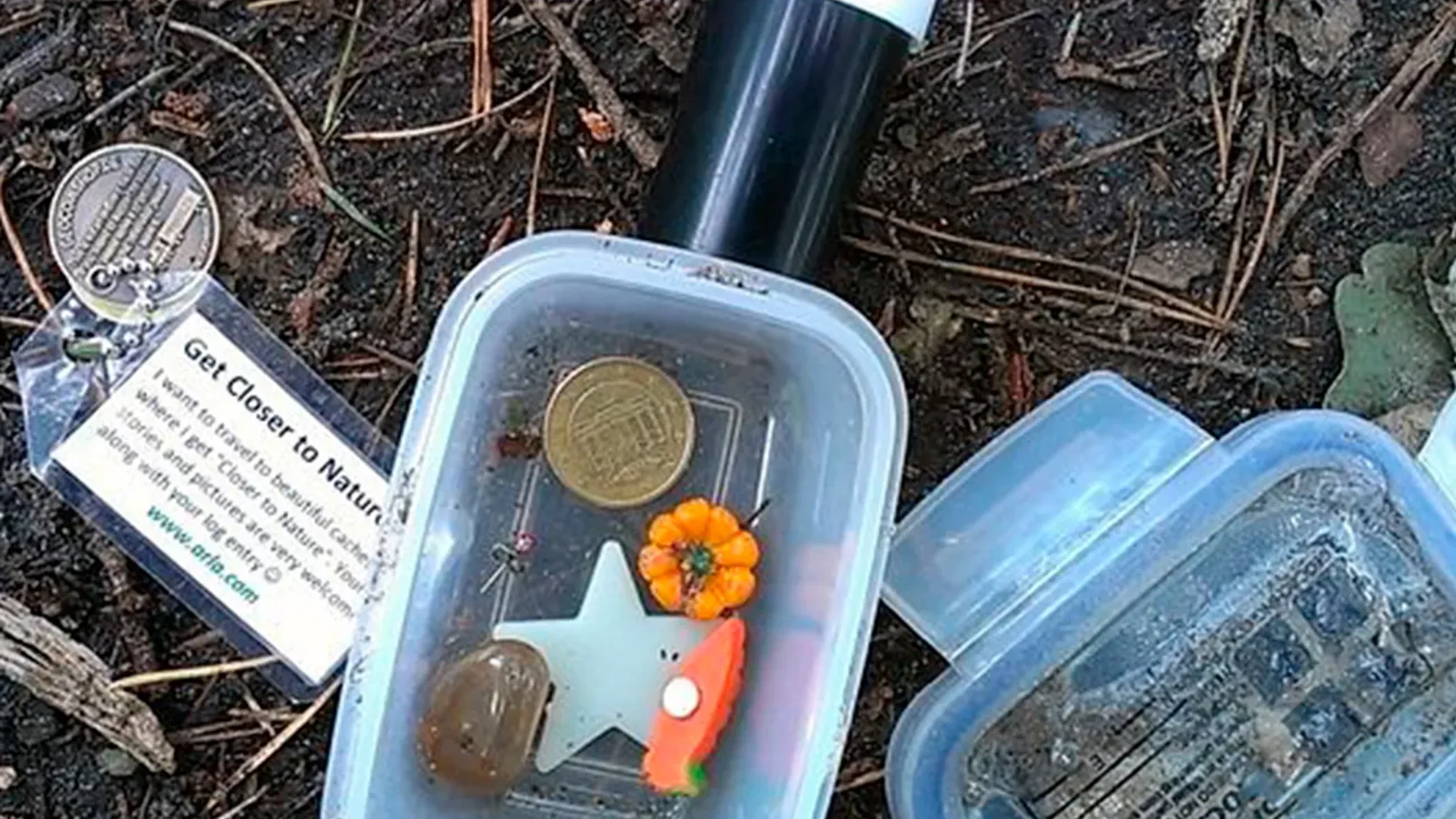
Think treasure hunt with GPS: someone hides a waterproof container, posts coordinates and hints, and you navigate to it and sign the logbook. The cache can be a film canister or a sturdy box with small trinkets, but the real prize is the find itself. A faint breeze rattling oak leaves might be your only witness when the lid finally clicks open. You’ll see difficulty (how tricky the hide is) and terrain (how demanding the approach is), both rated from 1 (easy) to 5 (expert), which helps match routes to your group.
Here’s how it works in practice. You create a free account on a platform such as Geocaching® (by Geocaching HQ), choose a cache near a trail or park, and use your phone’s GPS arrow to get within a few meters. You search respectfully, avoiding damage to vegetation or heritage features, and you never dig; caches are hidden, not buried. A short pencil and a gentle touch are the geocacher’s best tools. When you find it, you sign the paper log, re-hide it exactly as found, and log it online with a brief note to thank the cache owner (CO).
Types of caches vary and keep things interesting. Traditional caches sit at the posted coordinates; multi-caches lead you to several stages; mystery/puzzle caches require solving a clue first; earthcaches teach a geology lesson on-site with no physical container; and virtuals ask for a photo or answer at a landmark. Think of earthcaches as open-air classrooms smelling faintly of wet rock after a drizzle. Basic good practice applies everywhere: stay on marked paths, minimize noise, pack out litter, and skip swaps like food, scented items, or anything unsafe; if you take a trinket, leave one of equal value.
Getting Started in Spain: Gear, Apps, and Good Practice
Starting is simple: a smartphone, a sense of direction, and a free account take you 90% of the way. Keep it light, keep it safe, and build from easy terrain to more adventurous goals. Cool shade and the feel of gravel under sturdy shoes make the first route feel welcoming.
Essential gear
Bring a smartphone with reliable GPS and a power bank (10,000 mAh or more) to avoid battery stress on longer hunts. Pack a small notebook and pens, a compact torch for crevices, tweezers for tiny logs, and two or three small, clean trinkets for fair swaps. A zip bag for wet logs and a simple microfiber cloth feel like magic when a damp cache turns up. Wear weather-appropriate layers, a hat, and supportive trail shoes; add a light rain jacket in shoulder seasons. For families, choose bright, easy-to-carry swaps (stickers, keychains) and let kids handle the final “reveal” to keep motivation high. If you’re wondering how to start geocaching without overspending, use what you already have: a basic daypack, a water bottle, and your phone’s compass are enough for your first finds. Families should plan short loops near picnic areas and restrooms to keep the day stress-free.
Recommended apps and platforms
The Geocaching® official app is the gateway: it shows nearby caches, difficulty/terrain filters, and recent activity. You can save lists for offline use, which is handy when signal fades between ravines and ridge crests. The app’s soft chime feels like a friend tapping your shoulder when you get close. For power users on desktop, tools like GSAK (Windows) help manage pocket queries and statistics; mobile alternatives like Cachly (iOS) or c
(Android) are popular in Spain for advanced filtering and offline maps. Create a free account, set filters (terrain ≤ 2 for family geocaching Spain; size ≥ small for easier handling), and sort by “most favorited” within 10–20 km of your base. Download offline tiles when possible and pre-load lists along natural corridors (river paths, greenways, park loops) so you can navigate even in flight mode.Good practice and safety
Respect the land first: obey park signs, seasonal closures, and area-specific rules, especially in national parks and nature reserves. Many parks require explicit permission for placing caches and prohibit hiding off-trail; hunters should stick to established paths and official viewpoints. The scent of warm thyme underfoot reminds you that this is someone’s cared-for home, not a game board. Walk on marked routes, carry at least 1 liter of water per person on short outings (more in summer), and tell someone your plan. Keep group spacing on narrow paths, watch weather windows, and turn back early if needed. For families, choose terrain 1–2 and caches closer to trails, with daylight to spare for unhurried searching. Follow Leave No Trace: no digging, no pruning, no stacking stones in sensitive areas, and no disturbance to wildlife. In national parks, check official websites for any specific geocaching notices before you go.
Map of Locations: How to Use Our Circuits Layer
You’ll find a single interactive map embedded alongside this article with all recommended circuits. It includes start points, a short description, suggested loops, and links back to each route’s quick sheet. The map opens like a green constellation of pins across Spain’s parks and sierras. Each pin is tagged by difficulty (beginner, mixed, advanced), estimated duration windows (for example, 1–2 hours, 2–4 hours), and family suitability.
To use it on mobile, open the map and choose “Save offline” or export the KML/GPX overlay to your preferred app. Filters let you display only family geocaching Spain options, only routes under 3 hours, or only pins within a province or autonomous community. Slide the difficulty filter to match your group’s comfort level, and tap each pin to reveal parking tips, highlights, and cache types you’re likely to encounter. The map also flags seasonal notes, such as summer heat warnings or winter access advisories. Download before you leave Wi‑Fi, and keep your phone in battery-saver mode on trail. If you prefer paper, jot down the start coordinates and a few GC codes for offline reference.
Spain’s Best Natural Geocaching Circuits (top 7)
Below you’ll find seven carefully chosen circuits across iconic Spanish landscapes. Each blends accessible trails, scenic interest, and a variety of hides to keep your day moving. A faint pine resin smell and the distant clink of trekking poles set the rhythm from cache to cache. Use the quick facts to decide fast, then scan the local tips before heading out.
1.Sierra de Albarracín: Pine Forests and Red-rock Gorges
Teruel’s Sierra de Albarracín offers quiet forest tracks, trout rivers, and sandstone outcrops around towns like Albarracín and Bronchales. The light clatter of river stones underfoot guides you along shaded bends. Expect traditional caches near viewpoints, bridge crossings, and hermitages, plus the occasional multi-cache threading through narrow alleys in Albarracín’s walled old town.
- Location and access: Western Teruel; access from
A-1512via Albarracín or Bronchales; parking near trailheads and picnic areas. - Best season: Spring to autumn; winters can be cold and snowy at higher spots.
- Ideal for: Families, first-timers, photographers, and mellow hikers.
- Terrain and cache types: Terrain 1.5–2.5 on forest paths; traditional and multi-caches; some small/regular containers.
- Nearby interest: Pinares de Rodeno boulders, Río Guadalaviar bends, Albarracín historic center.
- Permissions and notes: No fees for walking; respect local signs in protected areas like Pinares de Rodeno.
- Local tip: Start early to enjoy empty paths and soft light on red rock walls; carry tweezers for micro logs.
Routes geocaching naturales España don’t get much friendlier than a pine-ringed loop with easy pullouts and picnic tables. Watch for interpretive panels that double as puzzle hint spots without touching or moving anything.
2.Picos de Europa: High Trails and Balcony Views
Northern Spain’s Picos straddle Asturias, Cantabria, and León with limestone massifs and classic balcony viewpoints. Cooler air and the chalky scent of karst lift from the cliffs as you pause to scan for chamois. Geocaches here may sit along established hiking routes, cable-car approach paths, or lower-valley strolls.
- Location and access: Main gateways at Covadonga (Asturias), Fuente Dé cable car (Cantabria), and Posada de Valdeón (León).
- Best season: Late spring to early autumn for high routes; winter only for low valleys or with expert skills.
- Ideal for: Fit hikers, photographers, mixed-experience groups seeking options.
- Terrain and cache types: Terrain 2–4 depending on route; traditional caches near miradores; occasional earthcaches explaining karst features.
- Fees and permits: No hiking fee; parking controls at Covadonga lakes in peak season—use shuttle when required.
- Family options: Choose lower-valley paths or short mirador walks around Covadonga or Fuente Dé base.
- Safety: Carry layers, water, and a small first-aid kit; check forecast and avoid foggy ridge plans.
Expect fewer caches than in urban parks but higher scenic payoff, with best geocaching trails Spain showcasing limestone balconies and well-marked paths. Keep to signed routes, and never step near cliff edges for a hide.
3.Doñana National Park: Marshlands and Migratory Life
Doñana’s marshes, dunes, and pinewoods in Andalusia host sensitive habitats for birds and Iberian lynx. A warm breeze carries brackish scents as herons lift in ragged flocks over the marsh. Geocaching opportunities focus on buffer zones and adjacent public areas, not the most protected cores.
- Location and access: Provinces of Huelva, Seville, and Cádiz; main visitor centers near El Acebuche, El Rocío, and La Rocina.
- Best season: Late winter to spring and autumn migrations for birdlife; summers are hot.
- Ideal for: Families, nature watchers, and patient walkers.
- Terrain and cache types: Terrain 1–2 on boardwalks and sandy tracks; traditional and earthcaches that highlight dunes, marsh hydrology, or cork oak stands.
- Permissions and rules: Strict protections in core zones; geocaching hides typically not allowed in restricted areas—verify current rules on official park channels.
- Alternatives nearby: Public footpaths around El Rocío, Matalascañas outskirts, and adjacent natural areas.
- Local tip: Bring binoculars and avoid early morning vehicle traffic on sandy tracks; respect bird quiet zones.
Here, the game is less about numbers and more about quiet interpretation, so plan few caches and longer observation stops. Keep the impact minimal: stay on boardwalks and avoid handling logs near nesting zones.
4.Sierra de Grazalema: Karst, Caves, and Water Meadows
Between Cádiz and Málaga, Grazalema’s limestone blocks, fir groves, and white villages create a compact playground of trails. The scent of wet stone after a passing shower sharpens the contrast of green meadows and grey karst. Cache placements often align with signed miradores, fountains, and cultural markers between villages like Grazalema and Zahara de la Sierra.
- Location and access: Via
A-372(Ronda–Grazalema) andA-2300(Zahara approaches); multiple car parks at village edges. - Best season: Spring for flowers and streams; autumn for clear views; summers can be hot mid-day.
- Ideal for: Hikers who enjoy mixed terrain; families on short loops; photographers.
- Terrain and cache types: Terrain 2–3 on rocky paths; traditional caches and earthcaches on karst features; occasional multi.
- Fees and permits: Some sensitive zones (like pinsapar) require permits for hiking—check availability in season.
- Family options: Short loops near Puerto del Boyar or village circuits with easy access to cafés.
- Local tip: Carry grippy shoes for limestone; start early to catch vultures circling uplifts at first light.
This is a landscape of viewpoints and stone lanes, so plan 2–3 featured caches and let the scenery carry the day. Never enter caves for a cache unless listings expressly confirm safe, public access.
5.Montseny and Nearby Ranges: Mediterranean Forests Close to Barcelona
Just an hour from Barcelona, Montseny Natural Park and adjacent ranges bundle oak, beech, and chestnut forests with old farm lanes. Dappled light on leaf litter softens footfalls and voices alike. Cache series often follow family-friendly loops, watercourses, and hilltop hermitages.
- Location and access: Province of Barcelona; access via
C-17and local roads toward Montseny, Viladrau, or Sant Celoni; frequent train-to-bus combos. - Best season: Spring and autumn; summers suit early morning; winter brings crisp, quiet days.
- Ideal for: Families, walkers with strollers on certain tracks, and city dwellers seeking a half-day escape.
- Terrain and cache types: Terrain 1–2.5 on forest roads and signed trails; traditional caches, occasional multi, and friendly-size containers.
- Regulations: Park has conservation rules; stick to marked paths and respect private property near masías (farmsteads).
- Add-on activities: Picnic areas, small refuges, and low-slung ridgelines with wide views.
- Family tip: Pick short cache circuits near visitor centers where facilities and shaded tables keep energy high.
If you want natural geocaching routes without a long drive, Montseny offers a reliable blend of shade, waymarks, and variety. Save a list offline before you leave the train station signal behind.
6.La Garrotxa Volcanic Zone: Cones, Beech Groves, and Quiet Valleys
In Girona’s hinterland, Garrotxa’s dormant cones and lava flows thread with green lanes and beech stands like Fageda d’en Jordà. Damp earth smells sweet and cool beneath a dense beech canopy. Caches highlight viewpoints on cinder cones, lava fields, and waypoints tying heritage mills to river bends.
- Location and access: Near Olot; start points at Can Serra (Fageda), Santa Margarida volcano parking, and Croscat viewpoints.
- Best season: Spring and autumn; summer mornings are fine; winter is serene and cool.
- Ideal for: Families, geology-curious walkers, and photographers.
- Terrain and cache types: Terrain 1.5–2.5 on well-signed park paths; traditional caches and earthcaches focused on volcanic features.
- Fees and permits: No general entry fee; paid parking may apply at specific lots—check on arrival.
- Safety and terrain: Volcanic gravel and roots can be slick after rain; use poles if balance is a concern.
- Local tip: Combine a short cone ascent with a flat Fageda loop for an easy 2–3 cache day.
These routes pair learning with low effort, making Garrotxa a top pick among the best geocaching trails Spain for mixed groups. Keep kids engaged by letting them read the hint and call the final “got it.”
7.Sierra Nevada: High Mountain Lakes and Skyline Ridges
Andalusia’s Sierra Nevada offers Europe’s southernmost high mountains, with glacial bowls, summer meadows, and snow in season. Thin, cool air and the hiss of wind across scree lend a high-country hush. Caches reward persistence on signed paths near tarns, passes, and historic irrigation acequias.
- Location and access: Access from Granada (Hoya de la Mora) and Alpujarra villages (Capileira, Trevélez) for varied elevation starts.
- Best season: Summer to early autumn for high routes; winter geocaching favors lower slopes and villages.
- Ideal for: Fit hikers, summit chasers, mountain photography.
- Terrain and cache types: Terrain 2.5–4 on altitude paths; traditional caches near cairns and lake outlets; occasional earthcaches on glacial features.
- Fees and permits: No hiking fee; road and parking controls may apply seasonally; check bus shuttles to high trailheads.
- Safety: Pace yourself at altitude, carry sun protection, and monitor storms; turn back at first thunder.
- Local tip: Mix one high-elevation cache with a lower, shaded acequia stroll for a balanced day.
Altitude adds effort but also clarity: on a still morning, the mirror of a high tarn makes the search feel meditative. Match terrain ratings to your fitness and bring extra water above treeline.
Choosing Your Circuit and Planning the Day
Pick routes by season, group, and time window, not by the number of caches. The sweet spot is a loop that feels spacious, not rushed. The soft rustle of leaves around a rest bench often beats a fourth hurried find. To choose well, start with terrain ≤ 2 when you have children or newcomers, and ramp up gradually. For hot summers, select shaded forests or coastal breezes; in winter, prefer low valleys and sunny slopes.
Use this quick checklist before you go:
- Weather: Check forecast and mountain warnings; set a turnaround time.
- Daylight: Note civil sunset and plan to finish 60–90 minutes before.
- Maps: Save offline maps and cache lists (KML/GPX where available).
- Permissions: Verify park rules on cache pages and official park notices.
- Group plan: Assign roles—navigator, reader of hints, log writer, kid “spotter.”
- Safety: Pack water, snacks, first aid, and a charged power bank.
- Contacts: Share your route and an emergency phone with a friend; set phone in battery-saver mode.
Estimate time with a simple rule: walking time for the loop plus 10 minutes per easy cache (more for tricky hides). A breeze on your neck is a good reminder to slow down, look up, and enjoy the place. Combine activities to fit your group: two caches plus a short viewpoint detour might beat a long out-and-back for kids. If starting out, favor circuits with visible landmarks and larger container sizes (small or regular) to build confidence. Minimize impact by staying on trail corridors, avoiding narrow wildlife areas at dawn/dusk, and keeping voices low around bird hides.
Adapting with children makes the day smoother:
- Choose loops with frequent benches or picnic tables.
- Bring fun swaps and let kids control the final approach.
- Keep a surprise snack for morale after a DNF (did not find).
- End near a river, fountain, or playground to close on a high note.
Finally, layer your plan: a primary loop, a shorter bail-out option, and a snack break pinned on the map. If conditions shift, you still finish with smiles.
Frequently Asked Questions About Geocaching in Spain
Do I need permission to place caches in parks?
Yes, you need the land manager’s permission, and many national and natural parks restrict or prohibit placements off-trail. Check the park’s official website and the cache listing guidelines, and always follow posted rules.
What can I swap inside a cache?
Swap only small, family-safe, and scent-free items like stickers or keychains. Do not place food, liquids, knives, matches, or anything perishable or illegal. If you take something, leave something of equal value.
How do I register a find?
Sign the paper log in the container, re-hide it exactly as found, then log online in your app/account with a brief note. If the log is wet or damaged, note it politely so the owner can maintain it.
Is geocaching safe for kids?
Yes, when you choose appropriate terrain (1–2) and stay on marked paths. Keep children within sight, avoid roads and steep edges, and carry water, sun protection, and snacks. Pick larger caches so kids can handle the container easily.
Where can I find family-friendly routes?
Use app filters for terrain ≤ 2, size ≥ small, and recent “Found it” logs. Look for loops near visitor centers, greenways, or forest parks, such as Montseny or Garrotxa, where facilities and shade are common.
Are there fees for geocaching?
Walking is usually free, but parking, shuttles, or controlled-access areas may charge seasonal fees. Confirm on official park pages or at trailheads and bring small change or a card.
What are the essential geocaching safety tips?
Tell someone your plan, carry enough water, watch weather, respect closures, and avoid searching in risky terrain. Do not cross fences or disturb wildlife, and stop if the search requires unsafe moves.
Book your experience — discover active tourism activities in Spain with providers verified by Picuco.
Conclusion
Geocaching in Spain turns regular walks into small adventures that blend nature, learning, and shared discovery. You pick a pin on the map, follow a path, and a quiet ta‑da at a hidden container becomes the day’s highlight. Families, couples, and groups can dial difficulty up or down to fit the season and mood. With a few safety habits and a couple of offline lists, you’re ready for easy wins and memorable views.
Your next step is simple: choose one circuit from the list, save it offline, and pack light. Start with a shaded loop, set a relaxed turnaround time, and aim for two or three varied caches. As confidence grows, add a new landscape—marsh, beech grove, or limestone ridge—and enjoy how the game sharpens your eye for detail. When the lid clicks shut and the log bears your names, the landscape feels more familiar, and the path home feels earned.