Why Spain Is Perfect For Multi‑day Gravel And Bikepacking
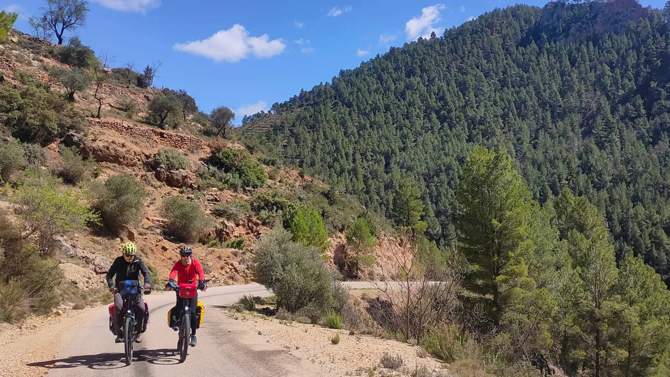
Spain is built for gravel, and these gravel bike routes Spain deliver scenery, culture, and real adventure. You will cross empty sierras, roll through vineyards, and finish days in stone villages where a menu del día restores your legs. Expect a practical, rider‑tested list of 10 multi‑day cycling routes Spain, plus advice on levels, gear, and planning. We chose each route for landscape value, access, typical duration, difficulty, surface mix, services and lodging, and cultural interest, so you can match your ride to your pace. Picture early light on a dirt road as swallows skim the field edge. Start with a route that fits your time and fitness, then adapt stages and overnights to your style; if you want curated experiences or rentals, explore options on Picuco when you’re ready.
Cycling today in Spain
Cyclotourism—cicloturismo—is growing fast in Spain, with more waymarked routes, the expanding Vía Verde Spain network on former railbeds, and more riders seeking two‑to‑five‑day escapes. Gravel España has unlocked thousands of kilometers of compact farm roads and forest pistes where traffic is scarce and landscapes are wide. Families favor greenways and coastal paths; seasoned riders stitch sierras and plateaus into weeklong loops. According to Fundación de los Ferrocarriles Españoles, Spain now hosts 120+ Vías Verdes totaling over 2,900 km, creating safe corridors that connect towns and services. RENFE regional trains (‘Media Distancia’) accept bikes on many lines, which eases point‑to‑point logistics. A faint scent of thyme rises off sun‑warmed cuttings along the trail. The result is a country where multi‑day bike touring Spain can be as gentle or as wild as you make it, from Mediterranean promenades to high‑country tracks.
How we selected the routes
We prioritized scenic value (mountains, coast, dehesa), reliable services (water, shops, lodging), safety (low‑traffic roads, predictable surfaces), and cultural interest (historic paths, villages, food traditions). We balanced diversity of surfaces—typical mixes of asphalt, graded gravel, and occasional trail—with realistic daily distances and stage options. We included routes clearly suited to gravel bikes plus a few mixed options where a wider tire helps. Imagine the crunch of fine gravel under tires as a bell tower marks noon. Each pick includes best season, access by train or bus where possible, and tips to shorten, extend, or link sections.
Picuco te puede ayudar
Does something here catch your eye?
Tell us.
Write to us on WhatsApp or email: we answer questions, find the best options and help you sort out the booking.
Make These Trips Work For You
You’ll see distance, elevation, and surface described in each route, with notes on services and lodging. Read difficulty as a blend of daily kilometers, climbing, and surface roughness; a smooth 90 km on a Vía Verde is not the same as 60 km of corrugated pista. Expect a quick view of highlights and logistics—how to get in and out, where water and shops cluster, and how to trim miles if weather or legs demand it. Warm evening air carries the scent of orange blossom on a coastal approach. Adjust stages to daylight, weather, and your fitness, and plan stops where towns offer beds and food to avoid long empty gaps.
Levels of difficulty and fitness
We classify routes as easy, moderate, or challenging based on daily distance, elevation, and surface. Easy suits families or first gravel trips: 40–70 km/day, <800 m climb, mostly compact gravel or cycleways—think rutas gravel on greenways and quiet lanes. Moderate fits riders with regular fitness: 60–90 km/day, 800–1,500 m climb, mixed gravel and secondary roads with short rough sections. Challenging targets endurance cyclists: 80–120 km/day, >1,500 m climb, substantial unpaved segments and occasional technical bits. Picture cool morning air and a steady rhythm on a shaded farm track. If in doubt, scale down your first day to test legs and luggage, then lengthen stages.
Recommended gear for gravel and bike touring
A gravel bike with 38–45 mm tires balances speed and comfort; for rougher terrain, 45–50 mm helps. Choose between bikepacking bags (light and agile) or panniers (more capacity, more wind drag). Essentials include: multitool, chain links, two tubes, plugs for tubeless tires, mini‑pump, tire boots, and a first‑aid kit. Navigation matters: carry GPX files (a universal route file) plus a paper map backup; apps with offline maps help when coverage drops. The soft rasp of knobby tires over packed clay keeps you honest. Helmets, lights, and a reflective vest improve safety; consider renting a bike near big hubs if traveling light—compare rental specs to your fit before committing.
Planning stages and reading profiles
Divide days by hours on the bike, not only distance; rough gravel or long climbs slow averages. A common pace is 12–18 km/h loaded, depending on terrain. Cluster stages around water and lodging nodes to avoid dry camps unless you plan to bivouac. Check elevation profiles to spot stacked climbs and long descents; a “sawtooth” day can be harder than one big pass. As late sun slants through poplars, the road hums like a low string. Book beds ahead in peak seasons or remote areas, and build a short “buffer” day for rest or weather; reroute if rain turns clay pistes into sticky ‘arcilla’ that can halt wheels.
10 Multi‑day Gravel And Bikepacking Routes Across Spain
From the Pyrenees to the dehesa and the Mediterranean, this numbered list gives you planning‑grade snapshots for Spain gravel adventures. Each entry includes distance, days, surface mix, difficulty, season, services, highlights, logistics, and quick budget notes to set expectations. The dry air of the meseta can carry the sound of cowbells for minutes. Start where the mix of terrain and culture feels like a story you want to ride.
1.Transpirenaica: sea to sea across the Pyrenees
The Transpirenaica links the Mediterranean and Cantabrian seas along the southern flank of the Pyrenees, often shadowing the hiking route GR-11. Typical cycling variants run 800–1,000 km from Llançà/Cadaqués to Hondarribia/Irun, with 10–16 riding days. Surfaces are a practical blend of quiet asphalt, graded gravel, and occasional rougher track. Pines give resin scent as you crest a col and see ridgelines fold away.
- Distance/duration: 800–1,000 km; 10–16 days
- Surface: ~55% asphalt, 40% gravel, 5% trail (varies by variant)
- Difficulty: Challenging (high passes, weather exposure)
- Best season: Late June–September; watch for storms in late afternoon
- Services: Regular towns each stage; some high stretches sparse
- Highlights: Aigüestortes viewpoints, Ordesa canyons, Navarrese beech forests
- Logistics: Trains to Girona/Figueres (east) and Irun (west); bus links into valleys
- Variants: “More gravel” options via forest pistes around Benasque and Roncal; avoid high clay after rain
- Budget/infra: Frequent lodging; camping options near resort towns; confirm mountain road openings with local councils
2.Transandalus: a loop around Andalucía
TransAndalus is a 2,000‑km community route circling Andalucía through sierras, desert badlands, and coast, modular in 6–25 day sections. Gravel riders often tackle province‑length chunks—Granada to Almería or Cádiz to Málaga—mixing pistas, lanes, and short road connectors. Hot summers demand dawn starts and siesta strategy. The scent of olive mills hangs in the air by autumn.
- Distance/duration: 300–2,000 km; 5–25 days (modular)
- Surface: ~40% asphalt, 55% gravel, 5% trail
- Difficulty: Moderate to Challenging (terrain and heat)
- Best season: March–May, October–November; avoid peak summer inland
- Services: Regular villages; some sierras require water planning
- Highlights: White villages, Alpujarras terraces, Doñana fringes, Cabo de Gata
- Logistics: Access via Seville, Málaga, Granada airports; regional trains to many starts
- Variants: Coastal sections for easier riding; Sierra Nevada spurs for strong riders
- Budget/infra: Rural casas and small hotels common; shoulder seasons have better availability
3.Camino de Santiago (gravel variants): historic crossings
The main Camino routes—Francés (~780 km), Portugués (Lisbon ~620 km; Porto ~260 km), and del Norte (~825 km)—adapt well to gravel by paralleling footpaths on pistas and quiet roads. Expect a rhythm of towns every 15–30 km with albergues and cafes, plus cultural depth from Romanesque churches to market squares. Early bells ring as pilgrims share the path’s quiet.
- Distance/duration: 260–825 km; 5–14 days
- Surface: ~35% asphalt, 60% gravel/dirt, 5% trail (avoid singletrack where crowded)
- Difficulty: Easy to Moderate (steady gradients, frequent services)
- Best season: April–June, September–October; avoid high summer crowds on Francés
- Services: Excellent—albergues, shops, pharmacies; cash helps in small towns
- Highlights: León and Burgos cathedrals, Galician forests, Basque coast on the Norte
- Logistics: Train access to Pamplona, Burgos, León, Oviedo; Santiago airport for returns
- Notes: Respect walking pilgrims; detour on roads where trails narrow
- Tie‑ins: Vías Verdes España segments connect near Burgos and León for quiet alternatives
4.Montañas Vacías: solitude in the Celtiberian ranges
Montañas Vacías is a 700‑km loop in the Serranía Celtibérica, mostly in Teruel, threading silent pine forests, paramera plateaus, and forgotten villages. Services are scarce by design; riders need self‑sufficiency and water awareness. Empty tracks crunch like coarse salt under your tires. The reward is big‑sky riding and rural hospitality where you find it.
- Distance/duration: ~700 km; 8–12 days
- Surface: ~20% asphalt, 75% gravel, 5% trail
- Difficulty: Challenging (remoteness, elevation gain ~13,000 m on the classic loop)
- Best season: May–June, September–October; winters cold, summer storms possible
- Services: Sparse—plan food/water for 80–100 km gaps; call ahead for lodging
- Highlights: Albarracín’s red sandstone, Sierra de Javalambre, high plateaus
- Logistics: Trains to Teruel (limited); consider Zaragoza or Valencia plus bus
- Safety: Carry filters or tablets; track fuel stations and fountains on your GPX
- Budget/infra: Modest rural hotels; some refuges; book well ahead
5.Vía Verde de Ojos Negros: Spain’s longest greenway for gravel
Ojos Negros follows a historic mining line from the Teruel highlands toward the Mediterranean, offering over 160 km of compact gravel with gentle railway gradients ideal for gravel bikes and families. You roll through tunnels and over viaducts as horizons widen toward citrus country. Warm breeze carries a hint of sea as you near the coast.
- Distance/duration: 160+ km (I + II); 2–4 days
- Surface: ~5% asphalt, 95% compacted gravel
- Difficulty: Easy to Moderate (gradual slopes, wind exposure near coast)
- Best season: Spring and autumn; summers hot inland, winters brisk on the plateau
- Services: Frequent towns and picnic areas; fountains variable—check locally
- Highlights: Sierra Menera views, Jérica’s Mudejar tower, orange groves near Sagunt
- Logistics: Rail links near Teruel and Valencia; local trains access coastal ends
- Variants: Extend to Valencia via cycleways; reverse direction for more downhill
- Budget/infra: Consistent waymarking and amenities; lodging easy in towns
- Source note: Fundación de los Ferrocarriles Españoles lists this as Spain’s longest Vía Verde
6.Pirinexus: Costa Brava and French border loop
Pirinexus is a 353‑km circumnavigation linking Girona, the Costa Brava, and the Roussillon in France, mixing greenways like the Carrilet with backroads and farm pistas. Spring and autumn shine with mild air and quiet paths. Salt on the wind mingles with pine as you roll toward the coast.
- Distance/duration: ~353 km; 4–6 days
- Surface: ~45% asphalt, 50% gravel/greenway, 5% trail
- Difficulty: Moderate (rolling terrain, some short climbs)
- Best season: April–June, September–October
- Services: Excellent—regular towns, signed route, bike‑friendly culture
- Highlights: Girona’s old quarter, medieval villages, Empordà wetlands, Côte Vermeille glimpses
- Logistics: Girona has airport and high‑speed rail; cross‑border segments are straightforward
- Variants: Add gravel detours in Les Gavarres; shorten with rail returns to Girona
- Budget/infra: Many lodging options; family‑friendly with clear signage
- Source note: Route coordinated by Consorci de les Vies Verdes de Girona
7.Al Ballut and the dehesas of Los Pedroches: oaks and rural tracks
This dehesa ride explores Los Pedroches in northern Córdoba, where holm oaks shade broad pastures and low stone walls frame centuries of pastoral life. Expect smooth ranch tracks, farm lanes, and gently rolling terrain that suits loaded gravel bikes. The earthy scent of acorns and dry grass rides the afternoon air.
- Distance/duration: 200–350 km; 3–5 days (modular loops from Pozoblanco/Villanueva)
- Surface: ~30% asphalt, 65% gravel, 5% trail
- Difficulty: Easy to Moderate (wind and heat can add challenge)
- Best season: October–April; summers hot, spring wildflowers outstanding
- Services: Town hubs every 30–50 km; fountains at hermitages and plazas
- Highlights: Dehesa landscapes, Iberian pig routes, granite outcrops, dark‑sky nights
- Logistics: Train access via Córdoba + bus; local roads are quiet
- Variants: Link into Valle de Alcudia or Sierra Morena greenways
- Budget/infra: Rural casas and posadas; confirm ranch gate pass‑throughs and track status locally
- Cultural note: Respect livestock gates and greet owners—this is working land
8.Badlands: Granada to Cabo de Gata across semi‑desert
This traverse strings Granada’s highlands, the Gorafe badlands, Tabernas desert, and the volcanic coast of Cabo de Gata. It’s a marquee gravel route known for stark beauty and logistical demands—heat, water, and sand demand respect. Wind carves ripples in pale silt as you cut across dry ramblas.
- Distance/duration: 700–760 km; 6–10 days (commonly broken into segments)
- Surface: ~35% asphalt, 60% gravel/sand, 5% rocky trail
- Difficulty: Challenging (exposure, resupply gaps, soft sand)
- Best season: March–May, October–November; avoid peak summer inland
- Services: Sparse between towns—carry 4–6 L of water on long stretches
- Highlights: Sierra de Huétor, Gorafe canyons, Tabernas film sets, Cabo de Gata coves
- Logistics: Start/finish in Granada/Almería; buses link to coastal towns
- Gear tips: 45–50 mm tires, inserts help; low gearing aids sand and climbs
- Budget/infra: Mixed—campings on the coast, inland guesthouses; plan overnight anchors in advance
9.Valencia Mediterráneo (staged route): coast and quiet interiors
This Valencia province route blends Mediterranean cycleways with huerta farm lanes and low sierras inland, perfect for a 3–5 day sampler. Expect easy logistics, frequent services, and flexible stages that suit mixed groups. Sea breeze meets orange blossom as the skyline of Valencia recedes.
- Distance/duration: 220–320 km; 3–5 days
- Surface: ~50% asphalt (cycleways/lanes), 45% gravel, 5% trail
- Difficulty: Easy to Moderate (flat to rolling)
- Best season: March–June, September–November
- Services: Frequent—towns every 15–25 km; excellent food stops
- Highlights: Albufera wetlands, rice paddies, coastal promenades, inland hermitages
- Logistics: Cercanías trains accept bikes off‑peak; airport for fly‑ins
- Variants: Add hillier gravel in Serra Calderona; trim stages along the coast
- Budget/infra: Plentiful lodging from seaside hotels to rural stays; reserve weekends
10.Ruta de la Plata (gravel versions): south–north through history
The Ruta Vía de la Plata runs Sevilla to Gijón along an ancient Roman artery, with modern cyclo routes on quiet roads and emerging gravel parallels. You’ll cross dehesa, sierras, and the western meseta, stringing historic cities at humane daily distances. Church bells echo at dusk across wide stone plazas.
- Distance/duration: 800–900+ km; 8–14 days
- Surface: ~60% asphalt, 35% gravel, 5% trail (varies by stage)
- Difficulty: Moderate to Challenging (length, heat in south)
- Best season: April–June, September–October
- Services: Reliable—cities like Mérida, Cáceres, Salamanca, Zamora anchor stages
- Highlights: Roman Mérida, Extremadura dehesa, Duero vineyards, Asturian foothills
- Logistics: High‑speed rail to Sevilla and León; Gijón/Oviedo for returns
- Variants: Mix Camino Mozárabe/Sanabrés sections for quieter gravel
- Budget/infra: Excellent lodging spectrum; Red de Cooperación de Ciudades en la Ruta Vía de la Plata publishes updated info
Interactive Map: Layers, Gpx And On‑route Help
Our map gathers the 10 routes with color‑coded lines and start/finish markers, plus layers for surface (asphalt/gravel/trail), difficulty, water and shop clusters, and suggested overnight towns. Tap a route to see its factsheet and to download GPX files for your GPS or phone app; GPX is the standard track format most devices read. A faint crunch underfoot at a viewpoint reminds you to zoom for contour shading. On mobile, toggle filters for duration (2–5, 6–10, 10+ days), difficulty (easy/moderate/challenging), or theme (greenway, mountain, coast), then save an offline snapshot before you travel. You can also switch on a lodging layer to spot rural inns and campings in range of your planned stage, and a transport layer for train/bus nodes that simplify point‑to‑point itineraries.
Practical Tips For Choosing A Route And Preparing Stages
Match route to your profile. If you’re new to bikepacking Spain, choose greenways and coastals with frequent towns; if you’re used to long days, stack sierras with clear resupply. Begin with a realistic daily window (5–7 hours pedaling), then check elevation: 1,000 m of climbing on gravel doubles the work of flat miles. The smell of wet earth after a brief storm reminds you to respect clay. Study forecast patterns on AEMET (Spain’s official weather) and adapt start times for heat and wind.
Assess infrastructure before you commit. Identify water points, shop days (some businesses close on Mondays), and shoulder seasons when rural lodging is open. In remote areas, call ahead to confirm beds and meal times. For safety, run front/rear lights even by day, a reflective gilet at dusk, and a small first‑aid kit. On pistas, ride two abreast only when visibility and dust allow; on roads, single file in traffic.
Travel light unless conditions demand more. Bikepacking bags keep weight centered; panniers carry comfort like extra clothes or camera gear. Tools and spares: multitool with chain breaker, quick links, tire plugs and patches, two tubes, boot, pump, and a small lube. Pack chain lube compatible with dust, plus a rag. Navigation: carry GPX on two devices, paper map backup from IGN (Instituto Geográfico Nacional), and a small power bank. For food and water, plan 60–90 minutes between snacks, and 500–750 ml per hour in heat, more in deserts; purification tabs extend options at fountains.
Build reservations around anchors: cities or towns with multiple lodgings every 2–3 days, and one short day as a buffer. Add a rest afternoon after a high‑climb stage to avoid fatigue creep. If rain is forecast on clay segments, hold position or reroute on asphalt; sticky ‘barro’ can jam drivetrains. For mechanicals, a derailleur hanger, spare brake pads, and a short cable can save a trip. Communities along these routes keep the landscape alive; greet farmers, close gates, and support local shops when you can.
- Quick checklist:
- Route fit: distance, climbing, surfaces, season
- Logistics: start/finish access, train/bus options, rest day
- Navigation: GPX + backup, offline maps, power bank
- Hydration/food: carry capacity, known resupplies, tabs/filters
- Safety: lights, reflective gear, med kit, emergency contacts
- Spares: tubes, plugs, links, hanger, pads, lube
- Lodging: book remote nights, confirm meal times
- Sources: Vías Verdes (Fundación FFEE), RENFE bike policy, AEMET, local tourism boards, gravel forums
Frequently Asked Questions
What fitness level do I need for these routes?
Pick an easy greenway if you ride occasionally and can manage 40–60 km on flat ground; moderate gravel routes fit regular riders comfortable with 60–90 km and 800–1,500 m climb; challenging itineraries suit endurance cyclists used to 80–120 km with big elevation. A cool dawn roll‑out helps your legs settle into the day. Always test your loaded bike on a shorter shake‑down before committing.
Can I rent a gravel bike near these routes?
Yes, major hubs like Girona, Valencia, Granada, Sevilla, and Bilbao have rental shops offering gravel or touring bikes; some deliver to trailheads. Check frame size, gearing, tire width, and luggage options before booking. The quiet clack of a freehub at pickup is your last equipment check. Compare rental conditions to your route’s surfaces and carry‑capacity needs.
How do I travel with my bike by train or plane in Spain?
On RENFE Media Distancia and many regional lines, assembled bikes are allowed free or with a small reservation; long‑distance often requires bikes bagged or boxed—confirm specific policies before travel. Airlines require a bike bag/box and deflated tires; arrive early for check‑in. The echo of station halls reminds you to pad hub ends and derailleur. Use local commuter trains (Cercanías) to bridge last‑mile gaps when allowed.
Is it safe to ride in remote areas?
Yes, with preparation: carry enough water, a charged phone, lights, and a GPS with GPX backup. Share your daily plan with someone, and note emergency numbers. Wind over open plateau can hide how far the next village is. In heat or storms, shorten stages and choose asphalt detours; respect private land and livestock.
Should I book accommodation in advance?
In peak seasons or remote regions, yes—book at least 24–72 hours ahead. In cities or along popular routes, you can sometimes ride‑and‑book the same day, but weekends fill fast. The smell of woodsmoke at dusk means it’s time to stop. Always confirm check‑in windows and meal availability, especially on Sundays and holidays.
Book your experience — discover active travel in Spain with vetted providers on Picuco.
Conclusion
Gravel and cyclotouring in Spain connect landscapes, history, and local hospitality at the speed of your breath. From the sea‑to‑sea Transpirenaica to dehesa loops and greenways, these 10 routes balance scenery, access, and culture so you can plan multi‑day rides that fit your legs and your curiosity. Evening light pools on a village square as you sip water and check tomorrow’s climbs. Choose a route by season and surface, download the GPX, and sketch stages around water and towns; then leave room for serendipity, a bakery detour, or a local’s viewpoint tip. When you’re ready to turn ideas into pedals, explore options on Picuco for rentals and activities, and use our interactive map to refine your plan. Spain rewards those who ride at their own pace, and the road, pista, and trail are waiting.