Why Active Tourism in Galicia Stands Out
Galicia invites you to move: active tourism in Galicia blends ocean, forest, and mountain in a compact, easy-to-plan region. You’ll find rías lined with white-sand beaches, Atlantic forests dripping with moss, a serrated wild coast, and river canyons cut between vineyard terraces. The air tastes of salt and pine after a passing shower.
We chose these 10 experiences for what matters on the ground: accessibility without a car where possible, landscape uniqueness, quality of local operators, sustainability practices, and a clear safety framework. Families get short, low-exposure plans; hikers and paddlers get distance and gradient; photographers get sunrise-sunset timing and tide hints; nature lovers get wildlife windows. Expect concrete facts—distances, seasonal notes, and rough prices—so you can act, not just dream. Gravel crunches underfoot at trailheads where locals greet you with a nod.
You’ll move between beaches and islands (Atlantic Islands National Park), old-growth river valleys (Fragas do Eume), the Sil canyons of Ribeira Sacra canoeing fame, wind-brushed dune systems, and high ridges of Ancares and O Courel. We flag where permits are mandatory, when quotas apply, and how to respect habitats and working landscapes like vineyards and shellfish banks. A cormorant dives in a smooth arc beside your kayak.
Use this as both inspiration and logistics: each experience includes where to go, how to get there, what to do, ideal seasons, effort level, prices, local services, and safety and sustainability tips. When you’re ready, explore operators and dates through Picuco to compare schedules and confirm final pricing. The scent of wet granite after rain anchors you to place as you plan your route.
Picuco te puede ayudar
Does something here catch your eye?
Tell us.
Write to us on WhatsApp or email: we answer questions, find the best options and help you sort out the booking.
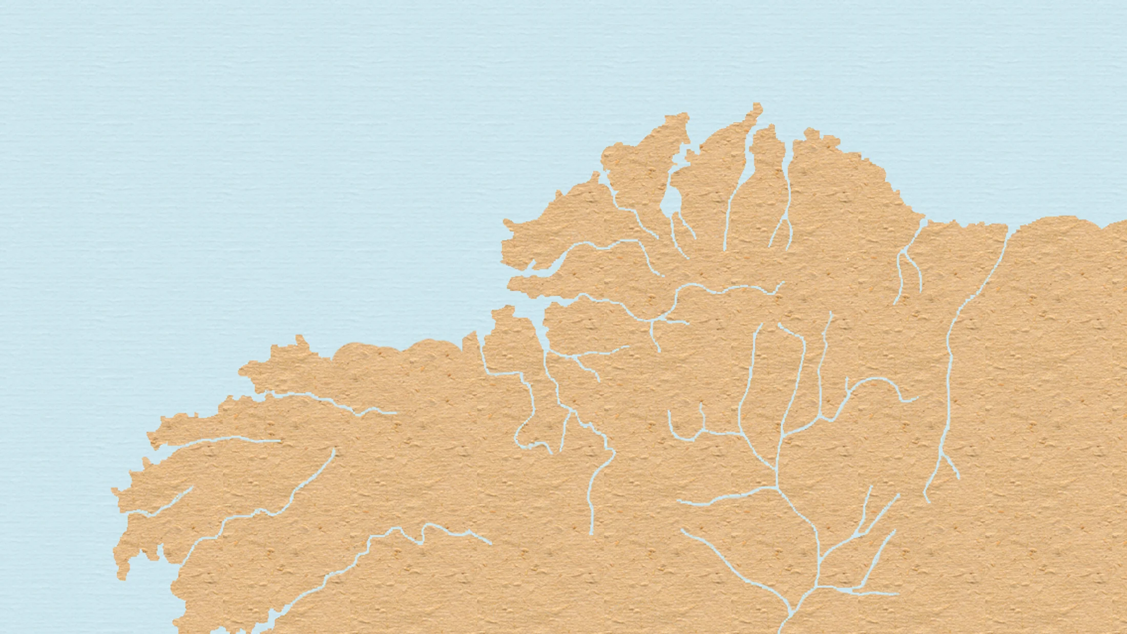
Map of Locations
A dynamic map pins the 10 experiences so you can see how rías, forests, and mountains line up along Galicia’s coast and interior. Toggle helpful layers: access points (car parks, ferry terminals), tourist offices, boat embarkation spots, tide-dependent areas, and public transport hubs. Blue lines trace kayak loops; green lines mark hiking circuits. A gull calls above a harbor buoy as you zoom in.
Open the map on Google Maps or a routes app to download GPX/KML for offline use and navigation. Each pin includes essential notes—permit links, tide windows, and nearest services—so you can chain experiences in one area (for example, Cíes + Ría de Vigo, or Corrubedo + Ribeira Sacra). For multi-day trips, cluster stays by coast (Rías Baixas, Costa da Morte) or inland (Ribeira Sacra, Ancares). Map tiles load fast even on patchy coastal signal.
What Each Experience Tells You
To keep things scannable, every experience follows the same structure you can trust. You’ll see location and access, approximate price or free alternatives, ideal season, who it suits, what to do with suggested itineraries, duration and difficulty, local services, and safety and sustainability tips. Icons indicate fit: family-friendly, adventurous, low-cost, or accessible. The page smells faintly of sea salt as you filter options on your phone.
- Filters and search ideas:
- By activity: hiking Galicia, kayaking Galicia, surf Galicia
- By protected area: Atlantic Islands activities, Serra do Xurés
- By theme: photography, birdwatching, family half-days
- Each card clarifies jargon:
- “Neap tide” = smallest tidal range; “swell” = wave energy from distant storms; “grade” = relative effort vs. terrain
- Find operators with verified credentials on Picuco; confirm final prices and what's included (guide, gear, insurance).
- Use keywords to narrow down: “Ribeira Sacra canoeing”, “Islas Cíes actividades”, “Camiño dos Faros stage 3”.
You’ll get time estimates in hours, distances in km, effort in plain language, and notes on when to book. With that, you can align conditions and calendars without guesswork.
Active Tourism in Galicia: 10 Experiences Among Rías, Atlantic Forests and Wild Coast
1) Islas Cíes and Atlantic Islands National Park: beaches, trails, and boat trips
Cíes packs turquoise water, white sand, and clifftop paths into a single ferry hop from Vigo. The National Park applies daily quotas and permits that keep this paradise quiet and wild. Sand squeaks under bare feet as you crest the dune behind Praia de Rodas.
- Location and access:
- Three main islands (Monteagudo, do Faro, San Martiño) in the Ría de Vigo mouth.
- Regular ferries April–October from Vigo (also Cangas or Baiona in season); advance reservation mandatory in peak dates.
- Permits and capacity:
- Visitor quotas require prior authorization; ferry booking typically integrates the permit.
- Overnighting only at the regulated Cíes campsite; wild camping is prohibited.
- What to do:
- Trails: Monte Faro loop (~7–8 km, moderate), Alto do Príncipe (~3 km, easy), Faro da Porta (~5–6 km, easy).
- Islas Cíes actividades include guided snorkel in calm coves and paddle/kayak outings with authorized operators.
- Prices and options:
- Ferries roughly 20–30 € return p.p.; guided snorkel/kayak 35–60 € p.p. (check inclusions; confirm current rates on Picuco).
- Best times:
- Late May–June and September for lighter crowds, warm water by Atlantic standards, and good visibility.
- Ideal for:
- Families (short trails), photographers (golden hours at Rodas), nature lovers (seabirds, dunes).
- Safety and sustainability:
- Stay on marked paths; dune systems are fragile. Pack out all waste; no fires.
- Water is scarce—carry 1–2 liters per person; respect lifeguard flags on beaches.
- Local services:
- Seasonal food kiosks and campsite services; no shops beyond basics—bring snacks and layers.
2) Fragas do Eume: deep walks in the Atlantic forest
One of Europe’s best-preserved Atlantic river forests shades you in oak, alder, and birch as the Eume whispers nearby. Mist hangs like lace in the gorge at dawn. Moss cushions the sound of your steps on a riverside boardwalk.
- Location and access:
- Between Pontedeume, As Pontes, and Monfero (A Coruña province).
- Main entries: Porta do Ser Pantaleu (Pontedeume) and the road to Monasterio de Caaveiro (restricted vehicle access on busy days).
- What to do:
- Senda do Río Eume: 6–10 km out-and-back variations, easy-moderate, minimal elevation.
- Monasterio de Caaveiro: short, steep approaches from car parks; guided visits available.
- Link with nearby greenways for cycling on gentler grades.
- Prices and options:
- Park entry free; paid guided walks available (15–35 € p.p.); confirm schedules on Picuco.
- Best times:
- Spring and autumn for flowing water, ferns, and mushrooms; summer for shade; winter can be wet and slippery.
- Ideal for:
- Families (short segments), hikers, photographers (soft, diffused light), birdwatchers.
- Difficulty and duration:
- Choose 2–5 hours depending on segment; trails generally low technical difficulty with occasional roots and muddy patches.
- Safety and sustainability:
- Stay on trails to protect understory plants; avoid loud noise during nesting periods.
- Carry rain layers and grippy footwear; floods can affect riverside sections—check conditions.
- Local services:
- Visitor centers provide maps and updates; local guides offer naturalist walks and cultural interpretation (search “Fragas do Eume rutas”).
3) Ribeira Sacra: canoes and Sil canyons between vineyards
Carved between granite walls and terraced vines, the Sil canyons offer calm-water paddling beneath eagles and miradores. The echo of a paddle tap returns from the opposite cliff face. Grapevines crease the slopes like green contour lines.
- Location and access:
- Along the Sil River between Ourense and Lugo provinces; embark points near Doade, Os Chancís, and Santo Estevo.
- Access by car from Monforte de Lemos or Ourense; limited public transport to canyon edges.
- What to do:
- Ribeira Sacra canoeing (and “Ribeira Sacra canoa” searches) lead to half-day or full-day downstream trips with vehicle shuttles.
- Suggested: 8–12 km calm-water stretch under the main viewpoints, 2.5–4 hours, low-moderate effort.
- Combine with short vineyard path hikes and scenic lookouts (e.g., glass balconies and classic miradores).
- Prices and options:
- Guided canoe/kayak 30–55 € p.p. including gear and shuttle; self-guided rentals similar—confirm on Picuco.
- Best times:
- April–June and September–October for mild temps and harvest colors; mid-summer brings heat and more traffic.
- Ideal for:
- Families with older kids (able to paddle), first-time paddlers, photographers, wine-curious travelers.
- Safety and sustainability:
- Wear a PFD (life jacket) at all times; winds can funnel in the canyon.
- Respect private vineyard terraces and avoid loud noise near nesting raptors; pack out everything.
- Local services:
- Operators offer dry bags, basic instruction, and shuttles; wineries schedule tastings—book ahead to space paddling and visits.
4) Costa da Morte: coastal hiking and surf beneath wild cliffs
This cape-studded coast delivers untamed hiking and some of the most reliable breaks in surf Galicia. Atlantic spray freckles your face as a wave detonates against black rock. Lighthouses blink like metronomes on the horizon.
- Location and access:
- Northwest coast from Malpica to Fisterra; primary road AC-552 links towns and trailheads.
- What to do:
- Hike sections of the Camiño dos Faros (~200 km in 8 recommended stages).
- Examples: Laxe–Arou (~17–18 km, moderate), Camariñas–Muxía (~25 km, long), Niñóns–Ponteceso (~26 km, long).
- Surf spots with schools clustered around Razo, Soesto, Traba (conditions vary—seek instruction if new).
- Hike sections of the Camiño dos Faros (~200 km in 8 recommended stages).
- Prices and options:
- Surf lesson + board/wetsuit: 30–50 € per session; guided hiking day: 25–45 € p.p.; confirm on Picuco.
- Best times:
- Surf: autumn–spring for consistent swell; summer offers mellower days for beginners.
- Hiking: April–June and September–October for cooler temps and clearer horizons.
- Ideal for:
- Hikers, surfers, landscape photographers.
- Safety and sustainability:
- Cliffs and blowholes demand distance; obey signage and keep dogs leashed.
- Check tides and swell; never turn your back on the ocean; stick to marked coastal paths to prevent erosion.
- Local services:
- Seasonal lifeguards on main beaches; surf schools and guiding available in key towns; frequent cafés for post-hike caldo and empanada.
5) Praia das Catedrais and Ribadeo: tidal arches and coastal geology
Cathedral-like arches, carved by Atlantic swell, turn walkable windows at low tide into forbidden corridors at high tide. The breeze smells of iodine and wet stone. Light pours through rock vaults at golden hour.
- Location and access:
- Near Ribadeo (Lugo province) on the Cantabrian coast; signposted from the A-8.
- Reservations and tides:
- In peak summer and Easter, free but mandatory reservations control access; plan for low tide windows.
- Best photography: 1–2 hours around low tide; avoid mid-tide when routes pinch off unexpectedly.
- Prices and options:
- Entry free; guided geology/photo walks 10–25 € p.p.; parking near access points can fill early—arrive ahead.
- What to do:
- Arch walk on the sand at low tide (easy, 1–2 hours).
- Alternative coastal paths and viewpoints if tides or quotas don’t align.
- Combine with Ribadeo port strolls, birdwatching on nearby estuaries, or short cliff-top routes.
- Best times:
- Spring and autumn for softer light and fewer crowds; winter storms sculpt dramatic textures but require caution.
- Ideal for:
- Photographers, families (strict tide timing), geology enthusiasts.
- Safety and sustainability:
- Never climb the arches; rock is fragile and slippery.
- Track tide charts the day before; keep footwear with grip and watch for sudden surges.
- Local services:
- Tourist info in Ribadeo posts reservation details and tide tables; cafés and bakeries fuel early starts.
6) Ría de Vigo and Ons: sea kayaking, snorkel, and navigating to the archipelago
Crystalline shallows, seagrass meadows, and sheltered coves make the Ría de Vigo a prime base for kayaking Galicia and snorkel days. Sunlight flickers on sand through six meters of clear water. Fishing skiffs hum past on their morning rounds.
- Location and access:
- Launch points in Vigo and Cangas with rental and guided options; ferries to Ons depart from several Rías Baixas ports in season.
- What to do:
- Sea kayak loops hugging the coast: 6–10 km, 2–3 hours, low-moderate effort.
- Snorkel in calm coves on neap tides for better visibility.
- Trips to Ons: respect National Park rules; guided paddles typically avoid open crossings by using ferries and starting inside the archipelago.
- Prices and options:
- Kayak rental 20–35 € half-day; guided 35–60 €; snorkel sets 10–20 €; confirm on Picuco.
- Best times:
- Late spring to early autumn; water warms through summer, visibility peaks on low-wind days.
- Ideal for:
- Beginners seeking instruction, families with teens, nature lovers spotting starfish and small shoals.
- Permits and protection:
- Atlantic Islands activities in Ons require permits for landing and certain zones; operators manage quotas.
- No-anchoring zones protect seabeds—follow briefings carefully.
- Safety and sustainability:
- Wear PFDs; check wind (nortadas can build afternoon chop); choose early starts for calmer water.
- Give wide berth to working bateas (mussel platforms) and avoid disturbing seabirds.
7) Baixo Miño and Monte Santa Trega: river kayaking, riverside cycleway, viewpoints
Where the Miño meets the Atlantic, river and ocean fuse under hilltop castro ruins at Santa Trega. Eucalyptus and gorse carry a honeyed scent on warm afternoons. Terns stitch bright arcs above the current.
- Location and access:
- Southern tip of Galicia between A Guarda (ES) and Caminha (PT); easy access via PO-552 and EN-13.
- What to do:
- River kayak sections on the lower Miño: 8–12 km, 2–3 hours, generally calm with tidal influence near the mouth.
- Cycle the ecopista/greenway along the riverbanks (excellent for families).
- Drive or hike to Monte Santa Trega for sweeping views of estuary and ocean.
- Prices and options:
- Kayak rental/guided: 20–45 € p.p.; bike rental: 10–25 €; confirm on Picuco.
- Best times:
- Spring and autumn for mild temperatures and stable river levels; summer sea breezes cool afternoons.
- Ideal for:
- Families, cyclists, first-time kayakers, border-curious travelers.
- Cross-border notes:
- Carry ID; check any cross-border landing regulations if you plan to step onto the opposite bank.
- Ferries and bridges connect both sides; tidal currents strengthen near the mouth—time your paddle.
- Safety and sustainability:
- Wear PFDs; avoid shipping lanes; give anglers space.
- Pack out litter; respect bird nesting on islets.
- Local services:
- Riverfront cafés, bike and kayak operators with safety briefings, and archaeology centers at Santa Trega.
8) Serra do Xurés / Baixa Limia: mountain routes and wildlife watching
Granite domes, ancient drovers’ paths, and thermal springs shape Galicia’s transboundary mountain park, part of the Baixa Limia–Serra do Xurés UNESCO Biosphere Reserve. A red stag’s bark rolls across a valley at dusk. Heather scratches your calves on high ridges.
- Location and access:
- Southwest Ourense on the Portuguese border, linked with Portugal’s Peneda-Gerês; trailheads near Lobios and Entrimo.
- What to do:
- Trekking routes from 8–20 km, moderate to strenuous, with 400–900 m elevation gain.
- Wildlife and flora walks: Iberian wolf is elusive; more likely are roe deer, wild horses, and raptors.
- Connect hikes with hot-spring soaks and traditional granaries (hórreos) in local villages.
- Prices and options:
- Guided mountain days 35–70 € p.p.; wildlife hides/photography outings vary—confirm on Picuco.
- Rural lodgings and mountain hostels from budget to mid-range.
- Best times:
- Spring for orchids and flowing streams; autumn for rutting deer and color; summers can be hot at low elevations; winter brings frost and occasional snow.
- Ideal for:
- Experienced hikers, naturalists, photographers seeking open granite light.
- Permits and conservation:
- Some zones have access controls; always check park advisories.
- Drones often restricted to protect fauna—ask in advance.
- Safety and sustainability:
- Carry maps/GPS, layers, and 2+ liters of water; storms build quickly on ridges.
- Stay on marked trails to reduce erosion and avoid lighting fires year-round.
9) Corrubedo Dune Complex: shifting sands, lagoon, and wind sports
A mobile dune about 20 m high and nearly 1 km long rolls like a frozen wave beside a brackish lagoon. Fine sand hisses along the surface in steady wind. Marsh reeds clack softly under migrating flocks.
- Location and access:
- Parque Natural do Complexo Dunar de Corrubedo e Lagoas de Carregal e Vixán (A Coruña province).
- Boardwalks from signed car parks lead to overlooks; sensitive zones are fenced.
- What to do:
- Walk boardwalk circuits to dune and lagoon viewpoints: 2–6 km, easy and accessible options.
- Nearby beaches host wind and kite surfing outside protected cores; lessons and rentals available in neighboring towns.
- Prices and options:
- Park access free; guided interpretation 8–20 € p.p.; wind/kite sessions 40–80 € depending on level; confirm on Picuco.
- Best times:
- Spring and autumn for bird migration; summer sea breezes for wind sports; winter for stormy drama and solitude.
- Ideal for:
- Families, birders, wind sport enthusiasts, landscape seekers.
- Safety and sustainability:
- Never climb the protected dune; footprints scar its face and destabilize it.
- Stick to boardwalks; keep distance from nesting birds; pack binoculars.
- Local services:
- Visitor center with exhibits; seasonal lifeguards on adjacent beaches; cafés in Corrubedo village.
10) Ancares and O Courel: remote trekking and trail running
High ridges, ancient chestnut groves, and slate hamlets set the stage for Galicia’s quietest big days. Your breath puffs white on a dawn ridge push. A spring gurgles from a mossed stone trough.
- Location and access:
- Eastern Galicia, Lugo province; mountain roads lead to villages like Piornedo (Ancares) and Seoane do Courel (O Courel).
- What to do:
- Trekking classics: Pico Cuiña ridge from Piornedo (~12–16 km, 800–1,000 m gain), Devesa da Rogueira circuit (~4–7 km, moderate) amid a UNESCO Global Geopark (Montañas do Courel).
- Trail running: stitch ridgelines into 15–25 km stages with bailout options to valleys.
- Prices and options:
- Guided traverses and logistics (transfers, baggage) 40–90 € p.p.; refuges, rural casas, and small inns from budget to mid.
- Best times:
- Late spring to early autumn for dry trails; autumn for forest color; winter can bring snow and ice above 1,400 m.
- Ideal for:
- Hikers seeking solitude, strong intermediate to advanced runners, photographers chasing cloud inversions.
- Safety and sustainability:
- Carry paper maps plus GPS; phone coverage is patchy.
- Refill at signed fountains only; treat water if unsure; watch livestock and close gates behind you.
- Local services:
- Seasonal huts and year-round village stays; local guides know weather patterns and safe ridgeline exits.
- Context:
- Ancares includes a Biosphere Reserve; slate-roofed pallozas speak to pastoral lifeways—support village shops and bakeries.
Quick Comparison: Best Season, Access, and Approximate Cost
Use this at-a-glance table to align time of year, logistics, and budget. The sea smells fresher after a passing squall, a cue to scan spring options.
| Experience | Best time | Access (car/boat/public) | Cost level |
|---|---|---|---|
| Islas Cíes | May–June, Sep | Boat + public/car to port | Medium |
| Fragas do Eume | Apr–Jun, Sep–Oct | Car; limited public buses | Low |
| Ribeira Sacra (Sil) | Apr–Jun, Sep–Oct | Car | Medium |
| Costa da Morte | Apr–Jun, Sep–Mar (surf) | Car; some buses between towns | Low–Med |
| Praia das Catedrais | Spring, Autumn | Car; A-8; limited buses | Low |
| Ría de Vigo & Ons | May–Sep | Car/public to port + boat | Low–Med |
| Baixo Miño & Santa Trega | Spring, Autumn | Car; train/bus to nearby hubs | Low–Med |
| Serra do Xurés | Spring, Autumn | Car | Med |
| Corrubedo Dune Complex | Spring, Summer, Autumn | Car | Low |
| Ancares & O Courel | Late spring–Autumn | Car | Med |
Combinations: Cíes + Ría de Vigo (coast); Corrubedo + Ribeira Sacra (dunes + canyons); Costa da Morte + Praia das Catedrais (photo-driven coast); Xurés + Ancares (mountains). In winter, pivot to coastal hikes and photo outings; in summer, add sea kayaking and island ferries.
Picking the Right Experience by Level and Season
Start with fitness and comfort in elements, then match season and duration. A cool breeze on the nape signals early starts in summer.
- Beginners and families:
- 2–4 hours: Fragas do Eume (riverside), Praia das Catedrais (low tide), Ría de Vigo kayak loops, Baixo Miño cycling.
- Gear: grippy shoes, light rain shell, daypack, water, snacks; PFDs for paddling.
- Intermediates:
- 4–6 hours: Cíes Monte Faro trail, Ribeira Sacra half-day canoe, Costa da Morte stage segments.
- Gear: trekking poles, headlamp, extra layers, sun protection; neoprene in shoulder-season paddles.
- Advanced:
- 6–9 hours or committing terrain: Ancares ridges, O Courel traverses, long Camiño dos Faros days.
- Gear: map/GPS, emergency blanket, 2–3 L water, nutrition, whistle.
- Seasonal pivots:
- Hot inland day? Shift to coast (Ría de Vigo, Corrubedo).
- Heavy swell/wind? Swap sea kayak for forest hike; consult operators for weather calls.
- Where to hire guides:
- For sea states, canyon winds, or remote ridges, book verified local guides through Picuco to learn safely and support communities.
Safety, Permits, and Sustainability
Know the rules, respect the sea and mountains, and leave places better than you found them. Pine needles release a clean scent when crushed underfoot.
- Permits and quotas:
- Atlantic Islands National Park (Cíes, Ons): daily quotas; permits integrated with ferry or operator bookings.
- Praia das Catedrais: free but reservation required in peak periods.
- Navigation and water:
- Always wear PFDs for kayak/canoe; check tides, wind (especially afternoon nortadas), and swell forecasts.
- Avoid open-water crossings without training or support boats; hug shorelines and heed no-anchoring zones.
- Mountain basics:
- Carry map/GPS, layers, rain gear, and headlamp; tell someone your plan; watch thunderstorms.
- Emergencies:
- Know local emergency number 112; provide location references (trail names, nearby lighthouses, or coordinates).
- Leave No Trace:
- Stay on marked trails; pack out all waste; no fires; keep noise low around wildlife and working areas (vineyards, bateas).
- Community respect:
- Support small businesses; ask before entering private land; close gates; buy local produce to sustain rural economies.
Frequently Asked Questions
When should I book ferries, permits, and guides?
For July–September and Easter, book ferries to Cíes/Ons and Praia das Catedrais reservations 2–3 weeks out; guides 1–2 weeks. Shoulder seasons are more flexible, but weekends still fill.
What should I pack for hiking Galicia?
Wear grippy shoes, quick-dry layers, rain shell, hat, and carry 1–2 liters of water, snacks, and a small first-aid kit. For longer days, add poles, headlamp, and paper map plus GPS.
What about kayaking Galicia—do I need experience?
Beginners can start in sheltered rías with a guide who provides PFD, paddle, and briefing. Choose short coastal loops or river sections; avoid open crossings or strong wind days without training.
Can I get around without a car?
You can reach major ports (Vigo, Cangas) and some trail towns by bus/train, then join guided activities with transport included. Rural interiors (Ancares, Xurés) are easiest by car.
What are typical costs?
- Sea kayak/snorkel half-day: 20–60 € p.p.
- Surf lesson with gear: 30–50 €.
- Guided hiking day: 25–70 €. Confirm exact inclusions (insurance, transfers) on Picuco before booking.
Any tips for families or tight schedules?
Aim for 2–4 hour experiences near hubs: Cíes short trails, Ría de Vigo kayaks, Fragas do Eume segments, Praia das Catedrais at low tide. Book early slots to dodge heat and crowds.
Book your experience — discover active tourism across Spain with Picuco-verified providers.
Conclusion
Galicia rewards movement, from tide-timed beach walks to granite summits that frame whole valleys. With these 10 experiences, you can pair islands with forests, dunes with canyons, or ridgelines with hot springs, always respecting places and the people who keep them alive. The late light turns ría water to hammered gold as you decide where to start.
For three days, try Cíes + Ría de Vigo + Fragas do Eume; for five, add Ribeira Sacra and Corrubedo; for a week, loop Costa da Morte and a mountain finale in Xurés or O Courel. Sleep in rural casas, coastal campsites, or historic inns, and confirm dates, gear, and guides through Picuco. Pack light, tread gently, and let weather guide your pace.
Resources and Useful Contacts
- Atlantic Islands National Park (Cíes, Ons): search “Parque Nacional Marítimo-Terrestre das Illas Atlánticas” for permits and rules.
- Praia das Catedrais reservations and tide info: search “Xunta de Galicia Praia das Catedrais”.
- Provincial tourism offices: A Coruña, Lugo, Ourense, Pontevedra for maps and transport.
- Parks and reserves: “Fragas do Eume”, “Parque Natural de Corrubedo”, “Baixa Limia–Serra do Xurés”.
- Activities and guides: browse sea kayak, surf, hiking, and Ribeira Sacra canoeing options on Picuco to compare dates and inclusions.
- Route apps and maps: download GPX/KML for Camiño dos Faros stages, Cíes trails, and Ancares/O Courel circuits; carry offline backups.