Why Urkiola Is Perfect For A Half‑day Escape From Bilbao
Slip out of Bilbao after breakfast and be on a mountain ridge by mid‑morning. Urkiola Natural Park lies roughly 45–55 minutes from the city by road, offering short, rewarding trails that fit neatly into a 3–5 hour window. A breeze smells of damp beech leaves and limestone as you step onto the path. If you are choosing between coast or countryside for a quick outing, these Urkiola hikes give you crest walks, mossy forests, and open pastures with big‑sky views.
Urkiola was declared a Natural Park in 1989 by the Basque Government and spans the limestone massifs of Anboto, Alluitz, Saibi, and Mugarra (source: Gobierno Vasco, euskadi.eus). The pass of Urkiola sits near 700 m, so you start high and gain views fast. Sunlight catches on the Sanctuary’s stone walls while griffon vultures circle on midday thermals. The park’s clear paths and waymarked routes mean you can focus on pace and panorama, not navigation.
This guide spotlights three half‑day routes that begin near the Sanctuary and return in time for txakoli or a late lunch. The Saibigain out‑and‑back climbs smoothly to a famous 360‑degree viewpoint in around two to three hours. The classic Saibi–Saibitxiki circular strings two neighboring summits with a mix of wide track and rocky ridge, perfect for varied terrain in a compact loop. The Urkiolagirre–Larrano option traces a gentle crest before opening to big meadows below Anboto, ideal if you want more distance without complex scrambling. The pines whisper and the limestone warms under your boots as you choose your line. Each route can flex for families, couples, or small groups by trimming spurs or reversing the loop.
Expect real mountain atmosphere without committing a full day. “Half‑day” here means 6–10 km distances with 250–500 m of elevation gain, which many walkers cover in 2.5–4 hours plus stops. On clear days you can see the Cantabrian coast ridges to the north and the Txindoki silhouette to the east. The scent of crushed bilberry leaves clings to your shoes near the summits. If fog (a common occurrence known locally as “borrina”) drifts in, these routes still work thanks to well‑trodden paths and frequent waymarks.
You also walk through living landscapes, not museum dioramas. Baserris (traditional farmsteads) manage pastures around the park, and herds of latxa sheep shape the look of these hills. Cowbells carry across the hollows like a slow metronome. Please greet shepherds, close gates, and keep dogs leashed near livestock—your presence in shoulder seasons supports rural bars and refuges. Knowing your outing bolsters local life adds warmth to every step.
Logistically, Urkiola suits a late start or a compact morning push before afternoon plans in Durango. Driving from Bilbao via the AP-8 and BI-623 is the fastest route, while public transport combos to Durango plus a short taxi ride can make a car‑free day feasible. The chill of early shade fades quickly as the pass catches the sun. With predictable access, multiple water points, and wide tracks near the Sanctuary, these Urkiola hikes remove friction so you can focus on weather windows and simple gear.
Here’s what you’ll find below: how to reach the pass efficiently on weekdays and weekends, where to park without stress, and what accommodations or extra activities pair well with a short hike. The three routes include distances, elevation, best direction, water, and micro‑tips to make the most of your window. The granite‑gray ridges glow honey‑toned at midday. Pick your line, keep an eye on the forecast, and enjoy a crisp half‑day adventure that delivers a full‑day sense of place.
Picuco te puede ayudar
Does something here catch your eye?
Tell us.
Write to us on WhatsApp or email: we answer questions, find the best options and help you sort out the booking.
Getting To Urkiola From Bilbao Without Hassle
By car: quickest routes and smart timing
If you are weighing how to get to Urkiola from Bilbao, driving is the simplest choice most days. The usual route is AP-8 east toward Durango, then exit to the BI-623 that climbs directly to the Urkiola pass and Sanctuary; it’s about 45–55 km and typically 45–55 minutes door to door, traffic depending. Pine resin and cool air drift through the windows as the road curves higher. Tolls apply on parts of the AP-8, and you can avoid them by following the slower N-634 to Durango before taking the BI-623.
Weekend mornings between 10:00 and 12:00 can bring slowdowns near Durango and limited parking at the pass. The warmth inside the car meets a quick mountain chill when you open the door. Leave Bilbao by 08:30 for a calm arrival, or aim after 14:00 for an afternoon loop and sunset light. If rain bands are moving through the Cantabrian coast, watch the forecast carefully; showers often clear inland by late morning. Save time by fueling in Bilbao and checking the BI-623 status on the provincial road info pages (bizkaia.eus) before you go.
By public transport: train, bus, and simple combos
Getting to the exact pass purely by bus is limited, but a smooth combo works well for a half‑day. Take Euskotren line E1 from Bilbao (Zazpikaleak/Casco Viejo) to Durango; journeys are around 35–40 minutes with frequent departures (euskotren.eus). The carriage hum blends with tunnel echoes as you roll toward the foothills. From Durango, options vary by day: a regional Bizkaibus toward Otxandio may stop near Urkiola on some runs, but schedules change seasonally—check current timetables at bizkaibus.eus.
For reliable senderismo medio día desde Bilbao, pair the train with a short taxi: Durango to the Urkiola Sanctuary is roughly 12–15 km and 20–25 minutes. The scent of rain on limestone greets you as you step out at the pass. Ask the driver to pick you up at a set time or keep a local number handy, as data service can be patchy. Door to door, expect 70–90 minutes each way using train plus taxi; start on the 07:50–08:30 trains to catch mid‑morning views and be back in Bilbao by mid‑afternoon.
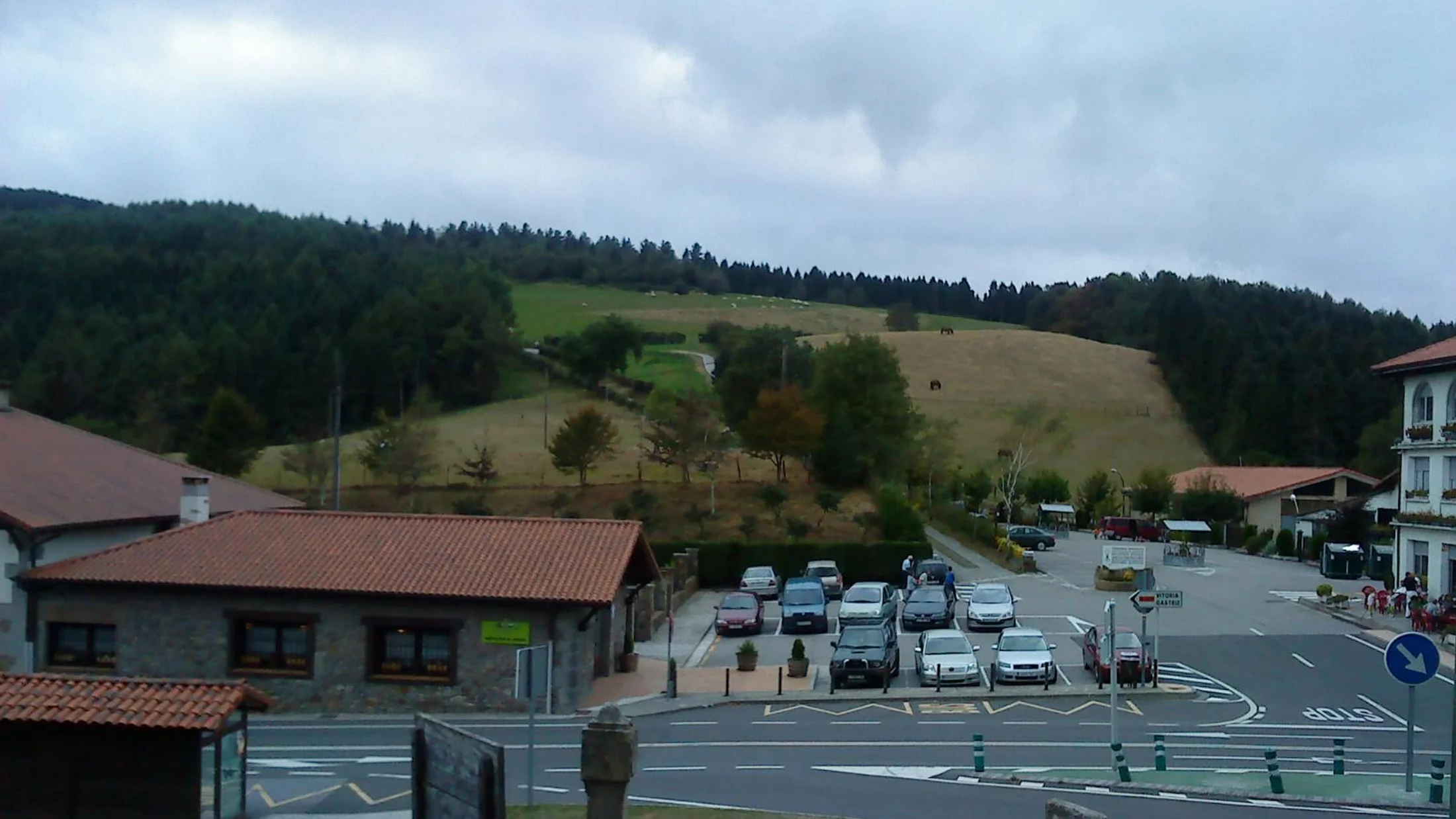
Parking and permits: where to leave the car and what to know
Parking is straightforward if you arrive early. The main lots cluster around the Sanctuary of Urkiola at the pass—signed, free, and unpaved/mixed surface in places. Dust lifts in small clouds as cars pull out at midday. Secondary access points include the Atxarte valley (Abadiño side) for climbing and ravine walks, with very limited spaces, and small pull‑outs on the BI-623 near trailheads; never park on blind bends or block farm tracks.
On busy weekends, the Sanctuary lots often fill by 10:30–11:00. The scent of coffee wafts from hikers finishing early loops. If full, wait for turnover around 13:00 or shift to a later start, or park in Durango and taxi up. Urkiola is a protected Natural Park: no permits are required for hiking on established trails, but drones are restricted, fires are prohibited year‑round, and dogs must be on leash near livestock. If you’re explaining to a friend cómo llegar Urkiola without stress, tell them: arrive early, stick to marked bays, and carry out all waste—wardens do patrol on peak days (source: Bizkaia Natural Parks, bizkaia.eus).
Stay Longer: Sleep In Durango And Explore Around Atxarte
Where to sleep: Durango and rural options
If your half‑day turns into a full escape, staying nearby makes sense. Durango offers hotels and guesthouses with evening dining and easy train access for a car‑free plan, plus a compact old town for a stroll. Soft yellow windows glow on stone facades after sunset. Rural stays—agroturismos and country houses—in Abadiño, Atxondo, Otxandio, and Mañaria give you early trail access and quiet nights.
Pick Durango if you want late check‑in, dinner options, and a simple morning taxi back to the pass. The smell of fresh bread drifts from cafés when you step out early. Choose a rural house if you’re traveling as a family or group and value kitchens, parking, and garden space; many are within 15–25 minutes of the Sanctuary. For couples, smaller guesthouses with breakfast help you hit the trail by 09:00. Typical double‑room rates in the area range broadly from 70–130 € per night; confirm current prices and policies directly with the property or explore curated rural stays via Picuco to match your route plans.
What to do around: viewpoints, wildlife, and the Urkiola Sanctuary
Beyond walking, Urkiola’s extras make a half‑day feel complete. The Sanctuary of Urkiola, dedicated to Saints Anthony and Anthony, anchors the pass and offers a quiet courtyard and fountains, with a short path up to a viewpoint ridge for sunset. Stone warms under your hand on the balustrade as the sky turns orange. Bring a small picnic and wrap your hike with 20 minutes of horizon gazing. Birdlife is rich—look for griffon vultures, ravens, and alpine choughs riding the wind near Saibi and Urkiolagirre; spring brings orchids and bilberry flowers along the paths.
Atxarte, a dramatic limestone gorge below Alluitz, is a classic add‑on for the afternoon: drive 20 minutes from the Sanctuary down toward Abadiño and follow signs to the valley. The air is cooler and smells of wet rock beside the stream. Climbing regulations can change seasonally to protect nesting raptors—check notices at access points. In Durango, a gentle loop of the historic center and riverside parks pairs well with morning hiking; museums open mid‑afternoon on some days, so verify hours if that’s a priority. A simple plan is best: hike in the morning, lunch in Durango or a rural asador, then a short sunset stroll at the Sanctuary before returning to Bilbao.
Three Half‑day Urkiola Hikes With Big Views
1.Saibigain: direct path with a panorama payoff
This is the quickest win if you want maximum views for modest effort. Start at the Sanctuary of Urkiola (pass ~700 m) and follow signed paths toward Saibi/Saibigain; the summit is about 942 m. A faint honey smell rises from sun‑warmed gorse on the ridge. Expect 5.5–6.5 km round trip, around +250–300 m elevation gain, and 2–3 hours including photos.
The route climbs on clear tracks, then narrows on the ridge with easy rock steps; it’s exposed to wind but never technical in dry conditions. On top, you’ll get a 360‑degree sweep toward Anboto, Mugarra, and the Udalatx massif. The wind brushes your jacket as bells sound from the pass below. Best tackled in the morning for calmer air and clearer light; in summer, begin before 09:00 to avoid heat and crowds. Wear grippy footwear because polished limestone can be slick after rain or fog. Water is available at Sanctuary fountains; bring at least 1–1.5 L per person as the ridge is dry. If mist rolls in, retrace the ridge carefully along the same well‑trodden line.
Key details:
- Start/finish: Sanctuary of Urkiola parking
- Distance/time: 6 km RT, 2–3 h
- Ascent: +250–300 m
- Difficulty: Easy‑moderate (wind exposure, short rocky steps)
- Highlights: 360° summit view, fast access, classic Urkiola hike
2.Saibi and Saibitxiki loop: a compact classic
If you want variety in a neat circuit, the Saibi Saibitxiki loop delivers. Begin at the Sanctuary, ascend toward Saibigain first for the big view, then continue the undulating ridge to Saibitxiki before looping back on forest tracks. Pine needles soften the footfall as shade cools the return. The loop runs 7–8.5 km with +300–350 m of gain, typically 2.5–3.5 hours at an unhurried pace.
Walk it clockwise: climb Saibigain first while legs are fresh, linger on the crest, then descend via signed tracks that rejoin near the pass. Short hands‑on moves appear on the ridge, but you can skirt minor rock steps on bypass paths if needed. A gentle breeze carries resin and heather scents across the saddle. Photo stops are best between the summits, where Anboto’s profile opens; save energy snacks for this section. Waymarks are frequent near the pass, then occasional cairns and posts along the ridge—download an offline map for confidence. Water is at the Sanctuary; none reliably on route.
Key details:
- Start/finish: Sanctuary of Urkiola parking
- Distance/time: 7–8.5 km loop, 2.5–3.5 h
- Ascent: +300–350 m
- Difficulty: Moderate (short rocky ribs, mild exposure)
- Highlights: Two summits, ridge vistas, shaded forest return
3.Urkiolagirre and Larrano: meadows below Anboto
For a slightly longer outing without technical terrain, choose Urkiolagirre Larrano. From the Sanctuary, follow signs up Urkiolagirre (1,008–1,009 m), then continue along the broad crest toward the Larrano meadows below Anboto before looping back via Pol‑Pol fountain. Sheep bleat from the slopes as cloud shadows slide over the grass. The circuit totals 9–10.5 km, +450–550 m of ascent, and 3.5–4.5 hours including breaks.
This route rewards stable weather, as the open crest and meadows shine in clear light. In light fog, stay on the main track lines and avoid straying toward steeper ground beneath Anboto’s cliffs. The Pol‑Pol spring offers a classic refill near the return leg—treat or filter if you’re sensitive, though many hikers drink here. Cold water stings your palms as you splash your face. Footwear with decent tread is important for occasional muddy patches. From Bilbao, it’s ideal for those who want a half‑day that still feels expansive, with a strong sense of the Anboto amphitheater and fewer rocky steps than Saibi’s ridge.
Key details:
- Start/finish: Sanctuary of Urkiola parking
- Distance/time: 9–10.5 km loop, 3.5–4.5 h
- Ascent: +450–550 m
- Difficulty: Moderate (longer distance, open terrain)
- Highlights: Broad crest walking, Larrano meadows, Pol‑Pol spring, Anboto views
Practical Tips To Hike Urkiola Safely And Smoothly
Essential gear for a half‑day outing
Pack light but smart, and you’ll enjoy senderismo medio día desde Bilbao without surprises. Wear trail shoes or lightweight boots with good grip; limestone can be slick after mist. The first cold sip from your bottle tastes sharper on these heights. Carry 1–2 L of water per person, a windproof layer, sun protection (hat, sunglasses, SPF), and a small first‑aid kit.
Food matters more than you think: bring 400–600 kcal of snacks per person—nuts, fruit, sandwiches—to keep pace steady on the ridges. The sweet smell of citrus lifts mood at a viewpoint stop. Add a fully charged phone, a power bank if you rely on navigation apps, and a printed or offline map. In shoulder seasons, toss in a thin fleece and gloves; in summer, add extra water capacity. Trekking poles help on the Saibi descent and muddy sections toward Larrano.
Signs, maps, and reading the route
Urkiola’s main paths are well trodden, but fog and branching tracks can confuse newcomers. Trail posts, cairns (small stone stacks), and paint marks guide the way near the pass and along popular crests. The metallic ping of a pole tip on rock anchors your rhythm. Download an offline map on apps like IGN Mapas, Wikiloc, or Gaia GPS, and carry the scale 1:25,000 Instituto Geográfico Nacional print if you like paper backup.
Before you start, scan the loop on your phone and identify three reference points—summit name, a saddle, and a water spot—to keep mental bearings. The earthy smell of beech duff tells you you’ve slipped into the forest return. If multiple tracks diverge, pause and compare features: fence lines, forest edges, and the angle of the ridge. Following clockwise vs. counterclockwise can change how fast you gain views; Saibi clockwise front‑loads the climb, while Urkiolagirre’s crest feels gradual either way.
Safety and what to do in an emergency
Mountain rules still apply, even on half‑days. Tell someone your route and expected return time, and set a firm turnaround—if you haven’t reached the high point by your cut‑off, head back. A faint metallic taste of rain in the air warns you to add a layer. Check AEMET’s forecast for the Gorbeialdea/Durangaldea area the night before and on the morning; wind and fog change plans more than temperature here.
In an emergency, call 112 (Basque Country emergency number) and provide your location, route, and condition; enable location sharing in your phone settings to speed rescue. The stillness between gusts helps you hear responders if they’re near. Keep dogs leashed around livestock and wildlife, and step aside politely for groups on narrower sections. If fog closes in, stop, eat, layer up, and retrace to your last known marker rather than wandering on faint sheep paths. Carry a simple foil blanket year‑round—it’s light, cheap, and buys warmth if you must wait.
Faqs: All You Need Before You Set Out From Bilbao
How long do these routes actually take, and how hard are they?
Plan your day door to door so your half‑day stays half a day. From central Bilbao by car, expect 45–55 minutes to the Urkiola pass; train‑plus‑taxi takes around 70–90 minutes. The crisp smell of morning coffee fades as mountain air cools your cheeks. On trail, Saibigain is 2–3 hours RT, Saibi–Saibitxiki 2.5–3.5 hours, and Urkiolagirre–Larrano 3.5–4.5 hours at a steady, photo‑friendly pace.
In terms of effort, all three are easy‑to‑moderate if you hike occasionally: 250–550 m of climbing on good paths, with a few rocky steps on the Saibi ridge. A salt tang from dried sweat reminds you to sip water often. If you’re short on time, choose Saibigain for the fastest payoff, or walk Saibi–Saibitxiki but skip the final ridge spur. Among Urkiola hikes, these are some of the most efficient for views per minute—just start early to dodge parking stress and midday haze.
Are these routes suitable for beginners or families?
Yes, with smart choices and fair weather. Saibigain is the friendliest: wide paths, moderate climb, and an obvious turn‑around if kids tire. A cool breeze on the ridge keeps summer heat manageable. Saibi–Saibitxiki adds short rocky sections and mild exposure; keep younger hikers close on the crest and take the forest return if winds pick up. Urkiolagirre–Larrano is longer but stays on broad terrain; the meadows make perfect snack stops if attention spans waver.
For senderismo medio día desde Bilbao with mixed experience levels, pick a clear day, start by 09:00, and set a simple rule: 90‑minute out, then return. The crunch of gravel under small boots sets an easy rhythm. Bring poles for stability and pack layers for quick changes; fog can chill children fast. If you’re unsure, do a trial walk in Pagasarri or Artxanda the week before to gauge pace, then aim for Saibigain here.
When is the best time to go, and what about weather?
Spring and autumn are ideal for stable temperatures and clear air. After rain, the beech woods smell sweet and the limestone shines under brief sun breaks. Summer brings long days and warmer midday ridge winds; start early, wear sun protection, and carry more water. Winter can be beautiful with frost or occasional snow—check ice risk and consider microspikes if forecasts mention freeze‑thaw.
Fog (“borrina”) is common year‑round, especially mornings; it often lifts by late morning or early afternoon. The world narrows to a soft gray bubble when it settles on the crest. On windy days, Saibi’s ridge can feel brisk—choose Urkiolagirre–Larrano to stay on broader ground. Check AEMET (aemet.es) for Urkiola/Durangaldea and remember conditions change faster on ridges than in valleys. If the BI-623 shows low clouds as you climb, start with the forested section of a loop and aim for summits later.
What rules or restrictions should I know before hiking?
Urkiola is a protected Natural Park with simple, common‑sense rules. Stick to marked paths, do not light fires, and carry out all trash—there are few bins at the pass. The smell of woodsmoke should never be part of a hiking day here. Dogs must be on leash near livestock and wildlife; shepherds and wardens are active, and fines apply for disturbances.
Climbing in Atxarte has seasonal restrictions to protect nesting raptors; check posted notices at access points. A kestrel’s call echoes sharply along the gorge walls. Drones are restricted and require permission in protected zones—assume no unless you have explicit authorization. Parking only in designated areas, no camping near the pass, and no swimming or washing in fountains like Pol‑Pol. For updates, consult official park pages (Bizkaia Natural Parks at bizkaia.eus and Gobierno Vasco at euskadi.eus) before your trip.
Can I combine these hikes with visits to Durango or Atxarte?
Absolutely—this area is perfect for a blended day. A common plan is Saibigain in the morning, lunch in Durango, and a gentle old‑town stroll before returning to Bilbao. The smell of fresh tortillas and coffee drifts from Durango’s bars at midday. Transfer times are short: Sanctuary to Durango is 20–25 minutes by car, and Durango back to Bilbao is 30–40 minutes by train or 35–50 by car, traffic depending.
If you want rock scenery, pair the Saibi–Saibitxiki loop with a drive to Atxarte for a 45–60 minute ravine walk and photo stop among cliffs and old bridges. Cool air rises from the stream as shade deepens the greens. Urkiolagirre–Larrano combines nicely with a late‑afternoon Sanctuary viewpoint visit for sunset. Keep it simple: one hike plus one town or valley, and you’ll be back in Bilbao with time to spare and no rush.
Book your experience — discover outdoor activities in Spain with providers verified by Picuco.
Conclusion: plan your half‑day in Urkiola with confidence
Urkiola stands out for quick access, satisfying crests, and uncomplicated logistics, making these half‑day routes a smart pick from Bilbao. The clean taste of cool fountain water marks the moment you switch from city mode to mountain pace. Choose Saibigain for a swift 360‑degree view, Saibi–Saibitxiki for a varied ridge‑plus‑forest loop, or Urkiolagirre–Larrano for longer, open walking beneath Anboto.
To lock in a smooth outing, check the BI-623 and AEMET forecast the evening before, aim to arrive by 09:00 on weekends, pack light but complete, and respect the park’s people and wildlife. Gravel crackles under your tires as you roll back to the city, satisfied and unhurried. Save this guide for your next clear window, share it with your hiking partner, and set a date—Urkiola will be ready when you are.